Antique Maps West Indies

7
to
17
84
42
81
47
44
26
21
21
12
10
9
7
6
6
6
6
5
4
4
3
3
2
2
2
1
1
1
1
1
1
1
1
1
1
1
1
1
1
9
7
7
2
1
Sort By
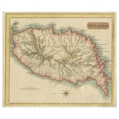
Copper Engraved Grenada Map by John Thompson Published in 1810
Located in Langweer, NL
coloring, embodies a significant contribution to the category of Maps West Indies Whole. Crafted with
Category

Early 19th Century Antique Maps West Indies

Materials

Paper

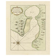
Roseaux, St. Lucia Island Map by BELLIN, Handcolored Engraving, 1763
Located in Langweer, NL
intricacies. Its inclusion in the "Maps West Indies St. Lucia" category underscores its significance in
Category

1760s Antique Maps West Indies

Materials

Paper

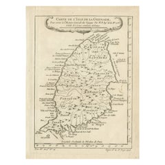
Antique Map of Grenada, West Indies, 1758
Located in Langweer, NL
"Exquisite 1758 Map: 'CARTE DE L'ISLE DE LA GRENADE' This alluring map presents a detailed
Category

1750s Antique Maps West Indies

Materials

Paper

Antique Map of Grenada, West Indies, 1758
No Reserve
H 9.85 in W 7.09 in D 0.01 in
Antique Map of the West Indies by Wyld '1845'
Located in Langweer, NL
Antique map titled 'Map of the West India Islands'. Original antique map of the West Indies
Category

Mid-19th Century Antique Maps West Indies

Materials

Paper

Antique Map of the West Indies by Wyld '1845'
H 10.24 in W 14.18 in D 0.02 in
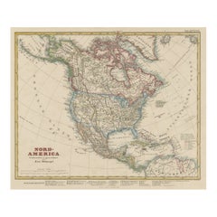
Antique Map of North America Including the West Indies
Located in Langweer, NL
Original antique map titled 'Nord-America'. Old map of North America and the West Indies. Also
Category

Mid-19th Century Antique Maps West Indies

Materials

Paper

Antique Map of Central America and the West Indies, 1882
Located in Langweer, NL
West Indies. This map originates from 'The Royal Atlas of Modern Geography, Exhibiting, in a Series of
Category

19th Century Antique Maps West Indies

Materials

Paper

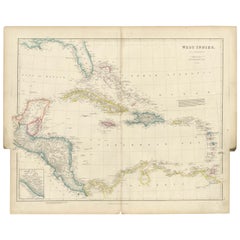
Original Antique Map of the West Indies by J. Arrowsmith, 1842
Located in Langweer, NL
Title: "J. Arrowsmith's 19th Century Map of the West Indies" This original antique map, crafted by
Category

Early 19th Century Antique Maps West Indies

Materials

Paper

Antique Map of the West Indies and Central America by Lowry '1852'
Located in Langweer, NL
Antique map titled 'West Indies and Central America'. Original map of the West Indies and Central
Category

Mid-19th Century Antique Maps West Indies

Materials

Paper

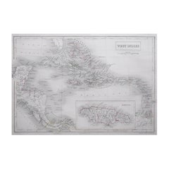
Large Original Antique Map of The West Indies by Sidney Hall, 1847
Located in St Annes, Lancashire
Great map of The West Indies Drawn and engraved by Sidney Hall Steel engraving Original
Category

1840s Scottish Antique Maps West Indies

Materials

Paper

Antique Map with Hand Coloring of North America and the West Indies
Located in Langweer, NL
Original antique map titled 'Nord-America'. Old map of North America and the West Indies. This
Category

Late 19th Century Antique Maps West Indies

Materials

Paper

Original Antique Map of the Island of Dominica in the West Indies, 1794
Located in Langweer, NL
MAP OF THE ISLAND OF DOMINICA for the History of the West Indies, by Bryan Edwards. Esq. Dominica
Category

1790s Antique Maps West Indies

Materials

Paper

Antique Map of North America and the West Indies by Stieler, circa 1865
Located in Langweer, NL
Antique map titled 'Nord-America und West-Indien'. Old map of North America and the West Indies
Category

Mid-19th Century Antique Maps West Indies

Materials

Paper

Authentique Map by Pilon of The French Colonies in The West Indies, 1876
Located in Langweer, NL
This map is a significant representation of the French colonies in the West Indies during the late 19th
Category

Late 19th Century Antique Maps West Indies

Materials

Paper

Antique Map of South American, The West Indies & Most of Africa, Ca.1775
Located in Langweer, NL
, but includes most of Africa, the southern part of North America and the West Indies. Arrows in the
Category

1770s Antique Maps West Indies

Materials

Paper

Original Antique Map of Martinique Island In The West Indies by Bonne, circa1780
Located in Langweer, NL
Antique map titled 'Carte de l'Isle de la Martinique Colonie Francoise dans les Isles Antilles
Category

18th Century Antique Maps West Indies

Materials

Paper

Original Engraved Map of Saint Lucia in the West Indies by Bellin, 1758
Located in Langweer, NL
Hydrographer and engineer of the French Navy, is a remarkable antique map showcasing the intricate details of
Category

1750s Antique Maps West Indies

Materials

Paper

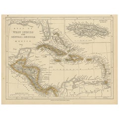
Antique Map of Mexico, Central America and West Indies by A & C. Black, 1870
Located in Langweer, NL
Antique map titled 'Mexico, Central America and West Indies'. Original antique map of Mexico
Category

Late 19th Century Antique Maps West Indies

Materials

Paper

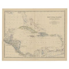
Antique Map of the West Indies and Central America by W. G. Blackie, 1859
Located in Langweer, NL
Antique map titled 'The West India Island & Central America'. Original antique map of the West
Category

Mid-19th Century Antique Maps West Indies

Materials

Paper

Antique Map of the Gulf of Mexico and all the islands of the West Indies
Located in Langweer, NL
all the islands of the West Indies. It also includes nice detail of the southern United States
Category

Early 19th Century Antique Maps West Indies

Materials

Paper

Engraving by Tallis and Rapkin of Map of the West Indies in The Caribbean, 1851
Located in Langweer, NL
John Tallis' 1851 map of the West Indies stands as a striking example of his renowned cartographic
Category

Mid-19th Century Antique Maps West Indies

Materials

Paper

Old German Map of the United States, Central America and the West Indies, c.1870
Located in Langweer, NL
, Central America and the West Indies. This map originates from 'H. Kiepert's Kleiner Atlas der Neueren
Category

19th Century Antique Maps West Indies

Materials

Paper

Engraved Map by Bellin of Saint Lucia or Sainte Lucie in the West Indies, 1764
Located in Langweer, NL
Hydrographer and engineer of the French Navy, is a remarkable antique map showcasing the intricate details of
Category

Late 19th Century Antique Maps West Indies

Materials

Paper

Antique Map of the East Indies by Janssonius, c.1644
By Johannes Janssonius
Located in Langweer, NL
Indies and Southeast Asia showing the area between India in the West and parts of Japan, the Marianas and
Category

17th Century Antique Maps West Indies

Materials

Paper

Original Engraving of the West Indies, Gulf of Mexico, Antilles, Caribbean, 1780
Located in Langweer, NL
Rigobert Bonne and G. Raynal's 1780 map of the West Indies, Gulf of Mexico, Antilles, and the
Category

Late 18th Century Antique Maps West Indies

Materials

Paper

Old Antique Map of the East Indies and Southeast Asia, ca.1644
Located in Langweer, NL
Indies and Southeast Asia showing the area between India in the West and parts of Japan, the Marianas and
Category

1640s Antique Maps West Indies

Materials

Paper

Original Antique Map of the East Indies (Indonesia) by Janssonius, c.1644
By Johannes Janssonius
Located in Langweer, NL
Indies and Southeast Asia showing the area between India in the West and parts of Japan, the Marianas and
Category

17th Century Antique Maps West Indies

Materials

Paper

Antique Map of the Strait of Malacca, Malay Peninsula & Dutch Indies, c.1670
Located in Langweer, NL
Antique map titled 'Indiae Orientalis, nec non Insularum Adiacentium Nova Descriptio.' Map of
Category

1670s Antique Maps West Indies

Materials

Paper

Original Antique Hand-Colored Map of The East Indies and Southeast Asia, c.1644
Located in Langweer, NL
Indies and Southeast Asia showing the area between India in the West and parts of Japan, the Marianas and
Category

1640s Antique Maps West Indies

Materials

Paper

West Coast of Africa, Guinea & Sierra Leone: An 18th Century Map by Bellin
By Jacques-Nicolas Bellin
Located in Alamo, CA
expansive work that mapped China, the East Indies, Asia, the Americas, early voyages to Australia, New
Category

Mid-18th Century French Antique Maps West Indies

Materials

Paper

Antique Map of Peru by Carey, 1822
Located in Langweer, NL
, Being A Guide To The History Of North And South America, And The West Indies ... To The Year 1822
Category

19th Century Antique Maps West Indies

Materials

Paper

Antique Map of Peru by Carey, 1822
H 17.33 in W 21.66 in D 0 in
1875 "North America" Map by J. Bartholomew
Located in Colorado Springs, CO
United States, Mexico, the countries of Central America, and the islands of the West Indies. Prominent
Category

1870s Scottish Antique Maps West Indies

Materials

Paper

Antique Map of France by Kitchin, c.1770
Located in Langweer, NL
West Indies. Condition: Good. Age-related toning. Please study image carefully. Date: c.1770
Category

18th Century Antique Maps West Indies

Materials

Paper

Antique Map of France by Kitchin, c.1770
H 8.27 in W 10.63 in D 0 in
Interesting Original Antique Map of South America, 1822
Located in Langweer, NL
Guide To The History Of North And South America, And The West Indies ... To The Year 1822'. Artists and
Category

19th Century Antique Maps West Indies

Materials

Paper

Antique Map of South America by Finlayson, 1822
Located in Langweer, NL
History Of North And South America, And The West Indies (..)'. Artists and Engravers: Drawn by J
Category

19th Century Antique Maps West Indies

Materials

Paper

Antique Map of the Moluccas by Porcacchi, 'circa 1620'
Located in Langweer, NL
Antique map titled 'Isole Molucche'. The map depicts the East Indies and Indochina, including
Category

Early 17th Century Antique Maps West Indies

Materials

Paper

Ornate Cartography of Colonial Grandeur: The West India Islands around 1851
Located in Langweer, NL
illustrations. The map itself is a mid-19th-century depiction of the West Indies, which is a region of the
Category

1850s Antique Maps West Indies

Materials

Paper

Original Steel Engraved Map of French Colonies in America, 1854
Located in Langweer, NL
: 1. **French West Indies**: This includes the islands of Martinique, Guadeloupe, Saint Martin, Saint
Category

Mid-19th Century Antique Maps West Indies

Materials

Paper

Original Steel Engraved Map of French Colonies in America, 1854
Free Shipping
H 13.12 in W 18.71 in D 0.02 in
Rare Small Map of Sumatra, Java, Borneo, Macassar, Madura, Bali, 1614
Located in Langweer, NL
One of the first maps of the Indonesia islands of Java, Bali, Sumbawa etc. in early days of the
Category

Early 17th Century Antique Maps West Indies

Materials

Paper

Antique Map of the Empire of Morocco by Kitchin, c.1760
By Thomas Kitchin
Located in Langweer, NL
hydrographer to the king. He was also an author, who wrote about the history of the West Indies. Condition
Category

18th Century Antique Maps West Indies

Materials

Paper

Antique Map the Windward or South Caribbean Islands and Guiana, 1859
Located in Langweer, NL
, generally larger islands of the Lesser Antilles. Part of the West Indies, they lie south of the Leeward
Category

Mid-19th Century Antique Maps West Indies

Materials

Paper

Interesting Map of the Atlantic Showing Nelson's and Trade Routes, 1817
By John Thomson
Located in Langweer, NL
Antique map titled 'Chart of the North Atlantic Ocean with Tracks of the Shipping to West Indies
Category

19th Century Antique Maps West Indies

Materials

Paper

Large Antique Map of Guadeloupe and Antigua with Adjacent Isles, 19th Century
Located in Langweer, NL
about the West Indies. The condition of the map appears to be good, with the paper showing signs of
Category

Early 19th Century Antique Maps West Indies

Materials

Paper

Antique Map of the Coast of Southwest Asia by Kitchin, c.1770
By Thomas Kitchin
Located in Langweer, NL
West Indies. Condition: Fair, age-related toning. Repair on large tear near 'Bombay'. Blank verso
Category

18th Century Antique Maps West Indies

Materials

Paper

Antique Map of Cayenne and Cassepouri, French Guinea, South America, c.1730
Located in Langweer, NL
Cayenne and Cassepouri, French Guinea, South America, and Martinique in the West Indies. The map of
Category

18th Century Antique Maps West Indies

Materials

Paper

1859 "Map of the United States of America..." by J. H. Colton
By J.H. Colton
Located in Colorado Springs, CO
Presented is an 1859 “Map of the United States of America, the British Provinces, Mexico, the West
Category

1850s American Antique Maps West Indies

Materials

Paper

1817 John Thomson's Handcolored Antique Map of St. Kitts, Nevis, and St. Lucia
Located in Langweer, NL
This is an antique map depicting the islands of St. Kitts (St. Christopher's) and Nevis in the West
Category

Early 19th Century Antique Maps West Indies

Materials

Paper

St. Christophe 'St. Kitts' Island: An 18th Century Hand-colored Map by Bellin
By Jacques-Nicolas Bellin
Located in Alamo, CA
", published in Paris in Prevost's "L'Histoire Generale des Voyages". The West Indies island of Saint Kitts
Category

Mid-18th Century French Antique Maps West Indies

Materials

Paper

Old Map of the Kingdoms of Fez, Algiers, Segelmese, Tafilet and Morocco, ca.1760
Located in Langweer, NL
became hydrographer to the king. He was also an author, who wrote about the history of the West Indies
Category

1760s Antique Maps West Indies

Materials

Paper

Very Decorative Original Antique Map of the World, Published in France in c.1780
By Rigobert Bonne
Located in Langweer, NL
prospects. Nice treatment of the East and West Indies. Tasmania still attached to Australia, with only a
Category

18th Century Antique Maps West Indies

Materials

Paper

Attractive Antique Map of Western Africa with Lots of Details on the Coast, 1655
Located in Langweer, NL
incorporates the discoveries made by Samuel Blommaert, who was director of the Dutch West Indies Company, in
Category

1650s Antique Maps West Indies

Materials

Paper

Map of Tapi or Tapti River in Central India and Along the Arabian Sea, 1726
Located in Langweer, NL
it. One of the main rivers in India, the Tapti runs east to west, and the map features rhumb lines
Category

1720s Antique Maps West Indies

Materials

Paper

Antique Map of Western Tartary and the Gobi Desert of the Russian Empire, c.1750
Located in Langweer, NL
an author, who wrote about the history of the West Indies. Condition: Good, minor defects from
Category

18th Century Antique Maps West Indies

Materials

Paper

Antique Map of Mar del Sur, Chile, Peru, New Guinea and Tierra del Fuego, 1621
Located in Langweer, NL
and Tierra del Fuego. This map originates from 'Miroir Oost & West-Indical, auquel sont descriptes les
Category

17th Century Antique Maps West Indies

Materials

Paper

Jacques Nicolas Bellin, St Lucia, West Indies, Hand Colored Map
By Jacques-Nicolas Bellin
Located in Norwich, GB
Carte De L’Isle De Sainte Lucie Detailed copper engraved map of Saint Lucia by Jacques Nicolas
Category

1770s Dutch Georgian Antique Maps West Indies

Materials

Paper

Very Large Hand-Drawn View of St Iago Cape Verde, by Frederici, 1783
Located in Amsterdam, NL
in the West Indies of the same period.
Category

Late 18th Century Cape Verdean Dutch Colonial Antique Maps West Indies

Materials

Paper

Rare Engravings of Council of War in Bantam and Javanese Local Traders, 1614
Located in Langweer, NL
centre for trade. The English East India Company began to send ships to the East Indies around 1600 and
Category

Early 17th Century Antique Maps West Indies

Materials

Paper

Seminal guide to the East and West Indies, with 42 coloured maps and plates
By Jan Huygen van Linschoten
Located in ZWIJNDRECHT, NL
Seminal guide to the East and West Indies, with 42 double-page and folding plates, including 6 maps
Category

Early 17th Century Dutch Dutch Colonial Antique Maps West Indies

Materials

Paper

West Coast of Africa; Guinea & Sierra Leone: Bellin 18th Century Map
Located in Alamo, CA
Voyages" was an expansive work that mapped China, the East Indies, Asia, the Americas, early voyages to
Category

1740s Old Masters Antique Maps West Indies

Materials

Engraving

St. Christophe (St. Kitts): Bellin 18th Century Hand Colored Map
Located in Alamo, CA
", published in Paris in Prevost's "L'Histoire Generale des Voyages". The West Indies island of Saint Kitts
Category

1740s Other Art Style Antique Maps West Indies

Materials

Engraving

one of the earliest large-scale English maps of North America
By John Senex
Located in London, GB
., 1710 [-1728]. A fine map of North and Central America, with the West Indies. One of the earliest
Category

1710s Naturalistic Antique Maps West Indies

Materials

Watercolor, Engraving

  • 1
Get Updated with New Arrivals
Save "Antique Maps West Indies", and we’ll notify you when there are new listings in this category.

Antique Maps West Indies For Sale on 1stDibs

There is a range of antique maps west indies for sale on 1stDibs. Frequently made of paper, wood and fruitwood, all antique maps west indies available were constructed with great care. Antique maps west indies have long been popular, with older editions for sale from the 18th Century and newer versions made as recently as the 19th Century. Regency and Victorian antique maps west indies are consistently popular styles. Many antique maps west indies are appealing in their simplicity, but Nicolas Sanson and Pierre Mortier produced popular antique maps west indies that are worth a look.

How Much are Antique Maps West Indies?

Prices for antique maps west indies start at $91 and top out at $6,500 with the average selling for $395.

Read More

Pamela Shamshiri Shares the Secrets behind Her First-Ever Book and Its Effortlessly Cool Interiors

The sought-after designer worked with the team at Hoffman Creative to produce a monograph that beautifully showcases some of Studio Shamshiri's most inspiring projects.

Moroccan Artworks and Objects Take Center Stage in an Extraordinary Villa in Tangier

Italian writer and collector Umberto Pasti opens the doors to his remarkable cave of wonders in North Africa.

Montecito Has Drawn Royalty and Celebrities, and These Homes Are Proof of Its Allure

Hollywood A-listers, ex-pat aristocrats and art collectors and style setters of all stripes appreciate the allure of the coastal California hamlet — much on our minds after recent winter floods.

Whaam! Blam! Pow! — a New Book on Pop Art Packs a Punch

Publishing house Assouline and writer Julie Belcove have teamed up to trace the history of the genre, from Roy Lichtenstein, Andy Warhol and Yayoi Kusama to Mickalene Thomas and Jeff Koons.

The Sparkling Legacy of Tiffany & Co. Explained, One Jewel at a Time

A gorgeous new book celebrates — and memorializes — the iconic jeweler’s rich heritage.

What Makes a Gem-Encrusted Chess Set Worth $4 Million?

The world’s most opulent chess set, weighing in at 513 carats, is literally fit for a king and queen.

Tauba Auerbach’s Geometric Pop-Up Book Is Mighty Rare, Thanks to a Hurricane

This sculptural art book has an epic backstory of its own.

Step inside the Storied Mansions of Palm Beach’s Most Effervescent Architect

From Spanish-style courtyards to fanciful fountains, these acclaimed structures abound in surprising and elegant details.