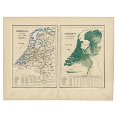
Netherlands Antique Map

10
to
92
861
130
757
419
277
226
118
52
47
47
45
40
25
21
21
16
15
14
11
11
11
10
10
8
8
7
6
6
6
6
4
4
3
3
3
2
2
2
2
2
2
2
1
1
1
1
70
13
12
12
11
Sort By
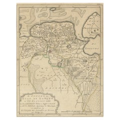
Antique Map of Groningen, the Netherlands, 1771
Located in Langweer, NL
province of Groningen, the Netherlands. This map originates from 'Nieuwe kerkelyke geographische zak- en
Category

18th Century Netherlands Antique Map

Materials

Paper

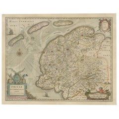
Antique Map of Friesland, The Netherlands, 1638
Located in Langweer, NL
Antique map titled 'Frisia Occidentalis'. Original antique map of Friesland, the Netherlands
Category

17th Century Netherlands Antique Map

Materials

Paper

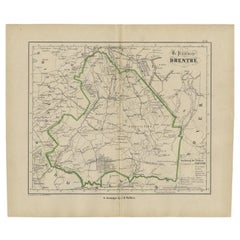
Antique Map of Drenthe, The Netherlands, 1864
Located in Langweer, NL
Antique map titled 'De Provincie Drenthe'. Map of the province of Drenthe, the Netherlands. This
Category

19th Century Netherlands Antique Map

Materials

Paper

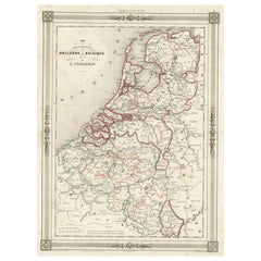
Antique Map of the Netherlands, Belgium and Luxembourg
Located in Langweer, NL
Antique map titled 'Carte des Royaumes Hollande et Belgique'. Attractive map of the Netherlands
Category

Mid-19th Century Netherlands Antique Map

Materials

Paper

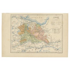
Antique Map of Utrecht in The Netherlands, 1883
Located in Langweer, NL
Antique map titled 'Utrecht'. Map of Utrecht, a province of the Netherlands. This map originates
Category

19th Century Netherlands Antique Map

Materials

Paper

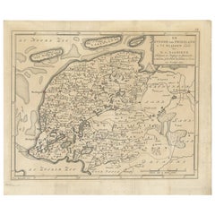
Antique Map of Friesland in the Netherlands, 1770
Located in Langweer, NL
province of Friesland, the Netherlands. This map originates from 'Nieuwe kerkelyke geographische zak- en
Category

18th Century Netherlands Antique Map

Materials

Paper

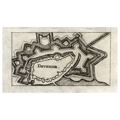
Antique Map of Deventer in the Netherlands, 1691
Located in Langweer, NL
Plate 'Devendr.' (Plan of the fortified city of Deventer, The Netherlands.) This attractive
Category

17th Century Netherlands Antique Map

Materials

Paper

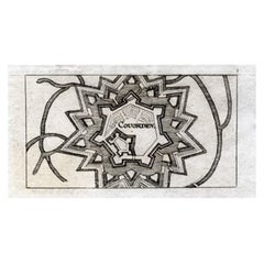
Antique Map of Coevorden in the Netherlands, 1691
Located in Langweer, NL
Plate 'Covorden.' (Plan of the fortified city of Coevorden, The Netherlands.) This attractive
Category

17th Century Netherlands Antique Map

Materials

Paper

Antique Map of the Netherlands by Kuyper, 1883
Located in Langweer, NL
orohydrographic map of the Netherlands, two maps on one sheet. This map originates from 'Atlas van Nederland
Category

19th Century Netherlands Antique Map

Materials

Paper

Antique Map of the Netherlands by Brugsma, 1864
Located in Langweer, NL
Antique map titled 'Het Koningrijk der Nederlanden'. Map of the Netherlands. This map originates
Category

19th Century Netherlands Antique Map

Materials

Paper

Antique Map of the Netherlands by Petri, 1852
Located in Langweer, NL
Antique map titled 'Het Koninkrijk der Nederlanden'. Map of the Netherlands, with coats of arms of
Category

19th Century Netherlands Antique Map

Materials

Paper

Antique Map of the Netherlands by Guicciardini, 1582
Located in Langweer, NL
Antique map titled 'Hollandiae Cattorum Regionis Typus'. Early copper engraving of the Netherlands
Category

16th Century Netherlands Antique Map

Materials

Paper

Antique Map of the Netherlands by Zannoni, 1765
Located in Langweer, NL
Pays Bas (..)'. Beautiful old map of the Netherlands. This map originates from 'Atlas Historique de la
Category

18th Century Netherlands Antique Map

Materials

Paper

Antique Map of the Netherlands by Guicciardini, 1612
Located in Langweer, NL
Antique map titled 'Belgicarum Provinciarum Nova Descriptio'. Beautiful old map of the Netherlands
Category

17th Century Netherlands Antique Map

Materials

Paper

Antique Map of Province Friesland, The Netherlands, 1787
Located in Langweer, NL
Jacobus Kok'. Original antique map of the province of Friesland, the Netherlands. This map originates from
Category

18th Century Netherlands Antique Map

Materials

Paper

Antique Map of Hennaarderadeel, Friesland, the Netherlands, 1868
Located in Langweer, NL
Antique map titled 'Provincie Friesland - Gemeente Hennaarderadeel'. Map of the township of
Category

19th Century Netherlands Antique Map

Materials

Paper

Antique Map of Dantumadeel, Friesland, The Netherlands, 1868
Located in Langweer, NL
Antique map titled 'Provincie Friesland - Gemeente Dantumadeel'. Map of the township of Dantumadeel
Category

19th Century Netherlands Antique Map

Materials

Paper

Antique Map of Ferwerderadeel, Friesland, the Netherlands, 1868
Located in Langweer, NL
Antique map titled 'Provincie Friesland - Gemeente Ferwerderadeel'. Map of the township of
Category

19th Century Netherlands Antique Map

Materials

Paper

Antique Map of Lemsterland in the Netherlands, 1868
Located in Langweer, NL
Antique map titled 'Provincie Friesland - Gemeente Lemsterland'. Map of the township of
Category

19th Century Netherlands Antique Map

Materials

Paper

Antique Map of Ijlst , Friesland in the Netherlands, 1865
Located in Langweer, NL
Friesland: Gemeente IjJlst. These scarse detailed maps of Dutch Towns originate from the 'Gemeente
Category

19th Century Netherlands Antique Map

Materials

Paper

Antique Map of the Province of Overijssel, the Netherlands
Located in Langweer, NL
Original antique map titled 'Ditio Trans-Isulana'. Original old map of the province of Overijssel
Category

Mid-17th Century Netherlands Antique Map

Materials

Paper

Antique Map of the Netherlands and Belgium, circa 1880
Located in Langweer, NL
Antique map titled 'Hollande et Belgique'. Old map of the Netherlands and Belgium. With decorative
Category

19th Century Netherlands Antique Map

Materials

Paper

Antique Map of Zeeland, The Netherlands, by Jaillot, 1693
Located in Langweer, NL
Antique map titled 'Le Comte de Zeelande (..).' Detailed map of the province of Zeeland, The
Category

17th Century Netherlands Antique Map

Materials

Paper

Antique Map of Drenthe, Province in the Netherlands, 1883
Located in Langweer, NL
Antique map titled 'Drenthe'. Map of Drenthe, a province of the Netherlands. This map originates
Category

19th Century Netherlands Antique Map

Materials

Paper

Antique Map of Gaasterland in Friesland, the Netherlands, 1718
Located in Langweer, NL
map of Gaasterland, Friesland, the Netherlands. Originates from 'Uitbeelding van de Heerlijkheid van
Category

18th Century Netherlands Antique Map

Materials

Paper

Antique Map of the Province Limburg, The Netherlands, 1864
Located in Langweer, NL
Antique map titled 'De Provincie Limburg'. Map of the province of Limburg, the Netherlands. This
Category

19th Century Netherlands Antique Map

Materials

Paper

Antique Map of Fortification of Bellingwolderschans, The Netherlands, 1673
Located in Langweer, NL
, the Netherlands. This map originates from 'Teatro del Belgio', by G. Gualdo Priorato. Artists and
Category

17th Century Netherlands Antique Map

Materials

Paper

Antique Map of the Netherlands by Brugsma, c.1870
Located in Langweer, NL
Antique map titled 'Het Koningrijk der Nederlanden'. Map of the Netherlands. This map originates
Category

19th Century Netherlands Antique Map

Materials

Paper

Antique Map of Friesland, Province in The Netherlands, 1864
Located in Langweer, NL
Antique map titled 'De Provincie Friesland'. Map of the province of Friesland, the Netherlands
Category

19th Century Netherlands Antique Map

Materials

Paper

Antique Map of Haskerland in Friesland, The Netherlands, 1868
Located in Langweer, NL
Antique map titled 'Provincie Friesland - Gemeente Haskerland'. Map of the township of
Category

19th Century Netherlands Antique Map

Materials

Paper

Antique Map of Gaasterland, Friesland in the Netherlands, 1868
Located in Langweer, NL
Antique map titled 'Provincie Friesland - Gemeente Gaasterland'. Map of the township of Gaasterland
Category

19th Century Netherlands Antique Map

Materials

Paper

Antique Map of Baarderadeel in Friesland, The Netherlands, 1868
Located in Langweer, NL
Antique map titled 'Provincie Friesland - Gemeente Baarderadeel'. Map of the township Baarderadeel
Category

19th Century Netherlands Antique Map

Materials

Paper

Antique Map of Kollumerland in Friesland, The Netherlands, 1868
Located in Langweer, NL
Antique map titled 'Provincie Friesland - Gemeente Kollumerland en Nieuw-Kruisland'. Map of the
Category

19th Century Netherlands Antique Map

Materials

Paper

Antique Map of Leeuwarderadeel in Friesland, The Netherlands, 1868
Located in Langweer, NL
Antique map titled 'Provincie Friesland - Gemeente Leeuwarderadeel'. Map of the township of
Category

19th Century Netherlands Antique Map

Materials

Paper

Antique Map of the Netherlands by N. Visscher, 1684
Located in Langweer, NL
Antique map titled 'Comitatus Hollandiae Tabula Pluribus Locis Recens Emendata a Nicolao I
Category

Late 17th Century Netherlands Antique Map

Materials

Paper

Antique Map of Belgium and the Netherlands by Johnston '1909'
Located in Langweer, NL
Antique map titled 'Belgium and The Netherlands'. Original antique map of Belgium and the
Category

Early 20th Century Netherlands Antique Map

Materials

Paper

Antique Map of the Southern Netherlands by Bowles, c.1780
Located in Langweer, NL
, or Netherlands’. Original antique map of the Southern Netherlands. The Southern Netherlands, also
Category

18th Century Netherlands Antique Map

Materials

Paper

Antique Map of Drenthe, the Netherlands, with Original Hand Coloring
Located in Langweer, NL
Original antique map titled 'Illustribus ac Potentibus Comitatus Drentiae (..)'. Old map of the
Category

Mid-17th Century Netherlands Antique Map

Materials

Paper

Decorative Antique Map of the Netherlands and Belgium, ca.1875
Located in Langweer, NL
Antique map titled 'Pays-Bas Belgique (..)'. Large map of the Netherlands and Belgium. This map
Category

Late 19th Century Netherlands Antique Map

Materials

Paper

Original Colored Antique Map of Utrecht & Surroundings, The Netherlands, c1690
Located in Langweer, NL
Emensus est Bernardus du Roy'. Map of the region of Utrecht, The Netherlands. This map depicts many
Category

1690s Netherlands Antique Map

Materials

Paper

Antique Map of the Netherlands and Belgium by Bowen, 1747
By Emanuel Bowen
Located in Langweer, NL
Antique map Belgium titled 'A New and Accurate Map of the Netherlands or Low Countries'. Detailed
Category

18th Century Netherlands Antique Map

Materials

Paper

Antique Map of Zaltbommel in the Netherlands, by Guicciardini, 1613
Located in Langweer, NL
Netherlands). This map originates from 'Discrittione di tutti i Paesi Bassi' by L. Guicciardini. Artists
Category

17th Century Netherlands Antique Map

Materials

Paper

Antique Map of Brabant, the Netherlands, with Original Hand Coloring
Located in Langweer, NL
Brabant, the Netherlands. North is to the right. Like all other maps of Brabantiae Ducatus, it encloses
Category

Mid-17th Century Netherlands Antique Map

Materials

Paper

Antique Map of Western Germany with part of the Netherlands
Located in Langweer, NL
Antique map titled 'Ducatus Iuliacensis Cliviensis et Montensis (..)'. Original old map of Western
Category

Mid-18th Century Netherlands Antique Map

Materials

Paper

Antique Map of Drenthe, a Province of The Netherlands, 1635
Located in Langweer, NL
Antique map titled 'Drentiae'. Original antique map of the province of Drenthe, the Netherlands
Category

17th Century Netherlands Antique Map

Materials

Paper

Antique Map of Harlingen, Harbour City in the Netherlands, 1691
Located in Langweer, NL
Plate 'Harlingen.' (Plan of the city of Harlingen, The Netherlands.) This attractive original old
Category

17th Century Netherlands Antique Map

Materials

Paper

Antique Map of the Netherlands and Belgium by Hérisson, 1829
Located in Langweer, NL
understanding of the early 19th century. The map's delineation of the Kingdom of the Netherlands, including both
Category

Mid-19th Century Netherlands Antique Map

Materials

Paper

Antique Map of Belgium and the Netherlands by Johnston, 1882
By Alexander Keith Johnston
Located in Langweer, NL
Antique map titled 'Belgium and the Netherlands'. Old map of Belgium and the Netherlands. This map
Category

19th Century Netherlands Antique Map

Materials

Paper

Antique Map of Drenthe, a Province in The Netherlands, 1658
Located in Langweer, NL
, a province in the Netherlands. Large cartouche with coats of arms. This map is made by J. Janssonius
Category

17th Century Netherlands Antique Map

Materials

Paper

Antique Map of the Netherlands in 1560 by Mees, 1853
Located in Langweer, NL
bisdommen'. Map of the Netherlands in 1560. This map originates from 'Historische Atlas van Noord-Nederland
Category

19th Century Netherlands Antique Map

Materials

Paper

Antique Map of the Netherlands in 1811 by Mees, 1858
Located in Langweer, NL
Netherlands in 1811. This map originates from 'Historische Atlas van Noord-Nederland'. Artists and
Category

19th Century Netherlands Antique Map

Materials

Paper

Antique Map of the Netherlands in 1530 by Mees, 1852
Located in Langweer, NL
Netherlands in 1530. This map originates from 'Historische Atlas van Noord-Nederland'. Artists and Engravers
Category

19th Century Netherlands Antique Map

Materials

Paper

Antique Map of the Netherlands in 1590 by Mees, 1854
Located in Langweer, NL
Netherlands in 1590. This map originates from 'Historische Atlas van Noord-Nederland'. Artists and
Category

19th Century Netherlands Antique Map

Materials

Paper

Antique Map of the Netherlands in 1839 by Mees, 1860
Located in Langweer, NL
Antique map titled 'Noord-Nederland in 1839. De scheiding van België'. Map of the Netherlands in
Category

19th Century Netherlands Antique Map

Materials

Paper

Antique Map of the Netherlands in 1859 by Mees, 1861
Located in Langweer, NL
vervaardiging'. Map of the Netherlands in 1859. This map originates from 'Historische Atlas van Noord-Nederland
Category

19th Century Netherlands Antique Map

Materials

Paper

Antique Map of the Netherlands in 1648 by Mees, 1855
Located in Langweer, NL
'. Map of the Netherlands in 1648. This map originates from 'Historische Atlas van Noord-Nederland
Category

19th Century Netherlands Antique Map

Materials

Paper

Antique Map of the Netherlands in 1814 by Mees, 1858
Located in Langweer, NL
Netherlands in 1814. This map originates from 'Historische Atlas van Noord-Nederland'. Artists and
Category

19th Century Netherlands Antique Map

Materials

Paper

Antique Map of the Netherlands in 1798 by Mees, 1851
Located in Langweer, NL
ringen'. Map of the Netherlands in 1798. This map originates from 'Historische Atlas van Noord-Nederland
Category

19th Century Netherlands Antique Map

Materials

Paper

Antique Map of the Netherlands in 1860 by Mees, 1862
Located in Langweer, NL
Netherlands in 1860. This map originates from 'Historische Atlas van Noord-Nederland'. Artists and
Category

19th Century Netherlands Antique Map

Materials

Paper

Antique Map of the Netherlands in 1740 by Mees, 1857
Located in Langweer, NL
tot in 1795'. Map of the Netherlands in 1740. This map originates from 'Historische Atlas van Noord
Category

19th Century Netherlands Antique Map

Materials

Paper

  • 1
  • ...
Get Updated with New Arrivals
Save "Netherlands Antique Map", and we’ll notify you when there are new listings in this category.

Netherlands Antique Map For Sale on 1stDibs

Choose from an assortment of styles, material and more with respect to the Netherlands antique map you’re looking for at 1stDibs. A Netherlands antique map — often made from paper — can elevate any home. There are many kinds of the Netherlands antique map you’re looking for, from those produced as long ago as the 18th Century to those made as recently as the 19th Century. A well-made Netherlands antique map has long been a part of the offerings for many furniture designers and manufacturers, but those produced by F. Valentijn, Isaak Tirion and James Cook are consistently popular.

How Much is a Netherlands Antique Map?

Prices for a Netherlands antique map can differ depending upon size, time period and other attributes — at 1stDibs, they begin at $148 and can go as high as $7,045, while the average can fetch as much as $564.

Read More

Pamela Shamshiri Shares the Secrets behind Her First-Ever Book and Its Effortlessly Cool Interiors

The sought-after designer worked with the team at Hoffman Creative to produce a monograph that beautifully showcases some of Studio Shamshiri's most inspiring projects.

Moroccan Artworks and Objects Take Center Stage in an Extraordinary Villa in Tangier

Italian writer and collector Umberto Pasti opens the doors to his remarkable cave of wonders in North Africa.

Montecito Has Drawn Royalty and Celebrities, and These Homes Are Proof of Its Allure

Hollywood A-listers, ex-pat aristocrats and art collectors and style setters of all stripes appreciate the allure of the coastal California hamlet — much on our minds after recent winter floods.

Whaam! Blam! Pow! — a New Book on Pop Art Packs a Punch

Publishing house Assouline and writer Julie Belcove have teamed up to trace the history of the genre, from Roy Lichtenstein, Andy Warhol and Yayoi Kusama to Mickalene Thomas and Jeff Koons.

The Sparkling Legacy of Tiffany & Co. Explained, One Jewel at a Time

A gorgeous new book celebrates — and memorializes — the iconic jeweler’s rich heritage.

What Makes a Gem-Encrusted Chess Set Worth $4 Million?

The world’s most opulent chess set, weighing in at 513 carats, is literally fit for a king and queen.

Tauba Auerbach’s Geometric Pop-Up Book Is Mighty Rare, Thanks to a Hurricane

This sculptural art book has an epic backstory of its own.

Step inside the Storied Mansions of Palm Beach’s Most Effervescent Architect

From Spanish-style courtyards to fanciful fountains, these acclaimed structures abound in surprising and elegant details.