Mid-19th Century Maps
to
580
824
32
856
56
4
2
2,929
2,257
475
3
290
34
10
126
10
37
9
2
5
4
3
3
832
51
24
4
4
209
103
55
55
46
856
856
856
104
4
2
1
1
Period: Mid-19th Century
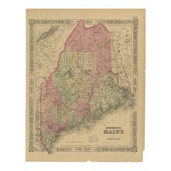
Maine County Map – Johnson, Hand-Colored, USA c.1864
Located in Langweer, NL
Johnson’s Maine Map, USA Published c.1864 – Hand-Colored County Map
This is a finely engraved and hand-colored map titled Johnson’s Maine, published by Johnson and Ward in New York ...
Category
American Antique Mid-19th Century Maps
Materials
Paper
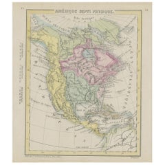
Small Map of the United States
Located in Langweer, NL
Antique map titled 'Amérique septe. Physique'. Small map of the United States. lithographed by C. Callewaert brothers in Brussels circa 1870.
Category
Antique Mid-19th Century Maps
Materials
Paper
$70 Sale Price
20% Off
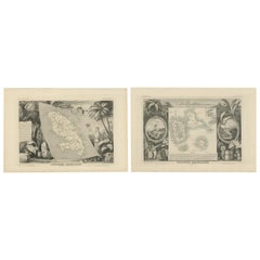
French Colonies in the Caribbean: Maps of Martinique and Guadeloupe (1852)
Located in Langweer, NL
This pair of maps, published in 1852, provides a detailed representation of the French Caribbean colonies, specifically Martinique and Guadeloupe. They were part of the *Atlas Univer...
Category
Antique Mid-19th Century Maps
Materials
Paper
$311 Sale Price / set
20% Off
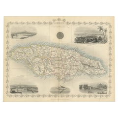
An Ornate and Historical Tallis Map of Jamaica with Decorative Vignettes, 1851
Located in Langweer, NL
This original antique map of Jamaica is part of the renowned series created by the Tallis Company, known for their detailed and decorative maps ...
Category
Antique Mid-19th Century Maps
Materials
Paper
$274 Sale Price
20% Off
United States, Canada & Mexico – 1857 North America Map
Located in Langweer, NL
North America Map – United States, Canada, Mexico 1857
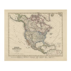
This impressive antique print shows “Nord-America” meaning “North America,” published in 1857 by Justus Perthes in Gotha as pa...
Category
German Antique Mid-19th Century Maps
Materials
Paper
Ireland Map – Provincial and County Divisions 1851
Located in Langweer, NL
Ireland Map – Provincial and County Divisions 1851
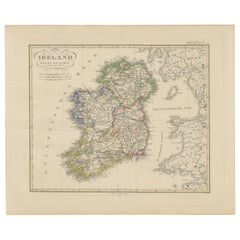
This fine antique print shows Ireland titled simply “Ireland,” published in 1851 by Justus Perthes in Gotha as part of Adolf Stiel...
Category
German Antique Mid-19th Century Maps
Materials
Paper
Original Antique Map or City Plan of Rome, Italy. Circa 1835
Located in St Annes, Lancashire
Nice map of Rome
Drawn and engraved by J.Dower
Published by Orr & Smith. C.1835
Unframed.
Free shipping
Category
English Antique Mid-19th Century Maps
Materials
Paper
Antique 1683 Map of Hispaniola and Puerto Rico in the Caribbean by Mallet
Located in Langweer, NL
Title: 17th Century Map of Hispaniola and Puerto Rico by Mallet (1683)
This exquisite 17th-century map by Mallet, titled "I. d'Hispaniola et P.to Rico," showcases the islands of Hispaniola and Puerto Rico with remarkable detail. Published in Paris in 1683 as part of Mallet's monumental "Description de l'Univers," this map is a prime example of historical cartography from the era.
Map Features:
- Detailed depiction of Hispaniola and Puerto Rico
- Nearby islands: Inagua islands, Mayaguana, Île-à-Vache, Saona, and Mona
- Three illustrated naval battles surrounding the islands
- Hand-colored illustrations typical of the period
- Published in Paris, 1683, as part of the "Description de l'Univers"
- Engraved with artistic and geographic precision
Collectors and enthusiasts of antique maps will appreciate the historical significance and artistic detail of this rare print. Although small, the map is perfect for framing and this map serves as a captivating piece of history, reflecting the maritime exploration and territorial knowledge of the late 17th century.
The maker of the map is Allain Manesson Mallet, a notable 17th-century cartographer, military engineer, and author. Born in Paris in 1630, Mallet served in the French army and worked as a military engineer under Louis XIV. He later became a professor of mathematics and military architecture.
Mallet is best known for his monumental work, "Description de l'Univers," published in Paris in 1683. This extensive publication is considered one of the greatest works of its kind in the 17th century, providing detailed descriptions and maps of various parts of the world. Mallet's maps are renowned for their artistic quality, intricate details, and the inclusion of illustrative elements such as ships, sea creatures, and topographical features.
Mallet's contributions to cartography and his work in "Description de l'Univers" have left a lasting impact on the field, making his maps highly valued by collectors and historians.
Keywords:
- 17th-century map
- Mallet map 1683
- Hispaniola map
- Puerto Rico map
- Antique Caribbean map...
Category
Antique Mid-19th Century Maps
Materials
Paper
$359 Sale Price
20% Off
Texas California Mexico Map – Antique Tallis Map with Gold Region, c.1850
Located in Langweer, NL
Texas California Mexico Map – Antique Tallis Map with Gold Region, c.1850
This highly decorative and historically rich map titled 'Mexico, California and Texas' was published around...
Category
Antique Mid-19th Century Maps
Materials
Paper
Old Map of British Mediterranean Territories with Images of Historic Sites, 1851
Located in Langweer, NL
John Tallis & Company was a British map-making firm that gained widespread acclaim in the 19th century, particularly known for their detailed and artistically embellished maps. The f...
Category
Antique Mid-19th Century Maps
Materials
Paper
$340 Sale Price
20% Off
Dresden Germany, Old Town Plan by Baldwin & Cradock 1833
Located in Langweer, NL
Dresden, depicted in this antique map by Baldwin & Cradock from 1833, was a historically significant city in Saxony, Germany. This map, published under the supervision of the Society...
Category
Antique Mid-19th Century Maps
Materials
Paper
Antique Lithography Map, Huntingdonshire, English, Framed Cartography, Victorian
Located in Hele, Devon, GB
This is an antique lithography map of Huntingdonshire. An English, framed atlas engraving of cartographic interest, dating to the mid 19th century and later.
Superb lithography of ...
Category
British Victorian Antique Mid-19th Century Maps
Materials
Glass, Wood, Paper
Iran and Turan Map – Persia, Afghanistan, Baluchistan, Turkestan 1858
Located in Langweer, NL
Iran and Turan Map – Persia, Afghanistan, Baluchistan, Turkestan 1858
This impressive antique print shows “Iran und Turan (Persien, Afghanistan, Beludschistan, Turkestan),” meaning ...
Category
German Antique Mid-19th Century Maps
Materials
Paper
Scotland Map – Highlands, Islands, and Northern England 1858
Located in Langweer, NL
Scotland Map – Highlands, Islands, and Northern England 1858
This attractive antique print shows Scotland and its surroundings titled “Schotland mit der ...
Category
German Antique Mid-19th Century Maps
Materials
Paper
Original Antique Map or City Plan of Amsterdam, Netherlands. Circa 1835
Located in St Annes, Lancashire
Nice map of Amsterdam
Drawn and engraved by J.Dower
Published by Orr & Smith. C.1835
Unframed.
Free shipping
Category
English Antique Mid-19th Century Maps
Materials
Paper
Original Antique Map of North America by Dower, circa 1835
Located in St Annes, Lancashire
Nice map of North America
Drawn and engraved by J.Dower
Published by Orr & Smith. C.1835
Unframed.
Free shipping
Category
English Antique Mid-19th Century Maps
Materials
Paper
Map of Eure-et-Loir France with Chartres Cathedral and Marceau Portrait, c.1850
Located in Langweer, NL
Map of Eure-et-Loir France with Chartres Cathedral and Marceau Portrait, 19th c
This detailed and elegantly illustrated 19th-century map of the Eure-et-Loir department in north-cent...
Category
French Antique Mid-19th Century Maps
Materials
Paper
Johnson’s Illinois Map, USA c.1864 – Hand-Colored with Chicago Courthouse View
Located in Langweer, NL
Johnson’s Illinois Map, USA c.1864 – Hand-Colored with Chicago Courthouse View
This is a finely engraved and hand-colored map titled Johnson’s Illinois, published by Johnson and War...
Category
American Antique Mid-19th Century Maps
Materials
Paper
Persia Unveiled: Antique Map of Iran, Afghanistan, and Beyond, 1852
Located in Langweer, NL
The antique map titled 'Royaumes de Perse Herat & Kaboul' is an attractive map of Persia. Here are the key details and features of the map:
1. **Geographic Coverage**:
- The map ...
Category
Antique Mid-19th Century Maps
Materials
Paper
$151 Sale Price
20% Off
Antique Map of Bourbon, or Reunion, Colony of France
Located in Langweer, NL
Original antique map titled 'Ile de la Réunion'. This is a fascinating map of the French department of Ile. Bourbon or Reunion. Bourbon, or Reunion, is a volcanic island off the coas...
Category
Antique Mid-19th Century Maps
Materials
Paper
$321 Sale Price
20% Off
Antique Map of the Kingdoms of Sweden and Norway by Wyld '1845'
Located in Langweer, NL
Antique map titled 'Kingdoms of Sweden and Norway'. Original antique map of the Kingdoms of Sweden and Norway. This map originates from 'An Atlas of the World, Comprehending Separate...
Category
Antique Mid-19th Century Maps
Materials
Paper
$141 Sale Price
40% Off
Levasseur's 1852 Cartographic Portrait of Gironde: Celebrating the Bordeaux Wine
Located in Langweer, NL
This original hand-colored map is from the "Atlas National Illustré," a work by Victor Levasseur, a French geographer and cartographer known for his richly illustrated maps.
The map is a steel engraving, which was a common and precise method for creating maps at the time. The inclusion of the publisher's name, A. Combette from Paris, and the addresses of the various contributors to the map's creation, like the engravers Laguillermie and Rainaud, adds to the historical context of the piece.
The margins of the map are adorned with detailed illustrations that serve as a visual encyclopedic reference to the region's geography, economy, and notable figures. The use of color along the boundaries makes the map not only a tool for navigation but also an educational resource, providing insights into the department's landscape, economy, and cultural significance.
The text included in the map's design provides statistical information, a map legend, and discussions about the land, local curiosities, notable personalities, products, and commerce, which would have been invaluable for education and reference at the time.
The 'Atlas National Illustré' is celebrated for its combination of cartographic detail and artistic embellishment, making it a valuable cultural artifact. It represents the height of decorative map-making in the 19th century, alongside the works of John Tallis and Archibald Fullarton.
This uploaded image is a detailed and colored map of the Département de la Gironde from Victor Levasseur's "Atlas National Illustré." Similar to the other maps from this series, it features a central map with the title 'Dépt. de la Gironde' at the bottom.
Surrounding the map are decorative vignettes and elements that bring to life the cultural and economic aspects of the Gironde department. On the left, there is likely statistical information about the department and its subdivisions, reflecting the population and administrative details. This is framed by images that may represent the local industries and natural resources, such as wine, which is a central feature of the Bordeaux region located within Gironde.
The right side of the map contains a textual history and descriptions of the region, coupled with portraits of notable figures, possibly historic personages or contributors to the region's cultural and economic development. The illustrations often include agricultural products, symbols of commerce, and scenes of daily life, as well as architectural landmarks.
The presence of wine bottles, barrels, and vineyards in the illustrations would be indicative of the Gironde's prominence in wine production, particularly Bordeaux wines, which are esteemed worldwide. These engravings serve to emphasize the richness of the land and the sophistication of its products.
Maps from this era, especially those by Levasseur, are notable for their combination of art and education, providing a snapshot not only of the geography but also of the societal and economic conditions of the time. The detailed engravings also suggest that this map was as much a decorative piece as it was a functional one, intended for display and reference by those interested in the illustrated region.
The Gironde department in France is renowned for its significant contribution to the wine industry, particularly through the Bordeaux wine region. A bit more about the important places within Gironde and the types of wine the area is known for:
1. **Bordeaux**: The capital city of the department and the heart of the wine region. It's not only an urban center but also a hub for the wine trade.
2. **Médoc**: North of Bordeaux, known for prestigious châteaux and wines like Margaux, Saint-Julien, Pauillac, and Saint-Estèphe.
3. **Saint-Émilion**: East of Bordeaux, recognized for its full-bodied red wines and the picturesque medieval town.
4. **Pomerol**: Also near Saint-Émilion, smaller than its neighbor but equally renowned, particularly for Château Pétrus...
Category
Antique Mid-19th Century Maps
Materials
Paper
$321 Sale Price
20% Off
Original Antique Map or City Plan of Venice, Italy. Circa 1835
Located in St Annes, Lancashire
Nice map of Venice
Drawn and engraved by J.Dower
Published by Orr & Smith. C.1835
Unframed.
Free shipping
Category
English Antique Mid-19th Century Maps
Materials
Paper
Large Antique Map of the State of Texas, 1861
Located in Langweer, NL
Antique map titled 'Johnson's New Map of the State of Texas' Large map of Texas, shows railroads, wagon roads, the U.S. Mail Route, rivers, ports, ...
Category
American Antique Mid-19th Century Maps
Materials
Paper
$463 Sale Price
20% Off
Rare 1864 Civil War Era Map of Michigan and Wisconsin with Great Lakes Detail
Located in Langweer, NL
Title: Rare 1864 Civil War Era Map of Michigan and Wisconsin with Great Lakes Detail
Description: This beautifully crafted antique map, titled "Johnson's Michigan and Wisconsin," wa...
Category
Antique Mid-19th Century Maps
Materials
Paper
Antique Map of South Africa by Lowry, 1852
Located in Langweer, NL
Antique map titled 'South Africa'. Two individual sheets of South Africa. This map originates from 'Lowry's table Atlas constructed and engraved from the most recent authorities' by ...
Category
Antique Mid-19th Century Maps
Materials
Paper
$141 Sale Price / set
20% Off
Antique Map of Persia and Tartary by Lowry, '1852'
Located in Langweer, NL
Antique map titled 'Persia and Tartary'. Original map of Persia and Tartary. This map originates from 'Lowry's Table Atlas constructed and engraved from the most recent Authorities' ...
Category
Antique Mid-19th Century Maps
Materials
Paper
$94 Sale Price
20% Off
Delaware and Maryland Map – Johnson, Hand-Colored with Insets, 1864
Located in Langweer, NL
Johnson’s Delaware and Maryland Map, USA c.1864 – Hand-Colored with Insets
This is a finely engraved and hand-colored map titled Johnson’s Delaware and Maryland, published by Johnso...
Category
American Antique Mid-19th Century Maps
Materials
Paper
Antique 1830 Map of Southern Scotland with Edinburgh, Berwick, Ayr, and Dumfries
Located in Langweer, NL
Title: Antique 1830 Map of Southern Scotland with Edinburgh, Berwick, Ayr, and Dumfries
Description: This 1830 German-language map, titled Britisches Reich – B. Kon Scotland, fo...
Category
Antique Mid-19th Century Maps
Materials
Paper
Rare 1864 Ohio Civil War Era Map with State Capitol Illustration
Located in Langweer, NL
Title: Johnson's Ohio Antique Map by Johnson and Ward, 1864
Description: This exquisite antique map, titled "Johnson's Ohio," was published in 1864 by Johnson and Ward, a prominent ...
Category
Antique Mid-19th Century Maps
Materials
Paper
Antique Map of Cuba, Haiti and Porto Rico by W. G. Blackie, 1859
Located in Langweer, NL
Antique map titled 'The Leeward or North Caribbean Islands'. Original antique map of Cuba, Haiti and Porto Rico. This map originates from ‘The Imperial Atla...
Category
Antique Mid-19th Century Maps
Materials
Paper
$236 Sale Price
20% Off
Historic 1864 Civil War Map of Pennsylvania and New Jersey with Coastal Focus
Located in Langweer, NL
Title: Historic 1864 Civil War Map of Pennsylvania and New Jersey with Coastal Focus
Description: This meticulously crafted antique map, titled "Johnson's Pennsylvania and New Jerse...
Category
Antique Mid-19th Century Maps
Materials
Paper
Paris and Surroundings – Antique Map by Gall and Inglis, Published 1843
Located in Langweer, NL
Antique Map of Paris and Environs by Gall and Inglis, 1843
This finely detailed map titled "Gall & Inglis’ Plan of Paris and Environs" was published in 1843 and provides a fascinati...
Category
English Antique Mid-19th Century Maps
Materials
Paper
1834 Mexico & Guatemala Framed Map by H.S. Tanner
Located in Stamford, CT
1834 Mexico & Guatemala map of published by H.S. Tanner, Philadelphia, Pennsylvania. Engraved by J. Knight.
As found high end custom framing with carved wood frame, custom matting a...
Category
American American Classical Antique Mid-19th Century Maps
Materials
Glass, Wood, Paper
Map of Charente-Inférieure France with La Rochelle and Coastal Vineyards, c.1850
Located in Langweer, NL
Map of Charente-Inférieure France with La Rochelle and Coastal Vineyards, 19th c
Description:
This decorative 19th-century map of the former department of Charente-Inférieure, now k...
Category
French Antique Mid-19th Century Maps
Materials
Paper
Map of Aube France with Troyes and Champagne Wine Region, 19th Century
Located in Langweer, NL
Map of Aube France with Troyes and Champagne Vineyards by Vuillemin, 19th c
Description:
This 19th-century map of the Aube department in the Grand Est region of northeastern France ...
Category
French Antique Mid-19th Century Maps
Materials
Paper
Antique Map of Syria by Wyld '1845'
Located in Langweer, NL
Antique map titled 'Map of Syria'. Original antique map of Syria. This map originates from 'An Atlas of the World, Comprehending Separate Maps of its
Var...
Category
Antique Mid-19th Century Maps
Materials
Paper
$236 Sale Price
20% Off
Mexico City by Braun & Hogenberg c. 1590
Located in Stamford, CT
Mexico by Braun & Hogenberg c. 1590
Category
European Spanish Colonial Antique Mid-19th Century Maps
Materials
Glass, Wood, Paper
Rare 1864 Civil War Era Map of Illinois with Lake Michigan Detail
Located in Langweer, NL
Title: Rare 1864 Civil War Era Map of Illinois with Lake Michigan Detail
Description: This intricately detailed antique map, titled "Johnson's Illinois," was published in 1864 by Jo...
Category
Antique Mid-19th Century Maps
Materials
Paper
Ornate 1850s Map of the United States: Featuring Iconic Landmarks and Portrets
Located in Langweer, NL
Ornate 1850s Map of the United States: Featuring Iconic Landmarks and Historical Portraits
This decorative 19th-century map of the United States, created by J. Rapkin and publishe...
Category
Antique Mid-19th Century Maps
Materials
Paper
Rare 1864 Civil War Era Map of North America with Detailed Borders
Located in Langweer, NL
Title: Rare 1864 Civil War Era Map of North America with Detailed Borders
Description: This remarkable antique map, titled "Johnson's North America," was published in 1864 by Johnso...
Category
Antique Mid-19th Century Maps
Materials
Paper
1859 "Map of the United States of America..." by J. H. Colton
By J.H. Colton
Located in Colorado Springs, CO
Presented is an 1859 “Map of the United States of America, the British Provinces, Mexico, the West Indies and Central America with Part of...
Category
American Antique Mid-19th Century Maps
Materials
Paper
1846 "North America" Map, Engraved by I. Dower
Located in Colorado Springs, CO
Presented is an original 1846 map of “North America.” The map was drawn and engraved by I. Dower and published in London by Orr & Company. The map depicts North America, to include G...
Category
English Victorian Antique Mid-19th Century Maps
Materials
Paper
Historic 1864 Civil War Era Map of Canada with Great Lakes Detail
Located in Langweer, NL
Title: Rare 1864 Civil War Era Map of Canada with Great Lakes Detail
Description: This finely detailed antique map, titled "Johnson's Canada," was published in 1864 by Johnson and W...
Category
Antique Mid-19th Century Maps
Materials
Paper
Small Antique Map of the European Turkey, Greece & Ionian Islands – c.1860
Located in Langweer, NL
Antique Map of the European Turkey, Greece & Ionian Islands – Stieler, c.1860
Original antique map titled *Die Europaeische Türkei, Griechenland und die ...
Category
Antique Mid-19th Century Maps
Materials
Paper
$113 Sale Price
20% Off
Original Antique Map of Scotland by Dower, circa 1835
Located in St Annes, Lancashire
Nice map of Scotland
Drawn and engraved by J.Dower
Published by Orr & Smith. C.1835
Unframed.
Free shipping
Category
English Antique Mid-19th Century Maps
Materials
Paper
Majestic Map of Europe by Andriveau-Goujon - Complete Continental View - ca.1849
Located in Langweer, NL
Majestic 19th Century Map of Europe by Andriveau-Goujon - Complete Continental View - Circa 1849
This magnificent and intricately detailed map of Europe, titled "Carte Physique et...
Category
Antique Mid-19th Century Maps
Materials
Paper
$727 Sale Price / set
20% Off
Plan of Baltimore City Map, USA c.1870 – Hand-Colored Street Plan
Located in Langweer, NL
Plan of Baltimore City Map, USA c.1870 – Hand-Colored Street Plan
This is a finely engraved and hand-colored street plan titled Plan of Baltimore, published in the United States cir...
Category
American Antique Mid-19th Century Maps
Materials
Paper
Antique 1830 Map of Scotland with Counties Renfrew, Stirling, Dumbarton and Bute
Located in Langweer, NL
Title: Antique 1830 Map of Scotland with Counties Renfrew, Stirling, Dumbarton, and Bute
Description:
This 1830 German-language map, titled Britisches Reich – B. Kon Scotland, ...
Category
Antique Mid-19th Century Maps
Materials
Paper
Original Antique Print of Two Women and a Man from Bolivia, South America, 1843
Located in Langweer, NL
Antique print titled 'Bolivia'.
Original antique print of two women and a man from Bolivia. This print originates from a work by Captain Gabriel-Pierre Lafond and illustrates peo...
Category
Antique Mid-19th Century Maps
Materials
Paper
$207 Sale Price
20% Off
Ornate 1850s Map of South America: A Masterpiece of Exploration & Art by Rapkin
Located in Langweer, NL
Decorative 19th-Century Map of South America by J. Rapkin, Published by J & F Tallis
Description: This beautifully detailed map of South America, drawn and engraved by J. Rapkin a...
Category
Antique Mid-19th Century Maps
Materials
Paper
Framed 1838 Mexico & Gulf of Mexico Map
Located in Stamford, CT
Framed 1838 Mexico & Gulf of Mexico map. Printed by Fisher, Son & Co. of London in 1838. As found framed condition. Map has not been examined outside of th...
Category
English American Classical Antique Mid-19th Century Maps
Materials
Glass, Wood, Paper
Map of Polynesia Highlighting Cultural Landscapes and Maritime Activities, 1851
Located in Langweer, NL
John Tallis & Company was a London-based map publisher that flourished during the 19th century. Their maps, characterized by elaborate borders and decorative vignettes, are some of t...
Category
Antique Mid-19th Century Maps
Materials
Paper
$274 Sale Price
20% Off
Large Folding Map of Paris, France, on Linen, 36 Segments, Published in 1836
Located in Langweer, NL
Antique map Paris titled 'Carte Topographique des Environs de Paris Nouvelle edition rectifié d'apres les travaux de la Nouvelle Carte De France'.
...
Category
Antique Mid-19th Century Maps
Materials
Paper
$1,275 Sale Price
20% Off
Antique Map of Germany c.1830 by Thomas Kelly – Hand-Coloured Copper Engraving
Located in Langweer, NL
Antique Map of Germany by Thomas Kelly, London, circa 1830, with hand colouring
Finely engraved map of Germany titled 'Germany', published by Thomas Kelly at 17 Paternoster Row, London, circa 1830. This historical map outlines the German states, duchies, and surrounding regions including parts of Austria, Switzerland, France, Poland, and Bohemia. Borders are hand-coloured by region, and major rivers, mountain ranges, and cities such as Berlin, Hamburg, Frankfurt, and Munich are clearly marked. Engraved by H. Cooper.
This beautifully detailed copperplate engraving features original hand colouring and displays the political divisions of early 19th-century Germany, including Prussia, Bavaria, Saxony, and Württemberg, along with neighboring regions such as Austria, Switzerland, Bohemia, and parts of Poland and France. Major cities like Berlin, Munich, Hamburg, and Frankfurt are clearly marked, as well as rivers, mountain ranges, and regional borders. Engraved by H. Cooper.
A fine historical map ideal for collectors, interior decorators, or anyone with an interest in European history or cartography.
Technique and material: Copperplate engraving, original hand colouring
Condition report : Good condition. Strong impression with hand colour. Small chips and edge wear to upper margin, not affecting image. Light age toning and minor handling marks. Tight on the left and right margins.
Framing tip:
Use a neutral or antique white mat to highlight the engraved detail. A dark wood or classic gilt frame complements the historical aesthetic. UV-filtering glass recommended to protect the original colouring.
Keywords for SEO:
antique map, map of Germany, 1830s map, hand-colored map, Thomas Kelly map, old Germany map, Prussia map...
Category
Antique Mid-19th Century Maps
Materials
Paper
$179 Sale Price
20% Off
Framed Mid-19th Century Wall Map of Long Island, the Hamptons
Located in Sag Harbor, NY
A Framed museum quality find. This large wall map dates to the mid-1800s. Detailed inset maps of, Sag Harbor, East Hampton, Amagansett, Shelter Island and most villages in Long Island. It also has agriculture stats for 1855. Detailed prints of homes on Scuttle Hole in Bridgehampton as well as several other detailed prints. Lists of businesses, distance tables and railroad schedules and stops. The total amount of detailed information about Suffolk County Long Island is staggering. A unique rare New York map...
Category
American Antique Mid-19th Century Maps
Materials
Linen, Paper
$7,100 Sale Price
20% Off
Old Print Depicting Various Inhabitants of Tonga Tabu, ca.1836
Located in Langweer, NL
Antique print titled 'Tonga-Tabu'.
Old print depicting various inhabitants of Tonga Tabu. This print originates from 'Entdeckungs, Reise der Franzosischen Corvette Astrolabe Unternomen auf Befehl Konig Karls...
Category
Antique Mid-19th Century Maps
Materials
Paper
$340 Sale Price
20% Off
1857 Map of Southern South America – Argentina, Chile, Rio de Janeiro
Located in Langweer, NL
1857 Map of Southern South America – Argentina, Chile, Rio de Janeiro
Original antique map titled “Der Südliche Theil von Süd-America” (The Southern Part of South America), publishe...
Category
German Antique Mid-19th Century Maps
Materials
Paper
1857 Map of Northern South America – Brazil, Colombia, Peru by Stülpnagel
Located in Langweer, NL
1857 Map of Northern South America – Brazil, Colombia, Peru by Stülpnagel
Antique map titled “Süd-America in zwei Blättern” (South America in Two Sheets), newly edited by V. v. Stül...
Category
German Antique Mid-19th Century Maps
Materials
Paper
1858 Map of the Baltic States & Inner Russia to Moscow – Justus Perthes
Located in Langweer, NL
1858 Map of the Baltic States & Inner Russia to Moscow – Justus Perthes
Description:
Antique map titled "Ostsee-Länder und das Innere Russland bis Moskau," published by Justus Perth...
Category
German Antique Mid-19th Century Maps
Materials
Paper
Recently Viewed
View AllMore Ways To Browse
Bavarian Porcelain Vases
Beer Tankard
Bjorn L
Black Cabinet With Flowers And Birds
Black Tansu Chest
Blue Morpho
Blue Opaline Crystal Vases
Bow Front Buffet
Boy And Girl Statues
Brass Donkey
Brass Hound
Bread Oven
Bronze Atlas Sculpture
Bronze Door Stop
Bronze Shakespeare Sculpture
Buddha Bell
Bull Terrier
Butlers Chest
