17th Century More Furniture and Collectibles

to
894
1,184
313
1,506
109
84
23
2
2
1
1
1
1
5,224
10,407
31,450
15,360
6,660
13,585
6,644
937
571
1,128
1,392
1,026
2,833
2,899
2,598
1,215
794
1,046
184
167
166
118
482
101
89
80
67
1,506
1,506
1,506
63
12
11
11
7
Period: 17th Century
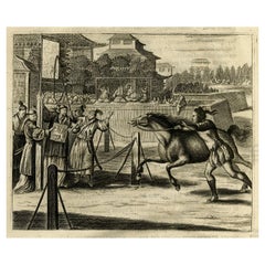
Original Antique Engraving of a Horse Race at a Japanese Racing Track, 1669
Located in Langweer, NL
Description: Antique print, titled: 'Japansche Ren-baanen.' - View of a race at a Japanese (horse) racing track. A man runs beside a horse (the horse's rein in his hand). A man w...
Category

Antique 17th Century More Furniture and Collectibles

Materials

Paper

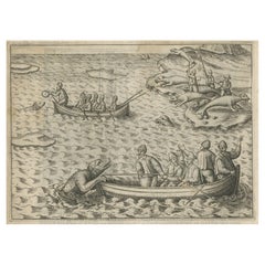
Rare Map of Kildin Island in Russia Plus Engraving of Seal Hunting, 1614
Located in Langweer, NL
Insula Kilduyn. Orig. copper-engraving after details from J. H. van Linschoten's map taken from his account of the three expeditions undertaken by Willem Barents in 1594, in an attem...
Category

Antique 17th Century More Furniture and Collectibles

Materials

Paper

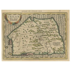
17th-Century Map of Sri Lanka (Ceylon) by Mercator & van den Keere, 1630
Located in Langweer, NL
This captivating 17th-century map titled "Zeilan ou Ceilon Isle" (Ceylon/Sri Lanka) was engraved by Petrus Kaerius (van den Keere) and published in Mercator's "Atlas Minor," edited b...
Category

Antique 17th Century More Furniture and Collectibles

Materials

Paper

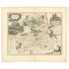
Circa 1659 Johannes Blaeu Map: Ducatus Silesiae Ligniciensis, Legnica Region
Located in Langweer, NL
Circa 1659 Johannes Blaeu Map: Ducatus Silesiae Ligniciensis, Legnica Region This hand-colored map from circa 1659 by Johannes Blaeu, titled "Ducatus Silesiae Ligniciensis," depicts the region centered around Legnica (Lignitz) in southwestern Poland. It extends to include the cities of Lublin, Jawor, and Lwówek Śląski. The map features decorative elements such as a title cartouche adorned with a putto, garlands of fruit, and birds, and a distance scale cartouche that includes a hunter with his dogs. This map is dedicated to Georgius Rodulfus, the Duke of Silesia, by Ionas Scultetus, reflecting the map's historical context and noble patronage. It includes Spanish text on the verso, indicating publication between 1659 and 1672. Measuring 20.9 inches wide by 16.3 inches high, the map is in excellent condition with a sharp impression, full contemporary color, and a large watermark of the god Atlas. Minor details include a bit of printer's ink residue at the right and slight marginal soiling. Keywords: - Johannes Blaeu map - Silesia historical map - Legnica (Lignitz) map - 17th-century Poland map...
Category

Antique 17th Century More Furniture and Collectibles

Materials

Paper

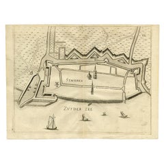
Antique Map of Stavoren by Priorato, 1673
Located in Langweer, NL
Antique map titled 'Staveren'. Original antique map of the city of Stavoren, Friesland, the Netherlands. This map orginates from 'Teatro del Belgio (..)', published in Frankfurt am Main in 1673 by Gualdo Priorato. Artists and Engravers: Author: Galeazzo Gualdo Priorato (1606-1678) entered military service at a very young age and served in Flanders under the Prince of Orange. After his retirement, he authored several historical accounts including the Teatro del Belgio, which described the Catholic/Protestant wars in Belgium and Netherlands during the seventeenth century. His superb plans do not show the internal layout of the cities, except for showing the locations of the major churches. Instead the emphasis is on the fortification, as well as on the surrounding site, rivers and canals...
Category

Antique 17th Century More Furniture and Collectibles

Materials

Paper

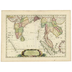
Antique Map of India and Southeast Asia by Sanson '1654'
Located in Langweer, NL
Antique map titled 'Partie Meridionale de l'Inde'. Early map of India and Southeast Asia. The map shows most of modern India, Bangladesh and Burma, the whole of Sri Lanka, Thailand, ...
Category

Antique 17th Century More Furniture and Collectibles

Materials

Paper

Antique Map of the Region of Oldenburg, Germany
Located in Langweer, NL
Antique map titled 'Oldenburg Comitatus'. Detailed old map of Oldenburg, Germany. The map also shows Bremen and the Jade Bight. Published by W. Blaeu, circa 1640. Willem Jansz. Blaeu...
Category

Antique 17th Century More Furniture and Collectibles

Materials

Paper

Rare Print of Genesis in the Old Testament; Adam and Eve Eating the Apple, 1674
Located in Langweer, NL
Antique print, titled: 'Lussa dei sumpto violantur ab arbore pomo, Efficit hoc tacitis vipera saeua dolis.' This original antique print shows a scene from Genesis in the Old Test...
Category

Antique 17th Century More Furniture and Collectibles

Materials

Paper

Antique Map of Turkey with Cyprus and Greece Islands by N. Sanson, circa 1652
Located in Langweer, NL
Antique map of Turkey, Anatolie with Cyprus and the Greece islands. Attractive scrolled title cartouche to top right corner. Blank verso.
Category

Antique 17th Century More Furniture and Collectibles

Materials

Paper

17th French Century Iron Figure of The Virgin
Located in Stamford, CT
Wonderful 17th century French Baroque cast iron figure of the Virgin praying. Likely originally part of an outdoor shrine as it has been exposed to the ...
Category

French Baroque Antique 17th Century More Furniture and Collectibles

Materials

Iron

Map of Languedoc-Roussillon and Provence in France and Piedmont in Italy, c1680
Located in Langweer, NL
Title: Antique map titled 'La basse Partie du Gouvernement de Languedoc, environne des Frontiers des Gouverns de Provence, de Dauphine de Lyonnais et de Guienne et Gascogne ; Les Fro...
Category

Antique 17th Century More Furniture and Collectibles

Materials

Paper

Antique Map of the Cape Verde Islands, Africa, ca.1670
Located in Langweer, NL
Antique map titled 'Pascaert van de Soute Eylanden ofte Ilhas de Cabo Verde'. This map depicts the Cape Verde Islands (Africa). Islands titled 'Ile de B...
Category

Antique 17th Century More Furniture and Collectibles

Materials

Paper

Antique Map of Japan by A.M. Mallet, 1683
Located in Langweer, NL
A charming late 17th century French map with a very decorative title cartouche showing trumpet-blowing cherubs, by Allain Manneson Mallet (1630-1706), a well traveled military engine...
Category

Antique 17th Century More Furniture and Collectibles

Materials

Paper

17th Century Hand Colored Map of the Liege Region in Belgium by Visscher
Located in Alamo, CA
An original 17th century map entitled "Leodiensis Episcopatus in omnes Subjacentes Provincias distincté divisusVisscher, Leodiensis Episcopatus" by Nicolaes Visscher II, published in Amsterdam in 1688. The map is centered on Liege, Belgium, includes the area between Antwerp, Turnhout, Roermond, Cologne, Trier and Dinant. This attractive map is presented in a cream-colored mat measuring 30" wide x 27.5" high. There is a central fold, as issued. There is minimal spotting in the upper margin and a tiny spot in the right lower margin, which are under the mat. The map is otherwise in excellent condition. The Visscher family were one of the great cartographic families of the 17th century. Begun by Claes Jansz Visscher...
Category

Dutch Antique 17th Century More Furniture and Collectibles

Materials

Paper

17th Century Flemish Tapestry Pillow 2083p
Located in Los Angeles, US
17th Century Flemish Tapestry Pillow beautiful and vibrant color and design
Category

Belgian Antique 17th Century More Furniture and Collectibles

Materials

Wool

Circa 1659 Willem Blaeu Map: Southwestern Switzerland with Geneva & Lakes
Located in Langweer, NL
Circa 1659 Willem Blaeu Map: Southwestern Switzerland with Geneva & Lakes This detailed map from circa 1659 by Willem Blaeu, titled "Das Wiflispurgergow," highlights the southwestern region of Switzerland. It features significant landmarks such as Geneva, Lake Geneva (Lacus Lemannus), Lake Neuchatel, Lake Biel, Bern, Freiburg, and Lake Thuner. Based on the work of Gerard Mercator, this map is published with Spanish text on the verso, dating from the period between 1659 and 1672. Measuring 19.9 inches wide by 15.1 inches high, the map is rendered in full contemporary color on a bright sheet that bears a large watermark of the god Atlas. The condition is excellent, with a sharp impression, short centerfold separations at the top and bottom margins, and an archivally repaired tear in the right margin. Keywords: - Willem Blaeu map - Gerard Mercator - 17th-century Switzerland map...
Category

Antique 17th Century More Furniture and Collectibles

Materials

Paper

Old Print of Standia, a Greek Island 'Heraklion, Crete, Greece, Balkans', 1688
Located in Langweer, NL
Antique print Greece titled 'Het Eilant Standia'. Old print of the island Standia, near Crete, Greece. This print originates from 'Nauwkeurige Bes...
Category

Antique 17th Century More Furniture and Collectibles

Materials

Paper

Antique Map of India and the Gulf of Bengal by Mallet, c.1686
Located in Langweer, NL
Antique map titled ?Partie Orientale de la Terre Ferme de l'Inde Moderne. Small map of India and the Gulf of Bengal. This map originates from a German edition of 'Description de l' Univers'. Artists and Engravers: Alain Manesson Mallet (1630-1706) was a French cartographer and engineer. He started his career as a soldier in the army of Louis XIV, became a Sergeant-Major in the artillery and an Inspector of Fortifications. He also served under the King of Portugal, before returning to France, and his appointment to the court of Louis XIV. His military engineering and mathematical background led to his position teaching mathematics at court. His 'Description de L'Universe' contains a wide variety of information, including star maps...
Category

Antique 17th Century More Furniture and Collectibles

Materials

Paper

Antique Plan of the Siege of Grave by Guicciardini, c.1608
Located in Langweer, NL
Antique map titled 'Hic est situs oppidi Grauiae (..)'. Bird's eye view plan of Grave, The Netherlands, Holland. Showing the siege of Grave in the year 1602. Source unknown, to be de...
Category

Antique 17th Century More Furniture and Collectibles

Materials

Paper

Territorium Norimbergense - Antique Map of Nürnberg by Janssonius (1645-58)
Located in Langweer, NL
This is an antique map of Nürnberg, titled "Territorium Norimbergense," created by Johannes Janssonius and published between 1645 and 1658. It is a copperplate engraving printed on p...
Category

Antique 17th Century More Furniture and Collectibles

Materials

Paper

Antique Map of Epirus 'Albania, Greece' by J. Janssonius, circa 1650
Located in Langweer, NL
This map covers the northwestern coast of Greece and part of present-day Albania. The map was drawn by Johannes Wilhelm Laurenberg, a mathematician and historian who produced several...
Category

Antique 17th Century More Furniture and Collectibles

Materials

Paper

Antique Map of the Berchtesgaden Region by Scherer, 1699
Located in Langweer, NL
Antique map titled 'Principat et praepositura Berchtesgadensis (..).' Detailed uncommon map of the Berchtesgaden region in southern Bavaria, Germany. Source unknown, to be determined...
Category

Antique 17th Century More Furniture and Collectibles

Materials

Paper

Antique Map of the Region of Bresse by Hondius, circa 1630
Located in Langweer, NL
Antique map titled 'Bresse'. Old map of the former region of Bresse, France. It is located in the regions of Auvergne-Rhône-Alpes and Bourgogne-Franche-Comté of eastern France. This ...
Category

Antique 17th Century More Furniture and Collectibles

Materials

Paper

Map of Styria by William Blaeu, 1645: A Masterpiece of 17th-Century Cartography
Located in Langweer, NL
This 1645 map, created by Willem Janszoon Blaeu, represents Styria (Steyrmark), a historical region in present-day Austria, located in the Alpine regions. Blaeu, one of the most sign...
Category

Antique 17th Century More Furniture and Collectibles

Materials

Paper

Early Woodcut Map of the Rhine River Region in Germany and Holland, circa 1628
Located in Langweer, NL
Early Woodcut Map of the Rhine River Region, "Die Dritte Tafel des Rheinstroms," ca. 16th Century This early woodcut map, titled "Die Dritte Tafel des Rheinstroms Innhaltend das Nid...
Category

Antique 17th Century More Furniture and Collectibles

Materials

Paper

Early Woodcut Map of Swabia and Bavaria in Germany, 1628
Located in Langweer, NL
Title: Early Woodcut Map of Swabia and Bavaria, 16th Century This early woodcut map titled "Schwaben und Bayernlande / Darbey auch begreiffen der Oenwaldt / Nordgaw / etc." provides...
Category

Antique 17th Century More Furniture and Collectibles

Materials

Paper

Woodcut Map of the Rhine River Region Covering the Palatinate, Austria and Elsa
Located in Langweer, NL
Early Woodcut Map of the Rhine River Region Covering the Palatinate, Austria, and Elsass, ca. 1628 This early woodcut map, titled "Die ander Tafel des Rheinstromes/begriffen die Pfa...
Category

Antique 17th Century More Furniture and Collectibles

Materials

Paper

Antique Map of Modern Day Ukraine and Russia Titled Moscovie 'Moscow', Ca.1683
Located in Langweer, NL
Antique map of modern day Ukraine and Russia titled ‚Moscovie‘. Miniature map of the Moscovia region by A.M. Mallet. Artists and Engravers: Alain Manneson Mallet (1630-1706) spent...
Category

Antique 17th Century More Furniture and Collectibles

Materials

Paper

Rare Copper Engraving of Female with Five Breasts Lactating onto Others, 1686
Located in Langweer, NL
Antique print titled 'Painting'. Rare antique print showing painters and various figures including: a female figure holding palette and brushes in centre, with another female figur...
Category

Antique 17th Century More Furniture and Collectibles

Materials

Paper

Antique Map of Southern Germany by F. de Wit, circa 1680
Located in Langweer, NL
This antique map depicts a portion of southern Germany that included the historic regions of Bavaria, the Palatinate, Prussia-Brandenburg, the Rhineland and Saxony. Regensberg, Freis...
Category

Antique 17th Century More Furniture and Collectibles

Materials

Paper

Antique Map of the Course of the Rhine River by Blaeu, circa 1640
Located in Langweer, NL
Antique map titled 'Rhenus Fluviorum Europae celeberrimus, cum Mosa, Mosella, et reliquis, in illum se exonerantibus, fluminibus'. Beautiful map of the course of the Rhine River...
Category

Antique 17th Century More Furniture and Collectibles

Materials

Paper

Old Map of Prussia, Embellished with a Large Cartouche and Compass Rose, ca.1680
Located in Langweer, NL
Antique map titled 'Prussiae nova Tabula'. Later edition of Blaeu's map of Prussia, embellished with a large cartouche and compass rose. Prussia was a historically prominent Germ...
Category

Antique 17th Century More Furniture and Collectibles

Materials

Paper

Antique Map: Carte du Détroit du Sond with Copenhagen Inset, 1693
Located in Langweer, NL
Antique Map: Carte du Détroit du Sond with Copenhagen Inset, Jaillot/Mortier, 1693 This rare and striking antique map, titled *Carte du détroit du Sond contenant les costes de l’Is...
Category

Antique 17th Century More Furniture and Collectibles

Materials

Paper

Original Engraving of Japanese Musicians Playing Native Music Instruments, 1669
Located in Langweer, NL
Antique print, titled: 'Japansche kamerspeelders.' - ('Japanese musicians'). Four chamber musicians are playing on native instruments outside. Arnol...
Category

Antique 17th Century More Furniture and Collectibles

Materials

Paper

The 17th Century Map of Northern Dithmarschen and Its Towns in Germany
Located in Langweer, NL
This is a detailed colored copperplate engraving depicting northern Dithmarschen, accompanied by town plans of Weßlingburen (now Wesselburen), Lunden, and Heyde (now Heide) at the to...
Category

Antique 17th Century More Furniture and Collectibles

Materials

Paper

Bishopric of Hildesheim Map in Northern Germany by Willem & Joan Blaeu, 1645
Located in Langweer, NL
This beautifully hand-colored map, titled "Episcopatus Hildesiensis Descriptio Novissima," depicts the Bishopric of Hildesheim, a historical ecclesiastical territory in present-day L...
Category

Antique 17th Century More Furniture and Collectibles

Materials

Paper

Early Original Antique Map of South East Asia with Large Parts Still Unknown
Located in Langweer, NL
Antique map titled 'Insulae Indiae Orientalis'. Original antique map of Southeast Asia. Shows towns, villages, landmarks, mountains, and rivers. Relief shown pictorially. This map or...
Category

Antique 17th Century More Furniture and Collectibles

Materials

Paper

Original Antique Map showing Southern India, Northern Sri Lanka & Malabar, 1652
Located in Langweer, NL
Antique map titled 'Presqu'Isle de l'Inde deca le Gange (..)'. Old map showing the southern part of India, including the northern part of Sri Lanka. With inset map of Southern India (Malabar). This map covers the subcontinent from the Bay of Bengal and the Gulf of Cambay to Ceylon. The Mogul Empire can be found in the north. Further south...
Category

Antique 17th Century More Furniture and Collectibles

Materials

Paper

Rare Small Antique Map of the Persian Empire, 1692
Located in Langweer, NL
Antique map titled 'Perse'. Small engraved map of the Persian Empire, decorated with a simple cartouche and armorial shield. This map originates from 'L'Atlas en Abrege, ou Nouvelle ...
Category

Antique 17th Century More Furniture and Collectibles

Materials

Paper

Antique Map of North Africa showing Egypt, Mauritania and Africa Minor, 1672
Located in Langweer, NL
Antique map titled 'Africa Minor, Mauritania , Aegyptus.' Charming miniature map of North Africa, showing Egypt, Mauritania and Africa Minor. This map originates from the pocket atla...
Category

Antique 17th Century More Furniture and Collectibles

Materials

Paper

Old Map of Ancient Times covering Egypt Towards Arabia and India to Java, c.1660
Located in Langweer, NL
Description: Antique map titled 'Erythraei Sive Rubri Maris Periplus olim ab arriano descriptus nunc vero ab abrah ortelio ex eodem delineatus'. Map of the Indian Ocean, or Erythraea...
Category

Antique 17th Century More Furniture and Collectibles

Materials

Paper

Antique Map of the City of Goch by Blaeu, 1649
Located in Langweer, NL
Antique map titled 'Gochum vernacule Goch'. Old map of the city of Goch, Germany. This map originates from 'Novum Ac Magnum Theatrum Urbium Belgicæ Liberæ ac Foederatæ' by J. Blaeu. ...
Category

Antique 17th Century More Furniture and Collectibles

Materials

Paper

Rare Original Handcolored Miniature Map of Malaysia and Singapore, 1600
Located in Langweer, NL
Very handsome original old coloured copper engraving of Malaysia and Singapore, with parts of Sumatra, inc the island of Bangka and Bintam. Title of the map 'Description Malacca'. On...
Category

Antique 17th Century More Furniture and Collectibles

Materials

Paper

Decorative Hand-Colored Map of Germany by Nicolas Sanson, 1648
Located in Langweer, NL
Title: Hand-Colored Map of Germany by Nicolas Sanson, 1648 This hand-colored map, titled "Allemagne," was created by Nicolas Sanson, a prominent 17th-century French cartographer and...
Category

Antique 17th Century More Furniture and Collectibles

Materials

Paper

Orignal Hand-Colored Antique Map of Chili by W. Blaeu, 1658
Located in Langweer, NL
Very decorative antique map of Chili published by W. Blaeu, 1658. This map depicts Chile from Copiapo southward to the island of Chiloé with ships and sea monsters adorning the sea. ...
Category

Antique 17th Century More Furniture and Collectibles

Materials

Paper

Antique Map of Cheshire, North West England
Located in Langweer, NL
Antique map titled 'Cestria comitatus Palatinus'. Original old map of Cheshire, Northwest England. Published circa 1665 by J. Blaeu. Willem Jansz. Blaeu and his son Joan Blaeu are th...
Category

Antique 17th Century More Furniture and Collectibles

Materials

Paper

Antique Map of Catalonia by Blaeu, circa 1650
Located in Langweer, NL
Antique map titled 'Catalonia'. Antique map of Catalonia, extending from C. De Romani on the Northern Coast to Alfachs and Panicola in Valencia on the southern end of the coast and s...
Category

Antique 17th Century More Furniture and Collectibles

Materials

Paper

America Septentrionalis by Carroli Allard (1648-1709) Copper Plate Engraving
Located in San Francisco, CA
"Recentissuma Novi Orbis Sive Americae Septentrionale et Meriodionalis" A hand-colored copper plate engraving of North and South America by Carel Allard depicting recent discoveries...
Category

Dutch Antique 17th Century More Furniture and Collectibles

Materials

Paper

Historic Map of the Bishopric of Paderborn by Blaeu, a Masterpiece of 1645
Located in Langweer, NL
This hand-colored map, titled "Paderbornensis Episcopatus Descriptio Nova," depicts the Bishopric of Paderborn, a historical ecclesiastical territory within the Holy Roman Empire, lo...
Category

Antique 17th Century More Furniture and Collectibles

Materials

Paper

Antique Map of Madagascar by N. Sanson, circa 1680
Located in Langweer, NL
Antique map titled 'Isle de Madagascar ou de St. Laurens. Tiree de Sanutu &c'. Antique map of Madagascar, first published by Sanson in 1657. Sanson n...
Category

Antique 17th Century More Furniture and Collectibles

Materials

Paper

Rare 16th Century Original Handcolored Miniature Map of Java, Indonesia, 1616
Located in Langweer, NL
Very handsome original old coloured copper engraving by Bertius of the island of Java in the early days of the Dutch colonisation - at that time named The Dutch East Indies or nowada...
Category

Antique 17th Century More Furniture and Collectibles

Materials

Paper

Rare Antique Miniature Map of Pakistan, India and Cambaia, ca.1616
Located in Langweer, NL
Old 17th century miniature antique map of 'Cambaia' , from the 1616 edition of Jadocus Hondius Atlas by Petrus Bertius. Original copperplate engraving with hand coloring. Carto...
Category

Antique 17th Century More Furniture and Collectibles

Materials

Paper

Battle of Wimpfen, 1622: Engraving by Matthäus Merian (ca. 1645)
Located in Langweer, NL
Title: Battle of Wimpfen, 1622: Engraving by Matthäus Merian (ca. 1645) Description: This antique copper engraving, created by the renowned Swiss-German engraver Matthäus Merian aro...
Category

Antique 17th Century More Furniture and Collectibles

Materials

Paper

Antique Map of the Burgundy Region by Mallet, c.1683
Located in Langweer, NL
Antique map titled 'Cercle de Bourgogne'. Detailed miniature map of the Burgundy region, France. Also shows the Netherlands and Belgium. Originates from Mallet's 'Description de l'Un...
Category

Antique 17th Century More Furniture and Collectibles

Materials

Paper

Original Antique Map of the Road from Marlborough to Huntspil
Located in Langweer, NL
Antique map titled 'The Continuation of the Road from London to Bristol (..)'. A strip map of the continuation of the road from London to Bristol, this particular sheet showing the r...
Category

Antique 17th Century More Furniture and Collectibles

Materials

Paper

Old Print of Ascension Island with Ships, a Whale and Flying Fish, 1601
Located in Langweer, NL
Antique print, titled: 'Vera effigies et delineato Insulae Ascenstio …' - Bird's eye view of Ascension Island. Five large sailing ships in the background and flying fish and waterfowl in the foreground. On the rear an image of four ships sailing towards a whale, accompanied by fowl, flying fish and dolphins. From 'Indiae Orientalis', 1598-1604. Artists and Engravers: Made by an anonymous engraver after 'Jean Theodore de Bry...
Category

Antique 17th Century More Furniture and Collectibles

Materials

Paper

The 1649 Haderschleben Map of Western Jutland and North Sea Islands
Located in Langweer, NL
This is a beautiful example of an antique map, titled "Westertheil des Amptes Haderschleben Zusambt Rieben und dem Loehmcloster Anno 1649." It's a hand-colored copper etching by Matt...
Category

Antique 17th Century More Furniture and Collectibles

Materials

Paper

Rare 17th Century Baroque Cabinet, South Germany Probably Augsburg, Wunderkammer
Located in Worpswede / Bremen, DE
A small architectural table cabinet, veneered in walnut and mulberry, the centre doors enclosing an arrangement of nine various sized drawers with bone knobs, behind a central door a...
Category

German Baroque Antique 17th Century More Furniture and Collectibles

Materials

Brass

Read More

Medal-Worthy Memorabilia from Epic Past Olympic Games

Get into the games! These items celebrate the events, athletes, host countries and sporting spirit.

Ahoy! You’ve Never Seen a Collection of Sailor Art and Kitsch Quite Like This

French trendsetter and serial collector Daniel Rozensztroch tells us about his obsession with objects related to seafaring men.

39 Incredible Swimming Pools

It's hard to resist the allure of a beautiful pool. So, go ahead and daydream about whiling away your summer in paradise.

Pamela Shamshiri Shares the Secrets behind Her First-Ever Book and Its Effortlessly Cool Interiors

The sought-after designer worked with the team at Hoffman Creative to produce a monograph that beautifully showcases some of Studio Shamshiri's most inspiring projects.

Moroccan Artworks and Objects Take Center Stage in an Extraordinary Villa in Tangier

Italian writer and collector Umberto Pasti opens the doors to his remarkable cave of wonders in North Africa.

Montecito Has Drawn Royalty and Celebrities, and These Homes Are Proof of Its Allure

Hollywood A-listers, ex-pat aristocrats and art collectors and style setters of all stripes appreciate the allure of the coastal California hamlet — much on our minds after recent winter floods.

Whaam! Blam! Pow! — a New Book on Pop Art Packs a Punch

Publishing house Assouline and writer Julie Belcove have teamed up to trace the history of the genre, from Roy Lichtenstein, Andy Warhol and Yayoi Kusama to Mickalene Thomas and Jeff Koons.

The Sparkling Legacy of Tiffany & Co. Explained, One Jewel at a Time

A gorgeous new book celebrates — and memorializes — the iconic jeweler’s rich heritage.
Recently Viewed

View All