Engraved More Furniture and Collectibles

to
340
612
270
895
5
5
22
16
13
12
12
12
10
7
4
2
2
2
1
1
1
1
513
240
142
10
66
33
25
7
4
3
5
6
1
4
10
3
4
674
196
98
78
40
356
103
78
70
63
905
905
905
10
9
9
8
5
Technique: Engraved
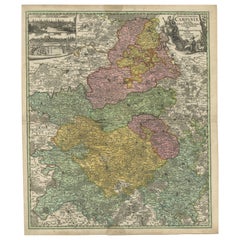
Antique Map of Champagne France by Johann Baptist Homann circa 1710 Hand-Colored
Located in Langweer, NL
Antique Map of Champagne France by Johann Baptist Homann circa 1710 Hand-Colored This richly detailed antique map titled Tabula Geographica Campani...
Category

1720s Antique Engraved More Furniture and Collectibles

Materials

Paper

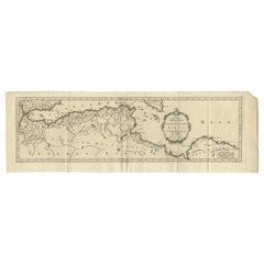
Original Antique Map of Northern Africa by Van Dùren (1749)
Located in Langweer, NL
This is a German antique map titled 'Neue Geographische Vorstellung der Mitternaechtlichen Küste von Africa'. Original antique engraving of Northern Africa extending from the Strait ...
Category

Mid-18th Century Antique Engraved More Furniture and Collectibles

Materials

Paper

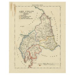
1830 Map of Northern England and Durham, Cumberland, Westmorland, Northumberland
Located in Langweer, NL
Title: Antique 1830 Map of Northern England with Durham, Cumberland, Westmorland, and Northumberland Description: This 1830 German-language map, titled Britisches Reich – A. Kon...
Category

1830s Antique Engraved More Furniture and Collectibles

Materials

Paper

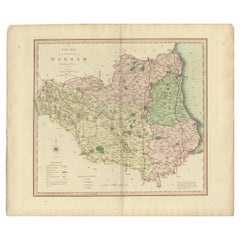
Original Hand-Colored Antique County Map of Durham, England, 1804
Located in Langweer, NL
Antique county map of Durham first published c.1800. Villages, towns, and cities illustrated include Gateshead, South Shields, and Darlington. C...
Category

Early 1800s Antique Engraved More Furniture and Collectibles

Materials

Paper

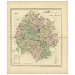
Original Hand-Colored Antique Map of the County of Hereford in England, 1804
Located in Langweer, NL
Antique county map of Herefordshire first published c.1800. Villages, towns, and cities illustrated Avenbury, Ashpurton, Kineton, and Bromyard. ...
Category

Early 19th Century Antique Engraved More Furniture and Collectibles

Materials

Paper

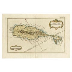
Old Map of the island of Saint Christopher or St. Kitts in the Caribbean, c.1765
Located in Langweer, NL
Antique map titled 'Carte de l'Isle de Saint-Christophe'. A detailed map of the island of Saint Christopher or St. Kitts showing mountain ranges, port towns and parishes. This map ...
Category

18th Century Antique Engraved More Furniture and Collectibles

Materials

Paper

Monuments of Herculaneum Engraved by Bayardi, 1762
Located in Langweer, NL
Antique print originating from 'Le Antichita di Ercolano Esposte'. A vast survey of the bronzes, statues, wall-paintings, and monuments of Herculaneum. This monumental work was the f...
Category

18th Century Antique Engraved More Furniture and Collectibles

Materials

Paper

Pair of Chinese Carved Stone Dog Bookends
Located in Queens, NY
Pair of Asian Chinese-style (19/20th Century) carved brown stone bookends depicting a group of dogs over a lightly engraved base. (PRICED AS PAIR).
Category

20th Century Chinese Export Engraved More Furniture and Collectibles

Antique Hand-Colored County Map of Rutland, England, 1804
Located in Langweer, NL
Antique county map of Rutland first published c.1800. Villages, towns, and cities illustrated include Oakham, Uppingham, and Normanton. Charles ...
Category

Early 1800s Antique Engraved More Furniture and Collectibles

Materials

Paper

Antique Decorative County Map of Lincolnshire, England, 1804
Located in Langweer, NL
Antique county map of Lincolnshire first published circa 1800 Cities illustrated include Grantham, Spalding, Boston, and Market Raisin. Charles Smith was a cartographer working in...
Category

Early 1800s Antique Engraved More Furniture and Collectibles

Materials

Paper

Antique County Map of Monmouthshire, England, circa 1804
Located in Langweer, NL
Antique county map of Monmouthshire first published circa 1800. Villages, towns, and cities illustrated include Newport, Chepstow, Rockfield, and P...
Category

Early 1800s Antique Engraved More Furniture and Collectibles

Materials

Paper

Two Sheet Map of the Principality of Wales Divided into Counties, 1804
Located in Langweer, NL
A well engraved and detailed large-scale map of Wales, printed on two sheets . The map is thoroughly detailed and includes good information regarding t...
Category

Early 1800s Antique Engraved More Furniture and Collectibles

Materials

Paper

Engraved Large Map of The Kingdom of Portugal Original Handcolored, 1854
Located in Langweer, NL
Antique map titled 'Mappa Corografica do Reino de Portugal - Chorographical map of the Kingdom of Portugal divided into its Grand Provinces.' Large map of...
Category

1850s Antique Engraved More Furniture and Collectibles

Materials

Paper

Map of South America 1792 by Elwe – Hand-Colored Antique Dutch Engraving
Located in Langweer, NL
Map of South America 1792 by Elwe – Hand-Colored Antique Dutch Engraving This striking antique map of South America, titled "L'Amerique Meridionale," was published in 1792 by the Du...
Category

Late 18th Century European Antique Engraved More Furniture and Collectibles

Materials

Paper

Antique Map of Friesland 'The Netherlands' by J. Bussemacher, 1596
By Johann Bussemacher
Located in Langweer, NL
Beautiful hand-colored engraving of the province Friesland (The Netherlands). This map originates from the Atlas 'Europae totius orbis terrarium partis praestantissimae, universalis ...
Category

16th Century European Antique Engraved More Furniture and Collectibles

Materials

Paper

Joseph Crossard French Silver Gold Plated and Engraved Traveling Liqueur Bottle
By Joseph Crossard 1
Located in Delft, NL
Joseph crossard French silver gold plated and Engraved traveling liqueur Bottle, 1900. A French Art Nouveau crystal bottle, richly decorated with gol...
Category

Early 20th Century French Engraved More Furniture and Collectibles

Materials

Crystal, Silver

Engraved Copper Plate – 18th Century
Located in Madrid, ES
Interesting and rare original 18th-century copper plate used for printing religious engravings. The plate is finely engraved with a burin, depicting sacred scenes typical of the devo...
Category

18th Century European Baroque Antique Engraved More Furniture and Collectibles

Materials

Copper

Antique Map of Ambon and Surroundings by Valentijn '1726'
Located in Langweer, NL
Antique map titled 'De landvoogdy van Amboina met de elf onderhoorige Eylanden'. Decorative map of the eastern tip of the islands of Ambon, Indonesia. This print originates from 'Oud...
Category

Early 18th Century Dutch Antique Engraved More Furniture and Collectibles

Materials

Paper

Antique Print Religion 'Joshua Makes a Convenant with God' by De Hondt, 1728
Located in Langweer, NL
Antique religion print titled 'Joshua makes a convenant with God'. This print originates from 'Figures de la Bible'. Published by P. de Hondt. Illustrated by G. van der Gouwen.
Category

Mid-18th Century Dutch Antique Engraved More Furniture and Collectibles

Materials

Paper

Antique Map of Western Africa and the Cape Verde Islands by Coronelli, 1691
Located in Langweer, NL
Antique map titled 'Bocche del Fiume Negro et Isole di Capo Verde'. Antique map of Western Africa with the Cape Verde Islands and an inset of Goree Island. Originates from 'Atlante V...
Category

Late 17th Century Italian Antique Engraved More Furniture and Collectibles

Materials

Paper

Antique Map Normandy 'France' by Homann Heirs, Published in c.1740
Located in Langweer, NL
Antique map France titled 'Normannia Galliae celebris Provincia in terras suas Ballisiatus (..)'. Decorative regional map of Normandy, France, circa ...
Category

Mid-18th Century German Antique Engraved More Furniture and Collectibles

Materials

Paper

Antique Map of South America by G. Anson, 1749
Located in Langweer, NL
Antique map titled 'Kaart van het Zuidelykste Gedeelte van Zuider Amerika (..) - Carte de la Partie Meridionale de l'Amerique Meridionale (..)'. Detailed chart tracking the route of Capt. George Anson's ship The Centurion in 1745. The chart shows the tracks of Anson's ships around South America & Cape Horn to the Juan Fernandes Islands, with notes on currents and positions. This map originates from 'Reize rondsom de Werreld (..)' by George Anson, published 1749. In 1740 Capt. George Anson (1697-1762) of the Royal Navy, was given command of a squadron of ships. As England was at war with France and Spain, Anson's task was to intercept and capture a Spanish treasure...
Category

Mid-18th Century Dutch Antique Engraved More Furniture and Collectibles

Materials

Paper

Set of 24 Engravings by Richard Blome Framed in Pair of Regency Screens
Located in Charleston, SC
Regal set of twenty-four steel engravings of English Hunt Scenes by Richard Blome (1635-1705) framed in a pair of three panel mahogany Regency Screens, 17th century. The etchings are from "BLOME, Richard (1635-1705): The Gentlemans Recreation. ... An Encyclopedia of the Arts and Sciences ... [and] Horsemanship, Hawking, Hunting, Fowling, Fishing and Agriculture. With a Short Treatise of Cock-Fighting. London: S. Roycroft for R. Blome, 1686". Twenty-three of the twenty-four hunt engravings...
Category

Late 17th Century English Charles II Antique Engraved More Furniture and Collectibles

Materials

Upholstery, Mahogany, Paper

Dutch 18th Century Copper Tobacco Box
Located in Delft, NL
A Dutch 18th century copper tobacco box A beautiful Dutch 18th century copper tobacco box with engraved on both sides and old Dutch text. The copper box is lined with tin on the ins...
Category

18th Century Dutch Antique Engraved More Furniture and Collectibles

Materials

Tin, Copper

OriginaAntique 17th-Century Map of Guizhou Province, China – (Qveichev) by Blaeu
Located in Langweer, NL
Title: Antique 17th-Century Map of Guizhou Province, China – "Qveichev" by Blaeu, Richly Illustrated and Colored Description: This remarkable map of Guizhou Province, historically known as "Qveichev," was created by Johannes Blaeu and published in 1655 as part of his *Novus Atlas Sinensis*. This atlas, developed in collaboration with Jesuit missionary Martino Martini, marked the first Western attempt at a comprehensive geographic representation of China. Blaeu’s map offers a detailed depiction of the mountainous terrain, rivers, and towns of Guizhou, a province known for its rugged beauty and cultural diversity. The map is adorned with two decorative cartouches, each reflecting the artistic and cultural influences of the time. The title cartouche in the lower-right corner features two figures in traditional Chinese attire, symbolizing the blend of European cartographic mastery and Chinese heritage. The upper-left corner includes a secondary cartouche with an explanatory key, adding a touch of elegance to the map’s functionality. Towns, mountains, and rivers are meticulously labeled in Latin, showcasing Blaeu’s dedication to detail and accuracy. Crafted using the copperplate engraving technique, this map demonstrates exceptional precision. The hand-coloring enhances its visual appeal, highlighting borders and geographic features with vibrant tones. Blaeu’s work is not only a tool for geographic understanding but also a piece of art that embodies the spirit of exploration during the Dutch Golden Age. Guizhou Province, historically known as "Qveichev," is renowned for its breathtaking natural landscapes, rich ethnic diversity, and historical significance. As one of China's most mountainous regions, Guizhou is characterized by dramatic karst formations, lush green hills, and cascading waterfalls. The province is also home to a variety of ethnic minority groups, including the Miao, Dong, and Bouyei, whose traditions, colorful costumes, and vibrant festivals make the region culturally significant. Famous features and important places include Huangguoshu Waterfall, one of Asia's largest and most iconic waterfalls, located near the city of Anshun. Zhijin Cave, a vast karst cave system, is celebrated for its stunning stalactites and stalagmites. Kaili is known as the cultural center of Miao traditions, with picturesque villages and celebrated festivals. Zunyi holds historical importance for the Zunyi Conference, a pivotal event in the Chinese Communist Party's history. Fanjing Mountain, a UNESCO World Heritage Site, stands out for its unique biodiversity and sacred Buddhist sites. Keywords: antique map of China, Guizhou map, Qveichev, 17th-century China map...
Category

1650s Antique Engraved More Furniture and Collectibles

Materials

Paper

17th Century Hand Colored Map of the Liege Region in Belgium by Visscher
Located in Alamo, CA
An original 17th century map entitled "Leodiensis Episcopatus in omnes Subjacentes Provincias distincté divisusVisscher, Leodiensis Episcopatus" by Nicolaes Visscher II, published in Amsterdam in 1688. The map is centered on Liege, Belgium, includes the area between Antwerp, Turnhout, Roermond, Cologne, Trier and Dinant. This attractive map is presented in a cream-colored mat measuring 30" wide x 27.5" high. There is a central fold, as issued. There is minimal spotting in the upper margin and a tiny spot in the right lower margin, which are under the mat. The map is otherwise in excellent condition. The Visscher family were one of the great cartographic families of the 17th century. Begun by Claes Jansz Visscher...
Category

Late 17th Century Dutch Antique Engraved More Furniture and Collectibles

Materials

Paper

1592 Abraham Ortelius Map "Lorraine: Lotharingiae Nova Descripti, Ric.A005
Located in Norton, MA
1592 Abraham Ortelius map entitled "Lorraine: Lotharingiae Nova Descripti Ric.a005 Description: Ortelius is best known for producing the atlas from which this map comes from, "...
Category

16th Century Dutch Antique Engraved More Furniture and Collectibles

Materials

Paper

Picardy Map - Hand-Colored 17th-Century Engraving by Frederik De Wit c. 1688
Located in Langweer, NL
Title: Picardy Map - Hand-Colored 17th-Century Engraving by Frederik De Wit c. 1688 Description: This beautifully detailed map, "Nova Picardiae Tabula," captures the Picardy region ...
Category

1680s Antique Engraved More Furniture and Collectibles

Materials

Paper

Rare Hand-Colored Map of Lyonnais Region in France by Frederik De Wit c. 1688
Located in Langweer, NL
Title: Rare Hand-Colored Map of Lyonnais Region by Frederik De Wit c. 1688 Description: This beautifully detailed map, "Gouvernement General du Lyonnois," showcases the Lyonnais reg...
Category

1680s Antique Engraved More Furniture and Collectibles

Materials

Paper

Stunning Hand-Colored Map of Languedoc in France by Frederik De Wit c. 1688
Located in Langweer, NL
Title: Stunning Hand-Colored Map of Languedoc by Frederik De Wit c. 1688 Description: This elegant 17th-century map, "Gouvernement General de Languedoc," beautifully illustrates the...
Category

1680s Antique Engraved More Furniture and Collectibles

Materials

Paper

1832 Large Map "Russian & Poland" Ric. R0012
Located in Norton, MA
Large map 1832 "Russian & Poland" Ric.r0012 Russia & Poland, by J. Arrowsmith. London, pubd. 15 Feby. 1832 by J. Arrowsmith, 35 Essex Street, Strand., ...
Category

19th Century Unknown Antique Engraved More Furniture and Collectibles

Materials

Paper

Antique Art Deco Sterling Silver and Blue Guilloche Enamel Ladies Dresser Set
Located in Hamilton, Ontario
This three piece sterling silver and guilloche enameled dresser set was made in England in circa 1920 in the period Art Deco style. The set is compo...
Category

Early 20th Century English Art Deco Engraved More Furniture and Collectibles

Materials

Sterling Silver

Dutch 18th Century Copper Tobacco Box
Located in Delft, NL
A Dutch 18th century copper tobacco box A Dutch 18th century copper tobacco box, octagonal with engraving on the front and back. Name and title engraved on top and front. The copp...
Category

18th Century Dutch Antique Engraved More Furniture and Collectibles

Materials

Tin, Copper

1849 Map of "Europaische Russland", 'Meyer Map of European Russia', Ric. R017
Located in Norton, MA
1849 Map of "Europaische Russland" ( Meyer Map of European Russia) Ric.r017 A lovely map of European Russia dating to 1849 by Joseph Meyer. It covers the European portions of...
Category

19th Century Unknown Antique Engraved More Furniture and Collectibles

Materials

Paper

1590 Mercator Map Entitled "France Picardie Champaigne, Ric.0001
Located in Norton, MA
Description: Published in Amsterdam by Mercator/Hondius ca. 1590. Ric.0001 Artists and Engravers: Map : 'France Picardie Champaigne cum regionibus adiacentibus'. (Map of the french provinces of Picardie and Champagne.) Copper engraved map of the french provinces of Picardie and Champagne, showing the cities of Caen, Paris, Melun, Auxerre, Verdun, etc. Copperplate engraving on verge type hand laid paper with watermark. Description: Published in Amsterdam by Mercator/Hondius ca. 1600.Artists and Engravers: Mercator was born in Rupelmonde in Flanders and studied in Louvain under Gemma Frisius, Dutch writer, astronomer and mathematician. The excellence of his work brought him the patronage of Charles V, but in spite of his favor with the Emperor he was caught up in the persecution of Lutheran protestants and charged with heresy, fortunately without serious consequences. No doubt the fear of further persecution influenced his move in 1552 to Duisburg, where he continued the production of maps, globes and instruments. Mercator's sons and grandsons, were all cartographers and made their contributions in various ways to his atlas. Rumold, in particular, was responsible for the complete edition in 1595. The map plates...
Category

16th Century Dutch Antique Engraved More Furniture and Collectibles

Materials

Paper

1635 Willem Blaeu Map of Northern France"Comitatvs Bellovacvm" Ric.a08
Located in Norton, MA
1635 Willem Blaeu map of northern France, entitled. "Comitatvs Bellovacvm Vernacule Beavvais," Colored Ric.a008 “COMITATVS BELLOVACVM…” Amsterdam: W...
Category

17th Century Unknown Antique Engraved More Furniture and Collectibles

Materials

Paper

Northern Scotland: A 16th Century Hand-colored Map by Mercator
Located in Alamo, CA
A framed hand-colored 16th century map of Northern Scotland by Gerard Mercator entitled "Scotiae pars Septentrionalis", published in Amsterdam in 1636. It is a highly detailed map of the northern part of Scotland, with the northwest Highlands and the cities Inverness and Aberdeen, as well as the Orkney Islands and the Hebrides. There is a decorative title cartouche in the upper left corner. The map is presented in an antiqued brown wood...
Category

16th Century Dutch Antique Engraved More Furniture and Collectibles

Materials

Paper

1620 Map of Artois Entitled "Artesia Comitatvs Artois, " by Bleau, Ric.a012
Located in Norton, MA
1640 map of Artois entitled "Artesia Comitatvs Artois," by Bleau Colored A-012. Detailed map of the northern province of Artois, France on the border with Belgium. Feature...
Category

17th Century Dutch Antique Engraved More Furniture and Collectibles

Materials

Paper

Antique Gilt Copper & Enamel Ladies Compac with Hand Painted Portrait
Located in Hamilton, Ontario
This antique miniature ladies compac is unsigned with respect to the maker, but originated from Italy and dates to approximately 1880 and done in a Renaissance Revival style. The box...
Category

Late 19th Century Italian Renaissance Revival Antique Engraved More Furniture and Collectibles

Materials

Copper

Russian Engraved Crystal Beaker, Commemorative of Alexander I, "The Blessed"
Located in West Palm Beach, FL
Russian Engraved Crystal Beaker, Commemorative of Alexander I, "The Blessed" Russian, 19th Century Presenting an exquisite 19th-century Russian crystal beaker that pays homage to the revered Emperor Alexander I, known as "The Blessed." This intricately engraved piece showcases the fine craftsmanship and historical significance of Russian artistry. The beaker features three vignettes, each meticulously engraved with remarkable detail. The first vignette proudly displays the Russian Eagle...
Category

19th Century Russian Baltic Antique Engraved More Furniture and Collectibles

Materials

Crystal

1839 Map of Karte Des "Russischen Reiches in Europa Und Asien" Ric.R0013
Located in Norton, MA
1839 map of Karte Des "Russischen Reiches in Europa and Asien" Ric.r013 Map of the European and Asian parts of Russian Empire. Karte der Russischen Reiches in Europa und Asien...
Category

19th Century Unknown Antique Engraved More Furniture and Collectibles

Materials

Paper

1640 Willem Blaeu Map Entitled "Contado di molise et principato vltra, " Ric.a003
Located in Norton, MA
1640 Willem Blaeu map entitled "Contado di molise et principato vltra," Colored Ric. a003 Measures: 38 x 49.6 cm and wide margins DBLAEU. Cou...
Category

17th Century Dutch Antique Engraved More Furniture and Collectibles

Materials

Paper

1594 Maurice Bouguereau Map of the Region Limoges, France, Ric0015
Located in Norton, MA
1594 Maurice Bouguereau map of the region Limoges, France, entitled "Totivs Lemovici et Confinium Pro Uinciarum Quantum ad Dioecefin Lemo Uicenfen Fpectant," Hand Colored Ric0015 Jean IV Le Clerc...
Category

16th Century Dutch Antique Engraved More Furniture and Collectibles

Materials

Paper

1656 Jansson Map Metz Region of France Entitled "Territorium Metense" Ric0014
Located in Norton, MA
1656 Jansson map Metz Region of France entitled "Territorium Metense." Ric0014 " Authentic" - Map of the historical region surrounding Metz, in Lorraine, France. Oriented with ...
Category

17th Century Dutch Antique Engraved More Furniture and Collectibles

Materials

Paper

1627 Hendrik Hondius Map Entitled "Vltoniae Orientalis Pars, " Ric.a009
Located in Norton, MA
1627 Hendrik Hondius map entitled "Vltoniae orientalis pars," Ric.a009 Title: Vltoniae orientalis : pars Title (alt.) : Ultoniae orientalis pars Creator: Mercator, Gerh...
Category

17th Century Dutch Antique Engraved More Furniture and Collectibles

Materials

Paper

1590 Ortelius Map of Calais and Vermandois, France and Vicinity Ric.a014
Located in Norton, MA
1590 Ortelius map of Calais and Vermandois, France and Vicinity Ric.a014 Two rare regional Abraham Ortelius maps on a single folio sheet. Left map, entitled Caletensium, depic...
Category

16th Century Dutch Antique Engraved More Furniture and Collectibles

Materials

Paper

1633 Map "La Souverainete De Sedan Et De Raucourt, Et La Prevoste Ric0011
Located in Norton, MA
1653 map entitled "La Souverainete de Sedan et de Raucourt, et la Prevoste de Doncheri," Ric0011 Description: Lovely map centered on Sedan and Doncheri and the Meuze River fr...
Category

17th Century Dutch Antique Engraved More Furniture and Collectibles

Materials

Paper

1646 Jansson Map Entitled "Procinvia Connactiae, " Ric.a006
Located in Norton, MA
1646 Jansson map entitled "Procinvia connactiae," Ric.a006 Description: The PROVINCE of CONNAVGT 490 x 380From vol 4 of Jansson's Atlas Novus 1646, published in Amsterdam with...
Category

17th Century Unknown Antique Engraved More Furniture and Collectibles

Materials

Paper

1858 Colton's Map of New York, Ric.B011
Located in Norton, MA
An 1858 Colton's map of New York Ric.b011 Colton’s New York, 1858 - A large original color engraved and very detailed map of the state of New York,...
Category

19th Century Unknown Antique Engraved More Furniture and Collectibles

Materials

Paper

1633 Map, Entitled "La Douche De Berry, " Original Hand Colored Ric.0005
Located in Norton, MA
1633 map, entitled. "La douche de Berry," Hand Colored Ric.0005 Description: 1633 map, entitled "La douche de Berry,". Dimension: Paper: 23.3" W x 20.3" H (59 cm W x 51.7...
Category

17th Century Unknown Antique Engraved More Furniture and Collectibles

Materials

Paper

1633 map, entitled "La douche de Berry, " Original Hand Colored Ric.0005
Located in Norton, MA
1633 map, entitled "La douche de Berry," Hand Colored Ric.0005 Description: 1633 map, entitled "La douche de Berry," Dimension: Paper: 23.3" W x 20.3" H (59 cm W x 51.7 cm H) ; ...
Category

17th Century Dutch Antique Engraved More Furniture and Collectibles

Materials

Paper

Antique Equestrian Print, Heywood Hardy Engraving "Too Late"
Located in Oxfordshire, GB
Equestrian Print, Heywood Hardy. A fine photogravure after the original painting by Heywood Hardy titled 'Too Late'. The 'romantic' print depicts a young couple leaving the church w...
Category

1880s French Sporting Art Antique Engraved More Furniture and Collectibles

Materials

Paper

1853 Map of "Russia in Europe Including Poland" Ric.r016
Located in Norton, MA
Description Russia in Europe incl. Poland by J Wyld c.1853 Hand coloured steel engraving Dimension: Paper: 25 cm W x 33 cm H ; Sight: 22 cm W x 28 cm H Condition: Good ...
Category

19th Century Unknown Antique Engraved More Furniture and Collectibles

Materials

Paper

1640 Flandriae Partes Duae Quarum Altera Proprietaria, Ric0016
Located in Norton, MA
1640 Willem and Joan Blaeu map entitled "Flandriae Partes duae quarum altera Proprietaria, altera Imperialis vulgo dictur," Ric0016 (Mounted on Carboard) Willem Janszoon Blaeu...
Category

17th Century Dutch Antique Engraved More Furniture and Collectibles

Materials

Paper

1633 Map Entitled "Beauvaisis Comitatus Belova Cium, Ric.0002
Located in Norton, MA
1633 map entitled "Beauvaisis Comitatus Belova Cium," Hand Colored Ric.0002 Description: Cartographer : - Hondius, Henricus 1587-1638 Artists and Engravers:Jodocus Hondius, one of the most notable engravers of his time. He is known for his work in association with many of the cartographers and publishers prominent at the end of the sixteenth and the beginning of the seventeenth century. A native of Flanders, he grew up in Ghent, apprenticed as an instrument and globe maker and map engraver. In 1584, to escape the religious troubles sweeping the Low Countries at that time, he fled to London where he spent some years before finally settling in Amsterdam about 1593. In the London period he came into contact with the leading scientists and geographers of the day and engraved maps in The Mariner\\\\\\\\\\\\\\\'s Mirrour, the English edition of Waghenaer\\\\\\\\\\\\\\\'s Sea Atlas, as well as others with Pieter van den Keere, his brother-in-law. No doubt his temporary exile in London stood him in good stead, earning him an international reputation, for it could have been no accident that Speed chose Hondius to engrave the plates for the maps in The Theatre of the Empire of Great Britaine in the years between 1605 and 1610. In 1604 Hondius bought the plates of Mercator\\\\\\\\\\\\\\\'s Atlas which, in spite of its excellence, had not competed successfully with the continuing demand for the Ortelius Theatrum Orbis Terrarum. To meet this competition Hondius added about 40 maps to Mercator\\\\\\\\\\\\\\\'s original number and from 1606 published enlarged editions in many languages, still under Mercator\\\\\\\\\\\\\\\'s name but with his own name as publisher. These atlases have become known as the Mercator/Hondius series. The following year the maps were reengraved in miniature form and issued as a pocket Atlas Minor. After the death of Jodocus Hondius the Elder in 1612, work on the two atlases, folio and miniature, was carried on by his widow and sons, Jodocus II and Henricus, and eventually in conjunction with Jan Jansson in Amsterdam. In all, from 1606 onwards, nearly 50 editions with increasing numbers of maps with texts in the main European languages were printed. Summaries of these issues are given under the entry for Gerard Mercator. Jodocus Hondius the Elder * 1588 Maps in The Mariner\\\\\\\\\\\\\\\'s Mirrour (Waghenaer/Ashley) * 1590 World Map...
Category

17th Century Dutch Antique Engraved More Furniture and Collectibles

Materials

Paper

1571-1638 Willem Blaeu map entitled, "Ilcadorino, " Hand Colored Ric0009
Located in Norton, MA
Willem Blaeu map entitled, "Ilcadorino,". Hand colored. Description: large, unusual, and nice antique copper engraved map of Ilcadorino, by Willem BL...
Category

16th Century Dutch Antique Engraved More Furniture and Collectibles

Materials

Paper

1752 Vaugoundy Map of Flanders : Belgium, France, and the Netherlands, Ric.a002
Located in Norton, MA
Large Vaugoundy Map of Flanders: Belgium, France, and the Netherlands Colored -1752 Ric.a002 Description: This is a 1752 Didier Robert de Vaugondy map of Flanders. The map de...
Category

17th Century Unknown Antique Engraved More Furniture and Collectibles

Materials

Paper

1656 "La Souverainete de Sedan et de Raucourt, et la Prevoste de Doncheri Ric004
Located in Norton, MA
1656 map entitled "La Souverainete de Sedan et de Raucourt, et la Prevoste de Doncheri," Hand Colored Ric0004. Description: Lovely map centered on Sedan and Doncheri an...
Category

17th Century Dutch Antique Engraved More Furniture and Collectibles

Materials

Paper

1640 Joan Bleau Map Entitled"Diocecese de rheims et le pais de rethel, " Eic.a011
Located in Norton, MA
1640 Joan Bleau map entitled "Diocecese de rheims et le pais de rethel," Ric.a011 OAN BLAEU Diocecese de Rheims, et le pais de Rethel. Handcolored engraving, c.1640. ...
Category

17th Century Dutch Antique Engraved More Furniture and Collectibles

Materials

Paper

1643 Willem&Joan Blaeu Map NW Flanders "Flandriae Teutonicae Pars Prientalior
Located in Norton, MA
1643 Willem and Joan Blaeu map of northwest Flanders, entitled "Flandriae Teutonicae Pars Prientalior," Ric0012 " Authentic" - Map of the northwest Fl...
Category

17th Century Dutch Antique Engraved More Furniture and Collectibles

Materials

Paper

Read More

Medal-Worthy Memorabilia from Epic Past Olympic Games

Get into the games! These items celebrate the events, athletes, host countries and sporting spirit.

Ahoy! You’ve Never Seen a Collection of Sailor Art and Kitsch Quite Like This

French trendsetter and serial collector Daniel Rozensztroch tells us about his obsession with objects related to seafaring men.

39 Incredible Swimming Pools

It's hard to resist the allure of a beautiful pool. So, go ahead and daydream about whiling away your summer in paradise.

Pamela Shamshiri Shares the Secrets behind Her First-Ever Book and Its Effortlessly Cool Interiors

The sought-after designer worked with the team at Hoffman Creative to produce a monograph that beautifully showcases some of Studio Shamshiri's most inspiring projects.

Moroccan Artworks and Objects Take Center Stage in an Extraordinary Villa in Tangier

Italian writer and collector Umberto Pasti opens the doors to his remarkable cave of wonders in North Africa.

Montecito Has Drawn Royalty and Celebrities, and These Homes Are Proof of Its Allure

Hollywood A-listers, ex-pat aristocrats and art collectors and style setters of all stripes appreciate the allure of the coastal California hamlet — much on our minds after recent winter floods.

Whaam! Blam! Pow! — a New Book on Pop Art Packs a Punch

Publishing house Assouline and writer Julie Belcove have teamed up to trace the history of the genre, from Roy Lichtenstein, Andy Warhol and Yayoi Kusama to Mickalene Thomas and Jeff Koons.

The Sparkling Legacy of Tiffany & Co. Explained, One Jewel at a Time

A gorgeous new book celebrates — and memorializes — the iconic jeweler’s rich heritage.
Recently Viewed

View All