Antique Geographical Maps

91
to
200
1,139
163
592
546
372
288
166
166
144
116
113
90
87
64
50
48
45
41
38
37
22
21
20
17
17
15
15
14
11
9
9
9
9
9
8
8
8
6
6
6
5
5
5
4
4
4
3
3
2
2
1
25
19
16
14
8
Sort By
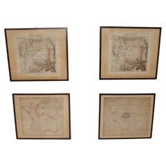
Set of 4 Antique Geographical Maps French-German War 1870-71
Located in Casale Monferrato, IT
Elegant late 19th century set of four antique geographical maps relating to the positioning of the
Category

1890s Italian Antique Geographical Maps

Materials

Paper

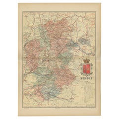
Burgos 1902: Geographic Map of Castile's Historic Heartland in Spain
Located in Langweer, NL
The map of the province of Burgos in the autonomous community of Castile and León in Spain, dated
Category

Early 1900s Antique Geographical Maps

Materials

Paper

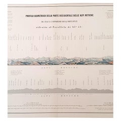
1880s Map of The Italian Alps from Milan to Lake Garda
Located in Roma, IT
Geographical Map of the Profile and Elevation of the Italian Alps from Milano to Lake Garda. The
Category

1880s Italian Antique Geographical Maps

Materials

Parchment Paper

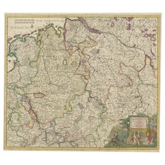
Antique Map of the Westphalia region of Germany
Located in Langweer, NL
Danckerts family created one of the leading Dutch geographical map and atlas publishing houses.
Category

Late 17th Century Antique Geographical Maps

Materials

Paper

Antique Map of the Westphalia region of Germany
Free Shipping
H 21.03 in W 23.63 in D 0.02 in
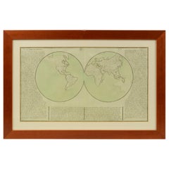
1850 Old French Map Depicting the Entire Earth's Surface Divided into Two Parts
Located in Milan, IT
Geographical map depicting the entire earth's surface divided into two parts that correspond to the
Category

Mid-19th Century French Antique Geographical Maps

Materials

Glass, Wood, Paper

Decorative Antique Map of Germany, 1846
Located in Langweer, NL
as a teacher before turning to publishing geography textbooks and maps. He became involved in
Category

1840s Antique Geographical Maps

Materials

Paper

Decorative Antique Map of Germany, 1846
H 13.59 in W 13.78 in D 0 in
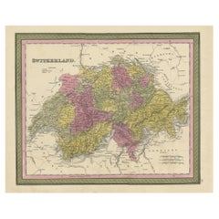
Colourful Antique Map of Switzerland, 1846
Located in Langweer, NL
. Mitchell worked as a teacher before turning to publishing geography textbooks and maps. He became involved
Category

1840s Antique Geographical Maps

Materials

Paper

Colourful Antique Map of Switzerland, 1846
H 13.78 in W 17.13 in D 0 in
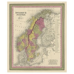
Old Colourful Map of Sweden and Norway, 1846
Located in Langweer, NL
geographer. Mitchell worked as a teacher before turning to publishing geography textbooks and maps. He became
Category

1840s Antique Geographical Maps

Materials

Paper

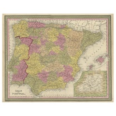
Old Map of Spain and Portugal, with an Inset Map of the Region of Madrid, 1846
Located in Langweer, NL
before turning to publishing geography textbooks and maps. He became involved in geography after teaching
Category

1840s Antique Geographical Maps

Materials

Paper

Old Colourful Decorative Map of Turkey in Europe, 1846
Located in Langweer, NL
geographer. Mitchell worked as a teacher before turning to publishing geography textbooks and maps. He became
Category

1840s Antique Geographical Maps

Materials

Paper

Colourful Old Map of the Austrian Empire, with an Inset Map of Vienna, 1846
Located in Langweer, NL
textbooks and maps. He became involved in geography after teaching and realizing that there were so many
Category

1840s Antique Geographical Maps

Materials

Paper

1850 Old French Map Depicting the Entire Earth's Surface Divided into Two Parts
Located in Milan, IT
Geographical map depicting the entire earth’s surface divided into two parts that correspond to the
Category

Mid-19th Century French Antique Geographical Maps

Materials

Glass, Wood, Paper

Antique Map of Spain and Portugal by Mitchell, 1846
Located in Langweer, NL
publishing geography textbooks and maps. He became involved in geography after teaching and realizing that
Category

19th Century Antique Geographical Maps

Materials

Paper

Antique Map of Sweden and Norway by Mitchell, 1846
Located in Langweer, NL
worked as a teacher before turning to publishing geography textbooks and maps. He became involved in
Category

19th Century Antique Geographical Maps

Materials

Paper

Old Antique Colourful Decorative Map of Northern Italy, 1846
Located in Langweer, NL
American geographer. Mitchell worked as a teacher before turning to publishing geography textbooks and maps
Category

1840s Antique Geographical Maps

Materials

Paper

Antique Map of Denmark, Original and Decorative, c.1846
Located in Langweer, NL
before turning to publishing geography textbooks and maps. He became involved in geography after teaching
Category

19th Century Antique Geographical Maps

Materials

Paper

1850 Old French Map Depicting the Entire Earth's Surface Divided into Two Parts
Located in Milan, IT
Geographical map depicting the entire earth's surface divided into two parts that correspond to the
Category

Mid-19th Century French Antique Geographical Maps

Materials

Glass, Wood, Paper

Antique Map of Germany from an American 19th Century Atlas, 1846
Located in Langweer, NL
before turning to publishing geography textbooks and maps. He became involved in geography after teaching
Category

19th Century Antique Geographical Maps

Materials

Paper

Antique Nicely Colored Map of Holland and Belgium, 1846
Located in Langweer, NL
geographer. Mitchell worked as a teacher before turning to publishing geography textbooks and maps. He became
Category

19th Century Antique Geographical Maps

Materials

Paper

Antique Map of Old European Russia, 1846
Located in Langweer, NL
. Mitchell worked as a teacher before turning to publishing geography textbooks and maps. He became involved
Category

19th Century Antique Geographical Maps

Materials

Paper

Antique Map of Old European Russia, 1846
H 17.13 in W 13.78 in D 0 in
Geographical Antique Map of Principality of Monaco
By Bruno Santini
Located in Alessandria, Piemonte
ST/609 - Interesting antique color map of Monaco Principality in French language : "Carte qui
Category

Late 18th Century Italian Other Antique Geographical Maps

Materials

Paper

1859 Classic Map of France: Blackie's Imperial Geographic Masterpiece
Located in Langweer, NL
The "Antique Map of France" from 'The Imperial Atlas of Modern Geography', published in 1859 by W
Category

Mid-19th Century Antique Geographical Maps

Materials

Paper

Antique Geographical, Historical and Statistical Map of Massachusetts, 1822
Located in Langweer, NL
extensive text outlining the geography, climate, and political composition of the state. The map, designed
Category

1820s Antique Geographical Maps

Materials

Paper

French Geographical, Statistical and Historical Map of Pensylvania, 1825
Located in Langweer, NL
Maryland, Delaware, New York and New jersey. Printed on the same page as the map is geographical
Category

1820s Antique Geographical Maps

Materials

Paper

Álava in Northern Spain: The Geography of Basque Heritage and Terrain, 1902
Located in Langweer, NL
. Benito Chias y Carbo, a known cartographer. The map features various elements common to geographic maps
Category

Early 1900s Antique Geographical Maps

Materials

Paper

Girona 1902: Geographic and Infrastructural Map of Catalonia’s Northern Province
Located in Langweer, NL
The map provided is of the province of Girona (in Catalan, Girona), located in the northeast of
Category

Early 1900s Antique Geographical Maps

Materials

Paper

1859 Vintage Maps of England and Wales: Blackie's Imperial Geographic Detail
Located in Langweer, NL
The "Antique Map of England & Wales" from 'The Imperial Atlas of Modern Geography', published by W
Category

Mid-19th Century Antique Geographical Maps

Materials

Paper

1859 Vintage Map of Holland and Belgium: Blackie's Imperial Geographic Insight
Located in Langweer, NL
The "Antique Map of Holland and Belgium" from 'The Imperial Atlas of Modern Geography', published
Category

Mid-19th Century Antique Geographical Maps

Materials

Paper

Ávila in a Historical Map of 1902: A Geographic and Administrative Overview
Located in Langweer, NL
and León in Spain, and it is dated from 1902. The map illustrates several geographic and man-made
Category

Early 1900s Antique Geographical Maps

Materials

Paper

Antique Map of the British Isles According to the Geography of the Roman Empire
Located in Langweer, NL
Antique map titled 'Insulae Britannicae'. Interesting map of Britain, Scotland, and Ireland. It
Category

Late 18th Century Antique Geographical Maps

Materials

Paper

Original 1859 Map of Asia from W.G. Blackie's Imperial Atlas of Modern Geography
Located in Langweer, NL
Modern Geography', published in 1859. This map offers a comprehensive and detailed representation of the
Category

Mid-19th Century Antique Geographical Maps

Materials

Paper

Large Antique Map of Asia The Royal Atlas of Modern Geography by Johnston, 1882
Located in Langweer, NL
Atlas of Modern Geography, Exhibiting, in a Series of Entirely Original and Authentic Maps, the Present
Category

19th Century Antique Geographical Maps

Materials

Paper

Yonne Map - Original Lithograph - 19th Century
Located in Roma, IT
good with some foxing. An interesting piece of art in this geographical map, with precise borders and
Category

19th Century Modern Antique Geographical Maps

Materials

Paper, Lithograph

Vintage Geographic Splendor: 1859 Spain and Portugal
Located in Langweer, NL
The "Vintage Geographic Splendor: 1859 Spain and Portugal" map is an original antique piece from
Category

Mid-19th Century Antique Geographical Maps

Materials

Paper

Vintage Geographic Splendor: 1859 Spain and Portugal
No Reserve
H 14.57 in W 21.26 in D 0.02 in
Map of Var - Original Lithograph- 19th Century
Located in Roma, IT
artwork is good. An interesting piece of art in this geographical map, with precise borders and names of
Category

19th Century Modern Antique Geographical Maps

Materials

Lithograph, Paper

Map of Tarn - Original Lithograph - 19th Century
Located in Roma, IT
good except for diffused foxing. An interesting piece of art in this geographical map, with precise
Category

19th Century Modern Antique Geographical Maps

Materials

Paper, Lithograph

Hautes-Pyrénées Map - Original Lithograph - 19th Century
Located in Roma, IT
good with small foxing. An interesting piece of art in this geographical map, with precise borders and
Category

19th Century Modern Antique Geographical Maps

Materials

Lithograph, Paper

Salon et Loire Map - Original Lithograph - 19th Century
Located in Roma, IT
artwork is good. An interesting piece of art in this geographical map, with precise borders and names of
Category

19th Century Modern Antique Geographical Maps

Materials

Paper, Lithograph

Tarn et Garonne Map - Original Lithograph - 19th Century
Located in Roma, IT
good. An interesting piece of art in this geographical map, with precise borders and names of places.
Category

19th Century Modern Antique Geographical Maps

Materials

Lithograph, Paper

Map of Vienne - Original Etching - 19th Century
Located in Roma, IT
represented in this geographical map, with precise borders and names of places.
Category

19th Century Antique Geographical Maps

Materials

Etching

Map of Seine - Original Etching - 19th Century
Located in Roma, IT
represented in this geographical map, with precise borders and names of places.
Category

19th Century Antique Geographical Maps

Materials

Etching

Map of Seine - Original Etching - 19th Century
Located in Roma, IT
represented in this geographical map, with precise borders and names of places.
Category

19th Century Antique Geographical Maps

Materials

Etching

Map of Somme - Etching - 19th Century
Located in Roma, IT
represented in this geographical map, with precise borders and names of places.
Category

19th Century Modern Antique Geographical Maps

Materials

Etching

Map Of Martinique - Etching - 19th Century
Located in Roma, IT
art represented in this geographical map, with precise borders and names of places.
Category

19th Century Modern Antique Geographical Maps

Materials

Etching

Map of Vaucluse - Etching - 19th Century
Located in Roma, IT
art represented in this geographical map, with precise borders and names of places.
Category

19th Century Modern Antique Geographical Maps

Materials

Etching

Map of Vendée - Etching - 19th Century
Located in Roma, IT
represented in this geographical map, with precise borders and names of places.
Category

19th Century Modern Antique Geographical Maps

Materials

Etching

Ancient Map of Senegal - Original Etching - 19th Century
Located in Roma, IT
geographical map, with precise borders and names of places.
Category

19th Century Antique Geographical Maps

Materials

Etching

Price - Map of Seine - Original Etching - 19th Century
Located in Roma, IT
represented in this geographical map, with precise borders and names of places.
Category

19th Century Antique Geographical Maps

Materials

Etching

Map of Terre Neuve - Original Etching - 19th Century
Located in Roma, IT
represented in this geographical map, with precise borders and names of places.
Category

19th Century Antique Geographical Maps

Materials

Etching

Map of Lyon - Original Etching - 19th Century
Located in Roma, IT
art represented in this geographical map, with precise borders and names of places.
Category

19th Century Modern Antique Geographical Maps

Materials

Etching

Map of Pyrénées - Original Etching - 19th Century
Located in Roma, IT
art represented in this geographical map, with precise borders and names of places.
Category

19th Century Modern Antique Geographical Maps

Materials

Etching

Map of Rhône - Original Etching - 19th Century
Located in Roma, IT
art represented in this geographical map, with precise borders and names of places.
Category

19th Century Modern Antique Geographical Maps

Materials

Etching

Ancient Map of Guyane - Original Etching - 19th Century
Located in Roma, IT
of art represented in this geographical map, with precise borders and names of places.
Category

19th Century Modern Antique Geographical Maps

Materials

Etching

Map of Deux Sèvres - Original Etching - 19th Century
Located in Roma, IT
piece of art represented in this geographical map, with precise borders and names of places.
Category

19th Century Modern Antique Geographical Maps

Materials

Etching

Map of Haute-Saône - Original Etching - 19th Century
Located in Roma, IT
piece of art represented in this geographical map, with precise borders and names of places.
Category

19th Century Modern Antique Geographical Maps

Materials

Etching

Huesca 1901: A Geographic Overview of Aragon's Northern Frontier in Spain
Located in Langweer, NL
The map provided is of the province of Huesca, located in the northeastern part of Spain, within
Category

Early 1900s Antique Geographical Maps

Materials

Paper

Map of Puy De Dome - Original Etching - 19th Century
Located in Roma, IT
represented in this geographical map, with precise borders and names of places.
Category

19th Century Antique Geographical Maps

Materials

Etching

1877 "Geological and Geographical Atlas of Colorado" by F. V. Hayden
Located in Colorado Springs, CO
This is F. V. Hayden's Geological and Geographical Atlas of Colorado and Portions of Adjacent
Category

1870s American Antique Geographical Maps

Materials

Paper

Antique Zoological Map, 1843
Located in Langweer, NL
. The lower map shows the distribution of birds & reptiles over the world. Originates from 'Geographical
Category

19th Century Antique Geographical Maps

Materials

Paper

Antique Zoological Map, 1843
H 11.23 in W 8.94 in D 0 in
18th Century Antique Map of the Virgin Islands and Caribbean Inset Maps
Located in Langweer, NL
A fascinating piece of cartographic history! The map, titled "Carte du supplément pour les Isles
Category

Late 18th Century Antique Geographical Maps

Materials

Paper

  • 1
  • ...
Get Updated with New Arrivals
Save "Antique Geographical Maps", and we’ll notify you when there are new listings in this category.

Antique Geographical Maps For Sale on 1stDibs

Find a variety of antique geographical maps available on 1stDibs. Frequently made of paper, wood and metal, all antique geographical maps available were constructed with great care. Antique geographical maps have been made for many years, and versions that date back to the 18th Century alongside those produced as recently as the 20th Century. Antique geographical maps are generally popular furniture pieces, but Baroque, Georgian and Victorian styles are often sought at 1stDibs. Antique geographical maps have been a part of the life’s work for many furniture makers, but those produced by F. Valentijn, Jacques-Nicolas Bellin and Pieter Van Der Aa are consistently popular.

How Much are Antique Geographical Maps?

Prices for antique geographical maps can differ depending upon size, time period and other attributes — at 1stDibs, antique geographical maps begin at $1 and can go as high as $266,842, while the average can fetch as much as $310.

Read More

Pamela Shamshiri Shares the Secrets behind Her First-Ever Book and Its Effortlessly Cool Interiors

The sought-after designer worked with the team at Hoffman Creative to produce a monograph that beautifully showcases some of Studio Shamshiri's most inspiring projects.

Moroccan Artworks and Objects Take Center Stage in an Extraordinary Villa in Tangier

Italian writer and collector Umberto Pasti opens the doors to his remarkable cave of wonders in North Africa.

Montecito Has Drawn Royalty and Celebrities, and These Homes Are Proof of Its Allure

Hollywood A-listers, ex-pat aristocrats and art collectors and style setters of all stripes appreciate the allure of the coastal California hamlet — much on our minds after recent winter floods.

Whaam! Blam! Pow! — a New Book on Pop Art Packs a Punch

Publishing house Assouline and writer Julie Belcove have teamed up to trace the history of the genre, from Roy Lichtenstein, Andy Warhol and Yayoi Kusama to Mickalene Thomas and Jeff Koons.

The Sparkling Legacy of Tiffany & Co. Explained, One Jewel at a Time

A gorgeous new book celebrates — and memorializes — the iconic jeweler’s rich heritage.

What Makes a Gem-Encrusted Chess Set Worth $4 Million?

The world’s most opulent chess set, weighing in at 513 carats, is literally fit for a king and queen.

Tauba Auerbach’s Geometric Pop-Up Book Is Mighty Rare, Thanks to a Hurricane

This sculptural art book has an epic backstory of its own.

Step inside the Storied Mansions of Palm Beach’s Most Effervescent Architect

From Spanish-style courtyards to fanciful fountains, these acclaimed structures abound in surprising and elegant details.