Map France Framed
5
to
38
331
226
240
171
138
96
82
66
52
47
41
37
32
28
27
22
19
18
18
17
17
14
12
10
10
9
9
9
8
8
7
7
6
5
5
5
5
4
4
3
3
3
2
2
2
2
2
2
2
1
1
1
1
1
1
1
1
1
42
42
10
9
9
Sort By
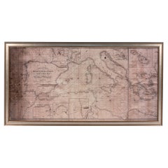
Large Framed Map of the Mediterranean
Located in New York, NY
, Corsica, part of France, etc. in a black frame.
Category
20th Century French Mid-Century Modern Maps
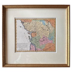
Original Antique Map of West Central France in Frame, 1748
Located in Langweer, NL
A nicely framed and hand-coloured decorative map titled "Gouvernemens Generaux De Poitou et De
Category
Antique 1740s Maps
Materials
Paper
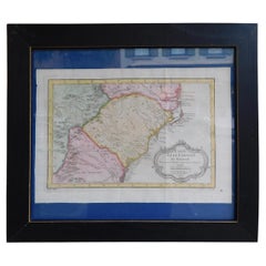
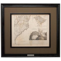
French Framed Copper Engraved Hand Colored Map of Carolina & Georgia, Circa 1757
Located in Hollywood, SC
French copper engraved hand colored map of Carolina & Georgia matted under glass with a painted
Category
Antique 1750s French Louis XV Maps
Materials
Paper, Paint, Wood, Glass
H 14.5 in W 16.75 in D 1 in
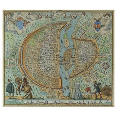
French Map of Paris, Musuem Carnavalet Rossingol University Map, 1576
Located in Gardena, CA
French Map of Paris, Musuem Carnavalet Rossingol University Map, 1576.
Map of Paris, France
Category
Antique 16th Century French Maps
Materials
Paper
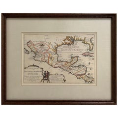
1705 Golfe de Mexico and Florida Framed Map
Located in Stamford, CT
Framed map of Mexico & Florida circa 1705, Paris. Small map with Mexico and the Gulf Coast. Inset
Category
Antique Early 1700s French Spanish Colonial Maps
Materials
Glass, Wood, Paper
1812 United States Map, by Pierre Tardieu, Antique French Map Depicting the U.S.
By Pierre François Tardieu
Located in Colorado Springs, CO
French and English. This extremely detailed map not only depicts the mountainous regions of the
Category
Antique 1810s French Maps
Materials
Paper
H 43.5 in W 48 in D 2.25 in
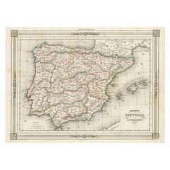
Antique Map of Spain and Portugal, with Frame Style Border
Located in Langweer, NL
Antique map titled 'Espagne et Portugal'. Attractive map of Spain and Portugal. The map covers all
Category
Antique Mid-19th Century Maps
Materials
Paper
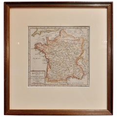
Antique Map of France by Vaugondy, circa 1750
Located in Langweer, NL
Antique map titled 'La France divisée (..)'. Map of France published by Robert de Vaugondy, circa
Category
Antique Early 18th Century Maps
Materials
Paper
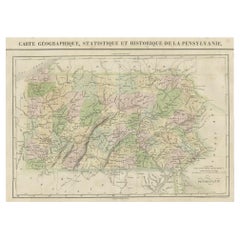
French Geographical, Statistical and Historical Map of Pensylvania, 1825
Located in Langweer, NL
1825 French Map of Pennsylvania, with a List of Prominent Rivers, Descriptions of Mountains, Climate
Category
Antique 1820s Maps
Materials
Paper
H 20.08 in W 25.99 in D 0 in
17th Century Map of Denmark by French Cartographer Sanson, Dated 1658
By Nicolas Sanson
Located in Copenhagen, K
"father of French cartography.
The engraved map is hand-colored and dated 1658.
The gilded frame is from
Category
Antique 17th Century French Maps
Materials
Paper
America "Amérique Septentrionale": A 19th Century French Map by Delamarche
By Maison Delamarche 1
Located in Alamo, CA
This framed mid 19th century map of North America entitled "Amérique Septentrionale" by Felix
Category
Antique Mid-19th Century American Other Maps
Materials
Paper
H 20 in W 22.63 in D 0.88 in
Plan of Paris, France, by A. Vuillemin, Antique Map, 1845
Located in Colorado Springs, CO
toning to the paper. The map has been backed onto linen. It is displayed in a custom archival wood frame
Category
Antique 1840s American Maps
Materials
Paper
1864 Map of North America, Antique Hand-Colored Map, by Adolphe Hippolyte Dufour
Located in Colorado Springs, CO
.
Adolphe Hippolyte Dufour (1795-1865) was a French-based map and atlas publisher active in the middle to
Category
Antique 1860s French Maps
Materials
Paper
H 44.5 in W 33 in D 1.5 in
Authentic 1644 Janssonius Map of the Champagne Region (Campania) in France
Located in Langweer, NL
"1644 Janssonius Map of Champagne, France"
This meticulously detailed original antique map
Category
Antique 1640s Maps
Materials
Paper
Free Shipping
H 21.86 in W 25.99 in D 0 in
1850 Old French Map Depicting the Entire Earth's Surface Divided into Two Parts
Located in Milan, IT
two hemispheres or globes, the map deals with the earth in general. Detailed explanation in French
Category
Antique Mid-19th Century French Maps
Materials
Glass, Wood, Paper
H 18.31 in W 27.45 in D 0.79 in
Antique Map of the French Colony Guadeloupe by V. Levasseur, 1854
By Victor Levasseur
Located in Langweer, NL
the Caribbean Sea, with decorative frame containing views of the island. This map originates from
Category
Antique Mid-19th Century Maps
Materials
Paper
1850 Old French Map Depicting the Entire Earth's Surface Divided into Two Parts
Located in Milan, IT
Geographical map depicting the entire earth’s surface divided into two parts that correspond to the
Category
Antique Mid-19th Century French Maps
Materials
Glass, Wood, Paper
H 18.19 in W 25.87 in D 0.79 in
1850 Old French Map Depicting the Entire Earth's Surface Divided into Two Parts
Located in Milan, IT
plate, Coeval coloring. Table n. 2, French manufacture from the mid-19th century, non-contemporary frame
Category
Antique Mid-19th Century French Maps
Materials
Glass, Wood, Paper
H 18.51 in W 27.76 in D 0.79 in
Striking Antique Map of Luxembourg and Northern France 'Lotharingen', c.1680
Located in Langweer, NL
.' -
Striking map of Luxembourg and Northern France. Includes the cities of Toul, Nancy, Metz and Trier
Category
Antique 1680s Maps
Materials
Paper
H 18.71 in W 22.25 in D 0 in
Old Map Depicting the Entire Earth's Surface Divided into Six Parts France 1850
Located in Milan, IT
Map depicting the entire earth's surface divided into six parts which depicts the position of
Category
Antique Mid-19th Century French Maps
Materials
Paper, Glass, Wood
H 18.51 in W 27.76 in D 0.79 in
1850 Old French Map Depicting the Entire Earth's Surface Divided into Two Parts
Located in Milan, IT
, coeval coloring. Table n. 11, French manufacture from the mid-19th century, non-contemporary frame made
Category
Antique Mid-19th Century French Maps
Materials
Glass, Wood, Paper
H 18.51 in W 25.99 in D 0.79 in
Map Colonies Francaises Martinique, 1845
Located in BUNGAY, SUFFOLK
, Hemisphere Boreaal No 90
1845
In an ebonised frame length 49cm., 19" height 38cm., 15".
Category
Antique 19th Century French Maps
Materials
Paper
18th Century French Map and City View of Joppe/Jaffa 'Tel Aviv' by Sanson
By Nicolas Sanson
Located in Alamo, CA
condition.
Another map of the "Holy Land" (by Claes Visscher in 1663), with an identical style frame and
Category
Antique Early 18th Century French Maps
Materials
Paper
H 18.88 in W 23 in D 1.13 in
Antique Miniature Map of the Old World and France by Mallet, circa 1683
Located in Langweer, NL
Antique map titled 'Planisphere du Monde - France'. Two miniature maps on one sheet. The upper map
Category
Antique Late 17th Century Maps
Materials
Paper
H 11.03 in W 8.86 in D 0.6 in
Antique Miniature Map of France and the Low Countries by Mallet, circa 1719
Located in Langweer, NL
Antique map titled 'France - Païs-Bas'. Miniature Map of France and the Low Countries. Published by
Category
Antique Early 18th Century Maps
Materials
Paper
H 11.82 in W 9.45 in D 0.6 in
Antique Miniature Map of the region of Poitou 'France' by Bertius, circa 1600
Located in Langweer, NL
Antique map titled 'Poictou'. Miniature map of the region of Poitou, France. Published by Pieter
Category
Antique Early 17th Century Maps
Materials
Paper
H 9.45 in W 10.44 in D 0.6 in
Dutch Map and City Plan of La Roche-sur-Foron, France, 17th Century Hand Colored
By Coenraet Decker
Located in Alamo, CA
issued. The map is in excellent condition. There are small abrasions and chips to the frame
Category
Antique Late 17th Century Dutch Maps
Materials
Paper
H 27.75 in W 32.5 in D 0.07 in
Antique Map of Paris, "Carte Routiere des Environs de Paris" 1841
Located in Colorado Springs, CO
than a way to protect the French people. Only seven years after this pocket map included the plans for
Category
Antique 1840s French Maps
Materials
Paper
Antique Map of the City of Paris by Tirion '1763'
Located in Langweer, NL
Paris, France. This map originates from 'Nieuwe en Beknopte Hand-Atlas, bestaande in eene Verzameling
Category
Antique Mid-18th Century Maps
Materials
Paper
Antique Engraved Map of Italy in Roman Times, ca.1730
Located in Langweer, NL
for colouring and/or framing.
Guillaume Delisle (1675-1726) was a French map maker who continually
Category
Antique 1730s Maps
Materials
Paper
Northern Scotland: A 16th Century Hand-colored Map by Mercator
By Gerard Mercator
Located in Alamo, CA
A framed hand-colored 16th century map of Northern Scotland by Gerard Mercator entitled "Scotiae
Category
Antique 16th Century Dutch Maps
Materials
Paper
Northern Scotland: A 17th Century Hand-colored Map by Mercator
By Gerard Mercator
Located in Alamo, CA
This is a framed hand-colored 17th century map of Northern Scotland by Gerard Mercator entitled
Category
Antique 1630s Dutch Maps
Materials
Paper
New Map of North America from the Latest Discoveries, 1763
Located in Philadelphia, PA
map).
Not observed outside the frame
The frame is in good condition with some spots of loss its
Category
Antique Mid-18th Century English Georgian Maps
Materials
Paper
West Coast of Africa, Guinea & Sierra Leone: An 18th Century Map by Bellin
By Jacques-Nicolas Bellin
Located in Alamo, CA
. Christophe", Reference #: LU117328585712 and a map of St. Lucie framed in lucite, Reference: LU117324370471
Category
Antique Mid-18th Century French Maps
Materials
Paper
H 10 in W 14.25 in D 0.07 in
St. Christophe 'St. Kitts' Island: An 18th Century Hand-colored Map by Bellin
By Jacques-Nicolas Bellin
Located in Alamo, CA
# LU117328585822 and a map of St. Lucie framed in lucite, Reference: LU117324370471. These maps would make a
Category
Antique Mid-18th Century French Maps
Materials
Paper
H 10 in W 14.25 in D 0.07 in
18th Century Emanuel Bowen Map of County of York, c.1740
By Emanuel Bowen
Located in Royal Tunbridge Wells, Kent
Antique 18th century British rare and original Emanuel Bowen (1694-1767) map of the County of York
Category
Antique Early 18th Century British Maps
Materials
Paper
Free Shipping
H 22.64 in W 29.34 in D 0.79 in
Hampshire County, Britain/England: A Map from Camden's" Britannia" in 1607
By John Norden
Located in Alamo, CA
part of the Isle of Wight.
The map is presented in a gold-colored wood frame with black trim and a
Category
Antique Early 17th Century English Maps
Materials
Paper
H 17.13 in W 18.75 in D 0.88 in
Original Antique Map of the Philippines, Malaysia, Indonesia, Singapore, c.1690
Located in Langweer, NL
Antique map titled 'Isole dell' Indie, diuise in Filippine, Molucche e della Sonda'.
Old map of
Category
Antique 1690s Maps
Materials
Paper
Free Shipping
H 19.49 in W 27.56 in D 0 in
Map of the Holy Land "Carte de la Syrie et de l'Egypte" by Pierre M. Lapie
By Pierre M. Lapie
Located in Alamo, CA
An early 19th century map of ancient Syria and Egypt entitled "Carte de la Syrie et de l'Egypte
Category
Antique Early 19th Century French Maps
Materials
Paper
H 27 in W 21.38 in D 0.75 in
17th Century Topographical Map of Cote D'azur, Avignon, Frejus by Iohan Peeters
Located in New York, NY
Fine topographical 17th century map by Iohan Peeters of the towns of Avignon and Frejus in the Cote
Category
Antique 17th Century Dutch Maps
Materials
Paper
H 12.5 in W 15 in D 0 in
Antique Map of Southern Asia with India, the Maldives, Ceylon and Arabia, c.1700
Located in Langweer, NL
Stunning Old Map of Asia.
Description: Two-sheet map of Asia, joined. The left part of this
Category
Antique Early 18th Century Maps
Materials
Paper
H 24.81 in W 37.01 in D 0 in
Globe, Solid Rotating Brass Frame with Spinning Globe
Located in Dallas, TX
Globe, solid rotating brass frame with spinning globe, faux hardstone.
Category
Mid-20th Century French Maps
Materials
Brass
18th Century Cartographic Depiction of Upper India and Ceylon, 1835
Located in Langweer, NL
connoisseur of historical maps.
The potential to frame these maps side by side offers a unique opportunity
Category
Antique 1830s Maps
Materials
Paper
Free Shipping
H 10.04 in W 14.57 in D 0 in
Mapping History: The Decorative Cartography of Indre-et-Loire by Levasseur, 1856
Located in Langweer, NL
additional annotations or simply serving to frame the map aesthetically when displayed. Such margins also
Category
Antique 1850s Maps
Materials
Paper
H 20.67 in W 14.34 in D 0 in
Levasseur's 1852 Cartographic Portrait of Gironde: Celebrating the Bordeaux Wine
Located in Langweer, NL
French geographer and cartographer known for his richly illustrated maps.
The map is a steel engraving
Category
Antique 1850s Maps
Materials
Paper
H 20.67 in W 14.06 in D 0 in
Early, Rare and Small Hand-Coloured Copper Engraving of Greece, ca. 1602
Located in Langweer, NL
'Grece' and page nr 89. Verso French text.
The accompanying text is by Michael Coignet. The map is
Category
Antique Early 17th Century Maps
Materials
Paper
Original Antique Sea Chart of the Coastline from England to Gibraltar, ca.1700
Located in Langweer, NL
Antique map titled 'A Chart of the Sea-Coast from England to the Streights.'
Original antique map
Category
Antique Early 1700s Maps
Materials
Paper
No Reserve
H 18.47 in W 23.55 in D 0 in
Gilt Framed Vintage Wine Regions of France Map
Located in Alton, GB
Framed French wine region map 1973. The print has been removed to clean the glass, the frame has
Category
Vintage 1970s French Posters
Materials
Paper
New France and Labrador - Detailed Graphite Landscape on Antiqued Map, Framed
By Don Pollack
Located in Chicago, IL
wooden measuring 21.75 x 27.5 x 1.5 inches.
Don Pollack
New France and Labrador, 2023
graphite on map
Category
21st Century and Contemporary Contemporary Landscape Drawings and Waterc...
Materials
Graphite, Archival Paper
Old Engraving Map of Paris French Munster 16th Century Walled City Framed
Located in Wilton, CT
Old or antique colored engraving of Munster's 1572 map of Paris, circa 19th or 20th century (Frame
Category
20th Century French Renaissance Prints
Materials
Paper
Antique Map of France
Located in Dallas, TX
Nice antique map of France in wood frame. This would make a great gift for a collector. A wonderful
Category
Early 20th Century Decorative Art
Materials
Glass, Wood, Paper
Large French Paris Metro Map 1960s
Located in North Hollywood, CA
Large French Paris Metro Map 1960s.
A large Vintage French framed map of the Parisian Metro from
Category
Mid-20th Century French Industrial Prints
Materials
Wood, Paper
French 1930s Map of Paris à Vol d'Oiseau under Glass in Custom Iron Frame
Located in Atlanta, GA
A French map of Paris from the early 20th century, with custom iron frame. Created in Paris during
Category
Early 20th Century French Prints
Materials
Iron
H 28.75 in W 40.25 in D 1 in
A Beautiful Antique Map of France
Located in Lincoln, GB
A Beautiful Antique Map of France
56 x 65cm
In a lovely frame, this map of France is in
Category
19th Century More Art
Materials
Paper
Lucien Boucher, Air France 'Nova et Vetera' Poster Map, Paris France, 1939
By Lucien Boucher
Located in Firenze, IT
Air France 'Nova et Vetera' poster map designed by Lucien Boucher
Paris France 1939
Category
Vintage 1930s French Modern Prints
Materials
Glass, Wood, Paper
H 23.63 in W 37.8 in D 0.79 in
Four Reproduction Vintage Panels of Air France World Map
Located in Los Angeles, CA
Reproduction of a beautiful green and blue mid-century Air France world map on four individual
Category
21st Century and Contemporary French Prints
Materials
Wood, Paper
Four Reproduction Vintage Panels of Air France World Map
Located in Los Angeles, CA
Reproduction of beautiful blue and green mid-century Air France world map on four individual panels
Category
21st Century and Contemporary French Prints
Materials
Paper, Wood
New France and Labrador - Graphite Drawing, Landscape, On Antiqued Map
By Don Pollack
Located in Chicago, IL
Coeur d’Alenes trail in Northern Idaho. It is a place of rugged and stark beauty barely on the old maps
Category
21st Century and Contemporary Contemporary Landscape Paintings
Materials
Canvas, Oil
Map of Paris "Le Plan des Paris Ses Faubourgs et Environs", 8 Framed Prints
By Henredon
Located in Miami, FL
Map of Paris "Le Plan des Paris Ses Faubourgs et Environs", 8 Framed Prints
Offered for sale is
Category
20th Century French Prints
Materials
Glass, Giltwood, Paper
H 30 in W 21.5 in D 1.08 in
Original Vintage Poster Illustrated Map Madagascar French Colony Industry Travel
Located in London, GB
illustrated map showing the various places on a road route, the cities and towns marked with the highlands and
Category
Vintage 1930s French Posters
Materials
Paper
H 47.25 in W 31.5 in D 0.04 in
- 1
Get Updated with New Arrivals
Save "Map France Framed", and we’ll notify you when there are new listings in this category.
More Ways To Browse
Old Prints Of Maps
Mormon Furniture
Maison Jansen Mahogany
French Table Naturalistic
Antique Packard
Miroir Soleil
Antique Folding Sink
Pierre Fran�ois Tardieu On Sale
Ca Map
Carte Egypte Antique
East Coast Australia Charts
Republic Of Texas Map
Antique Maps Washington Dc
Map Drawer Cabinet
Pakistan Antique Map
Antique Curiosities North Carolina
Epernay France
Panama Antique Map
