Collectibles and Curiosities

to
2,751
3,774
592
4,392
205
90
41
39
33
13
6
4
4
2
2
2
1
1
1
4,392
6,610
13,347
2,718
3,500
4,620
3,046
520
300
590
737
463
902
877
904
665
575
3,342
581
495
135
121
1,169
239
214
205
161
4,392
4,392
4,392
63
24
16
14
13
Collectibles and Curiosities For Sale
Period: 18th Century and Earlier
Period: Early 1700s
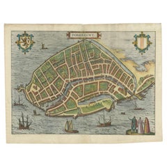
Antique Map of the City of Dordrecht by Braun & Hogenberg, c.1581
Located in Langweer, NL
Antique map titled 'Dordrecht'. Map of the city of Dordrecht, the Netherlands. Bird's-eye plan view of the city, with many ships and two coats of arms in upper corners. This map orig...
Category

16th Century Antique Collectibles and Curiosities

Materials

Paper

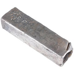
Colonial Silver VOC 'East-India Company' Ingot
Located in Amsterdam, NL
A silver 'V.O.C. AMSTERDAM' ingot circa 1738, with monogram and the assay mark of the Amsterdam Grill family With V.O.C. monogram and the A for Amsterdam. L. approx. 15.5 cm Weight approx. 2000 grams Note: The ingots were salvaged in 2004 from the wreck of the VOC indiaman Rooswijk, equipped by the Amsterdam VOC Chamber. The Rooswijk sank on its second voyage to the Dutch East Indies off the English coast on the Goodwin Sands...
Category

18th Century Dutch Antique Collectibles and Curiosities

Materials

Sterling Silver

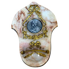
19th C. French 'Ave Maria' Bénitier / Holy Water Font, Devotional Reliquary
Located in West Palm Beach, FL
19th C. French 'Ave Maria' Bénitier / Holy Water Font, Devotional Reliquary  France, circa 1890s, artist signed 'Ale'  A stunning late 19th-century French Bénitier/Holy Water Font D...
Category

Late 18th Century French Belle Époque Antique Collectibles and Curiosities

Materials

Marble, Bronze, Ormolu

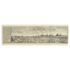
Rare Antique Engraving of the City of Copenhagen, Denmark, ca.1720
Located in Langweer, NL
Antique print titled 'Copenhagen. Die Königl. Residenz und Haupt Stadt in Dänemark'. Panoramic view of the city of Copenhagen, Denmark. This print, most likely, originates from the s...
Category

18th Century Antique Collectibles and Curiosities

Materials

Paper

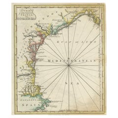
Antique Map of the Coast of Southern France, 1793
Located in Langweer, NL
Antique map titled '14th Chart of the Coast of France, from Port Vendres to the Petit Rhône'. Original map with later hand coroling of the coast of Southern France. The "14th Chart of the Coast of France, from Port Vendres to the Petit Rhône" is an antique map that offers a detailed depiction of the southern coast of France, specifically highlighting the Mediterranean coastline. This map, which dates back to 1793, was originally part of "Le Petit Neptune Français; Or, French Coasting Pilot," a publication designed for maritime navigation along the French coastlines. Key Features of the Map: 1. **Geographic Coverage**: - The map covers the southern French coastline from Port Vendres in the west to the Petit Rhône in the east. - It includes notable regions such as Languedoc, the Gulf of Lyon, and parts of Catalonia (Spain). 2. **Notable Places**: - **Montpellier**: A major city in the Diocese of Montpellier, an important cultural and economic center. - **Narbonne**: Located in the Diocese of Narbonne, a historical city with Roman heritage. - **Agde**: Situated in the Diocese of Agde, known for its ancient Greek colony origins. - **Béziers**: Part of the Diocese of Béziers, another city with deep historical roots dating back to Roman times. - **Port Vendres**: A critical port near the Spanish border. - **Catalonia**: Including parts of northeastern Spain, emphasizing the coastal connection between France and Spain. 3. **Dioceses and Regions**: - The map is marked with various dioceses such as Montpellier, Agde, Narbonne, and Béziers, indicating ecclesiastical boundaries. - It highlights the broader region of Languedoc, a historical province known for its wine production and medieval history. 4. **Navigational Aids**: - The map features a compass rose with radiating lines, a common navigational aid in maritime maps...
Category

Late 18th Century Antique Collectibles and Curiosities

Materials

Paper

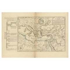
Moullart-Sanson Map of the Holy Land and Sacred Geography of the Old Testament
Located in Langweer, NL
"1716 Moullart-Sanson Map of the Holy Land and Sacred Geography of the Old Testament" This engraved map, created by Pierre Moullart-Sanson and reissued by Robert de Vaugondy in 1740...
Category

1710s Antique Collectibles and Curiosities

Materials

Paper

18th Century Polynesian Hardwood Ula Tavatava or Throwing War Club from Fiji
Located in Amsterdam, NL
A Polynesian hardwood Ula tavatava or throwing war club Fiji, probably 18th century All-over decorated in incised pattern, the bulbous top seems to have a stone grown into it. H. 42 cm Including museum-quality powder-coated stand. Provenance: Private collection, France Polynesian culture is traditionally a culture of power and prestige, and there was a fine line between battle and ceremony. Warrior people par excellence, the Fijians had at their disposal a large panoply of weapons, each for a specific use. The elegant Gata are called gun-sticks by Europeans due to the recognizable form. However, they are designed after a snake, gata in Fijian language. The Ula throwing clubs...
Category

18th Century Fijian Antique Collectibles and Curiosities

Materials

Hardwood

Italian 18th Century Hand Carved And Silvered Wooden Baroque Reliquary
Located in Buisson, FR
Wonderful and detailed reliquary holder with its beautiful weathered original silver, Italy, circa 1750. Weathered and small losses and old repairs.
Category

18th Century Italian Baroque Antique Collectibles and Curiosities

Materials

Wood

Antique Print of the City of Rome, Italy by Münster, C.1580
Located in Langweer, NL
Antique print titled 'Abbildung der Statt Rom/wie sie under Keyser Vespasiano und zu Plinii zeiten gewesen'. Woodcut of ancient Rome. This print originates from Munster's Cosmographi...
Category

16th Century Antique Collectibles and Curiosities

Materials

Paper

Bird's-Eye Views of Dunkerque, Gravelines, and Bourbourg by Braun and Hogenberg
Located in Langweer, NL
Bird's-Eye Views of Dunkerque, Gravelines, and Bourbourg by Braun and Hogenberg, 1597 This antique print, published in 1597 by Braun and Hogenberg, showcases three detailed bird's...
Category

16th Century Antique Collectibles and Curiosities

Materials

Paper

18th Century Gold Processional Religious Church Cross
Located in Hastings, GB
Wonderfully ornate gilt gesso over carved wood processional cross, probably northern Italy late 18th century. The large floral wreath with carved gilt ribbons, a small cross to the c...
Category

1780s Italian Baroque Antique Collectibles and Curiosities

Materials

Wood

18th Century Italian Wood and Copper Altar Vase
Located in Hastings, GB
A large hand-crafted wood and copper altar vase, late 18th century with stunning patina. Wear commensurate with the age of the piece. The antique fan coral will only be supplied ...
Category

Mid-18th Century Italian Baroque Antique Collectibles and Curiosities

Materials

Copper

Antique Map of the Area Around Venice in Italy by H. Hondius, circa 1606
By Jodocus Hondius, Gerard Mercator
Located in Langweer, NL
Attractive and early map of the area around Venice, Italy. With South-Tirol in the North, areas of Krain (Slovenia), Croatia, Ferrara, Modena and Piacenza. In the east with areas aro...
Category

Early 17th Century Antique Collectibles and Curiosities

Materials

Paper

1663 Blaeu's Engraved Map of Frankfurt with Decorative Coats of Arms
Located in Langweer, NL
This map, titled "Novam Hanc Territorii Francofurtensis Tabulam," is an exquisite hand-colored engraved map from around 1663, created by the renowned cartographers J. and C. Blaeu of...
Category

1660s Antique Collectibles and Curiosities

Materials

Paper

Very Rare Antique Print of the City of Nice in France, c.1700
Located in Langweer, NL
Antique print titled 'Nicaea Civitas'. Original antique print with a view of the city of Nice, France. Rare in this edition. Source unknown, to be determined. Artists and Engraver...
Category

17th Century Antique Collectibles and Curiosities

Materials

Paper

Sword with Wrought Iron Blade with Traces of Gold on Hilt with Cover Sheath
Located in Marbella, ES
Sword with Wrought Iron Blade with Traces of Gold on Hilt with Leather Cover Sheath
Category

17th Century Antique Collectibles and Curiosities

Materials

Gold, Wrought Iron

Map of the Kingdom of Sardinia and Part of the Kingdom of Genoa, Rome
Located in Hamilton, Ontario
18th century map by Italian engraver Giovanni Maria Cassini (Italy 1745-1824). Map of Part of the Kingdom of Sardinia and Part of the Kingdom of Genoa: Rome. This is a hand colored a...
Category

18th Century Italian Antique Collectibles and Curiosities

Materials

Paper

The Principality of Dombes: A 17th-Century Cartographic Jewel by Jan Jansson
Located in Langweer, NL
The text on the map "La principaute de Dombes; J. van den Eynde sculpit.; La Principavte de Dombes" indicates that it is a map of the principality of Dombes, engraved by J. van den E...
Category

1630s Antique Collectibles and Curiosities

Materials

Paper

1579 Ornate Map of Burgundy County by Ferdinand de Lannoy
Located in Langweer, NL
1579 Ornate Map of Burgundy County by Ferdinand de Lannoy Description of the Map: This is a beautifully detailed map of the Burgundy region, titled "Bvrgvndiae Comitatus Recentiss....
Category

16th Century Antique Collectibles and Curiosities

Materials

Paper

Antique Lithography Map, Oxfordshire, English, Framed Cartography, Robert Morden
Located in Hele, Devon, GB
This is an antique lithography map of Oxfordshire. An English, framed atlas engraving of cartographic interest by Robert Morden, dating to the late 17th century and later. Superb l...
Category

Late 17th Century British William and Mary Antique Collectibles and Curiosities

Materials

Paper

Monstrance (temple type). Silver. Spain, 16th century with restorations.
Located in Madrid, ES
Portable temple custody. Gilded silver, glass. 16th century, possible restorations. Custody made of gilded silver (the finish has been lost in some points) composed of a base, an ax...
Category

16th Century Spanish Renaissance Antique Collectibles and Curiosities

Materials

Silver, Other

Rare 1681 Map of Batavia: Detailed Dutch Colonial Era Cartography, 1681
Located in Langweer, NL
The map of Batavia (modern-day Jakarta) from 1681, attributed to Frederick de Wit holds significant historical importance for several reasons: Historical Context 1. Colonial Era: This map dates back to the Dutch colonial era when Batavia served as the administrative and commercial hub of the Dutch East India Company (VOC). The VOC was a powerful trading entity that played a crucial role in the global spice trade and colonization in Southeast Asia. 2. Strategic Importance: Batavia was strategically located on the northwestern coast of Java, providing the Dutch with a critical base for their maritime operations. The city became the center of Dutch political and military control in the region. Cartographic Significance 1. Detailed Urban Layout: The map meticulously details the layout of Batavia, including its fortifications, canals, streets, and significant buildings. This level of detail provides insights into the urban planning and architectural styles of the period. 2. Military Engineering: The fortifications shown on the map illustrate the advanced military engineering techniques used by the Dutch to protect their valuable colony. The walls, bastions, and moats indicate the strategic considerations taken to defend against potential invasions. 3. Maritime Activity: The depiction of ships in the harbor highlights Batavia's role as a major maritime center. The VOC's fleets were essential for trade routes connecting Europe, Africa, and Asia, making Batavia a crucial node in global commerce. Artistic and Cultural Value 1. Artistic Elements: The decorative elements, such as the lion holding a shield and the intricate cartouches, reflect the artistic trends of Dutch Golden Age cartography. These embellishments were not only informative but also served to display the cartographer's skill and the map's prestige. 2. Cultural Exchange: Maps like this one provide evidence of cultural exchange between the Dutch and the indigenous populations of Java. The blending of Dutch and local influences can be seen in various aspects of the map and the architecture of the city. Rarity and Preservation 1. Rarity: Maps from the 17th century, especially those in good condition, are relatively rare and highly valued by collectors and historians. Each map provides a unique snapshot of historical geography and urban development. 2. Preservation of History: This map serves as a historical document, preserving knowledge about Batavia's cityscape, infrastructure, and colonial governance. It helps historians and scholars understand the socio-economic and political dynamics of the period. Conclusion The map of Batavia from 1681 is special due to its detailed depiction of one of the most important colonial cities in Southeast Asia during the Dutch Golden Age. It reflects the strategic, economic, and cultural significance of Batavia, serving as a valuable resource for understanding the history of Dutch colonialism and its global impact. The map's artistry and precision make it an important artifact in the history of cartography. --------------- The map is an original and historical map of Batavia (present-day Jakarta) on the island of Java, dated 1681. There are several details to consider when evaluating its origins and possible authorship: 1. **Style and Detail**: The intricate details and style are reminiscent of maps created by Frederick de Wit, a prominent Dutch cartographer and engraver of the 17th century. He was known for his detailed city maps and sea charts. 2. **Lack of Signature**: The absence of "F. de Wit, Excudit" could indicate either an omission or a different engraver. However, it is essential to note that some maps from that period were reproduced or copied by other engravers and cartographers. This was not uncommon, as map-making was a collaborative effort, and copies of popular maps were frequently made. 3. **Map Characteristics**: - The depiction of ships and the detailed fortifications are typical of Dutch cartography in the late 17th century. - The decorative elements, such as the lion holding a shield, are also characteristic of Dutch map engravers. 4. **Other Possible Engravers**: While Frederick de Wit is a strong candidate, other notable Dutch engravers from that period include Joan Blaeu and Willem Janszoon Blaeu. They also produced highly detailed maps and could potentially be the creators or inspirers of this map. To determine the precise authorship, you might consider: - **Comparing** this map with other confirmed works of Frederick de Wit and his contemporaries to identify stylistic similarities and differences. - **Historical Records**: Consulting historical records or publications related to Dutch cartography in the 17th century might provide more context or even direct references to this particular map. If you have access to additional details or higher-resolution images of specific sections, it might help further pinpoint the map's origin and authorship. ------------- Frederick de Wit (1629–1706) was a prominent Dutch cartographer, engraver, and publisher known for his detailed and decorative maps, atlases, and globes. He played a significant role in the Dutch Golden Age of cartography, contributing to the wealth of geographic knowledge and artistic achievement during this period. Here are key aspects of his life and work: ### Biography - **Early Life**: Frederick de Wit was born in Gouda, Netherlands, in 1629. Little is known about his early years, but he moved to Amsterdam, the epicenter of Dutch cartography, in the mid-17th century. - **Career Beginnings**: De Wit began his career as an engraver and publisher, initially producing maps that were reissues of earlier works by other cartographers, such as Joan Blaeu and Willem Janszoon Blaeu. ### Contributions to Cartography - **Mapmaking**: De Wit was known for his meticulous attention to detail and artistic flair. He produced a wide range of maps, including world maps, regional maps, city plans, and maritime charts...
Category

1680s Antique Collectibles and Curiosities

Materials

Paper

1685 Alain Manesson Mallet Map of Hokkaido (Lesso) in Northern Japan
Located in Langweer, NL
Title: 1685 Alain Manesson Mallet Map of Hokkaido, Iesso, and Company’s Land Description: This engraved seventeenth-century map, titled Terre de Iesso, was published in 1685 as pa...
Category

1680s Antique Collectibles and Curiosities

Materials

Paper

Antique Russian Carved Sleigh
Located in Queens, NY
Russian (18/19th Cent) ornately painted and carved sleigh with carved shell front sleigh
Category

Late 18th Century Russian Rococo Antique Collectibles and Curiosities

Materials

Wood

Framed British Coat Of Arms
Located in Essex, MA
Framed crest with Latin inscription " Spero Meliora". Translates to I hope for better things. Seems to relate to the Moffat Clan of Scotland.
Category

Late 18th Century English Georgian Antique Collectibles and Curiosities

Materials

Wood

JESUS CHRIST CRUCIFIED Indo-Portuguese sculpture from the 18th Century
Located in Madrid, ES
JESUS CHRIST CRUCIFIED Indo-Portuguese sculpture from the 18th Century in ivor..... The figure is represented in agony, with cendal draped around the waist. Cross in rosewood wood ...
Category

Early 18th Century Portuguese Baroque Antique Collectibles and Curiosities

Materials

Wood

Antique Map of Warwickshire in England by Speed, c.1614
Located in Langweer, NL
Antique map titled 'The Counti of Warwick the Shire Towne and Citie of Coventre described'. Map of Warwickshire, England. Includes inset town plans of Warwic...
Category

17th Century Antique Collectibles and Curiosities

Materials

Paper

Antique Map of England and Wales Depicting the Period of the Saxon Heptarchy
Located in Langweer, NL
Antique map titled 'Britain as divided under the Saxon Heptarchy'. An antique copper engraving map of England and Wales by Joseph Ellis depicting the period of the Saxon Heptarchy. E...
Category

Late 18th Century Antique Collectibles and Curiosities

Materials

Paper

Edo-period Orange-Laced Samurai Suit
Located in New Orleans, LA
For samurai warriors, the functionality of their armor was as vital as its striking beauty—both elements held equal importance. This orange-laced armor is one of the rarest and most stunning complete Edo-period samurai suits ever crafted, designed for a military leader to convey the gravity of his power and warrior spirit at a single glance. This particularly rare armor...
Category

18th Century Asian Edo Antique Collectibles and Curiosities

Materials

Copper, Iron

1788 The Dramatick Writings of Will. Shakspere
Located in Bath, GB
A beautiful and scarce 'Bell's Edition of Shakespeare', the vanishingly scarce large paper variant, illustrated with engraved plates. The very scarce complete twenty volume set. A large paper edition, uniformly bound in full morocco. In 1785, John Bell began to issue the 36 separate plays of Shakespeare individually, collecting them here in twenty volumes in 1788 as the 'Dramatick writings of Will. Shakspere'. The set is scarcely found complete. The first two volumes here are a remarkably comprehensive and broad 'Prolegomena' to Shakespeare's works, and offer interesting analysis of Shakespeare from an era where many of his plays were often interpreted differently, both in their production and in their critical reception. The subsequent eighteen volumes consist of the plays themselves, along with notes from Samuel Johnson and George Stevens, a highlight of this particular edition. Volumes I & II: Prolegomena To The Dramatick Writings of Will. Shakespeare. Nine plates to volume I, and eight to volume II. Volume III: The Tempest and Two Gentlemen of Verona. Four plates. Volume IV: The Merry Wives of Windsor and Much Ado About Nothing. Four plates. Volume V: Measure for Measure and A Comedy of Errors. Four plates. Volume VI: Love's Labour's Lost and A Midsummer Night's Dream. Four plates. Volume VII: The Merchant of Venice and As You Like It. Four plates. Volume VIII: The Taming of The Shrew and All's Well That End's Well. Four plates. Volume IX: Twelfth Night and Winter's Tale. Four plates. Volume X: Macbeth and King John. Four plates. Volume XI: King Richard The Second...
Category

1780s British Antique Collectibles and Curiosities

Materials

Paper

18th Century Russian Icon St. Nicholas the Wonderworker, Circa 1780
Located in West Palm Beach, FL
18th-Century Russian Icon of St. Nicholas the Wonderworker, circa 1780 A finely painted and richly gilded Russian Orthodox icon depicting St. Nicholas the Wonderworker, dating to th...
Category

18th Century Russian Antique Collectibles and Curiosities

Materials

Wood

Antique Map Dedicated to British Merchants Trading to North America, ca.1746
Located in Langweer, NL
Description: Antique map titled 'A New Chart of the Coast of New England, Nova Scotia, New France or Canada, with the islands of Newfoundland, Capte Breton, St John's (..)'. Map stre...
Category

1740s Antique Collectibles and Curiosities

Materials

Paper

Antique Asian Temple Stone Relief Carved Architectural Element
Located in Forney, TX
A magnificent, rare, one of a kind, ancient Asian temple stone architectural panel, likely frieze fragment. Born in Asia, pre-18th century, most likely mu...
Category

18th Century Asian Ming Antique Collectibles and Curiosities

Materials

Stone

Antique Map of Arabia including Nubia and Abyssinia, also shows the Red Sea
Located in Langweer, NL
Antique map titled 'Nubie et Abissinie'. Original antique map of Nubia, a region along the Nile river, and Abyssinia or the Ethiopian Empire. This map o...
Category

Late 18th Century Antique Collectibles and Curiosities

Materials

Paper

Mapping the Heart of France: Willem Blaeu's 17th Century Île-de-France, ca.1650
Located in Langweer, NL
This original antique map titled "Le Gouvernement de l'Isle de France" represents the Île-de-France region, which historically was one of the provinces of France and contained the ci...
Category

1650s Antique Collectibles and Curiosities

Materials

Paper

17th Century Polychrome Wooden Niche with Angels and Pilasters
Located in Marbella, ES
17th century Polychrome wooden Niche with Angels and Pilasters.
Category

17th Century Spanish Antique Collectibles and Curiosities

Materials

Wood

Antique Print of Egyptian Objects, 1773
Located in Langweer, NL
Untitled print depicting various Egyptian objects including statues. Originates from the first Dutch editon of an interesting travel account of Northern Africa titled 'Reizen en Aanm...
Category

18th Century Antique Collectibles and Curiosities

Materials

Paper

The Tunning of Elinor Rumming, a Poem by John Skelton
Located in Middletown, NY
Skelton, John The Tunning of Elinor Rumming, a Poem London: Printed for Isaac Dalton, and sold by W. Boreham at the Angel in Pater-Noster-Row, 1718. Second Edition. Octavo, 7 5/8 x 4 5/8 in. (194 x 117 mm). pp. [8], 31, [1]. From the title page: by Skelton Laureat. Original unbound, rebound in modern pink paper over boards, leather spine label with gilt title. Some toning to last few leaves.boards All text is legible, some spot tanning throughout. In near fine condition. Rare. [ESTC N46064 ] ESTC shows two U.S. copies only: Henry E. Huntington Library and Yale University Beinecke Rare Book and Manuscript Library; and two British Isles copies only: Oxford University Bodleian Library (both copies). This poem was printed multiple times in the 16th century, including by William Caxton's successor, Wynken de Worde. Rare as a separate volume. John Skelton (c.1463 - 1529) was a remarkable, unusual poet and priest, who had been the tutor of the Tudors, Prince Arthur...
Category

Early 18th Century English Antique Collectibles and Curiosities

Materials

Gold Leaf

Antique Print of Majorinus Numida, a Bishop of Carthage in Dispute, 1701
Located in Langweer, NL
Antique portrait titled 'Majorinus Numida'. Portrait of Majorinus, a bishop of Carthage in dispute with Ceacilianus. He favored the so-called Donatist sect. He died ca. 329 AD. This print originates from 'Historie der kerken en ketteren van den beginne des Nieuwen Testaments tot aan het jaar onses Heeren 1688 ... In het Neederduyts vertaald' by G. Arnold. Artists and Engravers: Gottfried Arnold (1666 – 1714) was a German Lutheran...
Category

18th Century Antique Collectibles and Curiosities

Materials

Paper

Relieve Virgen Maria. Carved and Gilded Frame in the Baroque Style
Located in Mexico City, MX
Polychromed and Gilded Plaster Carved and Gilded Frame in the Baroque Style Hispanic World 18th-19th Century This beautiful bust figure of the Virgin Mary is carved in relief on liv...
Category

Late 18th Century Mexican Baroque Antique Collectibles and Curiosities

Materials

Plaster

A Double Barrel Flintlock Sporting Gun
Located in Lincolnshire, GB
A fine example of a double barrel flintlock sporting gun by Probin, London. The browned barrels and the locks are both signed, good colour walnut stock. circa 1795 Barrel length 83c...
Category

Late 18th Century English Antique Collectibles and Curiosities

Materials

Steel

Antique Map of America by Vaugondy, 1778
Located in Langweer, NL
Antique map titled 'Amerique ou Indes Occidentales (..)'. Vaugondy's map of America, pre-dating information from any of the Cook Voyages. The NW Coast of Amer...
Category

Late 18th Century Antique Collectibles and Curiosities

Materials

Paper

Antique Map of Nottinghamshire by Speed, 1676
Located in Langweer, NL
Antique map titled 'The Countie of Nottingham (..)'. Map of Nottinghamshire, England. Includes an inset town plan of Nottingham. This map originates from 'Theatre of Great Britaine' ...
Category

17th Century Antique Collectibles and Curiosities

Materials

Paper

1645 Blaeu Map of Westmorland, Northern England – Hand Colored, Decorative
Located in Langweer, NL
This map, "Westmoria Comitatus; Anglice Westmorland", was created by the esteemed Dutch cartographer Willem Blaeu and was published around 1645 in 'Le Theatre du Monde ou Nouvel Atlas'. It provides a detailed look at Westmorland, a historic county in northern England, based on John Speed’s earlier map. The map features numerous place names, parks, and estates, including Brigster Park, Colnhead Park, Crosbye, and Midleton, along with a detailed depiction of Windermere (spelled Wynandermere) and the surrounding regions. Additional Features: - Hand-colored map, with vibrant and detailed colors that bring out the topographical and decorative features. - Includes intricate cartouches, such as the royal coat of arms, a decorative title cartouche topped with putti (cherubic figures), and six coats of arms (two left blank). - Depicts the region’s rich landscape, including the rolling hills and mountainous terrain of northern England. - French text on the verso, indicative of the publication period from 1645-1648, part of Blaeu’s highly sought-after atlases. - Map shows precise details of small towns, estates, and parks, such as Brigster Park, Colnhead Park, Crosbye, and Wynandermere (now Windermere Lake). This map would be of particular interest to collectors of English county maps, antique maps of northern England, 17th-century cartography, and the decorative works of Willem Blaeu. Blaeu's maps are renowned for their accuracy, artistic beauty, and historical significance. Keywords: Willem Blaeu, Westmorland map, northern England, 17th-century map, antique map, English county map, John Speed, Windermere, decorative cartography, hand-colored map, rare map, antique cartography...
Category

1640s Antique Collectibles and Curiosities

Materials

Paper

Old Map of The Mughal Empire and the Indian Peninsula South of the Ganges, 1787
Located in Langweer, NL
This is a historical map titled "L'Empire Du Mogol, Et La Presqu Isle De L'Inde En Deca Du Gange." An original authentic map, created by Rigobert Bonne (1727-1794), an influential ...
Category

1780s Antique Collectibles and Curiosities

Materials

Paper

Antique Print with Coastal Views of Kamchatka in The Russian Far East, c.1784
Located in Langweer, NL
Antique print titled 'Views of the Coast of Kamtschatka (..)'. Print with coastal views of Kamchatka including volcanoes. Originates from an edition of Cook's Voyages. Artists and ...
Category

18th Century Antique Collectibles and Curiosities

Materials

Paper

Rare Hand-Colored Antique Map of Tartary, China and Korea, ca.1741
Located in Langweer, NL
Antique map titled 'A General Map of Eastern and Western Tatary, commonly call'd Tartary; drawn from the Particular Maps of the Jesuit Missionaries'. Rare antique map of Tartary, C...
Category

1740s Antique Collectibles and Curiosities

Materials

Paper

Voyage to the Cape of Good Hope, First Edition, c1785
Located in valatie, NY
Voyage to the Cape of Good Hope, towards the Antarctic polar circle, and round the world, but chiefly into the country of the Caffres, from the year ...
Category

18th Century Irish Antique Collectibles and Curiosities

Materials

Leather, Paper

Welsh Cider Flask - 18th Century
Located in Brussels, Brussels
18th century Welsh cider flask that farmers took with them to the fields for their lunch Small wrought iron carrying handle to carry it or hang it on the horse Wrought iron reinforce...
Category

18th Century British Aesthetic Movement Antique Collectibles and Curiosities

Materials

Wood

Senex Map of Castile, Leon & La Mancha in The Spanish Heartland, 1714
Located in Langweer, NL
This antique map, titled "A Map of Old & New Castile from the Observations of Rodrigo Mendes Silva and others," depicts the regions of Old Castile and New Castile in Spain, along with the Kingdom of Leon, Estremadura, La Mancha, among others. The map dates back to the early 18th century, a period marked by significant political shifts and territorial changes in Europe, particularly illustrated by the War of the Spanish Succession (1701–1714) that reshaped Spain’s governance and regional boundaries. The map itself was published in 1714 by John Senex, a prominent English mapmaker, surveyor, globemaker, and geographer of the early eighteenth century. He was apprenticed as a young man to bookseller Robert Clavell and collaborated with notable mapmakers such as Jeremiah Seller and Charles Price. In 1728, Senex's contributions to geography and mapping were recognized when he was elected a Fellow of the Royal Society, an exceptional honor for a mapmaker, underlining his significant role as the Society's engraver and a publisher of maps by Edmund Halley and other notable figures. John Senex is renowned for his English Atlas, first published in the same year as this map, 1714, and continued to be printed until the 1760s. Following his death in 1740, his widow Mary Senex managed the business until 1755. Afterward, the stock passed to William Herbert and Robert Sayer for maps, and to James Ferguson for globes. The map serves not just as a geographical record but also as a historical document, reflecting the territorial divisions significant to Spain's political and economic structure at the time. The focus on Old and New Castile underscores their importance during a transformative era in Spanish history. Here are some potentially significant places and features of this map: 1. **Old Castile (Castilla la Vieja)**: Historically significant as part of the former Kingdom of Castile, this region includes major cities such as Burgos and Valladolid. These cities could be popular search...
Category

Early 18th Century Antique Collectibles and Curiosities

Materials

Paper

Antique Map of South America by De la Harpe '1780'
Located in Langweer, NL
Antique map titled 'Carte de l'Amerique Méridionale'. Original antique map of South America. Note the 'Laguna de Xarayes' is illustrated as the source of the Paraguay river. The laguna is now known as Pantanal, world's largest tropical wetland area. This map orginates from 'Abrégé de l'histoire générale des Voyages' by J.F. de la Harpe.
Category

Late 18th Century Antique Collectibles and Curiosities

Materials

Paper

George III Mahogany Banjo Barometer Edinburgh
Located in Huntington, NY
George III Mahogany Banjo Barometer By Edie & Son. Edinburgh Alexander James Adie FRSE MWS (7 November 1775, Edinburgh – 4 December 1858, Edinburgh) was a Scottish maker of medical ...
Category

Late 18th Century English George III Antique Collectibles and Curiosities

Materials

Brass

18th Century Carved and Polychrome ''Virgin of Mercy'' Statue, Baroque Style
Located in Lisbon, PT
A 18th Century figure of the Pietà or the ''Virgin of Mercy'' , carved in polychrome chestnut wood. Our Lady appears seated on the throne with her head covered by a mantle supporting...
Category

18th Century Portuguese Baroque Antique Collectibles and Curiosities

Materials

Silver

Antique French Map of Hungary with Decorative Title Cartouche, c.1730
Located in Langweer, NL
Antique map titled 'La Hongrie suivant les Nouvelles Observations (..)'. Antique map of Hungary with decorative title cartouche. Artists and Engravers: ...
Category

18th Century Antique Collectibles and Curiosities

Materials

Paper

Antique Map of South Sweden 'Scandinavia' by F. de Wit, 1680
Located in Langweer, NL
Antique map titled 'Accurata Scaniae, Blekingae et Hallandiae Descriptio per F. de Wit Amstelodami'. This map shows South Sweden with an inset of Halmstad and vicinity. Contemporary ...
Category

Late 17th Century Antique Collectibles and Curiosities

Materials

Paper

Map of Comitatus Marchia et Ravensberg: Historical Counties in Germany, c.1660
Located in Langweer, NL
Antique map titled 'Comitatus Marchia et Ravensberg'. This map depicts two historical counties of the Holy Roman Empire: Marks and Ravensberg. Major cities, towns, mountains, and riv...
Category

Mid-17th Century Antique Collectibles and Curiosities

Materials

Paper

Original and Decorative Antique Engraved Map of Finland and Sweden, ca.1720
Located in Langweer, NL
Antique map titled 'Ducatus Uplandiae cum Westmanniae Sudermanniae (..)' This map shows parts of Finland and Sweden. Originally published by Frederick de Wit in the late 1600's. ...
Category

1720s Antique Collectibles and Curiosities

Materials

Paper

Hand bell or bell, “from Malinas”. Bronze. 16th century.
Located in Madrid, ES
Hand bell or bell, “from Malinas”. Bronze. 16th century. Hand bell with clapper made of bronze and decorated on the outside with a slight relief. The base has, between bands, an ins...
Category

16th Century European Renaissance Antique Collectibles and Curiosities

Materials

Bronze, Other

Antique and Vintage Collectibles and Curiosities for Sale

Antique and vintage collectibles and curiosities can bring whimsy and wonder to any interior. 

Decorating with old scientific instruments, historical memorabilia and vintage musical instruments, as well as other authentic collectibles and curiosities that can be found on 1stDibs, presents an opportunity to create a unique, natural history museum-like atmosphere in your home that can provoke conversation as often as it pays tribute to how far we’ve come in understanding our world. 

And bringing collectibles and curiosities into your space is actually on trend — Wunderkammern, or curiosity cabinets, were all the rage in Europe during the 1500s and continued to have adherents there and in the U.S. in the following centuries. Today, however, they’re experiencing a real surge in popularity and influencing how many interior designers are furnishing and decorating homes — combining contemporary with antique, scientific with tribal, earthly with extraterrestrial, Les Lalanne tables with Flemish tapestries.

The original Wunderkammern were entire rooms filled with objects demonstrating their owners’ worldly knowledge: A proper one included artificiala or preciosa (objets d’art); naturalia (such as skeletons, shells, minerals); exotica (taxidermy or dried plants); and scientifica (scientific instruments), frequently alongside religious relics and ancient artifacts.

Pay tribute to a history of rich and diverse musical traditions that have taken shape all over the world by decorating your home with a collection of antique and vintage musical instruments — with a little help from strong hanging wire or some wall hooks, vintage brass instruments such as a gong, French horn or trumpet can help elevate a home office or complement the efforts you’ve made to ensure a welcoming vibe in your home’s entryway. Bells or antique wind instruments can add provocative metallic contrasts to dark woods as tabletop decorative objects.  

Create an intriguing focal point with Georgian scientific instruments, such as stick barometers with mahogany cases or lacquered brass telescopes. These items stem from an era named for the monarchies of the four King Georges, who ruled England in succession starting in 1714 (plus King William’s reign, which lasted until 1837). Just as there was beautiful jewelry produced during the period that today is coveted by collectors, there is much to be found in the collectibles and curiosities realm too.

Wanderlust, nostalgia and a shared love of good design are contributing factors to certain trends in decorating — just as vintage trunks and luggage have reappeared as furniture or home accents in a bedroom or foyer, decorating with globes, maps or nautical objects is similarly rooted in the allure of travel and a penchant for the stylish finishing touch that collectibles bring to our homes.

Find a wide range of antique and vintage collectibles and curiosities on 1stDibs.

Read More

Medal-Worthy Memorabilia from Epic Past Olympic Games

Get into the games! These items celebrate the events, athletes, host countries and sporting spirit.

Ahoy! You’ve Never Seen a Collection of Sailor Art and Kitsch Quite Like This

French trendsetter and serial collector Daniel Rozensztroch tells us about his obsession with objects related to seafaring men.

Pamela Shamshiri Shares the Secrets behind Her First-Ever Book and Its Effortlessly Cool Interiors

The sought-after designer worked with the team at Hoffman Creative to produce a monograph that beautifully showcases some of Studio Shamshiri's most inspiring projects.

Moroccan Artworks and Objects Take Center Stage in an Extraordinary Villa in Tangier

Italian writer and collector Umberto Pasti opens the doors to his remarkable cave of wonders in North Africa.

Montecito Has Drawn Royalty and Celebrities, and These Homes Are Proof of Its Allure

Hollywood A-listers, ex-pat aristocrats and art collectors and style setters of all stripes appreciate the allure of the coastal California hamlet — much on our minds after recent winter floods.

Whaam! Blam! Pow! — a New Book on Pop Art Packs a Punch

Publishing house Assouline and writer Julie Belcove have teamed up to trace the history of the genre, from Roy Lichtenstein, Andy Warhol and Yayoi Kusama to Mickalene Thomas and Jeff Koons.

The Sparkling Legacy of Tiffany & Co. Explained, One Jewel at a Time

A gorgeous new book celebrates — and memorializes — the iconic jeweler’s rich heritage.

What Makes a Gem-Encrusted Chess Set Worth $4 Million?

The world’s most opulent chess set, weighing in at 513 carats, is literally fit for a king and queen.
Recently Viewed

View All