Antique Maps Of England

226
to
105
725
252
525
343
218
193
154
122
122
101
95
75
69
64
59
53
41
41
33
32
28
27
26
22
18
15
15
11
10
10
9
8
8
7
6
6
5
5
5
4
4
4
4
4
3
2
2
2
2
1
6
6
5
4
4
Sort By
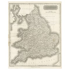
Small Steel Engraved Map of England
Located in Langweer, NL
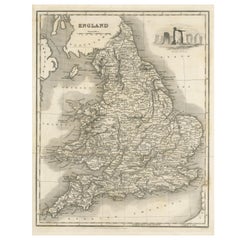
Antique map titled 'England'. Original steel engraved map of England. Drawn by A. Arrowsmith
Category

Mid-19th Century Antique Maps Of England

Materials

Paper

Antique Small Steel Engraved Map of England
Small Steel Engraved Map of England
H 10.63 in W 8.43 in D 0.02 in
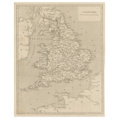
Steel Engraved Antique Map of England
Located in Langweer, NL
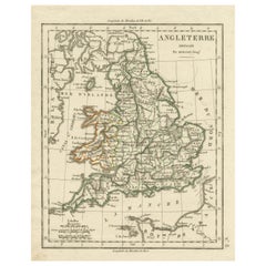
Antique map titled 'Angleterre'. Original antique map of England. Engraved by Th. Duvotenay
Category

Late 19th Century Antique Maps Of England

Materials

Paper

Steel Engraved Antique Map of England
H 10.75 in W 7.76 in D 0.02 in
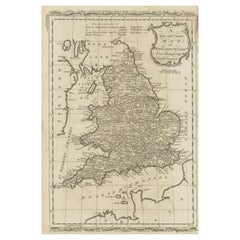
Original Antique Map of England and Wales
Located in Langweer, NL
Antique map titled 'A New and Correct Map of England and Wales from the Latest and Best
Category

Late 18th Century Antique Maps Of England

Materials

Paper

Original Antique Map of England and Wales
H 13.94 in W 9.38 in D 0.02 in
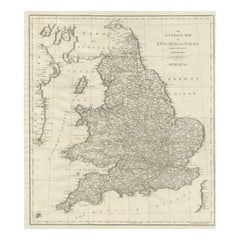
Large Antique Map of England and Wales
Located in Langweer, NL
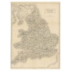
Antique map titled 'An Accurate Map of England and Wales'. Original old map of England and Wales
Category

Early 19th Century Antique Maps Of England

Materials

Paper

Large Antique Map of England and Wales
H 20.71 in W 17.49 in D 0.02 in
Lithographed Antique Map of England and Wales
Located in Langweer, NL
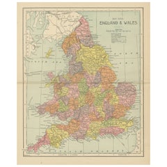
Original antique map titled 'Map XXIII England & Wales'. Lithographed map of England and Wales
Category

Late 19th Century Antique Maps Of England

Materials

Paper

Antique Folding Map of England and Wales
Located in Langweer, NL
Antique map titled 'England and Wales'. Original folding map of England and Wales. Publishes by A
Category

Late 19th Century Antique Maps Of England

Materials

Paper

Antique Folding Map of England and Wales
H 20.99 in W 15.52 in D 0.02 in
Antique Map of England with Vignette of Stonehenge
Located in Langweer, NL
Antique map titled 'England'. Original antique map of England, with decorative vignette of
Category

Mid-19th Century Antique Maps Of England

Materials

Paper

Antique Map of England with Contemporary Hand Coloring
Located in Langweer, NL
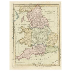
Antique map titled 'l'Angleterre'. Original antique map of England, with original/contemporary hand
Category

Late 18th Century Antique Maps Of England

Materials

Paper

Original Antique Map of England with Outline Coloring
Located in Langweer, NL
Antique map titled 'Angleterre'. Original old map of England with outline coloring. Source unknown
Category

Mid-19th Century Antique Maps Of England

Materials

Paper

Original Antique Map of England with Hand Coloring
Located in Langweer, NL
Antique map titled 'Engand'. Original old map of England. Engraved by W. Milton. Published by John
Category

Mid-19th Century Antique Maps Of England

Materials

Paper

Antique Map of England, Also Showing Calais
Located in Langweer, NL
of England, also showing Calais. This map originates from 'Voyage dans les trois royaumes
Category

Late 18th Century Antique Maps Of England

Materials

Paper

Antique Map of England, Also Showing Calais
H 9.53 in W 9.45 in D 0.02 in
Miniature Antique Map of England and Wales
Located in Langweer, NL
Miniature map titled 'England & Wales'. Original antique map of England & Wales. This map
Category

Early 19th Century Antique Maps Of England

Materials

Paper

Miniature Antique Map of England and Wales
H 6.03 in W 3.63 in D 0.02 in
Original Antique Map of England with Decorative Cartouche
Located in Langweer, NL
Antique map titled 'l'Angleterre (..)'. Original antique map of England, with beautiful hand
Category

Late 18th Century Antique Maps Of England

Materials

Paper

Antique Map of England & Wales by Wyld '1845'
Located in Langweer, NL
Antique map titled 'England & Wales'. Original antique map of England & Wales. This map originates
Category

Mid-19th Century Antique Maps Of England

Materials

Paper

Antique Map of England & Wales by Wyld '1845'
H 14.18 in W 10.24 in D 0.02 in
Antique Map of England and Wales with Roman Numerals
Located in Langweer, NL
Untitled original antique map of England and Wales. Drawn & Engraved for Cobbetts 'Geographical
Category

Mid-19th Century Antique Maps Of England

Materials

Paper

Miniature Map of England and Wales with Hand Coloring
Located in Langweer, NL
Antique map titled 'England and Wales'. An attractive miniature map of England and Wales enhanced
Category

Late 18th Century Antique Maps Of England

Materials

Paper

Large Antique Map of England Hand Colored by Counties
Located in Langweer, NL
Antique map titled 'A New Map of England from the latest Authorities'. Large map of England, hand
Category

Early 19th Century Antique Maps Of England

Materials

Paper

Antique Map of England and Wales by Johnson '1872'
Located in Langweer, NL
Antique map titled 'Johnson's England and Wales'. Original map of England and Wales. This map
Category

Late 19th Century Antique Maps Of England

Materials

Paper

Original Antique Map of England and Wales, with Decorative Cartouche
Located in Langweer, NL
Antique map titled 'England and Wales from the best Authorities'. Original antique map of England
Category

Late 18th Century Antique Maps Of England

Materials

Paper

Original Antique Map of England and Wales with Large Cartouche
Located in Langweer, NL
of England and Wales by J.B. Nolin after Coronelli. With decorative cartouche, table and inset map of
Category

Late 17th Century Antique Maps Of England

Materials

Paper

Old Horizontal Map of England
By Tasso
Located in Alessandria, Piemonte
ST/520 - Old rare Italian map of England, dated 1826-1827 - by Girolamo Tasso, editor in Venise
Category

Early 19th Century Italian Other Antique Maps Of England

Materials

Paper

Old Horizontal Map of England
H 15.75 in W 21.26 in D 0.04 in
Antique Map of England and Wales, with References to the Counties
Located in Langweer, NL
Antique map titled 'England and Wales'. Original antique map of England and Wales, with references
Category

Early 19th Century Antique Maps Of England

Materials

Paper

Original Antique Map of England, Ireland, Scotland and Wales
Located in Langweer, NL
Antique map titled 'Les Isles Britanniques, ou sont les Royaumes d Angleterre (..)'. Detailed map
Category

Early 18th Century Antique Maps Of England

Materials

Paper

Original Antique Map of England, Showing the Most Memorable Battles
Located in Langweer, NL
Royaume'. Original antique map of England, showing the most memorable battles. This map was originally
Category

Early 18th Century Antique Maps Of England

Materials

Paper

Antique Map of England and Wales, Also Showing the English Channel
Located in Langweer, NL
Antique map titled 'England and Wales'. Original antique map of England and Wales. Drawn and
Category

Mid-19th Century Antique Maps Of England

Materials

Paper

Antique Map of England by Mercator/Hondius, circa 1600
Located in Langweer, NL
issulis Mania et Anglesey'. Original antique map of England. Decorative regional map of Northwestern
Category

16th Century Antique Maps Of England

Materials

Paper

Antique Map of England with French Title, 1806
Located in Langweer, NL
Antique map titled 'L'Angleterre.' Map of England by Robert de Vaugondy, revised and published by
Category

19th Century Antique Maps Of England

Materials

Paper

Antique Map of England with Inset Maps of the Region of Liverpool and London
Located in Langweer, NL
Antique map titled 'England'. Original antique map of England, with two inset maps of the region of
Category

Mid-19th Century Antique Maps Of England

Materials

Paper

Antique Map of England and Wales, Also Including the Isle of Man
Located in Langweer, NL
Antique map titled 'England'. Original antique map of England and Wales from Northumberland to
Category

Mid-19th Century Antique Maps Of England

Materials

Paper

Antique Map of England and Ireland by Lattre, 1789
Located in Langweer, NL
Antique map titled 'Les Royaumes d'Angleterre d'Ecosse et d'Irlande'. Original antique map of
Category

18th Century Antique Maps Of England

Materials

Paper

Antique Map of England and Wales Depicting the Period of the Saxon Heptarchy
Located in Langweer, NL
Compleat Chorography of England and Wales in 50 Maps'. Circa 1766-77.
Category

Late 18th Century Antique Maps Of England

Materials

Paper

Small Antique Map of England, Wales, Scotland and Ireland with Original Coloring
Located in Langweer, NL
Scotland on the left and the kings of England on the right, ending with King George I. This map
Category

Early 18th Century Antique Maps Of England

Materials

Paper

Antique Map of England and Wales by Johnston, 1882
Located in Langweer, NL
Antique map titled 'England and Wales'. Old map of England and Wales, with an inset map of Scilly
Category

19th Century Antique Maps Of England

Materials

Paper

Colourful Antique Map of England and Wales Divided in Counties, 1854
Located in Langweer, NL
Antique map titled 'A Map Shewing the Places in England & Wales Sending Members to Parliament with
Category

19th Century Antique Maps Of England

Materials

Paper

1859 Vintage Maps of England and Wales: Blackie's Imperial Geographic Detail
Located in Langweer, NL
The "Antique Map of England & Wales" from 'The Imperial Atlas of Modern Geography', published by W
Category

Mid-19th Century Antique Maps Of England

Materials

Paper

Pair of Road Maps of England by John Ogilby
Located in Essex, MA
The first road maps of England. London to Holyhead and London to Carlisle. Nicely framed and matted
Category

1690s English Antique Maps Of England

Materials

Paper

Large 17th Century Hand Colored Map of England and the British Isles by de Wit
By Frederick de Wit
Located in Alamo, CA
A large hand colored 17th century map of England and the British Isles by Frederick de Wit entitled
Category

Late 17th Century Dutch Antique Maps Of England

Materials

Paper

Antique Map of England and London with Two Large Allegorical Views, c.1720
Located in Langweer, NL
, with map of England and two large allegorical views. This map originates from Chatelain's 'Atlas
Category

18th Century Antique Maps Of England

Materials

Paper

Original Antique Map of England and Wales from the 1909 Royal Atlas
Located in Langweer, NL
The antique map titled 'England and Wales' is a historical cartographic representation of these two
Category

Early 20th Century Antique Maps Of England

Materials

Paper

Colorful Detailed Antique Map of England and Wales, 1882
Located in Langweer, NL
Explore the Historic Splendor of 'England and Wales' with this Antique Map! Part of a distinguished
Category

1880s Antique Maps Of England

Materials

Paper

Antique Map of England and Wales with Decorative Vignettes, 1851
Located in Langweer, NL
Antique map titled ‘England and Wales’. Includes decorative vignettes titled The grand stand on the
Category

19th Century Antique Maps Of England

Materials

Paper

Colorful Detailed Antique Map of England and Wales (South Part), 1882
Located in Langweer, NL
Embark on a Journey Through the Southern Part of 'England and Wales' with this Exquisite Antique
Category

1880s Antique Maps Of England

Materials

Paper

Antique Map of England and Wales by A.K. Johnston, 1865
Located in Langweer, NL
Antique map titled 'England and Wales (Southern Sheet)'. With an inset map of the Scilly Islands
Category

Mid-19th Century Antique Maps Of England

Materials

Paper

Antique Map of England and Wales 'North' by A.K. Johnston, 1865
Located in Langweer, NL
Antique map titled 'England and Wales (Northern Sheet)'. This map originates from the ‘Royal Atlas
Category

Mid-19th Century Antique Maps Of England

Materials

Paper

Small Antique Map of England and Wales as It Was During the Heptarchy
Located in Langweer, NL
Antique map titled 'La Britannique dans sa Heptarchie Anglois Saxonique'. This little map shows
Category

Mid-18th Century Antique Maps Of England

Materials

Paper

Large Antique Map England and Wales, with Part of the Coastlines
Located in Langweer, NL
Antique map titled 'A Map of England and Wales (..)'. Large antique map of England and Wales, with
Category

Late 18th Century Antique Maps Of England

Materials

Paper

Antique Elizabeth Mason Signed 1789 George II Needlework Sampler Map of England
Located in GB
1830, 1747 and 1888, this sale is for the only map, the others were made by children This really is
Category

1780s English George II Antique Maps Of England

Materials

Cotton

Antique Map of, Northern England and Wales by Johnston, 1882
Located in Langweer, NL
Antique map titled 'England and Wales'. Old map of England and Wales. This map originates from
Category

19th Century Antique Maps Of England

Materials

Paper

Map Nottinghamshire Worksop Manor Newstead Abbey Nottingham Castle Shields H37cm
Located in BUNGAY, SUFFOLK
Map of Nottinghamshire with engravings of Worksop Manor Nottingham Castle Newstead Abbey
Category

19th Century English Victorian Antique Maps Of England

Materials

Paper

Original Antique Map of Leicestershire, England
Located in Langweer, NL
, England. This map originates from 'Britannia: or, a Geographical Description of the Kingdoms of England
Category

Late 17th Century Antique Maps Of England

Materials

Paper

Original Antique County Map of Derbyshire, England
Located in Langweer, NL
Antique map titled 'Darbyshire'. Original antique map of the country of Derbyshire, England
Category

Late 17th Century Antique Maps Of England

Materials

Paper

Large Antique County Map of Lincolnshire, England
Located in Langweer, NL
Antique map titled 'A Map of Lincolnshire from the best Authorities'. Original old county map of
Category

Early 19th Century Antique Maps Of England

Materials

Paper

Large Antique County Map of Essex, England
Located in Langweer, NL
Antique map titled 'A Map of Essex from the best Authorities'. Original old county map of Essex
Category

Early 19th Century Antique Maps Of England

Materials

Paper

Large Antique County Map of Essex, England
H 17.37 in W 21.42 in D 0.02 in
Large Antique County Map of Hertfordshire, England
Located in Langweer, NL
Antique map titled 'A Map of Hartfordshire from the best Authorities'. Original old county map of
Category

Early 19th Century Antique Maps Of England

Materials

Paper

Large Antique County Map of Somersetshire, England
Located in Langweer, NL
Antique map titled 'A Map of Somersetshire from the best Authorities'. Original old county map of
Category

Early 19th Century Antique Maps Of England

Materials

Paper

Large Antique County Map of Northamptonshire, England
Located in Langweer, NL
Antique map titled 'A Map of Northamptonshire from the best Authorities'. Original old county map
Category

Early 19th Century Antique Maps Of England

Materials

Paper

Large Antique County Map of Ruthlandshire, England
Located in Langweer, NL
Antique map titled 'A Map of Ruthlandshire from the best Authorities'. Original old county map of
Category

Early 19th Century Antique Maps Of England

Materials

Paper

Large Antique County Map of Norfolk, England
Located in Langweer, NL
Antique map titled 'A Map of Norfolk from the best Authorities'. Original old county map of Norfolk
Category

Early 19th Century Antique Maps Of England

Materials

Paper

Large Antique County Map of Norfolk, England
H 17.45 in W 21.26 in D 0.02 in
Large Antique County Map of Middlesex, England
Located in Langweer, NL
Antique map titled 'A Map of Middlesex from the best Authorities'. Original old county map of
Category

Early 19th Century Antique Maps Of England

Materials

Paper

Large Antique County Map of Buckinghamshire, England
Located in Langweer, NL
Antique map titled 'A Map of Buckinghamshire from the best Authorities'. Original old county map of
Category

Early 19th Century Antique Maps Of England

Materials

Paper

Large Antique County Map of Buckinghamshire, England
No Reserve
H 21.54 in W 15.6 in D 0.02 in
  • 1
  • ...
Get Updated with New Arrivals
Save "Antique Maps Of England", and we’ll notify you when there are new listings in this category.

Antique Maps Of England For Sale on 1stDibs

Find many varieties of an authentic antique maps of England available at 1stDibs. An antique maps of England — often made from paper, wood and fabric — can elevate any home. Your living room may not be complete without an antique maps of England — find older editions for sale from the 18th Century and newer versions made as recently as the 20th Century. An antique maps of England made by Victorian designers — as well as those associated with Georgian — is very popular. Aaron Arrowsmith, Herman Moll and J. Wyld each produced at least one beautiful antique maps of England that is worth considering.

How Much is a Antique Maps Of England?

An antique maps of England can differ in price owing to various characteristics — the average selling price 1stDibs is $360, while the lowest priced sells for $40 and the highest can go for as much as $88,500.

Read More

Pamela Shamshiri Shares the Secrets behind Her First-Ever Book and Its Effortlessly Cool Interiors

The sought-after designer worked with the team at Hoffman Creative to produce a monograph that beautifully showcases some of Studio Shamshiri's most inspiring projects.

Moroccan Artworks and Objects Take Center Stage in an Extraordinary Villa in Tangier

Italian writer and collector Umberto Pasti opens the doors to his remarkable cave of wonders in North Africa.

Montecito Has Drawn Royalty and Celebrities, and These Homes Are Proof of Its Allure

Hollywood A-listers, ex-pat aristocrats and art collectors and style setters of all stripes appreciate the allure of the coastal California hamlet — much on our minds after recent winter floods.

Whaam! Blam! Pow! — a New Book on Pop Art Packs a Punch

Publishing house Assouline and writer Julie Belcove have teamed up to trace the history of the genre, from Roy Lichtenstein, Andy Warhol and Yayoi Kusama to Mickalene Thomas and Jeff Koons.

The Sparkling Legacy of Tiffany & Co. Explained, One Jewel at a Time

A gorgeous new book celebrates — and memorializes — the iconic jeweler’s rich heritage.

What Makes a Gem-Encrusted Chess Set Worth $4 Million?

The world’s most opulent chess set, weighing in at 513 carats, is literally fit for a king and queen.

Tauba Auerbach’s Geometric Pop-Up Book Is Mighty Rare, Thanks to a Hurricane

This sculptural art book has an epic backstory of its own.

Step inside the Storied Mansions of Palm Beach’s Most Effervescent Architect

From Spanish-style courtyards to fanciful fountains, these acclaimed structures abound in surprising and elegant details.