Framed Map United States
to
51
589
98
321
183
181
176
130
88
73
53
47
39
37
31
31
23
17
17
16
15
14
14
14
13
12
12
10
9
9
8
8
7
5
4
3
2
2
1
1
1
1
42
42
41
36
21
Sort By
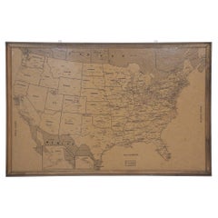
Vintage Framed United States Map
Located in New York, NY
Vintage aged paper map of the United States mounted on particle board and framed in a simple wooden
Category
20th Century American Mid-Century Modern Maps
Materials
Wood, Paper
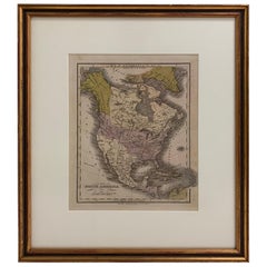
1830 Mexico and United States Framed Map
Located in Stamford, CT
Map of North America published circa 1830. Map shows United States into Canada. Mexico extending
Category
Antique 1830s American American Classical Maps
Materials
Glass, Wood, Paper
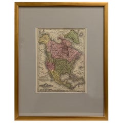
Framed 1839 Hand Colored Map of the United States
Located in Stamford, CT
Framed hand colored map of the United States of America from 1839. Newly framed in a giltwood frame.
Category
Antique 1830s American American Classical Maps
Materials
Giltwood, Paper, Glass
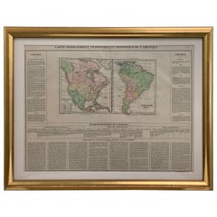
Framed 1820s Hand Colored Map of the United States
Located in Stamford, CT
Framed 1820s hand colored map photos of North America and South America. As found framed in
Category
Antique 1820s American Spanish Colonial Maps
Materials
Giltwood, Paper, Glass
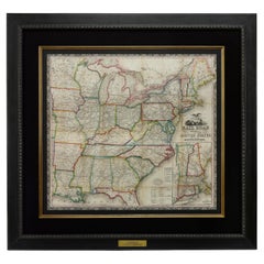
1866 Ensign & Bridgman's Rail Road Map of the United States
Located in Colorado Springs, CO
Presented is an 1866 issue of “Ensign & Bridgeman’s Rail Road Map of the United States, showing
Category
Antique 1860s American Late Victorian Maps
Materials
Paper
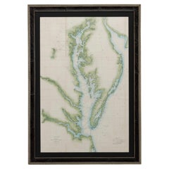
1856 U.S. Coast Survey Map of Chesapeake Bay and Delaware Bay
Located in Colorado Springs, CO
of the United States Coast Survey.
The Office of the Coast Survey, founded in 1807 by President
Category
Antique 1850s American Maps
Materials
Paper
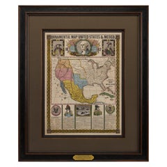
1847 Ornamental Map of the United States & Mexico by H. Phelps
Located in Colorado Springs, CO
map of the United States expressing U.S. dominance of the North American continent. The hand-colored
Category
Antique 1840s American Maps
Materials
Paper
1859 "Map of the United States of America..." by J. H. Colton
By J.H. Colton
Located in Colorado Springs, CO
Presented is an 1859 “Map of the United States of America, the British Provinces, Mexico, the West
Category
Antique 1850s American Maps
Materials
Paper
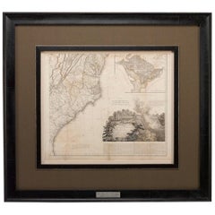
1812 United States Map, by Pierre Tardieu, Antique French Map Depicting the U.S.
By Pierre François Tardieu
Located in Colorado Springs, CO
Arrowsmith’s 4-sheet map of the United States, this map is completely engraved by Tardieu in Paris and
Category
Antique 1810s French Maps
Materials
Paper
H 43.5 in W 48 in D 2.25 in
Antique 1844 J Calvin Smith JH Colton Midwest United States Survey Map 27"
By J.H. Colton
Located in Dayton, OH
Antique framed black and white map of seven Midwestern American states. Guide Through Ohio
Category
Antique 1840s Maps
Materials
Paper
H 21 in W 26.5 in D 0.5 in
English Engraved Hand Colored Map of the North Eastern United States, circa 1817
Located in Hollywood, SC
English copper engraved hand colored map of the North Eastern United States matted under glass in a
Category
Antique 1810s English George III Maps
Materials
Glass, Giltwood, Paint, Paper
H 22 in W 25.75 in D 1 in
1879 "United States of America, Western Part" by O. J. Stuart
Located in Colorado Springs, CO
This colorful original map, titled “United States of America, Western Part,” was issued in Volume
Category
Antique 1870s American Maps
Materials
Paper
1873 "Map of the States of California and Nevada" by Chas. Drayton Gibbes
Located in Colorado Springs, CO
backed on linen. Repaired slight loss along some of the original fold lines.
Map has been framed in a
Category
Antique 1870s American Maps
Materials
Paper
Louisiana: A Framed 19th Century Map by O. W. Gray
By Gray and Co
Located in Alamo, CA
United States with General Maps of the World, accompanied by Descriptions Geographical, Historical
Category
Antique Mid-19th Century American Other Maps
Materials
Paper
Framed Mid-19th Century Wall Map of Long Island, the Hamptons
Located in Sag Harbor, NY
A Framed museum quality find. This large wall map dates to the mid-1800s. Detailed inset maps of
Category
Antique Mid-19th Century American Maps
Materials
Linen, Paper
1889 "The Pacific States and Territories"
Located in Colorado Springs, CO
Presented is an uncommon 1889 map of the western United States, titled “The Pacific States and
Category
Antique 1880s American Maps
Materials
Paper
1907 Map of Colorado, Antique Topographical Map, by Louis Nell
Located in Colorado Springs, CO
along fold lines. Printed color is bold. Paper is healthy, with no tears.
The map has been framed
Category
Antique Early 1900s American Maps
Materials
Paper
1854 Map of Massachusetts, Connecticut and Rhode Island, Antique Wall Map
Located in Colorado Springs, CO
This striking wall map was published in 1854 by Ensign, Bridgman & Fanning and has both full
Category
Antique 19th Century American Maps
Materials
Paper
H 38.13 in W 45 in D 3.5 in
"Clason's Guide Map of Montana" by The Clason Map Company, Circa 1920s
Located in Colorado Springs, CO
Clason Map Company was the first to publish a modern road atlas of the United States. Their success
Category
Vintage 1920s American Art Deco Maps
Materials
Paper
H 23.13 in W 33.88 in D 1.5 in
Pictorial Map of Chicago, circa 1926
Located in Colorado Springs, CO
very good condition. Paper is healthy, with original fold lines present.
Framed with "Pictorial Map
Category
Vintage 1920s American Maps
Materials
Paper
Large Antique 1859 Map of North America
Located in Sag Harbor, NY
This Map was made by Augustus Mitchell in 1859 It is in amazing condition for being 163 years old
Category
Antique Mid-19th Century American Maps
Materials
Canvas, Paper
1908 "Map of Texas" by The Kenyon Company
Located in Colorado Springs, CO
prominently on this fantastic map. Although uncolored, the bordering states of New Mexico, Oklahoma, Arkansas
Category
Antique Early 1900s American Maps
Materials
Paper
1855 "New-York City & County Map" by Charles Magnus
By Charles Magnus
Located in Colorado Springs, CO
text of the Declaration of Independence. The map is framed according to archival standards and sits
Category
Antique 1850s American Maps
Materials
Paper
Vintage Map of Nantucket Town by Ruth Haviland Sutton, 1946
Located in Nantucket, MA
Vintage Map of Nantucket Town by Ruth Haviland Sutton, 1946, a classic vintage tourist map of
Category
Vintage 1940s American Other Maps
Materials
Paper
America "Amérique Septentrionale": A 19th Century French Map by Delamarche
By Maison Delamarche 1
Located in Alamo, CA
This framed mid 19th century map of North America entitled "Amérique Septentrionale" by Felix
Category
Antique Mid-19th Century American Other Maps
Materials
Paper
H 20 in W 22.63 in D 0.88 in
1875 "North America" Map by J. Bartholomew
Located in Colorado Springs, CO
United States, Mexico, the countries of Central America, and the islands of the West Indies. Prominent
Category
Antique 1870s Scottish Maps
Materials
Paper
Plan of Paris, France, by A. Vuillemin, Antique Map, 1845
Located in Colorado Springs, CO
toning to the paper. The map has been backed onto linen. It is displayed in a custom archival wood frame
Category
Antique 1840s American Maps
Materials
Paper
1899 Poole Brothers Antique Railroad Map of the Illinois Central Railroad
Located in Colorado Springs, CO
, published by the Poole Brothers. The map focuses on the continuous United States from the Atlantic to the
Category
Antique 1890s American Maps
Materials
Paper
1840 Map of the City of Washington Published by William M. Morrison
Located in Colorado Springs, CO
This map, printed in 1840, is a detailed representation of Washington, D.C. in the mid-19th century
Category
Antique 1840s American Federal Maps
Materials
Paper
1915 "San Francisco City and County" Hanging Map by W. Bashford Smith
Located in Colorado Springs, CO
outer margins.
Map has been artfully mounted, hanging, inside a custom wooden frame, with linen mats
Category
Vintage 1910s American Art Deco Maps
Materials
Wood, Paper
1859 "Colton's New Map of the State of Texas..." by Johnson & Browning
Located in Colorado Springs, CO
Presented is "Colton's New Map of the State of Texas Compiled from De Cordova's Large Map
Category
Antique 1850s American Maps
Materials
Paper
H 27.75 in W 38.5 in D 1.38 in
1840 "New Map of the City of New York With Part of Brooklyn & Williamsburg"
Located in Colorado Springs, CO
Correct Map." This original folding booklet is framed alongside the map, at top left. The map was engraved
Category
Antique 1840s American Maps
Materials
Paper
H 30 in W 27.5 in D 3 in
1948 "A Hysterical Map of Yellowstone National Park" by Jolly Lindgren, 2nd Ed.
Located in Colorado Springs, CO
; light spotting in margin. Linen backed. B+/B. Map measures 16 x 16”. Map has been expertly framed, to
Category
Vintage 1940s American Maps
Materials
Paper
H 20 in W 20 in D 0.75 in
1837 Mitchell's "Tourist's Pocket Map of the State of Virginia" by J.H. Young
Located in Colorado Springs, CO
title, " Mitchell's Map of Virginia," on front cover. Map is framed with acid-free mats, UV glass, and a
Category
Antique 1830s American Maps
Materials
Paper
H 24.25 in W 25.75 in D 1.75 in
Scarce U.S. Coast Survey Map Depicting Entrance to San Francisco Bay Dated 1856
Located in San Francisco, CA
the United States.
An interesting and visually attractive historical document by Alexander Bache
Category
Antique Mid-19th Century American Maps
Materials
Paper
H 28 in W 46 in D 1.5 in
Art Deco Cartoon Style Map of Paris possibly by Arthur Zaindenberg circa 1930's
By Arthur Zaidenberg
Located in New York, NY
Art Deco cartoon style map of Paris possibly by Arthur Zaidenberg. The map depicts witty references
Category
Vintage 1930s American Art Deco Maps
Materials
Paper
H 21.5 in W 30 in D 0.75 in
New Map of North America from the Latest Discoveries, 1763
Located in Philadelphia, PA
predates the United States!
Date:
1763
Overall Condition:
It is in overall good, as-pictured, used
Category
Antique Mid-18th Century English Georgian Maps
Materials
Paper
1868 Map of the Upper Part of the Island of Manhattan Above 86th Street
By Wm. Rogers Mfg. Co.
Located in San Francisco, CA
fair condition with some paper loss around outside border of map, but map image itself is intact. The
Category
Antique 1860s American American Colonial Maps
Materials
Paper
Large Custom Framed 1857 U.S. Coast Survey of the Chesapeake Bay
Located in Bridgeport, CT
. 2: Head of the Bay to the Mouth of the Potomac River”. Created by the United States Coast Survey
Category
Antique 1850s American American Classical Maps
Materials
Paper
United States, 1844
Located in Houston, TX
Over 150 year old map of early United States of America with Western Districts from 1844. Original
Category
1840s More Prints
Materials
Ink, Watercolor, Handmade Paper
1912 "Panoramic View of New York City and Vicinity" by Jacob Ruppert
Located in Colorado Springs, CO
banner seen on some other existing copies.
Archivally framed. Map is mounted hanging in front of acid
Category
Vintage 1910s American Maps
Materials
Paper
Plan for the City of Washington by Andrew Ellicott, Antique Print, 19th Century
Located in Colorado Springs, CO
Territory of Columbia, ceded by the States of Virginia and Maryland to the United States of America and by
Category
Antique Late 19th Century American Maps
Materials
Paper
H 36 in W 43.75 in D 3 in
Original 'Map of the United States as Californians See It' vintage map poster
Located in Spokane, WA
Original vintage poster: "Map of the United States as Californians See It". 1947, artist: Oren
Category
1940s American Modern Landscape Prints
Materials
Offset
H 16.5 in W 20.5 in D 0.04 in
1864 U.S. Coast Survey of the Potomac River, from Indian Head to Georgetown
Located in Bridgeport, CT
): Sheet no. 4, from Indian Head to Georgetown". Created by the United States Coast Survey and notable
Category
Antique 19th Century American Classical Maps
Materials
Paper
1990 Triple Perspective Planet Earth Map Framed Poster
Located in New York, NY
enclosed in a black plastic frame, and the glass covering the poster is still intact. This particular map
Category
1990s American Posters
Materials
Glass, Plastic, Paper
Louisiana: A Framed 19th Century Map by O.W. Gray
Located in Alamo, CA
United States with General Maps of the World, accompanied by Descriptions Geographical, Historical
Category
1870s Landscape Prints
Materials
Engraving
H 20 in W 22.63 in D 0.88 in
Pair of Prints Depicting Antique World Maps Framed in Burl Wood
Located in Dallas, TX
A pair of prints depicting antique world maps framed in burl wood. One picture contains a depiction
Category
20th Century American Prints
Materials
Paper
Early Folk Art American Two Sided Framed Military Drawing with Map
Located in Savannah, GA
This unusual set of drawings in a double sided frame came out of an old New England Estate in a
Category
Antique Late 18th Century American Folk Art Political and Patriotic Memo...
Materials
Glass, Wood, Paper
Framed Original Land Map Survey of Tyler Park, Jersey City Railroad
Located in Lambertville, NJ
A framed and matted historical map of Tyler park jersey city New Jersey Railroad. The paper on
Category
Antique 1870s American Posters
Materials
Canvas, Glass, Wood
Forest Park Letter Pressed Map with Embossed Trails in Salvaged Fir Frame
Located in Portland, OR
Beautiful Minimalist limited edition letter pressed topographic map of Portland's Forest Park with
Category
2010s American Organic Modern Prints
Materials
Fir
North America: A Framed Hand-colored 19th Century German Map by Adolph Stieler
By Adolf Stieler
Located in Alamo, CA
This framed early 19th century map of North America entitled "Nord-Amerika" is plate No. LIV (No
Category
1830s Landscape Prints
Materials
Engraving
H 19.5 in W 22 in D 0.88 in
Map of Rome
Located in Los Angeles, CA
A reproduction of an antique map of Rome. Can be sold framed or unframed.
Category
2010s American Victorian Drawings
Materials
Wood, Paper
Old Framed Map of a Plan of the City of New York as Surveyed in 1767
Located in Lambertville, NJ
Old framed map of a plan of the City of New York as surveyed in 1767. Published by the Common
Category
Antique Late 19th Century American Prints
Materials
Wood, Paper
1861 Topographical Map of the District of Columbia, by Boschke, Antique Map
Located in Colorado Springs, CO
survey to the United States government for $20,000. Secretary Stanton, not estimating the extensive labor
Category
Antique 1860s American Historical Memorabilia
Materials
Paper
H 53.25 in W 53.75 in D 3.5 in
Pair of Monumental National Air Map Company Manhattan Aerial Photo Maps, 1955
Located in San Francisco, CA
A monumental and rare circa 1955 framed two-piece aerial photographic map of the borough of
Category
Vintage 1950s American Mid-Century Modern Photography
Materials
Acrylic, Wood, Paper
H 47.75 in W 33.25 in D 1.5 in
Skeletal System Poster by American Map Co.
Located in Philadelphia, PA
The Skeletal System Poster by American Map Co. - Circa 1950.
29" x 37" unfolded
9.5" x 12.5
Category
Mid-20th Century American Mid-Century Modern Posters
Materials
Paper
Catesby Map Table by David Duncan Studio
By David Duncan
Located in New York, NY
A modern, brass coffee table with round frame having four straight legs supported by X- shaped
Category
21st Century and Contemporary American Coffee and Cocktail Tables
Materials
Brass
"The Story Map Of The West Indies" 1936
Located in Bristol, CT
Framed colour map of the West Indies published 1936 w/ border design motif adapted from native West
Category
1930s More Prints
Materials
Paper
Advertising Puzzle USA Map Sherwin Williams Paint, 19th Century
Located in Fulton, CA
. Reverse of puzzle has map of United States. Features advertising for quick dry paint for coaches, house
Category
Antique Late 19th Century American Late Victorian Historical Memorabilia
Materials
Composition
Watercolour Drawing by Kenneth Stevens MacIntire of a Nautical Map
By Kenneth Stevens MacIntire
Located in Norwich, GB
A watercolour drawing of a three-fold screen design, depicting a nautical map of the Atlantic
Category
20th Century American American Classical Paintings
Materials
Paper
- 1
- ...
Get Updated with New Arrivals
Save "Framed Map United States", and we’ll notify you when there are new listings in this category.
Framed Map United States For Sale on 1stDibs
Find a variety of framed map United states available on 1stDibs. The range of distinct framed map United states — often made from paper, wood and glass — can elevate any home. Framed map United states have been produced for many years, with earlier versions available from the 18th Century and newer variations made as recently as the 21st Century. Framed map United states made by Mid-Century Modern designers — as well as those associated with Neoclassical — are very popular at 1stDibs. Many framed map United states are appealing in their simplicity, but Abraham Ortelius, Baker, Jones, Hausauer, Inc. and George F. Cram produced popular framed map United states that are worth a look.
How Much are Framed Map United States?
Framed map United states can differ in price owing to various characteristics — the average selling price at 1stDibs is $1,225, while the lowest priced sells for $260 and the highest can go for as much as $16,850.
More Ways To Browse
Graham And Greene
Graham Greene
Retro Working Record Player
Military Vintage Radios
Maps Of Tennessee
Bakery Sign Vintage
Vintage 1970 Record Player
Bakery Vintage Sign
Federalist Furniture
Rhode Coffee Table
Los Angeles Map
Maps South East Asia
Indian Ocean Antique Map
Mississippi Antique
Oklahoma Map
Antique Maps Of Rome
Vintage Yellowstone Park
Hirschfeld New York
