Map Danube

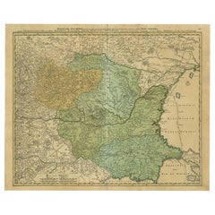
Antique Map of the Danube River by Homann, c.1720
By Homann Heirs
Located in Langweer, NL
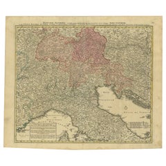
Antique map titled 'Danubii Fluminis (..)'. Regional map of the Donau river, Shows the Danube river
Category

Antique 18th Century Maps

Materials

Paper

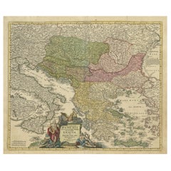
Antique Map of Greece with an Inset Map of the Upper Danube Region, c.1720
Located in Langweer, NL
with a striking cartouche and an inset map of the Upper Danube region and shows the straits from the
Category

Antique 18th Century Maps

Materials

Paper

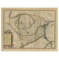
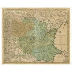
Antique Map of Romania and Bulgaria Centered on the Danube River
Located in Langweer, NL
Romania and Bulgaria centered on the Danube River. The map is based on Ortelius' map of the region which
Category

Antique Mid-17th Century Maps

Materials

Paper

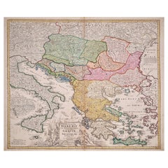
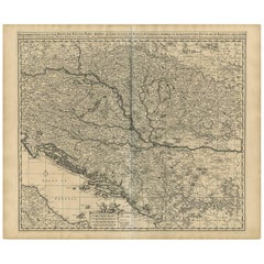
Hand-Colored 18th Century Homann Map of the Danube, Italy, Greece, Croatia
By Johann Baptist Homann
Located in Alamo, CA
"Fluviorum in Europa principis Danubii" is a hand colored map of the region about the Danube river
Category

Antique Early 18th Century German Maps

Materials

Paper

Antique Map of the Danube River and Surroundings by Homann Heirs, c.1730
By Homann Heirs
Located in Langweer, NL
Antique map titled 'Danubii Fluminus (a fontibus prope Doneschingam usq Posonium urbem defignati
Category

Antique 18th Century Maps

Materials

Paper

Hand Colored 18th Century Homann Map of Austria Including Vienna and the Danube
By Johann Baptist Homann
Located in Alamo, CA
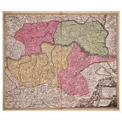
"Archiducatus Austriae inferioris" is a hand colored map of Austria created by Johann Baptist
Category

Antique Early 18th Century German Maps

Materials

Paper

Antique Map of Austria, Centered Around the Danube from Passau to Vienna, C.1690
Located in Langweer, NL
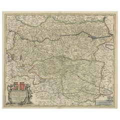
Antique map of Austria titled 'Circuli Austriaci pars septentrionalis in quia archiducatus Austriae
Category

Antique 1690s Maps

Materials

Paper

Old Decorative Map of Austria, Centered on the Danube River and Vienna, Ca.1720
Located in Langweer, NL
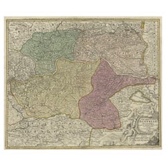
Antique map titled 'Archiducatus Austriae inferioris (..).' Decorative map of Austria, centered on
Category

Antique 1720s Maps

Materials

Paper

Danube River Incl Serbia, Moldavia, Transylvania, Romania, Bulgaria Etc, ca.1720
Located in Langweer, NL
Antique map titled 'Danubii Fluminis (..)'. Regional map of the Donau river, Shows the Danube
Category

Antique 1720s Maps

Materials

Paper

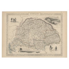
Old Engraved Map of Hungary with Decorative Vignettes, 1851
Located in Langweer, NL
Antique map titled Hungary. Includes decorative vignettes titled Hungarian Peasants, Pesth and the
Category

Antique 19th Century Maps

Materials

Paper

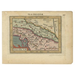
Antique Miniature Map of the Roman Province of Illyricum 'Dalmatia'
By Abraham Ortelius
Located in Langweer, NL
Antique miniature map titled 'Illyricum'. Original small map of Illyricum. The Roman province of
Category

Antique Early 17th Century Maps

Materials

Paper

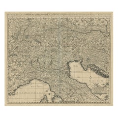
Antique Map Covering Northern Italy, Austria, Slovenia & Croatia, ca.1690
Located in Langweer, NL
Antique map titled 'Exactissima Tabula, qua tam Danubii Fluvii Pars Superior'. Detailed map
Category

Antique 1690s Maps

Materials

Paper

Antique Map of Ukraine, Bulgaria, Romania, Servia & Surroundings by N. Visscher
Located in Langweer, NL
, Moldovia, Bulgaria, Bessarabia et Romonia, aliiq Ucraniae ac Podoliae.' Detailed map of the lower Danube
Category

Antique Early 18th Century Maps

Materials

Paper

Old Eastern Balkans Map, with Dalmatia, Croatia, Slavonia, Bosnia, Serbia, 1633
Located in Langweer, NL
map details the course of the Danube, Sauus, and Drauus Rivers. Originates from the 1633 German
Category

Antique 1630s Maps

Materials

Paper

Finely Detailed Map Covering Northern Italy, Austria, Slovenia & Croatia, c.1690
Located in Langweer, NL
detailed map covering the region of northern Italy, Austria, Slovenia and Croatia. The course of the Danube
Category

Antique 1690s Maps

Materials

Paper

Old Map Showing Info Related to the Ottoman Wars including Conflict Dates, c1690
Located in Langweer, NL
& White This is the northwestern sheet of Coronelli's six-sheet map following the course of the Danube
Category

Antique 1690s Maps

Materials

Paper

Balkan Convergence: A Map of Turkey and Greece with the Balkan States, 1882
Located in Langweer, NL
culture. The map also meticulously charts the extensive river systems, such as the Danube, which have been
Category

Antique 1880s Maps

Materials

Paper

Roman Frontiers Engraved: Germania, Raetia, and Noricum, Published in 1880
Located in Langweer, NL
The map, titled "GERMANIA, RAETIA, NORICUM," depicts the regions of Germania, Raetia, and Noricum
Category

Antique 1880s Maps

Materials

Paper

Roman Balkans: Pannonia, Illyricum, Dacia, Moesia, Thracia, Macedonia and Thyris
Located in Langweer, NL
This original antique map showcases the Roman provinces in the Balkan region and parts of Central
Category

Antique 1880s Maps

Materials

Paper

Old Engraving of the Trarbach Battle in Rhineland-Palatinate, Germany, c.1710
Located in Langweer, NL
miles from the Low Countries to the River Danube in just five weeks, brilliantly keeping his destination
Category

Antique 1710s Maps

Materials

Paper

Hand Colored 18th Century Homann Map of Austria Including Vienna & the Danube
By Johann Baptist Homann
Located in Alamo, CA
"Archiducatus Austriae inferioris" is a hand colored map of Austria created by Johann Baptist
Category

Early 18th Century Old Masters Landscape Prints

Materials

Engraving

Danube River, Italy, Greece and Croatia: A Hand-colored 18th C. Homann Map
By Johann Baptist Homann
Located in Alamo, CA
"Fluviorum in Europa principis Danubii" is a hand-colored map of the region about the Danube river
Category

Early 18th Century Old Masters Landscape Prints

Materials

Engraving

Buda, Antique Map from "Civitates Orbis Terrarum" - 1572-1617
By Franz Hogenberg
Located in Roma, IT
shore of the Danube river. Good conditions, with a little medial hole, some stains at the bottom and a
Category

16th Century Landscape Prints

Materials

Etching

Hungary & Eastern Europe: A Large 17th C. Hand-colored Map by Sanson & Jaillot
By Nicholas Sanson d'Abbeville
Located in Alamo, CA
. The map includes the Danube River, present day Budapest, Vienna, Prague, Krakow, and the Dalmatian
Category

1690s Landscape Prints

Materials

Engraving

People Also Browsed

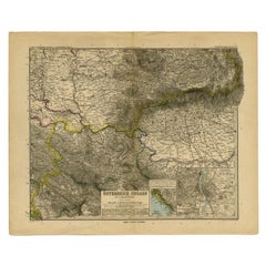
Antique Map of Eastern Europe by Stieler, 1890
Located in Langweer, NL
Antique map titled 'Osterreich-Ungarn in 4 Blattern, Blatt 4.' Map of Eastern Europe, with Montenegro in the lower left corner, the southern edge of Hungary (area Baja and Szeged) an...
Category

Antique 19th Century Maps

Materials

Paper

Gabriella Crespi Brass Pill Cigarette Card Box Italian, 1970s
By Gabriella Crespi
Located in New York, NY
Gabriella Crespi brass pill cigarette card box Italian, 1970s Measures: 4.4 inches wide on each side 0.3 inches deep Born in 1922, Gabriella Crespi studies architecture at the...
Category

Late 20th Century Italian Mid-Century Modern Decorative Boxes

Materials

Brass

Copper and Brass Parrot by Sergio Bustamante
By Sergio Bustamante
Located in Cathedral City, CA
Lifesize brass and copper Sergio Bustamante folk art parrot on a swing. Note that one of the tail feathers is loose and needs to be reattached to the other five tail feathers. Origin...
Category

Vintage 1970s Mexican Mid-Century Modern Animal Sculptures

Materials

Brass, Copper

Antique Map of Switzerland by N. Visscher, circa 1690
Located in Langweer, NL
Beautifully detailed map of Switzerland and surrounding regions in present-day France, Germany, and Italy. This map features two decorative cartouches: the larger is flanked by two p...
Category

Antique Late 17th Century Maps

Materials

Paper

Late 1960s Hollywood Regency Solid Bronze Ram's Head Tabletop Animal Sculpture
Located in Miami, FL
Hollywood Regency solid ram's head tabletop animal sculpture. Well-aged patina can be polished to perfection. Will look stunning on a column, pedestal or stand.    
Category

Vintage 1960s American Hollywood Regency Animal Sculptures

Materials

Bronze

Old Map of the Balkans Incl Greece, Turkey, Serbia, Montenegro, Bulgaria, C.1900
Located in Langweer, NL
Antique map titled 'Carte de la presqu-île du Balcan - Karte der Balkan Halbinsel'. Original antique map of the Balkans including Greece, Turkey, Serbia, Montenegro, Bulgaria and...
Category

Antique Early 1900s Maps

Materials

Paper

18th Century Map of the Southern Balkans by Giovanni Maria Cassini
By Giovanni Maria Cassini
Located in Hamilton, Ontario
18th century map by Italian engraver Giovanni Maria Cassini (Italy 1745-1824). Map of the Southern Balkans: Rome. Hand colored and copper engraved print done in the year 1788. It in...
Category

Antique 18th Century Italian Maps

Materials

Paper

Antique Pair of Seascape Oil Paintings Fishing Boats, 19th Century
Located in London, GB
A wonderful pair of seascape paintings of fishing boats attributed to William Mcalpine (British 19th century) titled 'Beached Fishing Vessels' and 'Shipping in Rough Seas', circa 186...
Category

Antique 1860s British Paintings

Materials

Canvas

19th Century Ships Compass From Amsterdam
Located in Norwell, MA
Antique ships compass with interesting Dutch lettering. Spun brass bowl with gimbal. Fitted to a primitive dovetailed box. Circa 1880. With compass card from L.J. Harri, Amsterdam.
Category

Antique 1880s European Scientific Instruments

Materials

Brass

'Pointer' by Pierre Jules Mêne
By Pierre Jules Mêne
Located in Forest Row, East Sussex
A late Victorian Bronze Pointer by Pierre Jules Mene (1810-1879). Excellent patination, signed 'P.J. Mene' to base. Dimensions: H 11cm W 22cm D 9.5cm Origin: French Date: Circa...
Category

Antique 1860s French Animal Sculptures

Materials

Bronze

'Pointer' by Pierre Jules Mêne
Free Shipping
H 4.34 in W 8.67 in D 3.55 in
Antique Eastern Turkestan Pictorial Khotan Rug with Eclectic Northwestern Style
Located in Dallas, TX
77325 antique Eastern Turkestan Pictorial Khotan rug with Eclectic Northwestern style. This hand knotted wool antique Eastern Turkestan Khotan rug features a pictorial design of Chin...
Category

Early 20th Century East Turkestani Khotan Central Asian Rugs

Materials

Wool

Antique Map of Moldova to Thessaly and from the Adriatic to the Black Sea, 1880
Located in Langweer, NL
Antique map titled 'Turquie d'Europe'. Map of the european parts of Turkey. The map covers from Moldova to Thessaly and from the Adriatic to the Black Sea. Greece and the island ...
Category

Antique 1880s Maps

Materials

Paper

Art Deco Turkey Bronze Bookends Signed Irenee Rochard
By Irénée Rochard
Located in Buenos Aires, Olivos
Art Deco Turkey bronze bookends signed Irenee Rochard. Very nice with original patina, mounted over marble bases. Irénée René Rochard (French, 1906 ~ 1984) born in Villefranche su...
Category

Vintage 1920s French Art Deco Animal Sculptures

Materials

Bronze

Original Antique World War One Poster Hark The Dogs Do Bark WWI Dogs Of War
Located in London, GB
Original Antique World War One poster - Hark! Hark! The dogs do bark! With note by Walter Emanuel - featuring a serio-comic map of Europe at war with military soldier caricature port...
Category

Vintage 1910s British Posters

Materials

Paper

Antique Map of the Saxony Region 'Germany' by F. de Wit, circa 1680
Located in Langweer, NL
A detailed map of a region in eastern Germany. Cartouches depict coat of arms surrounded by cherubs. The map is fully engraved with towns, political boundaries, rivers and forests. P...
Category

Antique Late 17th Century Maps

Materials

Paper

Antique Map of Eastern Europe, Incl Montenegro & Serbia & a Budapest Map, 1890
Located in Langweer, NL
Antique map titled 'Osterreich-Ungarn in 4 Blattern, Blatt 4.' Map of Eastern Europe, with Montenegro in the lower left corner, the southern edge of Hungary (area Baja and Szeged...
Category

Antique 1890s Maps

Materials

Paper

Recent Sales

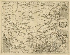
Ptolemaic map of Bulgaria, Rumania, Bosporus by Mercator - Engraving - 17th c
By Gerard Mercator
Located in Zeeland, Noord-Brabant
partem (…).' - A beautiful Ptolemaic map covering covers the northern Balkans (Bulgaria, Rumania) with
Category

1690s Old Masters More Prints

Materials

Engraving

Antique Map of Danube River 'Former Yugoslavia' by N. Visscher, circa 1690
Located in Langweer, NL
Shows the part of the Danube between Linz and Belgrade with former Yugoslavia and the Dalmatian
Category

Antique Late 17th Century Maps

Materials

Paper

Antique Map of Danube River 'Lower Part, Former Yugoslavia' by N. Visscher
Located in Langweer, NL
Danube, extending from Belgrade to the Black Sea. The map extends to Constantinople and the Bosphorus
Category

Antique Late 17th Century Maps

Materials

Paper

Map of River Danube, from Regensburg, Passau and Vienna to the Black Sea, c.1660
Located in Langweer, NL
et finitimis Regionibus Novissima Delineatio'. Map of the course of the Danube, from Regensburg
Category

Antique 1660s Maps

Materials

Paper

Antique Map of Ukraine and Surroundings, ca.1650
Located in Langweer, NL
Antique map titled 'Taurica Chersonesus hodie Przecopsca et Gazara dicitur'. Map showing the
Category

Antique 1650s Maps

Materials

Paper

Antique Map of Austria and Hungary by Ortelius, c.1590
Located in Langweer, NL
map of Austria and Hungary, following the Danube from Lintz to Bratislava and extending north to the
Category

Antique 16th Century Maps

Materials

Paper

Original Antique Map centered on Bulgaria, Moldavia and Romania
Located in Langweer, NL
Bulgaria centered on the Danube River, decorated with an allegorical strapwork cartouche. This map
Category

Antique Early 18th Century Maps

Materials

Paper

Antique Map of the Region Around Italy, Sicily and Greece by H. Heirs, 1766
Located in Langweer, NL
Gorgeous full color example of Homann's map of the region bounded by the Danube in the North, Italy
Category

Antique Mid-18th Century Maps

Materials

Paper

Komárno
By Franz Hogenberg
Located in Saint Augustine, FL
Antique map with two views of Komárno by Braun and Hogenberg: One from the northeast of the castle
Category

15th Century and Earlier Old Masters Landscape Prints

Materials

Copper

Louis Vuitton Danube Slim Bag Limited Edition Renaissance Map Damier Grap
By Louis Vuitton
Located in NY, NY
: Danube Slim Bag Limited Edition Renaissance Map Damier Graphite PM Exterior Material: Canvas Coated
Category

21st Century and Contemporary Crossbody Bags and Messenger Bags

Get Updated with New Arrivals
Save "Map Danube", and we’ll notify you when there are new listings in this category.

Map Danube For Sale on 1stDibs

Choose from an assortment of styles, material and more with respect to the map danube you’re looking for at 1stDibs. A map danube — often made from paper — can elevate any home. Your living room may not be complete without a map danube — find older editions for sale from the 17th Century and newer versions made as recently as the 18th Century. Many designers have produced at least one well-made map danube over the years, but those crafted by Johann Baptist Homann are often thought to be among the most beautiful.

How Much is a Map Danube?

The average selling price for a map danube at 1stDibs is $768, while they’re typically $287 on the low end and $1,549 for the highest priced.

Read More

Pamela Shamshiri Shares the Secrets behind Her First-Ever Book and Its Effortlessly Cool Interiors

The sought-after designer worked with the team at Hoffman Creative to produce a monograph that beautifully showcases some of Studio Shamshiri's most inspiring projects.

Moroccan Artworks and Objects Take Center Stage in an Extraordinary Villa in Tangier

Italian writer and collector Umberto Pasti opens the doors to his remarkable cave of wonders in North Africa.

Montecito Has Drawn Royalty and Celebrities, and These Homes Are Proof of Its Allure

Hollywood A-listers, ex-pat aristocrats and art collectors and style setters of all stripes appreciate the allure of the coastal California hamlet — much on our minds after recent winter floods.

Whaam! Blam! Pow! — a New Book on Pop Art Packs a Punch

Publishing house Assouline and writer Julie Belcove have teamed up to trace the history of the genre, from Roy Lichtenstein, Andy Warhol and Yayoi Kusama to Mickalene Thomas and Jeff Koons.

The Sparkling Legacy of Tiffany & Co. Explained, One Jewel at a Time

A gorgeous new book celebrates — and memorializes — the iconic jeweler’s rich heritage.

What Makes a Gem-Encrusted Chess Set Worth $4 Million?

The world’s most opulent chess set, weighing in at 513 carats, is literally fit for a king and queen.

Tauba Auerbach’s Geometric Pop-Up Book Is Mighty Rare, Thanks to a Hurricane

This sculptural art book has an epic backstory of its own.

Step inside the Storied Mansions of Palm Beach’s Most Effervescent Architect

From Spanish-style courtyards to fanciful fountains, these acclaimed structures abound in surprising and elegant details.