18th Century and Earlier Maps
to
2,336
2,867
64
2,934
26
12
1
1
2,934
2,282
475
3
290
34
10
126
10
37
9
2
5
4
3
3
2,920
30
20
3
3
307
111
81
53
52
2,934
2,934
2,934
59
21
13
12
12
Period: 18th Century and Earlier
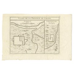
Antique Map of Two Cities in the Province of Shanxi or Chensi, China, 1748
Located in Langweer, NL
Antique map China titled ‘Villes de la Province de Chensi’. Interesting set of two local town plans of ""Si-Ngan-Fu: Capitale."" and ""Tchang Lan, Ou...
Category
Antique 18th Century and Earlier Maps
Materials
Paper
$295 Sale Price
20% Off
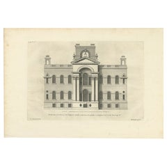
Antique Print of a New Building Design in Dorset, England by Campbell, 1717
Located in Langweer, NL
Antique print titled 'The Elevation of one end of a new design for a person of quality in Dorset-Shire (..)'.
View of new building design in Dorset (formerly known as Dorsetshire...
Category
Antique 18th Century and Earlier Maps
Materials
Paper
$400 Sale Price
20% Off
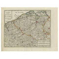
Antique Map of Flanders by Keizer & de Lat, 1788
Located in Langweer, NL
Antique map titled 'Nouvelle Carte du Comté de Flandre'. Uncommon original antique map of Flanders, Belgium. This map originates from 'Nieuwe Natuur- Geschied- en Handelkundige Zak- ...
Category
Antique 18th Century and Earlier Maps
Materials
Paper
$333 Sale Price
20% Off
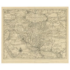
Old Map of Persia, incl the Caspian Sea and Part of the Arabian Peninsula, 1726
Located in Langweer, NL
Antique map of Persia. It covers from the Gulf of Suez eastward to Ahmedabad (Amadabad) in modern day western India.
This map, centered on Persia, includes the Caspian Sea and part of the Arabian...
Category
Antique 18th Century and Earlier Maps
Materials
Paper
$1,047 Sale Price
20% Off
Old Original Miniature View of the Skyline of Miaco 'Kyoto, Japan', 1683
Located in Langweer, NL
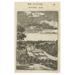
Antique print titled 'De l'Asie Figure XXV, Miaco'.
Miniature view of the skyline of Miaco (Kyoto, Japan). This print originates from 'Description de l'Univers', published 1683.
...
Category
French Antique 18th Century and Earlier Maps
Materials
Paper
$228 Sale Price
20% Off
Nice Hand-Colored Plan by Blaeu of Bolsward in Friesland, the Netherlands, 1652
Located in Langweer, NL
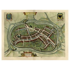
Antique print, titled: 'Bolswaert' - (Town plan of Bolsward).
Plan of Bolsward in Friesland, the Netherlands. A cartouche and two coats of arms. From the town atlas 'Toneel der S...
Category
Antique 18th Century and Earlier Maps
Materials
Paper
$1,095 Sale Price
20% Off
Antique Map of West Africa by R. Bonne, 1780
Located in Langweer, NL
Antique map titled 'Partie Occidentale De L'Ancien Continent Depuis Lisbonne Jusqua La Riviere De Sierra Leona Avec L'Isle de Madere, les Isles Canaries et celles Du Cap Verd'. Parts...
Category
French Antique 18th Century and Earlier Maps
Materials
Paper
$171 Sale Price
20% Off
Antique Engraving of Tinian, an Island of the Northern Mariana Islands, 1757
Located in Langweer, NL
Antique print titled 'Vue de la Rde de Tinian
Gezigt van de Rheede van Tinian (..)'. Views of the south-west side of the island of Tinian and a view of the anchorage of Tinian, w...
Category
Antique 18th Century and Earlier Maps
Materials
Paper
$342 Sale Price
20% Off
Old Print of a Partridge in Front of The Walled City of Azemmour, Morocco, c1630
Located in Langweer, NL
Antique print, titled: 'Azaamurum.' - Caption in the top reads: 'Foenerari iniustum est'.
A partridge in the foreground, with the walled city (Azemmour...
Category
Antique 18th Century and Earlier Maps
Materials
Paper
$276 Sale Price
20% Off
Old Print with a View on the City & Castle of Batavia 'Jakarta', Indonesia, 1668
Located in Langweer, NL
Antique print Indonesia titled ‘La ville de Batavie. De Stadt Batavia. Chateau de Batavia. ‘t Casteel van Batavia’.
Antique print with a view on the city of Djakarta, Indonesia. ...
Category
Antique 18th Century and Earlier Maps
Materials
Paper
$457 Sale Price
20% Off
Views of Saunders, Osnaburg, Boscawens, Admiral Keppel's & Wallis Island, c.1774
Located in Langweer, NL
Antique print titled 'Isles de Sir Charles Saunder Latitude (..)'.
Coastal views of Sir Charles Saunders Island ; Osnaburg Island [Mehetia, in French Polynesia] ; Boscawens Islan...
Category
Antique 18th Century and Earlier Maps
Materials
Paper
$390 Sale Price
20% Off
Beautiful Bird's-Eye View Plan of Enkhuizen in The Netherlands by Blaeu, 1649
Located in Langweer, NL
Antique print, titled: 'Topograhpiae Enchusae.'
Bird's-eye view plan of Enkhuizen in The Netherlands, with key to locations and coats of arms. Text in Dutch on verso. This plan o...
Category
Antique 18th Century and Earlier Maps
Materials
Paper
$1,095 Sale Price
20% Off
Very Old Original Hand-Colored Map of the Basel Region, Switzerland, Ca.1578
Located in Langweer, NL
Antique print titled 'Basiliensis territorii descriptio nova'.
Old map of the Basel region, Switzerland. Originates from 'Theatrum Orbis Terrarum' by A. Ortelius.
Artists and...
Category
Antique 18th Century and Earlier Maps
Materials
Paper
$695 Sale Price
20% Off
Original Antique Engraved Map of Part of the Red Sea, Arabia, 1775
Located in Langweer, NL
Antique map titled 'Carte de l'Entrée du Golfe de la Mer Rouge'. Uncommon sea chart of the entrance to the Red Seas as far as Mocha, with rhumb lines and soundings. Two insets of the...
Category
Antique 18th Century and Earlier Maps
Materials
Paper
$452 Sale Price
20% Off
Antique View of The N.W. side of Saypan and one of The Ladrones Islands, 1757
Located in Langweer, NL
Antique print titled 'Vue de deux des Iles des Larrons - Gezigt van twee der Eilanden Ladrones (..)'.
View of two Ladrones Islands; View of the N.W. side of Saypan, one of the La...
Category
Antique 18th Century and Earlier Maps
Materials
Paper
$342 Sale Price
20% Off
Antique Print of East African Island of Quiloa or Kilwa Kisiwani, Tanzania, 1749
Located in Langweer, NL
Antique print titled 'Plan de l'Isle et Ville de Quiloa, Grondtékening van 't Eiland en de Stad Quiloa'.
This bird's-eye view show the East African island of Quiloa, now known as...
Category
Antique 18th Century and Earlier Maps
Materials
Paper
$400 Sale Price
20% Off
Highly Detailed Antique Map of Brabant, Province of the Netherlands, ca.1700
Located in Langweer, NL
Antique print, titled: 'Brabantiae Batavae Pars Occidentalis : sive Antuerpiensis Tetrarchiae Pars Septentrionalis comprehendens Baroniam Bredanam, Marchionatum Bergensem ad Zoman al...
Category
Antique 18th Century and Earlier Maps
Materials
Paper
$1,095 Sale Price
20% Off
Antique Detailed Map of Papua New Guinea and the Regions to the West, ca.1780
Located in Langweer, NL
Antique map titled 'Carte des Decouvertes du Capite. Carteret dans La Nlle. Bretagne avec une parte du passage du Capite. Cook Par Le Detroit De L'Endeavor ...
Category
Antique 18th Century and Earlier Maps
Materials
Paper
$314 Sale Price
20% Off
Beautiful Old View of Spice Island Banda Neira with Fort Nassau, Indonesia, 1726
Located in Langweer, NL
Antique print titled 'Het Eyland Neira, en het Casteel Nassau mitsgaders Belgica'.
Beautiful view of Banda Neira with Fort Nassau, Indonesia. This print originates from 'Oud en Nie...
Category
Antique 18th Century and Earlier Maps
Materials
Paper
$904 Sale Price
20% Off
Beautiful Map of Arnhem and the Veluwe Region, Gelderland, The Netherlands, 1690
Located in Langweer, NL
Antique map titled 'Ducatus Geldriae tetrachia Arnhemiensis sive Velavia'.
Beautiful map of the region of Arnhem and the Veluwe region, Gelderland, t...
Category
Antique 18th Century and Earlier Maps
Materials
Paper
$933 Sale Price
20% Off
Antique Map of the French Province Maine, Showing Le Mans, Alencon Etc., Ca1640
Located in Langweer, NL
Antique map titled 'Le Maine'.
Old map of the province of Maine, France. It shows the cities of Le Mans, Alencon and others. This map originates from a composite atlas.
Artis...
Category
Antique 18th Century and Earlier Maps
Materials
Paper
$523 Sale Price
20% Off
Antique Map of Eastern Tartary, now the Primorsky Krai Area, Russia, 1758
Located in Langweer, NL
Antique map titled 'Carte de la Tartarie orientale.' A map of Eastern Tartary. East Tartary is an old names for the Manchu-inhabited territory extending from the River Amur to Sakhal...
Category
Antique 18th Century and Earlier Maps
Materials
Paper
$619 Sale Price
20% Off
Antique Map of Hangzhou, Capital of the Province of Zheijang, China, 1748
Located in Langweer, NL
Antique map titled 'Plan de la ville de Hang-Tcheou-Fou ou Hang-Chew-Fu Capitale de la Province de Che-Kiang’.
This original print shows a map of the city of Hangzhou, capital of...
Category
Antique 18th Century and Earlier Maps
Materials
Paper
$323 Sale Price
20% Off
Large Antique Detailed Map of a Part of the Spice Islands, Indonesia, 1726
Located in Langweer, NL
Antique matitled 'De Landvoogdy der Moluccos met de aangrenzende Eylanden'.
Large detailed map of a part of the Spice Islands. It includes Baru (Boero), Ambon, Seram and part of Ma...
Category
Antique 18th Century and Earlier Maps
Materials
Paper
$1,380 Sale Price
20% Off
Detailed Antique Map of Northern Spanish Region of Aragon, c.1650
Located in Langweer, NL
Antique map titled 'Arragonia Regnum'.
Detailed map of northern Spanish region of Aragon. The map is centered on the city of Zaragoza, aka, Saragossa. Shows towns, rivers, castle...
Category
Antique 18th Century and Earlier Maps
Materials
Paper
$1,095 Sale Price
20% Off
Original Antique Sea Chart of the Maas 'or Meuse' River with Neptunes, 1684
Located in Langweer, NL
Antique map titled 'Paskaerte van het inkoomen van de Maes (..)'.
Original antique sea chart of the Maas (or Meuse) river and part of the Dutch c...
Category
Antique 18th Century and Earlier Maps
Materials
Paper
$714 Sale Price
20% Off
Antique Map of South America by J. Cook (1775)
Located in Langweer, NL
Antique map titled 'Kaart van het Zuidlyk Eind van Amerika'. Map of the sourthern part of South America, focusing on Cook's tracks around the Cape Horn and Tierra del Fuego in 1775. ...
Category
Antique 18th Century and Earlier Maps
Materials
Paper
$561 Sale Price
20% Off
Antique Map of Friesland after the Floods of the 13th Century, 1718
Located in Langweer, NL
Antique map Friesland titled 'Pars II et III Frisiae Libera(..)'. Old map of Friesland, the Netherlands, after the floods of the 13th century. Originates from 'Uitbeelding van de Hee...
Category
Antique 18th Century and Earlier Maps
Materials
Paper
$333 Sale Price
20% Off
Striking Antique Map of Luxembourg and Northern France 'Lotharingen', c.1680
Located in Langweer, NL
Description: Antique map titled 'Exactissima Lotharingia tam Regis Gallorum quam Ducis.' -
Striking map of Luxembourg and Northern France. Includ...
Category
Antique 18th Century and Earlier Maps
Materials
Paper
$619 Sale Price
20% Off
Old Decorative & Highly Detailed Sea Chart of the North Dutch-German Coast, 1681
Located in Langweer, NL
Antique map titled 'Paskaart van een gedeelte van Vriesland, Groeninger, en Emderland. Met zyn onderhoorige Eylanden; Strekkende van't Eylant der Schelling'.
Decorative and highl...
Category
Antique 18th Century and Earlier Maps
Materials
Paper
$1,571 Sale Price
20% Off
Antique Map of the Region of Paris ‘France’ by H. Heirs, circa 1720
Located in Langweer, NL
Antique map titled 'Agri Parisiensis Tabula particularis, qua maxima Pars Insulae Franciae (..)'. Incredibly detailed map showing everything from tiny villages to forests, farmland, ...
Category
Antique 18th Century and Earlier Maps
Materials
Paper
$1,047 Sale Price
20% Off
Antique Map of Austria by Ortelius, c.1612
Located in Langweer, NL
Antique map titled 'Austriae Descrip. per Wolfgangum Lazium' Original antique map of Austria. Published by A. Ortelius, circa 1612.
Artists a...
Category
Antique 18th Century and Earlier Maps
Materials
Paper
$714 Sale Price
20% Off
Antique Map of Kuinderschans, Part of the Frisian Defense Line, Netherlands 1649
Located in Langweer, NL
Antique Dutch map titled 'Kuynder-Schans'. Old map of the 'Kuinderschans', a rampart to block passage over the Zuiderzeedijk and prevent an attack from the waterside.
The buildin...
Category
Antique 18th Century and Earlier Maps
Materials
Paper
$171 Sale Price
20% Off
Antique Map of West Russia, with Title a New Map of Moskovy, 1741
Located in Langweer, NL
Antique map Russia titled 'A New Map of Moscovy from the latest observations'.
Muscovy is an alternative name for the Grand Duchy of Moscow (126...
Category
Antique 18th Century and Earlier Maps
Materials
Paper
Decorative Original Old Map of Nova Zembla and the Russian Mainland, ca.1760
Located in Langweer, NL
Antique map titled 'Carte Des Pais Habites par les Samojedes et Ostiacs.'
Map of Novaya Zemlya and the Russian mainland. Source unknown, to be determined.
Artists and Engraver...
Category
Antique 18th Century and Earlier Maps
Materials
Paper
$428 Sale Price
20% Off
Antique Map of Friesland During Its Widest Spread, 1718
Located in Langweer, NL
Antique map Friesland titled 'Summaria descriptio Fresiae Universae (..)'. Old map of Friesland, the Netherlands. Depicts the general delineation of Friesland during its widest sprea...
Category
Antique 18th Century and Earlier Maps
Materials
Paper
$209 Sale Price
20% Off
Antique Map of France under the Second Race by Zannoni, 1765
Located in Langweer, NL
Antique map France titled 'Tableau du Domaine Royal (..)'. Beautiful old map of France. This map originates from 'Atlas Historique de la France Ancienne et Moderne' by M. Rizzi Zanno...
Category
Antique 18th Century and Earlier Maps
Materials
Paper
$142 Sale Price
20% Off
Antique Map of France under the Reign of Francois I, 1765
Located in Langweer, NL
Antique map France titled 'Etat des Possessions de la Couronne (..)'.
Beautiful old map of France. This map originates from 'Atlas Historique de la France Ancienne et Moderne' by...
Category
Antique 18th Century and Earlier Maps
Materials
Paper
$140 Sale Price
20% Off
Antique Map of Drenthe, a Province of The Netherlands, 1635
Located in Langweer, NL
Antique map titled 'Drentiae'. Original antique map of the province of Drenthe, the Netherlands. This map originates from 'Vyerige Colom verthonende de 17 Nederlandsche Provintien.',...
Category
Antique 18th Century and Earlier Maps
Materials
Paper
$198 Sale Price
20% Off
Antique Map of Batavia 'Jakarta, Indonesia', the Dutch East-Indies, 1782
Located in Langweer, NL
Antique map titled 'Batavia zo als het was in den Jaare 1731.' (Batavia as it was in the year 1731.) Map of the city of Batavia (Jakarta) in Indonesia. With legend and scale. This pr...
Category
Antique 18th Century and Earlier Maps
Materials
Paper
$609 Sale Price
20% Off
Antique Map of Hertfordshire in England by Speed, 1627
Located in Langweer, NL
Antique map titled 'Hartfordshire described the sittuations of Hartford (..)'.
Map of Hertfordshire, England. Includes inset maps of Hertford and the Roman settlement of Verolani...
Category
Antique 18th Century and Earlier Maps
Materials
Paper
$428 Sale Price
20% Off
Antique Map of Western Russia by Covens & Mortier, 1740
Located in Langweer, NL
Antique map titled 'Carte de Moscovie'. Antique map of the western portion of Russia. The map centers on Moscow (shown near the top of the lower sheet) and spans from the Sea of Azov...
Category
Antique 18th Century and Earlier Maps
Materials
Paper
$904 Sale Price
20% Off
Antique Engraved Map of Saxonia in Northern Germany, ca.1721-1750
Located in Langweer, NL
Duitsland, Sassonia; Johannes Baptist Homann - Circulus Saxoniae Inferioris in omnes suos Status et Principatus accurate divisus ex conatibus -
A large map of Lower Saxony, exten...
Category
Antique 18th Century and Earlier Maps
Materials
Paper
$809 Sale Price
20% Off
Antique Map of Cayenne and Cassepouri, French Guinea, South America, c.1730
Located in Langweer, NL
Antique map titled 'A Map of the Island Cayenne (..)’. A set of interesting copper engravings of Cayenne and Cassepouri, French Guinea, South America, and Martinique in the West Indies. The map of Cayenne, home of Cayenne pepper, has a key of symbols identifying the sugar works, petty plantations, indian carbet or village, woody country and palmetto trees. The plan of Fort Lewis, Cayenne also has a lettered key including; A. the fort on a pretty high hill...
Category
Antique 18th Century and Earlier Maps
Materials
Paper
$361 Sale Price
20% Off
Antique Map of The Frisian Cities Leeuwarden and Franeker in Friesland, 1580
Located in Langweer, NL
Antique map titled 'Lewardum Occidentlis Frisiae Opp: 1580, Franicher Nobiliu hominum, in Frisia Occidentali, ut plurimum saedes'.
This sheet contains two very detailed bird?s-ey...
Category
Antique 18th Century and Earlier Maps
Materials
Paper
$619 Sale Price
20% Off
Antique Map of Macjan or Makian Island in the Moluccas, Indonesia, c.1740
Located in Langweer, NL
Antique map titled 'Isle de Machian ou Maquien'. Map of the island of Macjan, Moluccas. Source unknown, to be determined. Artists and Engravers: Anonymous.
Artist: Anonymous.
Con...
Category
Antique 18th Century and Earlier Maps
Materials
Paper
$219 Sale Price
20% Off
Antique Map of Myanmar titled 'Regna Pegu et Aracam by Mapmaker Janssonius, 1651
Located in Langweer, NL
Antique map titled 'Regna Pegu et Aracam'. Beautiful map of part of Myanmar from Jansson's edition of Mercator's Atlas Minor. North to the right of map. Artists and Engravers: Johann...
Category
Antique 18th Century and Earlier Maps
Materials
Paper
$428 Sale Price
20% Off
Antique Map of Herefordshire by Morden, c.1700
Located in Langweer, NL
Antique map titled 'Herefordshire'. Detailed map of the county of Herefordshire embellished with a decorative title cartouche. Three scales. Imprint of Abel Swale, Awnsham Churchill ...
Category
Antique 18th Century and Earlier Maps
Materials
Paper
$380 Sale Price
20% Off
Antique 17th Century Map of the Islands Near Ceylon or Sri Lanka, 1672
Located in Langweer, NL
Antique map titled 'Eyland Ceylon.' Map of the islands near Ceylon or Sri Lanka. Dutch text on verso. Source unknown, to be determined.
Artists and Engravers: Philip Baldaeus (1632-...
Category
Antique 18th Century and Earlier Maps
Materials
Paper
$238 Sale Price
20% Off
Detailed Old Map of the Seven Provinces of the Belgian/Dutch Federation, ca.1748
Located in Langweer, NL
Antique map titled 'Septem Provinciae seu Belgium Foederatum quod generliter Hollandia (..).' Detailed antique map of the seven provinces of the Belgian Federation (Dutch Federation)...
Category
Antique 18th Century and Earlier Maps
Materials
Paper
$428 Sale Price
20% Off
Antique Chart of Dundee, Aberdeen and Montrose in Scotland, C.1774
Located in Langweer, NL
Antique map titled 'To the Honble the Magistrates of the Citty of Aberdeene'. Sea chart of Tay Estuary depictinging Dundee, with two further inset charts of Aberdeen and Montrose, wi...
Category
Antique 18th Century and Earlier Maps
Materials
Paper
$257 Sale Price
20% Off
Antique Map of the Region of Saintonge by Janssonius, 1657
Located in Langweer, NL
Antique map 'La Saintonge vers le Midy avecq le Brovageais'. Decorative map of the Saintonge region, a former province of France located on the west central Atlantic coast. This map ...
Category
Antique 18th Century and Earlier Maps
Materials
Paper
$571 Sale Price
20% Off
Antique Map of The Siege of Gennep, the Netherlands, c.1650
Located in Langweer, NL
Antique map titled 'Belagerung des Besten Schloss und Passes Gennep'. Old map of the Siege of Gennep, the Netherlands. This map originates from 'Theatrum Europaeum' by M. Merian. Art...
Category
Antique 18th Century and Earlier Maps
Materials
Paper
$228 Sale Price
20% Off
Antique Frontispiece by Tirion, Showing a Map of Africa, an Elephant Etc, 1731
Located in Langweer, NL
Antique frontispiece of the 3rd volume of 'Hedendaagsche historie of tegenwoordige staat van allen volkeren (..)' by Thomas Salmon. This volume describes Peg...
Category
Antique 18th Century and Earlier Maps
Materials
Paper
$133 Sale Price
20% Off
Antique Map of The Dutch Province of Groningen by De Wit, c.1680
Located in Langweer, NL
Antique map titled 'Tabulae dominii Groeningae quae et complecitur maximam partem Drentiae Emendata'.
Old map of the province of Groningen, the Netherlands. With an inset map of th...
Category
Antique 18th Century and Earlier Maps
Materials
Paper
$684 Sale Price
20% Off
Antique Copper Engraved Map of Gloucestershire in England, 1637
Located in Langweer, NL
Antique map titled 'Glocestriae comitatus olim sedes Dobunorum'. Map of Gloucestershire, England. This map originates from Camden?s 'Britannia' ...
Category
Antique 18th Century and Earlier Maps
Materials
Paper
$333 Sale Price
20% Off
Antique Map of Gloucestershire in Britain by Camden, 1637
Located in Langweer, NL
Antique map titled 'Glocestriae comitatus olim sedes Dobunorum'. Map of Gloucestershire, England. This map originates from Camden?s 'Britannia' ...
Category
Antique 18th Century and Earlier Maps
Materials
Paper
$342 Sale Price
20% Off
Old Original Antique Map of the Islands of East Indonesia, 1756
Located in Langweer, NL
Title: Isles Moluques.
Old and rare, this decorative map of the Maluku Islands in the period it was still controlled by the Dutch colonial power. It also shows the island of Bali, Lombok, part of Borneo (Kalimantan), Celebes (Sulawesi), Timor, The Lesser Sunda Islands, West Papua...
Category
Antique 18th Century and Earlier Maps
Materials
Paper
$428 Sale Price
20% Off
Antique Map of the Dutch Province of Gelderland by Visscher, c.1670
Located in Langweer, NL
Antique map titled 'Ducatus Geldria et Zutphania Comitatus'. Map of the Duchy of Gelre (Gelderland) and the county of Zutphen, The Netherlands. Artists and Engravers: Made after the ...
Category
Antique 18th Century and Earlier Maps
Materials
Paper
Antique Map of Asia, Showing Tradewinds, Silke Route Cities Etc, c.1780
Located in Langweer, NL
Antique map titled 'L'Asie.' Map of Asia. Offers considerable detail considering the size, showing the tradewinds in the Pacific and Indian Oceans as well as numerous Silk Route citi...
Category
Antique 18th Century and Earlier Maps
Materials
Paper
$428 Sale Price
20% Off
