Netherlands - Collectibles and Curiosities

to
2,756
6,183
14,750
11,427
6,144
26
13
52
24
19
18
16
6
5
5
4
2
1
1
1
3,076
2,387
681
39
286
112
34
79
5
6
10
6
15
29
13
5
4
5,538
353
202
83
78
583
175
99
59
44
6,183
6,182
6,182
104
59
20
14
14
Item Ships From: Netherlands
Cartographic Elegance of the Mughal Dominion in a Hand-Colored Antique Map, 1705
Located in Langweer, NL
This original antique map titled “'T Ryk van den Grooten Mogol” by Nicolas Sanson from 1705 is an interesting historical artifact. It depicts the extent of the Mughal Empire in North...
Category

Early 1700s Antique Netherlands - Collectibles and Curiosities

Materials

Paper

Old Map of the British Isles with the Faroes and Shetlands, Showing Cock Fights
Located in Langweer, NL
Antique map titled 'Les Isles Britaniques ou sont les Royaumes d'Angleterre (..)'. Original old map of the British Isles with inset maps of the Faroes and Shetlands. The title cartouche depicts dog...
Category

Early 18th Century Antique Netherlands - Collectibles and Curiosities

Materials

Paper

Antique Map of Tibet, The Gobi Desert and China by Bellin, circa 1764
Located in Langweer, NL
Antique map titled 'Carte de l'Empire de Hya et Partie de Tangut'. Old map of Tibet, Gobi desert and China depicting the Great Wall of China and caravan routes. Originates from Prevo...
Category

18th Century Antique Netherlands - Collectibles and Curiosities

Materials

Paper

Old Original Map of Pozzuoli Near Naples in the Campania Region, Italy, ca.1740
Located in Langweer, NL
Antique map titled 'Hic Jacent Puteolorum Bajarum (..)'. Old map of the region of Pozzuoli showing the topographic and architectural features of interest. Pozzuoli is a city and comu...
Category

1740s Antique Netherlands - Collectibles and Curiosities

Materials

Paper

Decorative Antique Map of the Southern Part of South America, 1806
Located in Langweer, NL
Description: Antique map titled 'Paraguay, Chili, Terre Magellan?' Decorative map of the southern part of South America by Robert de Vaugondy, revised and published by Delamarche. Source unknown, to be determined. Artists and Engravers: Charles Francois Delamarche (1740-1817) founded the important and prolific Paris based Maison Delamarche map publishing firm in the late 18th century. A lawyer by trade Delamarche entered the map business with the acquisition from Jean-Baptiste Fortin of Robert de Vaugondy's map plates...
Category

Early 1800s Antique Netherlands - Collectibles and Curiosities

Materials

Paper

Antique Map of Spain and Portugal by Cruchley, 1854
Located in Langweer, NL
"Antique map of Spain and Portugal. Also depicts the islands Formentera, Ibiza, Mallorca and Minorca. Artists and Engravers: Engraved and publishe...
Category

19th Century Antique Netherlands - Collectibles and Curiosities

Materials

Paper

Antique Map of Pomerania by Schenk, circa 1750
Located in Langweer, NL
The "Ducatus Pomeraniae" is a historical map depicting the Duchy of Pomerania, a region that straddles the modern border between northeastern Germany and Poland. Crafted with ornamen...
Category

Mid-18th Century Antique Netherlands - Collectibles and Curiosities

Materials

Paper

Large Religious Mezzotint Print of Batsheba Bringing Abishag to David, 1779
Located in Langweer, NL
Description: Antique print titled 'Batsheba bringing Abishag to David'. Large mezzotint depicting David, naked to the waist and sitting up in a luxurious bed, holding up his right ha...
Category

1770s Antique Netherlands - Collectibles and Curiosities

Materials

Paper

Antique Map of India and the Gulf of Bengal by Mallet, c.1686
Located in Langweer, NL
Antique map titled ?Partie Orientale de la Terre Ferme de l'Inde Moderne. Small map of India and the Gulf of Bengal. This map originates from a German edition of 'Description de l' Univers'. Artists and Engravers: Alain Manesson Mallet (1630-1706) was a French cartographer and engineer. He started his career as a soldier in the army of Louis XIV, became a Sergeant-Major in the artillery and an Inspector of Fortifications. He also served under the King of Portugal, before returning to France, and his appointment to the court of Louis XIV. His military engineering and mathematical background led to his position teaching mathematics at court. His 'Description de L'Universe' contains a wide variety of information, including star maps...
Category

17th Century Antique Netherlands - Collectibles and Curiosities

Materials

Paper

Antique Map of Turkey in Asia 'Asia Minor', 1841
Located in Langweer, NL
Antique map titled 'Turkey in Asia'. Original antique map of Asia Minor (Turkey). Source unknown, to be determined. Artists and Engravers: Published by O...
Category

19th Century Antique Netherlands - Collectibles and Curiosities

Materials

Paper

Antique Map of Central America Showing the Communication Lines, 1850
Located in Langweer, NL
Antique map titled 'Map of Central America Shewing the Different Lines of Atlantic & Pacific Communication'. A most unusual U.S. Government edition of this handsome map of Central Am...
Category

19th Century Antique Netherlands - Collectibles and Curiosities

Materials

Paper

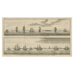
Antique Print of Batavia 'Jakarta', in the Dutch East Indies, 1744
Located in Langweer, NL
Two views on one plate titled 'A Prospect of The Town of Batavia (and) A View of the Citadel of Batavia'. Beautiful views of Batavia (Jakarta), Indonesia. The upper view shows the ci...
Category

18th Century Antique Netherlands - Collectibles and Curiosities

Materials

Paper

Antique Map of the Region of the Nile River by Bartholomew, 1922
Located in Langweer, NL
Antique map of Africa titled 'Egypt and the Nile'. Old map of Africa depicting Egypt, the Nile river and surroundings. This map originates from 'The Times' ...
Category

20th Century Netherlands - Collectibles and Curiosities

Materials

Paper

Antique Map Showing Estates of 1669 in Amsterdam, Published in c.1767
Located in Langweer, NL
Antique map titled 'Kaart der landeryen, gelegen aan of onder de honderd gaarden, zo in de Buitenvelder- als Stads-polder; van welken de gestreepten, voor 't geregt van Nieuwer-Amste...
Category

18th Century Antique Netherlands - Collectibles and Curiosities

Materials

Paper

Antique Map of the Gulf of Tomini by Winkler Prins, 1878
Located in Langweer, NL
Antique map titled 'Kaart van de Golf van Tomini of Gorontalo.' (Map of the Gulf of Tomini or Gorontalo.) This map shows the Gulf of Tomini near the Island of Sulawesi, Indonesia. Wi...
Category

19th Century Antique Netherlands - Collectibles and Curiosities

Materials

Paper

Rare Handcolored Map of Isle de Juan Fernandes 'Robinson Crusoe Island', Chili
Located in Langweer, NL
Antique map titled 'Die Insel Iuan Fernandes in der Sudsee (..)'. This map depicts Robinson Crusoe, one of the Juan Fernández Islands. Robinson Crusoe Island, formerly known as Más a Tierra, is the second largest of the Juan Fernández Islands. From 1704 to 1709, the island was home to the marooned sailor Alexander Selkirk, who at least partially inspired novelist Daniel Defoe's fictional Robinson Crusoe in his 1719 novel, although the novel is explicitly set in the Caribbean. This was just one of several survival stories from the period of which Defoe would have been aware. To reflect the literary lore associated with the island and attract tourists, the Chilean government renamed the place Robinson Crusoe Island in 1966. This map originates from a German edition of 'Voyage around the World...
Category

Mid-18th Century Antique Netherlands - Collectibles and Curiosities

Materials

Paper

Antique Map of Austria by Lowry, 1852
Located in Langweer, NL
Antique map titled 'Austria'. Original map of Austria. This map originates from 'Lowry's Table Atlas constructed and engraved from the most recent Autho...
Category

Mid-19th Century Antique Netherlands - Collectibles and Curiosities

Materials

Paper

Antique Map of the United Kingdom and Ireland, c.1873
Located in Langweer, NL
Antique map titled 'Groot Brittanje en Ierland'. Old map depicting the United Kingdom and Ireland, with inset maps of London and factory districts of the UK. This map originates from...
Category

19th Century Antique Netherlands - Collectibles and Curiosities

Materials

Paper

Antique Map of Old European Russia, 1846
Located in Langweer, NL
Antique map titled 'Russia in Europe'. Old map of European Russia. This map originates from 'A New Universal Atlas Containing Maps of the various Em...
Category

19th Century Antique Netherlands - Collectibles and Curiosities

Materials

Paper

Barados and St Christopher or St Kitts and Nevis Islands in the Caribbean, 1748
Located in Langweer, NL
This original map, a copperplate engraving by Le Rouge, presents two significant areas in the Caribbean. Titled "Isle St. Christophle une des Antilles aux anglois" and "La Barbade. d...
Category

Mid-18th Century Antique Netherlands - Collectibles and Curiosities

Materials

Paper

Antique Map of the Islands Within the Queen Charlotte's Islands
Located in Langweer, NL
Antique map titled 'Cote Septentrional de la plus grande des Isles de la Reine Charlotte (..)'. Map and coastal view of the islands within the Queen Charlotte's Islands (Santa Cruz I...
Category

Late 18th Century Antique Netherlands - Collectibles and Curiosities

Materials

Paper

Antique Map of Italy and Greece by H. Kiepert, circa 1870
By Heinrich Kiepert
Located in Langweer, NL
Antique map titled 'Italiae pars media'. This map originates from 'Atlas Antiquus. Zwölf Karten zur Alten Geschichte' by H. Kiepert. Published in Berlin, circa 187.
Category

Late 19th Century Antique Netherlands - Collectibles and Curiosities

Materials

Paper

Antique Terracotta Religious Wall Plaque / Sculpture of Christ in Deep Relief
Located in Lisse, NL
Impressive and all handcrafted, early 1900s sculpture of Christ suffering. Just like in the days when Christ lived on our planet, the truth (about who we are and how to best live o...
Category

Early 20th Century European Renaissance Revival Netherlands - Collectibles and Curiosities

Materials

Terracotta

Antique Print of the Yamuna River in India, 1839
Located in Langweer, NL
Antique print titled 'Die Quelle des Jumna'. View of the Yamuna river, India. This print originates from 'Meyer´s Universum oder Abbildung und Beschreibung des Sehenswerthesten und M...
Category

19th Century Antique Netherlands - Collectibles and Curiosities

Materials

Paper

Old Dutch Map of the City of Carthage and the Bay of Carthage, 1773
Located in Langweer, NL
Antique print titled 'Kaart van de Legging van het Oude Karthago'. Old map of the city of Carthage and the Bay of Carthage. It was the center or capital city of the ancient Carthagin...
Category

1770s Antique Netherlands - Collectibles and Curiosities

Materials

Paper

Antique Engraved Map with Original Hand Colour of French Guiana, 1876
Located in Langweer, NL
The 1876 map of French Guiana from the "Grand Atlas Départemental de la France de L'Algérie et des colonies" by H. Fisquet, published by A. Le Vasseur in Paris, is a significant piec...
Category

Late 19th Century Antique Netherlands - Collectibles and Curiosities

Materials

Paper

Old Hand-Colored Print of the Guards of the King of France, 1890
Located in Langweer, NL
Antique print titled 'Gardes-du-Crops du Roi'. Old print of the Guards of the King of France. This print originates from 'Histoire de la maison militaire du roi de 1814 à 1830 : ...
Category

1890s Antique Netherlands - Collectibles and Curiosities

Materials

Paper

Colorful Detailed Antique Map of Europe, Published in 1882
Located in Langweer, NL
"The Antique Map of Europe from 'The Comprehensive Atlas and Geography of the World,' published in 1882 by Blackie & Son, is a testament to meticulous cartography and scholarly preci...
Category

1880s Antique Netherlands - Collectibles and Curiosities

Materials

Paper

Antique Map of Tunis and Tripoli in Northern Africa, circa 1880
By J. Migeon
Located in Langweer, NL
Antique map titled 'Tunis et Tripoli & Empire de Maroc'. Old map of Tunis and Tripoli and the Empire of Morocco. This map originates from 'Géographie Universelle Atlas-Migeon' by J. ...
Category

19th Century Antique Netherlands - Collectibles and Curiosities

Materials

Paper

Mid-20th Century Decorative German Suitcase Set
Located in Delft, NL
Mid 20th Century decorative German suitcase set A German suitcase set from the 1950s and 1960s, flown with the Royal Dutch Airlines, SAS, Tee, among ot...
Category

Mid-20th Century German Netherlands - Collectibles and Curiosities

Materials

Leather

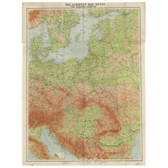
Antique Map of the War Situation in Europe and Asia, 1944
Located in Langweer, NL
Antique map titled 'Newsmap for the Armed Forces'. This "newsmap" was issued on Monday, December 18, 1944, and covers the news from December 6-13, 1945 - the 275th week of the war. T...
Category

20th Century Netherlands - Collectibles and Curiosities

Materials

Paper

Antique Religion Print of the Pharaoh and Israelites, 1913
Located in Langweer, NL
Large antique print of the Pharaoh and Israelites. Published by Mosella-Verlag, 1913. This print originates from a series titled 'Kathol. Schulbibelwerk von Dr. Ecker'.
Category

Early 20th Century Netherlands - Collectibles and Curiosities

Materials

Paper

Colorful Detailed Antique Map of England and Wales (South Part), 1882
Located in Langweer, NL
Embark on a Journey Through the Southern Part of 'England and Wales' with this Exquisite Antique Map! This map provides a vivid portrayal of the captivating landscapes and cultural h...
Category

1880s Antique Netherlands - Collectibles and Curiosities

Materials

Paper

Highly Decorative Map of The Eastern Mediterranean and The Middle East, ca.1700
Located in Langweer, NL
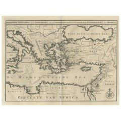
Antique map titled 'Byzondere Kaart van de Landen Daar de Apostelen Het Evangelium Gepredikt Hebben (..).' Highly decorative map of the eastern Mediterranean...
Category

Early 1700s Antique Netherlands - Collectibles and Curiosities

Materials

Paper

Colonial Crossroads: Angola and Mozambique in 1903
Located in Langweer, NL
The image for sale is an original historical map from 1903 that shows the Portuguese colonies of Angola on the left and Mozambique on the right. These two territories on the African ...
Category

Early 1900s Antique Netherlands - Collectibles and Curiosities

Materials

Paper

Barcelona 1901: A Cartographic Portrait of Catalonia's Capital Province
Located in Langweer, NL
This orignal antique map is a historical depiction of the province of Barcelona from 1901. It showcases the varied terrain of the province, with the Serra de Collserola ridge near the city of Barcelona and the Pyrenees to the north. The map includes the coastline along the Mediterranean Sea, indicating Barcelona's position as a coastal province. Blue lines indicate rivers, such as the Llobregat and Besòs, which are significant features in the province's geography. Dotted lines may signify the borders of the province within Catalonia. The coat of arms of Barcelona, highlighted with gold, is prominently displayed, featuring the Cross of Saint George (Cruz de Sant Jordi), the patron saint of Catalonia, and the red and yellow bars which are a symbol of the Aragonese and Catalan heritage. About the province of Barcelona: The province of Barcelona is part of the autonomous community of Catalonia in northeastern Spain. It is the most economically significant region of Catalonia, playing a crucial role in the country's economy due to its port, manufacturing, and service industries. The city of Barcelona is the capital and the second most populous city in Spain, known for its rich cultural heritage, architecture by Antoni Gaudí, such as the Sagrada Família, and its influential art scene. The province enjoys a Mediterranean climate and features diverse landscapes from the beaches along the coast to the mountains in the interior. Barcelona is also known for its vibrant festivals, cuisine, fashion, and sports, particularly football, being home to FC Barcelona...
Category

Early 1900s Antique Netherlands - Collectibles and Curiosities

Materials

Paper

Original Antique Map of England, Ireland, Scotland and Wales
Located in Langweer, NL
Antique map titled 'Les Isles Britanniques, ou sont les Royaumes d Angleterre (..)'. Detailed map of England, Ireland, Scotland and Wales, with French coast and part of the Netherlan...
Category

Early 18th Century Antique Netherlands - Collectibles and Curiosities

Materials

Paper

Antique Print of Tokyo Bay 'or Edo Bay', Located in Southern Kantō, Japan, 1856
Located in Langweer, NL
Antique print titled 'To-Ri-Ga-Sa-Ki, Yedo Bay'. View of Tokyo Bay (or Edo Bay), a bay located in the southern Kanto region of Japan, and spans the coasts of Tokyo, Kanagawa Prefectu...
Category

1850s Antique Netherlands - Collectibles and Curiosities

Materials

Paper

A Malachite pendant
Located in Delft, NL
A Malachite pendant A malachite pendant with silver eylet (835/000) with a scene of a cameleon in a tree with fruits and leaves. A hand-carved piece of malachite. The measurement i...
Category

20th Century African Netherlands - Collectibles and Curiosities

Materials

Malachite, Silver

Antique Map of the Eastern Mediterranean and the Balkans
Located in Langweer, NL
Antique map titled 'La Turquie d'Europe et celle d'Asie'. Attractive double page map of the Eastern Mediterranean and the Balkans by R. Bonne. Originates from 'Atlas de Toutes les Pa...
Category

Late 18th Century Antique Netherlands - Collectibles and Curiosities

Materials

Paper

Antique Print of the 'Buitenhof' in The Hague, The Netherlands, c.1770
By Georg Balthasar Probst
Located in Langweer, NL
Antique print titled 'Prospectus de Buyten Hof - Gezicht van het Buyten Hof tot Gravenhaghe'. Beautiful view of the Buitenhof, a square in The Hague, the Netherlands. This is an opti...
Category

18th Century Antique Netherlands - Collectibles and Curiosities

Materials

Paper

Original Copper Engraved Map of France
Located in Langweer, NL
Antique map titled 'New and Accurate Map of France from the latest improvements'. Original copper engraved map of France. Engraved by T. Bowen, published circa 1771.
Category

Late 18th Century Antique Netherlands - Collectibles and Curiosities

Materials

Paper

Scarce Antique Map of South America
Located in Langweer, NL
Antique map titled 'Carte de l'Amérique Méridionale'. Scarce map of South America, published in Paris in 1821. The map shows the continent in the ...
Category

Early 19th Century Antique Netherlands - Collectibles and Curiosities

Materials

Paper

Antique Map of the Burgundy Region by Mallet, c.1683
Located in Langweer, NL
Antique map titled 'Royaume de Bourgogne sous la seconde Race des Roys de France'. Detailed miniature map of the Burgundy region, France. Originates from Mallet's 'Description de l'U...
Category

17th Century Antique Netherlands - Collectibles and Curiosities

Materials

Paper

Antique Map of Guyenne, Gascony and Béarn, France
Located in Langweer, NL
Antique map titled 'Guyenne et Gascogne et Bearn'. Original old map of Guyenne (or Guienne), Gascony and Béarn, France. This map originates from 'Le Petit Atlas Maritime Recueil De C...
Category

Mid-18th Century Antique Netherlands - Collectibles and Curiosities

Materials

Paper

Antique Map of New Ireland, 1774
Located in Langweer, NL
Antique print titled 'Neu Irrland (..)'. Antique map of New Ireland with 7 coastal profiles, Papua New Guinea. Originates from 'Geschichte der See-Reisen u...
Category

18th Century Antique Netherlands - Collectibles and Curiosities

Materials

Paper

Antique Map of the Coast of China by Bellin, 1752
By Jacques-Nicolas Bellin
Located in Langweer, NL
Antique map titled 'Carte des Costes de Cochinchine, Tunquin et Partie de celles de Chine'. Detailed map of the region from the Cambodia River to Macao, along the coast of China. ...
Category

18th Century Antique Netherlands - Collectibles and Curiosities

Materials

Paper

Antique Print of the House of Roger Hudson by Campbell, 1725
Located in Langweer, NL
Antique print titled 'The Elevation of Roger Hudson Esqr. his house at Sunbury (..)'. Old engraving of the house of Roger Hudson in Sunbury. This print originates from 'Vitruvius Bri...
Category

18th Century Antique Netherlands - Collectibles and Curiosities

Materials

Paper

Ancient Babylon with The Tower of Babel According to Herodotus & Kircherus, 1730
Located in Langweer, NL
Antique print titled 'Platte Grond van de Stad Babilon, volgens Herodotus en A. Kircherus'. This original antique print shows a view of ancient Babylon with the tower of Babel...
Category

1730s Antique Netherlands - Collectibles and Curiosities

Materials

Paper

Detailed German Map of Australia Including Statistics of 1841, Published in 1854
Located in Langweer, NL
Title: "Detailed Map of Austral Land - 1854" This historic map, titled "Australland," was published in Glogau in 1854 by cartographer Carl Flemming. It's an intricately detailed dep...
Category

1850s Antique Netherlands - Collectibles and Curiosities

Materials

Paper

Antique Map of the Region of Le Mans 'France' by Blaeu, circa 1640
By Willem Blaeu
Located in Langweer, NL
Antique Map: Cenomanorum Galliae regionis typus vulgo le Mans – Blaeu, circa 1640 This beautifully engraved and hand-colored map depicts the historical province of Maine in northw...
Category

Mid-17th Century Antique Netherlands - Collectibles and Curiosities

Materials

Paper

Antique Map of the City of Bolsward, Friesland in The Netherlands, c.1598
Located in Langweer, NL
Antique map titled ‘Bolzvardia vetus in Frisia Foederis (..)’. Old map of the city of Bolsward, Friesland. Originally part of a sheet together with the cities of Stavoren, Harlingen ...
Category

16th Century Antique Netherlands - Collectibles and Curiosities

Materials

Paper

The Cavalry of the Dutch-Belgian Army 1841-1849, Published in 1900
Located in Langweer, NL
Antique print, titled: '2e Regiment Lansiers 1841-1849. Limburgsch Bonds-Contingent. Jagers te paard 1842-1849.' - This plate shows the 2nd. Regiment Lanciers (Cavalry) of the Dutch/Belgian army...
Category

20th Century Netherlands - Collectibles and Curiosities

Materials

Paper

Original Antique Bird's Eye View of Banten or Bantam in Java, Indonesia, 1725
Located in Langweer, NL
Antique print titled 'La Ville de Bantam capitale du Roiaume de meme nom'. A bird's eye view of the city Banten or Bantam near the western end of Java in Indonesia. Several tall ...
Category

1720s Antique Netherlands - Collectibles and Curiosities

Materials

Paper

Print of Garden Pavilions of the Earl of Tilney and Knight Stevenson, c.1785
Located in Langweer, NL
Antique print titled 'Pavillon pour les jardins (..)'. Copper engraving showing the pavilions of the Earl of Tilney and Knight Stevenson. Earl Tylney, of Castlemaine in the Count...
Category

18th Century Antique Netherlands - Collectibles and Curiosities

Materials

Paper

Antique Map of the Westphalia region of Germany
Located in Langweer, NL
Antique map titled 'Circulus Westphaliae (..)'. Original old map of the Westphalia region, Germany. Published by Justus Danckerts, circa 1696. Justus Danckerts I (11 November 1635 ...
Category

Late 17th Century Antique Netherlands - Collectibles and Curiosities

Materials

Paper

Antique Map of Berkshire, South East England
By Joan (Johannes) Blaeu
Located in Langweer, NL
Antique map titled 'Bercheria vernacule Barkshire'. Original old map of Berkshire, a historic county in South East England. Published circa 1665 by J. Blaeu. Willem Jansz. Blaeu and ...
Category

Mid-17th Century Antique Netherlands - Collectibles and Curiosities

Materials

Paper

Original Antique Map of the State of New Jersey Published in France
Located in Langweer, NL
Original antique map titled 'Carte Géographique Statistique et Historique du New-Jersey'. One of the earliest obtainable maps of the State of New Jersey published outside of the Unit...
Category

Early 19th Century Antique Netherlands - Collectibles and Curiosities

Materials

Paper

Read More

Medal-Worthy Memorabilia from Epic Past Olympic Games

Get into the games! These items celebrate the events, athletes, host countries and sporting spirit.

Ahoy! You’ve Never Seen a Collection of Sailor Art and Kitsch Quite Like This

French trendsetter and serial collector Daniel Rozensztroch tells us about his obsession with objects related to seafaring men.

Pamela Shamshiri Shares the Secrets behind Her First-Ever Book and Its Effortlessly Cool Interiors

The sought-after designer worked with the team at Hoffman Creative to produce a monograph that beautifully showcases some of Studio Shamshiri's most inspiring projects.

Moroccan Artworks and Objects Take Center Stage in an Extraordinary Villa in Tangier

Italian writer and collector Umberto Pasti opens the doors to his remarkable cave of wonders in North Africa.

Montecito Has Drawn Royalty and Celebrities, and These Homes Are Proof of Its Allure

Hollywood A-listers, ex-pat aristocrats and art collectors and style setters of all stripes appreciate the allure of the coastal California hamlet — much on our minds after recent winter floods.

Whaam! Blam! Pow! — a New Book on Pop Art Packs a Punch

Publishing house Assouline and writer Julie Belcove have teamed up to trace the history of the genre, from Roy Lichtenstein, Andy Warhol and Yayoi Kusama to Mickalene Thomas and Jeff Koons.

The Sparkling Legacy of Tiffany & Co. Explained, One Jewel at a Time

A gorgeous new book celebrates — and memorializes — the iconic jeweler’s rich heritage.

What Makes a Gem-Encrusted Chess Set Worth $4 Million?

The world’s most opulent chess set, weighing in at 513 carats, is literally fit for a king and queen.

Recently Viewed

View All