Maps
76
2,896
to
582
2,785
108
2,896
2,896
2,896
21
9
1
1
2,897
2,121
414
5
229
32
11
85
7
57
7
3
3
4
5
2
2,880
15
5
4
3
189
69
55
36
28
63
26
16
13
13
Maps For Sale
Period: 18th Century
Period: 17th Century
Period: 15th Century and Earlier
Period: 16th Century
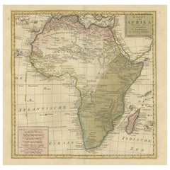
Antique Map of Africa with Original Hand Coloring
Located in Langweer, NL
Antique map titled 'Kaart van Afrika door den Heer d'Anville'. Detailed original old map of Africa, with very small inset map titled 'Vlaamsche Eilanden', which shows the Azores. Pub...
Category
Mid-18th Century Antique Maps
Materials
Paper
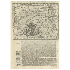
Antique Map of the Holy Land, with vignette of the Garden of Eden
Located in Langweer, NL
Antique map titled 'Hondius his Map of Paradise'. Beautiful map of the region bounded by the Holy Land. Syria, Mesopotamia, Chaldea and part of Arabia. With decorative vignette of th...
Category
Mid-17th Century Antique Maps
Materials
Paper
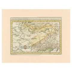
Antique Map of Tartary and Northeast Asia with Hand Coloring
Located in Langweer, NL
Antique map titled 'Carte de la Tartarie Occidentale'. An interesting map of Tartary and northeast Asia, from Lake Baykal, Partie du Siberia in the north, Pays des Kalkas at the cent...
Category
Mid-18th Century Antique Maps
Materials
Paper
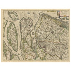
Antique Map of Delfland, Schieland and Islands of Zuid-Holland, the Netherlands
Located in Langweer, NL
Antique map titled 'Delflandia, Schielandia, et Insulae (..)'. Original antique map of Delfland, Schieland and islands of Zuid-Holland, the Netherlands. The 'Zuid-Hollandse Eilanden'...
Category
Mid-17th Century Antique Maps
Materials
Paper
Antique Map of Macedonia, Northern Greece and part of Turkey in Europe
Located in Langweer, NL
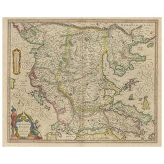
Antique map titled 'Macedonia Epirus et Achaia'. Original old map of Macedonia, northern Greece, and part of Turkey in Europe. Published by W.J. Blaeu, circa 1640.
Willem Janszoon ...
Category
Mid-17th Century Antique Maps
Materials
Paper
Detailed Antique Map of Italy and surrounding Islands
Located in Langweer, NL
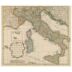
Antique map titled 'Italie volgens de allernieuwste Uitgave van den Heere d'Anville'. Very detailed antique map, based on D'Anville's important map of It...
Category
Mid-18th Century Antique Maps
Materials
Paper
Antique Map of India and Ceylon, along with the Maldives
Located in Langweer, NL
Antique map titled 'Stato del Mogol con l'Isole di Ceilan e Maldive'. Beautiful map of India and Ceylon, along with the Maldives. Includes a large decorative title cartouche. The map...
Category
Late 18th Century Antique Maps
Materials
Paper
Large Antique Plan of St. Philiou Bay or Sant Feliu Catalonia Spain, circa 1746
Located in Langweer, NL
This antique map is a black and white harbor chart, specifically a port plan of St. Philiou, which is likely associated with Sant Feliu, Spain. This historical cartographic piece ori...
Category
Mid-18th Century Antique Maps
Materials
Paper
Mercator's Ptolemaic Map of the Holy Land, Cyprus and Syria, circa 1580
Located in Langweer, NL
Antique map titled 'Asiae IIII Tab'. Beautiful map of Mercator's Ptolemaic map of the Holy Land, Cyprus, Syria, etc. Originates from Mercator's 'Geographia'.
Gerard Mercator (1512 ...
Category
16th Century Antique Maps
Materials
Paper
Antique Map of Russia and Central Asia, showing the Northeast Passage
Located in Langweer, NL
Antique map titled 'Generalis Totius Imperii Moscovitici (..)'. Decorative map of Russia and Central Asia, showing the Northeast Passage. The map covers the entirety of the Russian Empire at the time, stretching from the Arctic Circle in the north to the "Oceanus Orientalis" and the northern parts China (Chinae Septentrionalis confinia), Mongolia and India in the south. Published by J.B. Homann, circa 1730.
Johann Baptist Homann was born 1664 in Oberkammlach. He founded his business 1702 in Nuremberg, Germany. After a long period of Dutch domination in map publishing, the Homann publishing house became the most important map...
Category
Mid-18th Century Antique Maps
Materials
Paper
Antique Map of Silesia centered on Glogau
Located in Langweer, NL
Antique map titled 'Ducatus Silesiae Glogani vera delineatio'. This decorative map shows the Odra River valley based on the Silesian cartographer, Jonas Scultetus. The map is oriente...
Category
Mid-17th Century Antique Maps
Materials
Paper
Antique Map of the Empire of the Great Mogol and the Kingdom of Kachimere
Located in Langweer, NL
Antique map titled 'Genealogie des Empereurs Mogols depuis Tamberlan ou Tamerlan'. Two maps, a genealogical tree and three indigenous views of the Mogol Empire on one sheet with desc...
Category
Early 18th Century Antique Maps
Materials
Paper
Decorative Antique Map of Central Asia
Located in Langweer, NL
Antique map titled 'Carte de la Tartarie Indépendante (..)'. Decorative map of Central Asia (Tartary). Covers from the Black Sea south to China, north to Russia, and south to Persia ...
Category
Late 18th Century Antique Maps
Materials
Paper
Antique Map extending from the Spice Islands to the west of Papua New Guinea
Located in Langweer, NL
Antique map titled 'Kaart van de Papoasche Eilanden'. Beautiful original old map extending from the Spice Islands (Sallawatty, Patenta, Gammen, Land van Waigeeuw, Popo, Misool, and part of Seram) to the western end of Papua New Guinea. Many smaller islands are detailed, and depth soundings are shown near Seram and to the east of Misool. This map originates from 'Nieuwe en Beknopte Hand-Atlas, bestaande in eene Verzameling van eenige der algemeenste en nodigste Landkaarten' by I. Tirion. Published circa 1770.
Tirion was born in Utrecht in 1705. He moved to Amsterdam in 1725 and set up shop on Damrak as a book publisher. Tirion quick rose in prominence by publishing pamphlets, historical works, and, most importantly...
Category
Late 18th Century Antique Maps
Materials
Paper
Antique Map of Germany including surrounding countries
Located in Langweer, NL
Antique map titled 'Tabula Germaniae'. Orginal antique map of Germany by Claes Jansz. Visscher. Published circa 1650. including the Low Countries, Switze...
Category
Mid-17th Century Antique Maps
Materials
Paper
Antique Plan of Alicante Bay, Spain
Located in Langweer, NL
Antique map titled 'Plan de la Baye d'Alicant'. Black and white harbor chart /port plan of Alicante Bay, Spain. This map originates from the scarce atlas 'Recueil de Plusiers Plans d...
Category
Mid-18th Century Antique Maps
Materials
Paper
Antique Map of Asia Minor, showing Turkey, Cyprus and the Islands in the Aegean
Located in Langweer, NL
Antique map titled 'Natolia, quae olim Asia Minor'. Decorative map of Asia Minor, showing Turkey, Cyprus and the Islands in the Aegean. This attractive map shows all of Turkey, Cypru...
Category
Mid-17th Century Antique Maps
Materials
Paper
Antique Map of part of India, the Ganges and Hindustan
Located in Langweer, NL
Antique map titled 'Carte de l'Indoustan'. Original antique map of part of India, the Ganges and Hindustan. This map originates from 'Histoire Generale Des Voyages' by Antoine Franco...
Category
Mid-18th Century Antique Maps
Materials
Paper
Antique Map of Northern Germany, showing the area of Mecklenburg-Vorpommern
Located in Langweer, NL
Antique map titled 'Meklenburg Ducatus'. Attractive map of northern Germany, showing the area of Mecklenburg-Vorpommern. Published by J. Janssonius, circa 1630.
Jan Janssonius (als...
Category
Mid-17th Century Antique Maps
Materials
Paper
Antique Map of the Eastern Mediterranean and the Balkans
Located in Langweer, NL
Antique map titled 'La Turquie d'Europe et celle d'Asie'. Attractive double page map of the Eastern Mediterranean and the Balkans by R. Bonne. Originates from 'Atlas de Toutes les Pa...
Category
Late 18th Century Antique Maps
Materials
Paper
Antique Map of of Bengal and the mouth of the Ganges River
Located in Langweer, NL
Antique map titled 'Carte du Bengale, avec la partie Septentrionale (..)'. Original antique map of Bengal and the mouth of the Ganges river. This map ori...
Category
Late 18th Century Antique Maps
Materials
Paper
Antique Map centered on Nuremberg, Germany
Located in Langweer, NL
Antique map titled 'Territorium Norimbergense'. Beautiful map centered on Nuremberg, Germany. With decorative title cartouche and inset plan of the city. Published by W. Blaeu, circa...
Category
Mid-17th Century Antique Maps
Materials
Paper
Antique Plan of Ancient Syracuse, Plan of ancient Syracuse, Sicily, Italy
Located in Langweer, NL
Antique print titled 'Plan de l'Ancienne Ville de Syracuse'. Plan of ancient Syracuse, Sicily, Italy. This print originates from 'Histoire Universelle (..)'.
Artists and Engravers...
Category
18th Century Antique Maps
Materials
Paper
Antique Map of the German Empire with decorative Title Cartouche
Located in Langweer, NL
Antique map titled 'Germania, Non ea tantum quae Rheno, Vistula, Danubio, mariqz Germanico Veteribus claudebatur; Sed tota illa continens quae hodie communiter Germanica lingua utitu...
Category
Early 17th Century Antique Maps
Materials
Paper
Antique Map of Asia Minor including part of the Greek Archipelago and Cyprus
Located in Langweer, NL
Antique map titled 'Chersonesi quae hodie Natolia Descriptio'. Decorative, smaller map of Asia Minor including part of the Greek Archipelago and Cyprus. The drape-style title cartouc...
Category
Mid-18th Century Antique Maps
Materials
Paper
Antique Map of Northern Asia, with Russia, Korea and Northern Japan
Located in Langweer, NL
Antique map titled 'Nieuwe Kaart van Tartarie'. Map op Siberia and Chinese tartary. In the north Novaya Zemlya curls back to attach itself to the mainland by a narrow isthmus. In the...
Category
Mid-18th Century Antique Maps
Materials
Paper
Mercator's Ptolemaic map of Taprobana, (Ceylon) Sri Lanka
Located in Langweer, NL
Antique map titled 'Asiae XII Tab'. Mercator's Ptolemaic map of Taprobana. The map shows Ptolemy's erroneous location of the island of Sri Lanka near the equator, with a bit of India...
Category
16th Century Antique Maps
Materials
Paper
Antique Map of the region of Bremen and Verden, Germany
Located in Langweer, NL
Antique map titled 'Ducatus Bremae et Ferdae (..)'. Original antique map of the region of Bremen and Verden, Germany. Published by N. Visscher, circa 1690.
The Visscher family were...
Category
Late 17th Century Antique Maps
Materials
Paper
Antique Map of the Region of Fréjus, France
Located in Langweer, NL
Title: "Golf de Fréjus"
Description: This antique map, titled "Golf de Fréjus," is an original depiction of the region of Fréjus, France. It is part of the work "Le Petit Atlas Mari...
Category
Mid-18th Century Antique Maps
Materials
Paper
Old Ptolemaic Map of the Region Between the Persian Gulf and Caspian Sea, 1598
Located in Langweer, NL
"Tabula Asiae V", Ptolemy/Ruscelli
Subject: Persia - Iran
Period: 1598 (published)
Publication: Geografia di Claudio Tolomeo Allessadrino…
Claudius Ptolemy was a mathematician, ast...
Category
16th Century Antique Maps
Materials
Paper
Original Antique Map of England, Ireland, Scotland and Wales
Located in Langweer, NL
Antique map titled 'Les Isles Britanniques, ou sont les Royaumes d Angleterre (..)'. Detailed map of England, Ireland, Scotland and Wales, with French coast and part of the Netherlan...
Category
Early 18th Century Antique Maps
Materials
Paper
Set of 2 Antique Maps covering part of modern-day Czech Republic
Located in Langweer, NL
Set of two antique maps titled 'Marchionatus Moraviae circulus Preroviensis'. Two individual sheets covering part of modern-day Czech Republic. Cities included are Opava, Fulnek, Lip...
Category
Early 18th Century Antique Maps
Materials
Paper
Antique Map of the Duchy of Lüneburg, Lower Saxony, Germany
Located in Langweer, NL
Antique map titled 'Ducatus Luneburgensis (..)'. Map of the Duchy of Lüneburg in Lower Saxony, Germany. Published by J. Janssonius, circa 1664.
Jan Janssonius (also known as Johann ...
Category
Mid-17th Century Antique Maps
Materials
Paper
Antique Map of part of Central and Southern Asia
Located in Langweer, NL
Antique map titled 'Carte de la Partie Superieure de l'Inde en deca du Gange. Comprise entre la Cote du Concan et celle d'Orixa, avec l'Empire du Mogol, le Bengale, le R. d'Asham, pa...
Category
Late 18th Century Antique Maps
Materials
Paper
Original Antique Woodcut Map of Persia
Located in Langweer, NL
Antique map titled 'Tabula V Asiae'. Important early woodcut map of Persia, depicting the area of Mesopotamia, Armenia and the Gulf, to the Caspian and Carmania (Iran). Includes name...
Category
16th Century Antique Maps
Materials
Paper
Rare Small Antique Map of Great Britain and Ireland
Located in Langweer, NL
Antique map titled 'La Grande Bretagne et Irlande'. Small antique map of Great Britain and Ireland. Source unknown, to be determined. Publ...
Category
Mid-18th Century Antique Maps
Materials
Paper
Rare and Interesting Small Antique Woodcut Map of the Mediterranean
Located in Langweer, NL
Very rare untitled antique woodcut map showing the region of the missionary journeys of Apostle Paul. It shows the Mediterranean with Greece, Asia Minor (Turkey), Northern Africa, So...
Category
16th Century Antique Maps
Materials
Paper
Detailed Antique Map of the Black Sea, Balkans and Asia Minor
Located in Langweer, NL
Antique map titled 'Nuova Carta del Europa Turchesca (..)'. This is an Italian version of Tirion's detailed map of the Black Sea, Balkans, and Asia Minor. It is embellished with a si...
Category
Mid-18th Century Antique Maps
Materials
Paper
Antique Detailed World Map Drawn on Mercator's Projection, 1700
Located in Langweer, NL
Antique world map titled 'Carte generale du monde, ou description du monde terrestre & Aquatique - Generale Waereld kaart, of beschryving van de land en water waereld'. This is Pierr...
Category
17th Century Antique Maps
Materials
Paper
Antique Map of the Balkans with Coat of Arms
Located in Langweer, NL
Antique map titled 'Tavola Nuova di Schiavonia'. Ruscelli's map of the Balkans, with a coat of arms. The mountains are represented, river systems are shown in detail, and cities, towns and ports denoted throughout this 16th century map. A number of islands in the Adriatic Sea are also shown. This map originates from 'Espositione & introduttioni universali di Gir. Ruscelli sopra tutta la Geografia di Tolomeo (..)' published by Girolamo Ruscelli, 1561.
Girolamo Ruscelli (1500-1566) was a cartographer, humanist, and scholar from Tuscany. Ruscelli was a prominent writer and editor in his time, writing about a wide variety of topics including the works of Giovanni Boccaccio and Francesco Petrarch, Italian language, Italian poetry, medicine, alchemy, and militia. One of his most notable works was a translation of Ptolemy...
Category
16th Century Antique Maps
Materials
Paper
Old Map of the Arabian Peninsula with Parts of Egypt, Sudan, Eritrea & Ethiopia
Located in Langweer, NL
"Carte de l'Arabie, du Golfe Persique, et de la Mer Rouge, avec l'Egypte, la Nubie et l'Abissinie", Bonne, Rigobert
Subject: Arabia
Period: 1780 (circa)
Publication: Atlas de Toutes...
Category
1780s Antique Maps
Materials
Paper
Antique Print of the Chinese City of Anhing by Nieuhof, 1668
Located in Langweer, NL
Antique print China titled 'Anhing'. Old print depicting a view on the Chinese city of Anhing with its ramparts. This print originates from the Latin editio...
Category
17th Century Antique Maps
Materials
Paper
Antique Map of France, based on the work of Ptolemy
Located in Langweer, NL
Antique map titled 'Gallia Nova Tabula'. Ruscelli's map of France. This map originates from 'Espositione & introduttioni universali di Gir. Ruscelli sopra tutta la Geografia di Tolomeo (..)' published by Girolamo Ruscelli, 1561.
Girolamo Ruscelli (1500-1566) was a cartographer, humanist, and scholar from Tuscany. Ruscelli was a prominent writer and editor in his time, writing about a wide variety of topics including the works of Giovanni Boccaccio and Francesco Petrarch, Italian language, Italian poetry, medicine, alchemy, and militia. One of his most notable works was a translation of Ptolemy’s Geographia...
Category
16th Century Antique Maps
Materials
Paper
Antique Map of Sri Lanka with an unusual five-sided shape
Located in Langweer, NL
Antique map titled 'Ins. Ceilan quae incolis Tenarisin dicitur'. This exquisite, early map of Sri Lanka is shown with an unusual five-sided shape. North is oriented to the left by an...
Category
Early 17th Century Antique Maps
Materials
Paper
Small Original Antique Map of the Lower Alsace region, Germany
Located in Langweer, NL
Antique map titled 'Alsatia Inferior'. Small original antique map of the Lower Alsace region, Germany. This map originates from 'Atlas minor Gerardi Mercatoris a I. Hondio plurimis a...
Category
Early 17th Century Antique Maps
Materials
Paper
Antique Map of the World on Mercator Projection by Anson, 1749
Located in Langweer, NL
Antique map titled 'Nieuwe Wereld Kaart waar in de Reizen van den Hr. Anson rondsom de Wereld'. Original antique map of the world on Mercator'...
Category
18th Century Antique Maps
Materials
Paper
Antique Map of the Region involved in the Conquest of Cyrus the Great
Located in Langweer, NL
Antique map titled 'Tabula Itineris Decies Mille (..)'. This historical map illustrates the region involved in the conquest of Cyrus the Great (558-528 BC), the founder of the Persia...
Category
Mid-17th Century Antique Maps
Materials
Paper
Detailed Antique Map of the Lower Rhine region, Germany
Located in Langweer, NL
Antique map titled 'S.R.I. Circulus Rhanus Inferior sive Electorum Rheni (..)'. Detailed map of the Lower Rhine region, Germany. The title cartouche in the upper left quadrant featur...
Category
Mid-18th Century Antique Maps
Materials
Paper
Antique Map of the Namen or Namur Region in Wallonia, Belgium
Located in Langweer, NL
Description: Antique map titled 'Namurcum Comitatus' A map of the Namen/Namur region in Wallonia, Belgium. It is the capital of the province Namur and hosts the Walloon Parliament. T...
Category
1610s Antique Maps
Materials
Paper
Antique Map of Zeeland, The Netherlands, by Jaillot, 1693
Located in Langweer, NL
Antique map titled 'Le Comte de Zeelande (..).' Detailed map of the province of Zeeland, The Netherlands. Details shown include fortified towns, roads, sandbanks and marshlands. Base...
Category
17th Century Antique Maps
Materials
Paper
Original Old Map of Northeastern Greece & Northwestern Turkey, Published in 1661
Located in Langweer, NL
This small map was engraved by Petrus Kaerius and is based on Ortelius' map of the same title. It covers the ancient region of Thrace, present-day European Turkey and part of Greece....
Category
1660s Antique Maps
Materials
Paper
Small Original Antique Map of Upper Saxony, Germany
Located in Langweer, NL
Antique map titled 'Saxonia Superior'. Small original antique map of Upper Saxony, Germany. Upper Saxony (German: Obersachsen) was the name given to the majority of the German lands ...
Category
Early 17th Century Antique Maps
Materials
Paper
Antique Engraving with a Plan of Rhodes, Greece, 1688
Located in Langweer, NL
Description: Antique map, titled: 'Rhodos.' - Plan of Rhodes, Greece. This map originates from 'Nauwkeurige Beschrijving der eilanden in de in de Archipel der Middellantsche Zee', by...
Category
1680s Antique Maps
Materials
Paper
Old Map Showing Info Related to the Ottoman Wars including Conflict Dates, c1690
Located in Langweer, NL
"Corso del Danubio da Vienna Sui a Vicopoli, e Paesi Adiacenti - Northwestern Sheet", Coronelli, Vincenzo Maria
Subject: Central Europe, Danube River
Period: 1690 (circa)
Publicatio...
Category
1690s Antique Maps
Materials
Paper
Fabulous Original Antique two-sheet Map of the Caspian Sea, ca.1723
Located in Langweer, NL
Carte Marine de la Mer Caspiene... [and] Coste de Perse sur la Mer Caspiene et Partie de Celles de Tartarie", Delisle, Guillaume (2 maps)
Subject: Caspian Sea
Period: 1723 (circa)
P...
Category
1720s Antique Maps
Materials
Paper
Antique Map of Spain including the Balearic Islands
Located in Langweer, NL
Antique map titled 'Hispania Nova Tabula'. Ruscelli's map of Spain, including the Balearic Islands. This map originates from 'Espositione & introduttioni universali di Gir. Ruscelli sopra tutta la Geografia di Tolomeo (..)' published by Girolamo Ruscelli, 1561.
Girolamo Ruscelli (1500-1566) was a cartographer, humanist, and scholar from Tuscany. Ruscelli was a prominent writer and editor in his time, writing about a wide variety of topics including the works of Giovanni Boccaccio and Francesco Petrarch, Italian language, Italian poetry, medicine, alchemy, and militia. One of his most notable works was a translation of Ptolemy’s Geographia...
Category
16th Century Antique Maps
Materials
Paper
Original Antique Map of Arabia and the Red Sea
Located in Langweer, NL
Antique map titled 'Carte de la Coste d'Arabie (..) - Kaart van de Kust van Arabië (..)'. This is a Dutch version, engraved by J. van Schley, of Bellin's map of Arabia and the Red Se...
Category
Mid-18th Century Antique Maps
Materials
Paper
Antique Bird's Eye-view Atjien or Atjeh in Aceh in Northern Sumatra, Indonesia
Located in Langweer, NL
Description: Antique print Indonesia titled 'Atsjien'. Bird's eye-view of the Town of Atjien on the northernmost point of Sumatra. This print originates from 'Oud en Nieuw Oost-Indië...
Category
1720s Antique Maps
Materials
Paper
Recently Viewed
View AllMore Ways To Browse
Antique Sailing Map
Antique Sailing Maps
Bay Area Antique Furniture
West Coat Of Arms
Greek Asia Minor
Hemisphere World Map
Speed Map
Antique Maps Canada
Antique Map Canada
Canada Antique Map
Malaysian Antique
West Indies Map
Blaeu World Map
Charing Cross
Antique Maps Of Canada
Bali Map
Antique Portuguese Plates
Map Of Brazil
