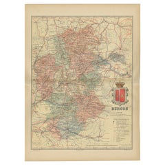
Agriculture Map
1
to
10
127
63
96
80
78
37
32
30
23
18
17
12
12
10
9
9
8
7
7
5
5
4
3
3
2
2
2
1
1
1
1
1
1
14
10
9
6
5
Sort By
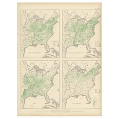
Pl. 36A Antique Chart of US Farms, Agriculture and Crops '1874'
Located in Langweer, NL
Antique chart titled 'Improved land in farms. Total agricultural production. Corn. Dairy products
Category
Antique Late 19th Century Maps
Materials
Paper
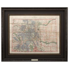
1907 Map of Colorado, Antique Topographical Map, by Louis Nell
Located in Colorado Springs, CO
map is colored to indicate Forest Reserves, agricultural lands, timber reserves, watersheds, and
Category
Antique Early 1900s American Maps
Materials
Paper
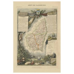
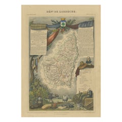
Old Map of the French Department of Ardèche, France
By Victor Levasseur
Located in Langweer, NL
Antique map titled 'Dépt. de l'Ardèche'. Map of the Department of Ardèche, France. This region is
Category
Antique Mid-19th Century Maps
Materials
Paper
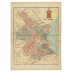
Topographical and Infrastructure Map of the Province of Valencia, 1901
Located in Langweer, NL
cities, including an extensive system of smaller roads and paths serving the agricultural areas. The map
Category
Antique Early 1900s Maps
Materials
Paper
Free Shipping
H 20.08 in W 14.77 in D 0 in
Hand Colored Antique Map of the Department of Ardèche, France
By Victor Levasseur
Located in Langweer, NL
Antique map titled 'Dépt. de l'Ardèche'. Map of the Department of Ardèche, France. This region is
Category
Antique Mid-19th Century Maps
Materials
Paper
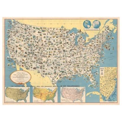
Old Decorative Pictorial Map of the United States, circa 1953
Located in Langweer, NL
including points of interest, natural resources, and agricultural products. At bottom are inset maps showing
Category
20th Century Maps
Materials
Paper
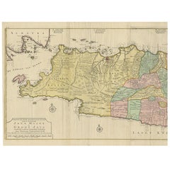
Large Antique Map of Java ‘Indonesia’ by F. Valentijn, 1728
Located in Langweer, NL
large-scale map of Java is richly engraved with details of agricultural fields, roads, temples, and
Category
Antique Early 18th Century Maps
Materials
Paper
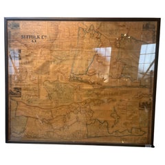
Framed Mid-19th Century Wall Map of Long Island, the Hamptons
Located in Sag Harbor, NY
A Framed museum quality find. This large wall map dates to the mid-1800s. Detailed inset maps of
Category
Antique Mid-19th Century American Maps
Materials
Linen, Paper
Burgos 1902: Geographic Map of Castile's Historic Heartland in Spain
Located in Langweer, NL
The map of the province of Burgos in the autonomous community of Castile and León in Spain, dated
Category
Antique Early 1900s Maps
Materials
Paper
Free Shipping
H 14.77 in W 20.08 in D 0 in
Girona 1902: Geographic and Infrastructural Map of Catalonia’s Northern Province
Located in Langweer, NL
The map provided is of the province of Girona (in Catalan, Girona), located in the northeast of
Category
Antique Early 1900s Maps
Materials
Paper
Free Shipping
H 14.77 in W 20.08 in D 0 in
Antique Map of Alentejo: Land of Tradition and Tranquility, 1903
Located in Langweer, NL
The image is a historical original antique map of the Alentejo region in Portugal. This map
Category
Antique Early 1900s Maps
Materials
Paper
Free Shipping
H 20.08 in W 14.77 in D 0 in
Original Antique Map of Palencia Province, in Northern Spain, 1901
Located in Langweer, NL
This historical map is of Palencia, a province in the northern part of Spain.
Palencia is
Category
Antique Early 1900s Maps
Materials
Paper
Free Shipping
H 14.77 in W 20.08 in D 0 in
An Antique Map of Extremadura: Crossroads of History and Nature, 1903
Located in Langweer, NL
The image is a historical map of Extremadura, an autonomous community of Spain, from an unspecified
Category
Antique Early 1900s Maps
Materials
Paper
Free Shipping
H 20.08 in W 14.77 in D 0 in
Antique Map of Seine et Oise 'France' by V. Levasseur, 1854
By Victor Levasseur
Located in Langweer, NL
Antique map titled 'Dépt. de Seine et Oise'. Map of the French department of Seine-et-Oise. Centred
Category
Antique Mid-19th Century Maps
Materials
Paper
Antique Map of The United States of North America, Pacific States, 1882
Located in Langweer, NL
The map is from the same 1882 Blackie Atlas and focuses on the Pacific States of the United States
Category
Antique 1880s Maps
Materials
Paper
No Reserve
H 14.97 in W 11.03 in D 0 in
Map of Tasmania with Illustrations of Local Fauna and Colonial Landmarks, 1851
Located in Langweer, NL
John Tallis & Company was renowned for their detailed and ornate maps during the 19th century
Category
Antique 1850s Maps
Materials
Paper
H 14.26 in W 10.71 in D 0 in
Hand Colored Antique Map of the department of Indre and Loire, France
By Victor Levasseur
Located in Langweer, NL
Antique map titled 'Dépt. d'Indre et Loire'. Map of the Department de L’Indre et Loire, France
Category
Antique Mid-19th Century Maps
Materials
Paper
H 20.28 in W 14.34 in D 0.02 in
Empire's Crossroads: An 1882 Map of Turkey in Asia by Blackie & Son
Located in Langweer, NL
This map, titled "Turkey in Asia," is another detailed illustration from the 1882 atlas by Blackie
Category
Antique 1880s Maps
Materials
Paper
Ávila in a Historical Map of 1902: A Geographic and Administrative Overview
Located in Langweer, NL
The map is of the province of Ávila, one of the provinces of the autonomous community of Castile
Category
Antique Early 1900s Maps
Materials
Paper
Free Shipping
H 14.77 in W 20.08 in D 0 in
Almería 1901: Coastal Contours and Landscapes in a Map of Southeastern Spain
Located in Langweer, NL
An original antique map of the province of Almería, Spain, from the year 1901.
The Mediterranean
Category
Antique Early 1900s Maps
Materials
Paper
Free Shipping
H 14.77 in W 20.08 in D 0 in
Map of Rhône: Culture and Commerce in Lyon's Silk and Wine Legacy, 1852
Located in Langweer, NL
century. The illustrations on the map reflect the local industries, agriculture, and landscapes that are
Category
Antique 1850s Maps
Materials
Paper
Navarra in Cartographic Detail: A 1902 Map of the Crossroads of Northern Spain
Located in Langweer, NL
The original antique map for sale shows the Spanish province of Navarra as it was in 1902. Here's a
Category
Antique Early 1900s Maps
Materials
Paper
Free Shipping
H 14.77 in W 20.08 in D 0 in
Authentique Map by Pilon of The French Colonies in The West Indies, 1876
Located in Langweer, NL
The 1876 map titled "Carte des Colonies Françaises aux Antilles" represents a significant
Category
Antique Late 19th Century Maps
Materials
Paper
H 14.38 in W 16.54 in D 0 in
Huge Old Map of Java, Indonesia, Published by the Dutch in Colonial Times, 1728
Located in Langweer, NL
large-scale map of Java is richly engraved with details of agricultural fields, roads, temples, and
Category
Antique 18th Century Maps
Materials
Paper
H 68.12 in W 21.07 in D 0 in
North African Coasts: Marmarica to Mauretania in Roman Times, Published in 1880
Located in Langweer, NL
The map with the title "MARMARICA, CYRENAICA, AFRICA, NUMIDIA, MAURETANIA secundum Italiam Poetarum
Category
Antique 1880s Maps
Materials
Paper
Free Shipping
H 15.56 in W 18.51 in D 0 in
Trás-os-Montes: A Cartographic Exploration of Portugal's Hidden Province in 1903
Located in Langweer, NL
This print is an original historical map of the Trás-os-Montes region in the northeastern part of
Category
Antique Early 1900s Maps
Materials
Paper
Free Shipping
H 20.08 in W 14.77 in D 0 in
Mapping History: The Decorative Cartography of Indre-et-Loire by Levasseur, 1856
Located in Langweer, NL
An original hand-colored map of the Département d'Indre-et-Loire created by Victor Levasseur in
Category
Antique 1850s Maps
Materials
Paper
H 20.67 in W 14.34 in D 0 in
Málaga 1901: A Cartographic Detailing of Andalusia's Coastal Jewel
Located in Langweer, NL
The map depicts the province of Málaga, located in the autonomous community of Andalusia in
Category
Antique Early 1900s Maps
Materials
Paper
Free Shipping
H 14.77 in W 20.08 in D 0 in
Castellón de la Plana 1901: A Cartographic Perspective of the Valencian Coast
Located in Langweer, NL
The authentic map depicts the province of Castellón de la Plana, often referred to simply as
Category
Antique Early 1900s Maps
Materials
Paper
Free Shipping
H 14.77 in W 20.08 in D 0 in
La Coruña 1901: A Cartographic View of Galicia's Maritime Province
Located in Langweer, NL
This antique map for sale showcases the province of La Coruña (in Galician, A Coruña), located in
Category
Antique Early 1900s Maps
Materials
Paper
Free Shipping
H 20.08 in W 14.77 in D 0 in
Levasseur's 1852 Cartographic Portrait of Gironde: Celebrating the Bordeaux Wine
Located in Langweer, NL
This original hand-colored map is from the "Atlas National Illustré," a work by Victor Levasseur, a
Category
Antique 1850s Maps
Materials
Paper
H 20.67 in W 14.06 in D 0 in
Cáceres 1901: Mapping the Crossroads of Extremadura, Western Spain
Located in Langweer, NL
The map depicts the province of Cáceres in Spain, dated 1901. Key features of the map include:
The
Category
Antique Early 1900s Maps
Materials
Paper
Free Shipping
H 14.77 in W 20.08 in D 0 in
Pl. 36 Antique Chart of US Crops, Wheat, Rice, Tobacco, Hops, Oats '1874'
Located in Langweer, NL
Antique chart titled 'Maps showing the range, and within the range, the degree of cultivation of
Category
Antique Late 19th Century Maps
Materials
Paper
H 21.66 in W 16.15 in D 0.02 in
Huesca 1901: A Geographic Overview of Aragon's Northern Frontier in Spain
Located in Langweer, NL
The map provided is of the province of Huesca, located in the northeastern part of Spain, within
Category
Antique Early 1900s Maps
Materials
Paper
Free Shipping
H 20.08 in W 14.77 in D 0 in
León 1903: A Cartographic Detailing of Castilla y León's Mountainous Province
Located in Langweer, NL
The map depicts the province of León, which is located in the northwest of Spain and forms part of
Category
Antique Early 1900s Maps
Materials
Paper
Free Shipping
H 14.77 in W 20.08 in D 0 in
Granada 1902: A Cartographic Exploration of Andalusia's Mountainous Province
Located in Langweer, NL
This original antique map depicts the province of Granada, part of the autonomous community of
Category
Antique Early 1900s Maps
Materials
Paper
Free Shipping
H 14.77 in W 20.08 in D 0 in
Lleida 1902: A Cartographic Perspective of Catalonia's Gateway to the Pyrenees
Located in Langweer, NL
The map for sale shows the province of Lleida, located in the western part of Catalonia, Spain, as
Category
Antique Early 1900s Maps
Materials
Paper
Free Shipping
H 20.08 in W 14.77 in D 0 in
Guadalajara 1902: A Cartographic Image of Castilla-La Mancha's Northern Province
Located in Langweer, NL
The map illustrates the province of Guadalajara, part of the autonomous community of Castilla-La
Category
Antique Early 1900s Maps
Materials
Paper
Free Shipping
H 14.77 in W 20.08 in D 0 in
1902 Murcia: A Cartographic Snapshot of Spain's Southeastern Province
Located in Langweer, NL
The map represents the province of Murcia, Spain, as it was in 1902. Here's an overview of its
Category
Antique Early 1900s Maps
Materials
Paper
Free Shipping
H 20.08 in W 14.77 in D 0 in
Burgundy's Viticultural Landscape: A 1640 Cartographic Engraving by Willem Blaeu
Located in Langweer, NL
An hand-colored original antique map with the title "Utriusque Burgundiae tum Ducatus tum Comitatus
Category
Antique 1640s Maps
Materials
Paper
Free Shipping
H 18.51 in W 23.43 in D 0 in
Ciudad Real 1902: A Detailed Cartographic Survey of La Mancha in Spain
Located in Langweer, NL
This original antitque map presents the province of Ciudad Real, located in the autonomous
Category
Antique Early 1900s Maps
Materials
Paper
Free Shipping
H 14.77 in W 20.08 in D 0 in
Cuenca 1901: A Historical Cartographic Detailing of High Plains and Mountains
Located in Langweer, NL
The original antique map displays the province of Cuenca, located in the autonomous community of
Category
Antique Early 1900s Maps
Materials
Paper
Free Shipping
H 14.77 in W 20.08 in D 0 in
Badajoz 1901: A Cartographic Record of Extremadura's Largest Province in Spain
Located in Langweer, NL
This original antique map for sale is of the province of Badajoz, part of the autonomous community
Category
Antique Early 1900s Maps
Materials
Paper
Free Shipping
H 14.77 in W 20.08 in D 0 in
Lugo 1901: A Cartographic Chronicle of Galicia's Ancient Roman Walled City
Located in Langweer, NL
The map presents the province of Lugo, located in the autonomous community of Galicia in
Category
Antique Early 1900s Maps
Materials
Paper
Free Shipping
H 20.08 in W 14.77 in D 0 in
Cartographic Treasures: A Journey Through the Gascogne and Guyenne Regions, 1680
Located in Langweer, NL
The antique map titled "Gouvernement de La Guienne & Gascogne" depicts the region of Gascogne and
Category
Antique Late 17th Century Maps
Materials
Paper
Free Shipping
H 20.08 in W 23.82 in D 0.02 in
Atlantic Eden: The Azores and Madeira Archipelagos in 1903
Located in Langweer, NL
This original antique print is a historical map titled "PORTUGAL INSULAR," which translates to
Category
Antique Early 1900s Maps
Materials
Paper
Albacete, Spain - 1902: A Cartographic Depiction of Landscape and Infrastructure
Located in Langweer, NL
historical map of the province of Albacete, dated 1902, from the "Atlas Geográfico Ibero-Americano España" by
Category
Antique Early 1900s Maps
Materials
Paper
Free Shipping
H 14.77 in W 20.08 in D 0 in
1877 "Geological and Geographical Atlas of Colorado" by F. V. Hayden
Located in Colorado Springs, CO
mapped; its drainage carefully determined, its economic and agricultural divisions noted, and its
Category
Antique 1870s American Maps
Materials
Paper
Antique Print of Agriculture Equipment, 1790
Located in Langweer, NL
Antique print titled 'Ridge's Patent Drill and Hoe Plough'. Print of agriculture equipment. This
Category
Antique 18th Century Prints
Materials
Paper
Original Vintage Illustrated Map Poster Schematic Map Soviet Union USSR Russia
Located in London, GB
Original vintage illustrated map poster - Schematic Map of the Soviet Union's East Siberia and the
Category
Vintage 1960s Russian Posters
Materials
Paper
H 25.2 in W 38.19 in D 0.04 in
Original WWII Illustrated Map Poster - Time And Tide Map Of The Atlantic Charter
By "Leslie MacDonald ""Max"" Gill"
Located in London, GB
Original vintage illustrated map poster in Spanish by the notable graphic designer, cartographer
Category
Vintage 1940s British Posters
Materials
Paper
H 44.89 in W 34.85 in D 0.04 in
American Election Map and 1960 Presidential Fact Sheet, Published 1960
Located in Langweer, NL
: 1960 (dated)
Color: Printed Color
Size: 24.9 x 17.9 inches (63.2 x 45.5 cm)
This colorful map of
Category
Vintage 1960s Posters
Materials
Paper
H 17.9 in W 24.9 in D 0.002 in
Original Vintage Illustrated Map Poster Union Of South Africa MacDonald Gill
By "Leslie MacDonald ""Max"" Gill"
Located in London, GB
Original vintage illustrated map poster for the Union of South Africa - Philips pictorial map based
Category
Vintage 1950s British Posters
Materials
Paper
H 33.08 in W 42.52 in D 0.04 in
Original Vintage Map Poster Marruecos Espanol Spanish Morocco Illustrated Design
Located in London, GB
Original vintage travel map poster for Marruecos Espanol / Spanish Morocco featuring a great
Category
Vintage 1940s Spanish Art Deco Posters
Materials
Paper
H 27.56 in W 38.39 in D 0.04 in
Original Vintage Poster Illustrated Map Madagascar French Colony Industry Travel
Located in London, GB
illustrated map showing the various places on a road route, the cities and towns marked with the highlands and
Category
Vintage 1930s French Posters
Materials
Paper
H 47.25 in W 31.5 in D 0.04 in
Frankfort, Germany: A 16th Century Hand-colored Map by Braun & Hogenberg
By Franz Hogenberg
Located in Alamo, CA
This is a 16th century original hand-colored copperplate engraved map of Frankfort, Germany
Category
16th Century Old Masters Landscape Prints
Materials
Engraving
Original Vintage Poster Union Of South Africa Map Natural & Industrial Resources
Located in London, GB
Original vintage illustrated map poster for the Union of South Africa Her Natural and Industrial
Category
Vintage 1940s British Posters
Materials
Paper
H 19.69 in W 29.53 in D 0.04 in
Original Vintage Poster French West Africa Map Afrique Occidentale Francaise Art
By alain cornic
Located in London, GB
Original vintage poster featuring an illustrated map of French West Africa / Afrique Occidentale
Category
Vintage 1950s French Posters
Materials
Paper
H 31.5 in W 47.25 in D 0.04 in
Canterbury: An Original 16th C. Framed Hand-colored Map by Braun & Hogenberg
By Franz Hogenberg
Located in Alamo, CA
This is a framed 16th century map and city view of Canterbury, England entitled "Cantuarbury" by
Category
16th Century Old Masters Landscape Prints
Materials
Engraving
H 18.75 in W 22.25 in D 0.88 in
Tournai (Tournay), Belgium: A 16th Century Hand-colored Map by Braun & Hogenberg
By Franz Hogenberg
Located in Alamo, CA
This is a 16th century original hand-colored copperplate engraved map of Tournai, Belgium, entitled
Category
16th Century Old Masters Landscape Prints
Materials
Engraving
- 1
Get Updated with New Arrivals
Save "Agriculture Map", and we’ll notify you when there are new listings in this category.
Agriculture Map For Sale on 1stDibs
Surely you’ll find the exact agriculture map you’re seeking on 1stDibs — we’ve got a vast assortment for sale. In our selection of items, you can find abstract examples as well as an Old Masters version. Making the right choice when shopping for a agriculture map may mean carefully reviewing examples of this item dating from different eras — you can find an early iteration of this piece from the 18th Century and a newer version made as recently as the 21st Century. Adding a agriculture map to a room that is mostly decorated in warm neutral tones can yield a welcome change — find a piece on 1stDibs that incorporates elements of gray, beige, brown, black and more. Finding an appealing agriculture map — no matter the origin — is easy, but Alisa Dworsky, Marissa Voytenko, Frans Hogenberg, Donise English and Maria Simonds-Gooding each produced popular versions that are worth a look. Artworks like these of any era or style can make for thoughtful decor in any space, but a selection from our variety of those made in paper, archival paper and graphite can add an especially memorable touch.
How Much is a Agriculture Map?
A agriculture map can differ in price owing to various characteristics — the average selling price for items in our inventory is $2,633, while the lowest priced sells for $69 and the highest can go for as much as $53,934.
More Ways To Browse
Vision International Flatware
Provence Flatware
Vintage Farm Tractors
Betty Jenkins
Vintage Road Maps
Jersey Cow
Vintage Drilling Machine
Scotland Map Vintage
Scotland Vintage Map
Senegal Tapestry
Garden Of Sultan Plates
Hillside Fence Landscape Art
Cape Cod Vintage Map
Travel Liquor
Dam Square
Leslie Winer
Senegal Rug
Vintage Map Of Cape Cod
