Antique Maps Of Ancient World

4
to
12
94
7
58
36
29
23
17
10
9
7
7
5
5
4
4
4
3
3
2
2
2
2
1
1
1
1
1
1
1
1
1
1
1
1
1
10
2
2
1
1
Sort By
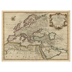
Ancient World Map of Europe, Asia & Northern Africa with Ancient Names, 1725
Located in Langweer, NL
ancient world depicting Europe, Asia, and northern Africa with ancient place names. This map originates
Category

Antique 1720s Maps

Materials

Paper

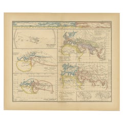
Original Old Composite of Several Maps of the Ancient World on One Sheet, 1880
Located in Langweer, NL
Theodorus Menke. The map is a detailed depiction of the ancient world. The atlas it comes from is known for
Category

Antique 1880s Maps

Materials

Paper

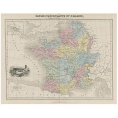
Antique Map of France in Ancient Roman Times, 1880
Located in Langweer, NL
Antique map titled 'Gaule indépendante et Romaine'. Old map of Gaul or France in ancient Roman
Category

Antique 19th Century Maps

Materials

Paper

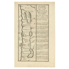
Antique Uncommon Dutch Map of Ancient Israel, c.1730
Located in Langweer, NL
Antique map titled 'Ontwerp en Erfdeeling van't Land Kanaan, volgens het gezicht van Ezechiel
Category

Antique 18th Century Maps

Materials

Paper

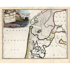
Antique Map of Westfriesland in Ancient Times by Alting, 1697
Located in Langweer, NL
original antique maps to collectors, historians, educators and interior decorators all over the world. Our
Category

Antique 17th Century Maps

Materials

Paper

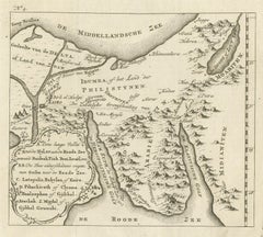
Antique Map of Edom, an Ancient Kingdom in Transjordan, 1773
Located in Langweer, NL
Antique print titled 'Idumea, of thet Land der Philistynen'. Old map of Edom, an ancient kingdom in
Category

Antique 18th Century Maps

Materials

Paper

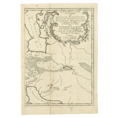
Antique Map of Ancient Persia, Assyria and surroundings, c.1760
Located in Langweer, NL
over the world. Our collection includes a wide range of authentic antique maps from the 16th to the
Category

Antique 18th Century Maps

Materials

Paper

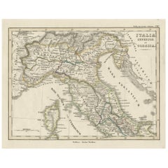
Antique Map of Italy and Corse in Ancient Times, 1848
Located in Langweer, NL
interior decorators all over the world. Our collection includes a wide range of authentic antique maps from
Category

Antique 19th Century Maps

Materials

Paper

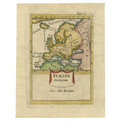
Antique Hand-Coloured Miniature Map of Ancient Europe, c.1685
Located in Langweer, NL
Antique map of Europe titled 'Europe Ancienne, Das alte Europa'. Hand-coloured miniature map with
Category

Antique 17th Century Maps

Materials

Paper

Colorful Detailed Antique Map of The World on Mercators Projection, 1882
Located in Langweer, NL
The 'World of Mercator's Projection' is a map with a stunning portrayal of global geography and
Category

Antique 1880s Maps

Materials

Paper

Antique Plan of Ancient Syracuse, Plan of ancient Syracuse, Sicily, Italy
Located in Langweer, NL
Antique print titled 'Plan de l'Ancienne Ville de Syracuse'. Plan of ancient Syracuse, Sicily
Category

Antique 18th Century Maps

Materials

Paper

Antique Map of Friesland Also Know as the Peacock Map, C.1580
Located in Langweer, NL
interior decorators all over the world. Our collection includes a wide range of authentic antique maps from
Category

Antique 18th Century Maps

Materials

Paper

Antique Plan of Ancient Syracuse, cicily, Italy, 1740
Located in Langweer, NL
Antique print titled 'Plan de l'Ancienne Ville de Syracuse'. Plan of ancient Syracuse, Sicily
Category

Antique 18th Century Maps

Materials

Paper

Old Map of Ancient Rome Illustrating Major Monuments and the Seven Hills, c.1704
Located in Langweer, NL
Antique map Rome titled 'Omnia Romanae cedant Miracula Terrae (..)'. Map of Ancient Rome
Category

Antique 18th Century Maps

Materials

Paper

Antique Map of Denmark by Hall, circa 1820
Located in Langweer, NL
atlases containing maps of the United Kingdom and of the ancient world. Condition: Very good, given age
Category

Antique 19th Century Maps

Materials

Paper

Antique Map of Denmark by Hall, circa 1820
H 17.33 in W 12.13 in D 0 in
Antique Map of Northern Asia by Mallet, 1719
Located in Langweer, NL
star maps, maps of the ancient and modern world, and a synopsis of the customs, religion and government
Category

Antique 18th Century Maps

Materials

Paper

Antique Map of Italy with an Inset of Rome, 1812
Located in Langweer, NL
Antique map titled 'Italie Ancienne'. Old map of ancient Italy, with an inset map of the region
Category

Antique 19th Century Maps

Materials

Paper

Genuine Antique Engraved Map of Helvetia or Switzerland, 1729
Located in Langweer, NL
request. We ship our antique maps and prints carefully packed across the world with Express Service
Category

Antique 1720s Maps

Materials

Paper

Old Map of Ancient Times covering Egypt Towards Arabia and India to Java, c.1660
Located in Langweer, NL
cities of the world"" (Townatlas), of the waterworld (Atlas Maritimus in 33 maps), and of the Ancient
Category

Antique 1660s Maps

Materials

Paper

Antique Map Made After a Roman Papyrus Travel Map, Known as Peutinger Map, 1773
Located in Langweer, NL
Old Dutch engraving with title: 'Romeinsche Reis Kaart van K. Peutinger'. Rare antique map based
Category

Antique 18th Century Maps

Materials

Paper

Antique Map of the Buton Strait by Philippe, 1787
Located in Langweer, NL
Celebes, Indonesia. This map originates from 'World atlas for the study of geography and ancient and
Category

Antique 18th Century Maps

Materials

Paper

Antique Map of the Empire of the Assyriens by Mallet, 1683
By Alain Manesson Mallet
Located in Langweer, NL
decorators all over the world. Our collection includes a wide range of authentic antique maps from the 16th
Category

Antique 17th Century Maps

Materials

Paper

Antique Map of The Kingdom of Alexander the Great, Published in 1880
Located in Langweer, NL
**: The map represents the Hellenistic world post-Alexander’s conquests, which led to the spread of Greek
Category

Antique 1880s Maps

Materials

Paper

Antique Map of Cities in the Region of Hubei in China, 1758
Located in Langweer, NL
Antique map titled 'Plans de Quelques villes de la province de Hou-Quang.' Three plans of cities in
Category

Antique 18th Century Maps

Materials

Paper

Decorative Original Antique Map of Valencia in Southern Spain, circa 1601
Located in Langweer, NL
This is an original antique map titled 'Valentiae Regni olim Contestanorum Si Ptolemaeo
Category

Antique Early 17th Century Maps

Materials

Paper

Antique Map of the Routes of Jean-françois de Galaup to Asia, 1787
Located in Langweer, NL
Antique map titled 'Suite de la Route des Vaisseaux Francois'. Antique map of the routes of Jean
Category

Antique 18th Century Maps

Materials

Paper

Antique Map of India and the Gulf of Bengal by Mallet, c.1686
Located in Langweer, NL
information, including star maps, maps of the ancient and modern world, and a synopsis of the customs
Category

Antique 17th Century Maps

Materials

Paper

Antique Map of the City of Algiers and Surroundings in Northern Africa, 1773
Located in Langweer, NL
the world. Our collection includes a wide range of authentic antique maps from the 16th to the 20th
Category

Antique 18th Century Maps

Materials

Paper

Antique Map of the Seine-et-Marne / Champagne Region by Janssonius, 1657
By Johannes Janssonius
Located in Langweer, NL
Antique map of France titled 'Valesium Ducatus Valois'. Oriented to the north of the Picardy region
Category

Antique 17th Century Maps

Materials

Paper

Antique Map of Northern India and the Bengal Gulf by Mallet, 1686
Located in Langweer, NL
information, including star maps, maps of the ancient and modern world, and a synopsis of the customs
Category

Antique 17th Century Maps

Materials

Paper

Antique Rand McNally & Company Schoolmap. Ancient Oriental Empires. Historical
By Rand McNally & Co.
Located in ROTTERDAM, ZH
made in the late 1920's. The map of all the Ancient Oriental Empires shows the world as it was ruled
Category

Vintage 1920s American American Classical Maps

Materials

Fabric, Paper

Antique Map of the Vermandois Region 'Picardy' in France by Janssonius, C.1640
Located in Langweer, NL
Antique map titled 'Vermandois'. Old map of the Vermandois region, France. Vermandois was a French
Category

Antique 17th Century Maps

Materials

Paper

1851 Map of "Independent Tartary", Ric. R018
Located in Norton, MA
. Tartary Antique Map Tartaria Russia by Tallis Rakin 1851 Title: Independent Tartarie Description: Fine
Category

Antique 19th Century Unknown Maps

Materials

Paper

Antique Map of the Region Between the Black and Caspian Sea by Cellarius, 1731
Located in Langweer, NL
the world. Our collection includes a wide range of authentic antique maps from the 16th to the 20th
Category

Antique 18th Century Maps

Materials

Paper

Antique Map of Egypt and the Nile River with Sphinx, Pyramids, Etc, c.1720
Located in Langweer, NL
Antique map titled 'Aegyptus Hodierna Ex itinerario Celeberrimi (..)'. Original antique map of
Category

Antique 18th Century Maps

Materials

Paper

Old Map of the Empire of the Assyriens & the Tigres and Euphrates Rivers, 1683
Located in Langweer, NL
, maps of the ancient and modern world, and a synopsis of the customs, religion and government of the
Category

Antique 1680s Maps

Materials

Paper

Almería 1901: Coastal Contours and Landscapes in a Map of Southeastern Spain
Located in Langweer, NL
An original antique map of the province of Almería, Spain, from the year 1901. The Mediterranean
Category

Antique Early 1900s Maps

Materials

Paper

Cartographic Elegance: The Art and Science of 17th-Century Asian Maps, ca.1681
Located in Langweer, NL
This original antique map is an artifact from a pivotal era in cartography, reflecting not only the
Category

Antique 1680s Maps

Materials

Paper

16th Century Map of Saudi Arabia, the Persian Gulf and Red Sea, ca. 1574
Located in Langweer, NL
” The subject of this antique map is Arabia, crafted by Ptolemy and further published by Ruscelli in the
Category

Antique 16th Century Maps

Materials

Paper

Ancient Crossroads: Albania to Assyria in Antiquity, Published in 1880
Located in Langweer, NL
, Iran, Iraq, and Syria. Some interesting facts of this original antique map: 1. **Ancient
Category

Antique 1880s Maps

Materials

Paper

Original Antique Engraving of a Sea Chart of the Western Mediterranean, ca.1650
Located in Langweer, NL
), and of the Ancient World (60 maps). The eleventh volume was the Atlas of the Heavens by Andreas
Category

Antique 1650s Maps

Materials

Paper

Original Antique Bird's Eye View Plan of Hoorn, The Netherlands by Blaeu, c.1700
Located in Langweer, NL
waterworld (Atlas Maritimus in 33 maps), and of the Ancient World (60 maps). The eleventh volume was the
Category

Antique Early 1700s Maps

Materials

Paper

Levant in Antiquity: Lands of Phoenicia, Judea, and Neighboring Kingdoms, 1880
Located in Langweer, NL
"Phoenicia, Coele-Syria, Idumea, Judea at the Time of the Maccabees." This original antique map is a rich
Category

Antique 1880s Maps

Materials

Paper

La Coruña 1901: A Cartographic View of Galicia's Maritime Province
Located in Langweer, NL
This antique map for sale showcases the province of La Coruña (in Galician, A Coruña), located in
Category

Antique Early 1900s Maps

Materials

Paper

Renaissance Mapping of Sumatra: Featuring Singapore in Münster’s Woodcut, c.1590
Located in Langweer, NL
Description: Antique map titled 'Sumatra ein grosse Insel / so von den alten Geographen Taprobana
Category

Antique 16th Century Maps

Materials

Paper

Cuenca 1901: A Historical Cartographic Detailing of High Plains and Mountains
Located in Langweer, NL
The original antique map displays the province of Cuenca, located in the autonomous community of
Category

Antique Early 1900s Maps

Materials

Paper

The Roman Empire from the Time of Constantine the Great, Published in 1880
Located in Langweer, NL
Antique map titled: "IMPERIUM ROMANORUM inde a Constantini Magni tempore," which translates to "The
Category

Antique 1880s Maps

Materials

Paper

Maps of the Ancient World and the Posterity of Noah, 1820
Located in Langweer, NL
Two maps on one sheet. Hhand colored engraved lithograph, depicting the world as known to the
Category

Antique 19th Century Prints

Materials

Paper

Antique Engraving of Ancient Coins, 1773
Located in Langweer, NL
original antique maps to collectors, historians, educators and interior decorators all over the world. Our
Category

Antique 18th Century Prints

Materials

Paper

Antique Engraving of Ancient Coins, 1773
H 10.24 in W 8.27 in D 0 in
Antique Print of an Ancient Bireme, 1802
Located in Langweer, NL
Antique print titled 'An Ancient Bireme, from Basius, having one tier of oars only'. View of an
Category

Antique 19th Century Prints

Materials

Paper

Antique Print of an Ancient Bireme, 1802
H 9.26 in W 11.62 in D 0 in
Antique Print of an Ancient Bireme from Basius, 1802
Located in Langweer, NL
interior decorators all over the world. Our collection includes a wide range of authentic antique maps from
Category

Antique 19th Century Prints

Materials

Paper

Antique Print of an Orrery and Ancient Church, 1754
Located in Langweer, NL
all over the world. Our collection includes a wide range of authentic antique maps from the 16th to
Category

Antique 18th Century Prints

Materials

Paper

Wool Persian Balouchi Rug, World Map, Vehicle Motifs, 3' x 5'
Located in New York, NY
medallion encapsulating calligraphy. The calligraphy in the center says “The World Map” in Farsi. This
Category

Early 2000s Persian Tribal Persian Rugs

Materials

Wool

Antique Print of a Carian, an ancient inhabitant of Caria in Southwest Anatolia
Located in Langweer, NL
: 1843 Overall size: 17 x 26.5 cm. Image size: 8.5 x 15 cm. We sell original antique maps to
Category

Antique 19th Century Prints

Materials

Paper

Mexico City & Cusco Antique Map, Civitates Orbis Terrarum by Braun & Hogenberg
By Franz Hogenberg
Located in Roma, IT
ruins of the Aztec city of Tenochtitlán from 1520, and Cusco, ancient capital of the Inca Empire
Category

16th Century Landscape Prints

Materials

Etching

Cambridge map 17th century engraving after John Speed
By John Speed
Located in London, GB
Engraving 8 x 12 cm A beautifully coloured map of Cambridgeshire, with an antique description of the county
Category

1620s Landscape Prints

Materials

Engraving

Antique Print of Edward, Prince of Wales, by Hill, 1811
Located in Langweer, NL
size: 26 x 34.5 cm. Image size: 20 x 25 cm. We sell original antique maps to collectors, historians
Category

Antique 19th Century Prints

Materials

Paper

Two Antique Views of the Ruins of the Tower of Babel, Babylon, 1683
Located in Langweer, NL
star maps, maps of the ancient and modern world, and a synopsis of the customs, religion and government
Category

Antique 1680s Prints

Materials

Paper

Antique Hand-Coloured Print of a Lady of the Reign of King Henry v, 1813
Located in Langweer, NL
carefully. Date: 1813 Overall size: 32 x 41 cm. Image size: 19 x 23 cm. We sell original antique maps
Category

Antique 19th Century Prints

Materials

Paper

Original Handcolored Antique Print of Arthur Mc Murroch, 1811
Located in Langweer, NL
decorators all over the world. Our collection includes a wide range of authentic antique maps from the 16th
Category

Antique 19th Century Prints

Materials

Paper

  • 1
Get Updated with New Arrivals
Save "Antique Maps Of Ancient World", and we’ll notify you when there are new listings in this category.

Antique Maps Of Ancient World For Sale on 1stDibs

With a vast inventory of beautiful furniture at 1stDibs, we’ve got just the antique maps of ancient world you’re looking for. An antique maps of ancient world — often made from paper, fabric and metal — can elevate any home. If you’re shopping for an antique maps of ancient world, we have 63 options in-stock, while there are 1 modern editions to choose from as well. You’ve searched high and low for the perfect antique maps of ancient world — we have versions that date back to the 18th Century alongside those produced as recently as the 21st Century are available. When you’re browsing for the right antique maps of ancient world, those designed in neoclassical styles are of considerable interest. Many designers have produced at least one well-made antique maps of ancient world over the years, but those crafted by Johannes Janssonius, Alain Manesson Mallet and Rand McNally & Co. are often thought to be among the most beautiful.

How Much is a Antique Maps Of Ancient World?

Prices for an antique maps of ancient world can differ depending upon size, time period and other attributes — at 1stDibs, they begin at $98 and can go as high as $4,200, while the average can fetch as much as $374.

Read More

Pamela Shamshiri Shares the Secrets behind Her First-Ever Book and Its Effortlessly Cool Interiors

The sought-after designer worked with the team at Hoffman Creative to produce a monograph that beautifully showcases some of Studio Shamshiri's most inspiring projects.

Moroccan Artworks and Objects Take Center Stage in an Extraordinary Villa in Tangier

Italian writer and collector Umberto Pasti opens the doors to his remarkable cave of wonders in North Africa.

Montecito Has Drawn Royalty and Celebrities, and These Homes Are Proof of Its Allure

Hollywood A-listers, ex-pat aristocrats and art collectors and style setters of all stripes appreciate the allure of the coastal California hamlet — much on our minds after recent winter floods.

Whaam! Blam! Pow! — a New Book on Pop Art Packs a Punch

Publishing house Assouline and writer Julie Belcove have teamed up to trace the history of the genre, from Roy Lichtenstein, Andy Warhol and Yayoi Kusama to Mickalene Thomas and Jeff Koons.

The Sparkling Legacy of Tiffany & Co. Explained, One Jewel at a Time

A gorgeous new book celebrates — and memorializes — the iconic jeweler’s rich heritage.

What Makes a Gem-Encrusted Chess Set Worth $4 Million?

The world’s most opulent chess set, weighing in at 513 carats, is literally fit for a king and queen.

Tauba Auerbach’s Geometric Pop-Up Book Is Mighty Rare, Thanks to a Hurricane

This sculptural art book has an epic backstory of its own.

Step inside the Storied Mansions of Palm Beach’s Most Effervescent Architect

From Spanish-style courtyards to fanciful fountains, these acclaimed structures abound in surprising and elegant details.