Benelux
47
to
29
370
4,708
4,248
40,922
21,560
15,363
13,394
11,005
9,071
8,248
7,517
6,804
6,299
4,717
4,415
3,326
3,251
2,296
2,117
1,523
1,385
1,198
1,019
930
860
822
804
618
576
411
405
402
370
295
264
253
217
203
183
176
135
134
134
131
117
100
99
97
90
90
80
74
65
58
57
55
51
49
43
42
29
26
25
20
13
3
3
3
2
1
Period: 1880s
Vibrant Elegance: Botanical Illustrations of Foliage from 1880 Paris
Located in Langweer, NL
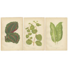
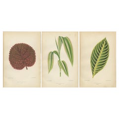
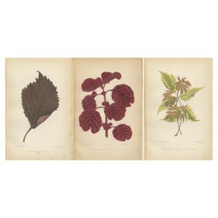
Decorative original antique botanical illustrations from "Les Plantes à Feuillage Coloré," published in 1880 in Paris with J. Rothschild as the editor. Each illustration depicts a different plant, characterized by its unique and colorful foliage, which was a common theme of interest during that period, especially among botanists and plant enthusiasts.
1. The first illustration shows "Maranta roseo-picta," commonly known as the Red-veined Prayer Plant...
Category
1880s Antique Benelux
Materials
Paper
Ancient Italy: Regions and Rome in the Roman Empire, Published in 1880
Located in Langweer, NL
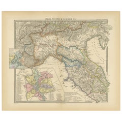
This print is an original detailed map titled "ITALIAE REGIONES I VII VIII IX XI," representing the regions of ancient Italy.
Key Features of the Print:
1. **Regional Demarcations...
Category
1880s Antique Benelux
Materials
Paper
Antique Decorative Coloured Map Egypt, Nubia, Abyssinia and more, 1882
Located in Langweer, NL
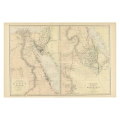
This image contains two maps, with the left one being labeled "Egypt" and the right one "Nubia, Abyssinia and the Adjacent Lands." These maps highlight the Nile Valley and surroundin...
Category
1880s Antique Benelux
Materials
Paper
Old Map of the Chinese Empire and Japan, 1882
Located in Langweer, NL
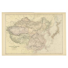
An original antique map titled "The Chinese Empire and Japan," dating from an 1882 atlas by Blackie & Son. It is a color map with geographical features such as mountain ranges, river...
Category
1880s Antique Benelux
Materials
Paper
Verdant Elegance: Botanical Artistry from 1880 Paris
Located in Langweer, NL
The three prints from "Les Plantes A Feuillage Colore Tome Second" feature illustrations of plants with distinctive and colorful foliage, a characteristic focus of the publication. H...
Category
1880s Antique Benelux
Materials
Paper
The Art of Botany: Colored Leaves from 1880 Paris
Located in Langweer, NL
The prints are original antique colored botanical illustrations from the second volume of "Les Plantes à Feuillage Coloré," published in Paris in 1880 with J. Rothschild as the edito...
Category
1880s Antique Benelux
Materials
Paper
Vibrant Botanicals: A Study of Leaf Patterns and Colors, Published in 1880
Located in Langweer, NL
These are beautifully detailed botanical illustrations from the second volume of "Les Plantes A Feuillage Colore," published in Paris in 1880, with J. Rothschild as the editor.
1. T...
Category
1880s Antique Benelux
Materials
Paper
Verdant Varieties: A Vintage Botanical Collection from 1880
Located in Langweer, NL
The original antique prints are from "Les Plantes à Feuillage Coloré" (Plants with Colored Foliage), Tome Second, which reflects the 19th-century European fascination with botany and...
Category
1880s Antique Benelux
Materials
Paper
A Symphony of Botanical Elegance: 19th-Century Colored Foliage Illustrations
Located in Langweer, NL
The prints are from "Les Plantes à Feuillage Coloré," which translates to "The Plants with Colored Foliage," and it appears to be the second volume, published in Paris in 1880 with J...
Category
1880s Antique Benelux
Materials
Paper
Verdant Variations: A Triptych of 19th Century Botanical Elegance, 1880
Located in Langweer, NL
These images are botanical prints from "Les Plantes à Feuillage Coloré, Tome Second," a book that was published in Paris in 1880 with J. Rothschild as the editor. This type of work i...
Category
1880s Antique Benelux
Materials
Paper
Botanical Elegance: Masterpieces of Victorian Horticulture, Published in 1880
Located in Langweer, NL
The decorative original antique prints are the second volume of "Les Plantes à Feuillage Coloré", published in Paris in 1880 by J. Rothschild, editor. These images are finely detaile...
Category
1880s Antique Benelux
Materials
Paper
Victorian Elegance: A Trio of Ornamental Foliage from 1880 Paris
Located in Langweer, NL
These are three botanical prints from "Les Plantes à Feuillage Coloré: Tome Second," published in Paris in 1880 by J. Rothschild, Editeur. Each print depicts a single plant leaf with...
Category
1880s Antique Benelux
Materials
Paper
ring set with Sapphire and diamonds 14k pink gold and silver
Located in The Hague, ZH
14k pink gold with silver ring set with sapphire and rose cut diamonds 1.00ct I/J - SI/P - ring size U.S. 7 - EU. 17.25 (54)
detailed description:
the top of the ring is in a oval ...
Category
1880s Dutch Early Victorian Antique Benelux
Materials
Diamond, Sapphire, Gold, 14k Gold, Silver
Earrings set with amethyst and pearls 18k yellow gold and silver
Located in The Hague, ZH
18k gold with silver ear clips with a central amethyst and entourage of pearls
detailed description:
the top of the ear clip is 2.3 cm high and 1.9 cm wide
weight 13.6 grams
set ...
Category
1880s Dutch Early Victorian Antique Benelux
Materials
Amethyst, Pearl, 18k Gold, Yellow Gold, Silver
Original Antique Coloured Map of Western Africa, Published in 1882
Located in Langweer, NL
This is a map of Western Africa from the 1882 Blackie & Son atlas. The map details the West African coast from the Sahara Desert in the north down to the Gulf of Guinea, including a ...
Category
1880s Antique Benelux
Materials
Paper
Chain with Pendant set with diamonds 14k yellow gold and silver
Located in The Hague, ZH
gold with silver pendant set with rose cut diamonds 2.00ct on a 14k yellow gold necklace - 45 cm
detailed description:
The length of the necklace is 45 cm long by 1.4 mm wide
the ...
Category
1880s Dutch Early Victorian Antique Benelux
Materials
Diamond, 14k Gold, Yellow Gold, Silver
Antique Map of Canada, The Province of Ontario and Part of Quebec, 1882
Located in Langweer, NL
This is a historical map from the 1882 Blackie Atlas, this time detailing "The Province of Ontario, and Part of Quebec" in Canada. The map presents a detailed illustration of Ontario...
Category
1880s Antique Benelux
Materials
Paper
Antique Decorative Coloured Map Marocco, Algeria and Tunis, 1882
Located in Langweer, NL
The maps is from the 1882 atlas by Blackie & Son and offers a detailed view of the North African regions as understood in the late 19th century.
**Map of Morocco, Algeria, and Tun...
Category
1880s Antique Benelux
Materials
Paper
Ring with emerald and diamonds 14k yellow gold
Located in The Hague, ZH
14k bicolor gold ring set with 3.50 carats cushion cut emerald and 82 rose cut diamonds 0.50 carats - ring size US. 8 - EU. 18.25(57)
detailed description:
The top of the ring is 9...
Category
1880s Dutch Early Victorian Antique Benelux
Materials
Diamond, Emerald, 14k Gold, Yellow Gold
Antique 19th Century Map of China by Blackie & Son, 1882
Located in Langweer, NL
This map is an 1882 Blackie & Son map of China. The title "CHINA." is prominently displayed at the bottom. The map is colored to differentiate various regions, possibly indicating di...
Category
1880s Antique Benelux
Materials
Paper
Decorative Antique Map of Eastern Canada, Published in 1882
Located in Langweer, NL
This is a historical map from the 1882 Blackie Atlas, focused on eastern Canada and the maritime provinces. The map is titled "Canada. No. 2. Provinces of Nova Scotia, New Brunswick,...
Category
1880s Antique Benelux
Materials
Paper
Ring with Sapphire and diamonds 14k pink gold
Located in The Hague, ZH
14k pink gold ring set with sapphire and old mine cut diamond 1.00 ct - ring size U.S. 9 - EU. 19.25(60)
detailed description:
the top of the ring is 9.5 mm wide
Ring size U.S. 9 ...
Category
1880s Dutch Early Victorian Antique Benelux
Materials
Diamond, Sapphire, Gold, 14k Gold
Original Map of Greece at the Time of the Dorian Migration, Published in 1880
Located in Langweer, NL
The map titled "GRAECIA TEMPORI MIGRATIONIS DORICAE," translates to "Greece at the Time of the Dorian Migration." This map showcases the regions of ancient Greece during the period f...
Category
1880s Antique Benelux
Materials
Paper
Gold and silver lock set with diamonds on a pearl bead necklace
Located in The Hague, ZH
14k yellow gold with silver clasp set with rose diamonds. 0.30ct on a two-row pearl necklace - 38 cm long
detailed description:
the necklace is 38 cm long and 1.3 mm wide
the size...
Category
1880s Dutch Early Victorian Antique Benelux
Materials
Diamond, Pearl, Gold, 14k Gold, Silver
The Roman Empire from the Time of Constantine the Great, Published in 1880
Located in Langweer, NL
Antique map titled: "IMPERIUM ROMANORUM inde a Constantini Magni tempore," which translates to "The Roman Empire from the time of Constantine the Great."
This map is designed to re...
Category
1880s Antique Benelux
Materials
Paper
Victorian Music Standard
Located in 'S-HERTOGENBOSCH, NL
An adjustable music standard in mahogany.
Category
1880s British High Victorian Antique Benelux
Materials
Mahogany
Ancient Realms of Northeast Africa: Arabia, Ethiopia, and Egypt, Published 1880
Located in Langweer, NL
This map, titled "ARABIA, AETHIOPIA, AEGYPTUS," illustrates the regions of ancient Arabia, Ethiopia, and Egypt.
Features that make this map interesting include:
1. **Geographical ...
Category
1880s Antique Benelux
Materials
Paper
Ring with Ruby verneuille and diamonds 18k yellow gold
Located in The Hague, ZH
18 kt yellow gold ring set with ruby verneuille and old mine cut diamonds tot. 0.40 ct - F/G - SI - ring size U.S. 8 - EU. 18(57)
detailed description:
the top of the ring is 1.3...
Category
1880s Dutch Early Victorian Antique Benelux
Materials
Diamond, 18k Gold, Yellow Gold
Ancient Iberia: Hispania Map from Spruner-Menke Atlas Antiquus, 1880
Located in Langweer, NL
This map is titled "HISPANIA," indicating it is a historical map of ancient Spain.
It is an original antique map from the "Spruner-Menke Atlas Antiquus," a 19th-century historical a...
Category
1880s Antique Benelux
Materials
Paper
Antique Map of The Kingdom of Alexander the Great, Published in 1880
Located in Langweer, NL
The map is titled "ALEXANDRI MAGNI REGNUM," which translates to "The Kingdom of Alexander the Great." It depicts the vast territories conquered by Alexander the Great during his reig...
Category
1880s Antique Benelux
Materials
Paper
Historical Map of Canaan with Insets of Jerusalem and Surrounding Regions, 1880
Located in Langweer, NL
The map titled "CANAAN" depicts the historical region known as Canaan, located in the Levant, which corresponds to modern-day Israel, Palestinian territories, Lebanon, and parts of S...
Category
1880s Antique Benelux
Materials
Paper
Necklace and pendant set with diamonds 14k yellow gold
Located in The Hague, ZH
14k yellow gold necklace with a pendant set with rose cut diamonds. 0.80ct – I/J – SI – 45 cm long
detailed description:
the necklace is 45 cm long and 0.7 mm wide
the pendant is ...
Category
1880s Dutch Early Victorian Antique Benelux
Materials
Diamond, 14k Gold, Yellow Gold
Necklace with pendant set with diamonds 14k yellow gold and silver
Located in The Hague, ZH
14k yellow gold necklace with a gold and silver pendant set with rose cut diamonds. 1.60ct - G/H - SI - 50 cm long
detailed description:
the necklace is 50 cm long and 1.0 mm wide....
Category
1880s Dutch Georgian Antique Benelux
Materials
Diamond, Yellow Gold, Silver
The World in the Assyrian Empire's Era: A Historical Map, Published in 1880
Located in Langweer, NL
This map from the "Spruner-Menke Atlas Antiquus" is titled "ORBIS TERRARVM regni Assyrii tempore," which translates to "The World at the Time of the Assyrian Kingdom." It depicts the...
Category
1880s Antique Benelux
Materials
Paper
Ancient Cartography of Britannia and Hibernia, Published in 1880
Located in Langweer, NL
This map depicts the geographical area of Great Britain and Ireland, labeled "BRITANNIA et HIBERNIA." It is a historical map, as indicated by the Latin titles and the classical names of regions and tribes.
In the main section of the map, Great Britain is depicted in fine detail, with topographical features such as mountains and rivers. The map is color-coded, to differentiate political or tribal boundaries. Various Roman place names are indicated, such as "Londinium" for London.
To the left of Great Britain is Ireland, referred to as "Hibernia," similarly detailed with its own topographical features and ancient...
Category
1880s Antique Benelux
Materials
Paper
Ring with pearl and diamonds 18k bicoulour gold
Located in The Hague, ZH
18k bicolour gold ring with pearl and rose cut diamond 0.10ct G/H - SI - ring size US. 7.5 - EU. 17.75 (56)
detailed description
the top of the ring is 1.4 cm wide and 7.5 mm high
...
Category
1880s Dutch Early Victorian Antique Benelux
Materials
Diamond, Pearl, Gold, 18k Gold
North African Coasts: Marmarica to Mauretania in Roman Times, Published in 1880
Located in Langweer, NL
The map with the title "MARMARICA, CYRENAICA, AFRICA, NUMIDIA, MAURETANIA secundum Italiam Poetarum" presents a historical geographical view of the northern coast of Africa, detailin...
Category
1880s Antique Benelux
Materials
Paper
Original Antique Map of Greece and Epirus after the Persian Wars, Published 1880
Located in Langweer, NL
The map titled "GRAECIA, EPIRUS post bella Persica," translates to "Greece and Epirus after the Persian Wars." It covers the regions of ancient Greece and Epirus following the Greco-Persian Wars, a series of conflicts between the Greek city-states and the Persian Empire during the 5th century BC.
What makes this map interesting:
1. **Historical Context**: The period after the Persian Wars was pivotal for ancient Greece, leading to the rise of Athens as a major power and the Golden Age of Athens.
2. **Inset Maps**: Detailed insets, such as the one showing the Acropolis of Athens, provide close-up views of historically significant locations.
3. **Topography**: It features the diverse terrain of Greece, from the rugged mountain ranges to the intricate coastlines and islands, influencing the development of Greek city-states.
4. **City-States**: The map likely details the various polis or city-states, such as Athens, Sparta, Thebes, and others, which played critical roles in the Persian Wars.
5. **Battle Sites**: It might mark important battle sites from the wars, like Marathon, Thermopylae, Salamis, and Plataea.
6. **Latin Labels**: The use of Latin for place names and descriptions adds to the map's scholarly quality.
7. **Cultural Landmarks**: The map may include locations of significant cultural and historical landmarks from the era, such as temples, theatres, and agoras.
This map is from the "Spruner-Menke Atlas Antiquus," compiled by Karl Spruner von Merz and edited by Theodorus Menke. The atlas, known for its detailed maps of historical and ancient geographies, was a significant educational tool in the 19th century.
The Greco-Persian Wars, which included famous battles such as Marathon and Salamis, were crucial for the preservation of Greek independence...
Category
1880s Antique Benelux
Materials
Paper
Roman Frontiers Engraved: Germania, Raetia, and Noricum, Published in 1880
Located in Langweer, NL
The map, titled "GERMANIA, RAETIA, NORICUM," depicts the regions of Germania, Raetia, and Noricum, which correspond to parts of modern-day Central and Eastern Europe, including areas of Germany, Austria, Switzerland, and the Balkans.
Features of the map include:
1. **Regional Divisions**: The map is divided into the regions of Germania, Raetia, and Noricum, each likely differentiated by color or shading.
2. **Topography**: It details the mountain ranges, rivers, and other geographical features of the region. The Alps, which are central to Raetia, are prominently displayed.
3. **Roman Settlements and Roads**: The map likely marks Roman...
Category
1880s Antique Benelux
Materials
Paper
Levant in Antiquity: Lands of Phoenicia, Judea, and Neighboring Kingdoms, 1880
Located in Langweer, NL
The map is titled "PHOENICE, COELESYRIA, IDUMAEA, JUDAEA MACCABAEORUM TEMPORE," which translates to "Phoenicia, Coele-Syria, Idumea, Judea at the Time of the Maccabees."
This origi...
Category
1880s Antique Benelux
Materials
Paper
Antique Map of The Regions of Italy and Sicily during the Roman Empire, 1880
Located in Langweer, NL
This map is an original antique engraving titled "ITALIAE REGIONES IIII SICILIA," which translates to "The Regions of Italy and Sicily." This detailed historical map portrays the reg...
Category
1880s Antique Benelux
Materials
Paper
Cluster ring set with diamonds 14k yellow gold and silver
Located in The Hague, ZH
18k gold with silver ring set with rose cut diamonds 0.50ct L/M - SI/P - ring size U.S. 7.5 - EU. 17.75 (56)
detailed description:
the top of the ring is 2.0 cm wide
weight 10.9 g...
Category
1880s Dutch Georgian Antique Benelux
Materials
Diamond, 14k Gold, Yellow Gold, Silver
Mediterranean Encounters: From the Punic Wars to the Hannibalic War, 1880
Located in Langweer, NL
The map, with the title "MARE INTERNUM cum populis adiacentibus a bello Hannibalico usque ad Vespasiani M. princip," depicts the Mediterranean Sea and its surrounding territories, ex...
Category
1880s Antique Benelux
Materials
Paper
Empires of Antiquity: The Persian Realm and Beyond Engraved, Published in 1880
Located in Langweer, NL
The map is titled "ORBIS TERRARUM regni Persici tempore," which translates from Latin to "The World at the Time of the Persian Empire." This map is particularly interesting for sever...
Category
1880s Antique Benelux
Materials
Paper
Imperium Romanum: A Detailed Map of the Roman Empire in its Zenith, 1880
Located in Langweer, NL
This original antique map, titled "IMPERIVM ROMANVM", is a detailed depiction of the Roman Empire at the height of its power. The main map encompasses the vast expanse of the Roman t...
Category
1880s Antique Benelux
Materials
Paper
Map of The Italian Peninsula with the islands of Sicily, Sardinia, Corsica, 1880
Located in Langweer, NL
This map, titled "ITALIA, Sicilia, Sardinia, Corsica," represents the Italian Peninsula along with the islands of Sicily, Sardinia, and Corsica. Inset maps offer detailed views of "R...
Category
1880s Antique Benelux
Materials
Paper
Brooch with diamonds 14k yellow gold and silver
Located in The Hague, ZH
14k yellow gold with silver brooch set with rose diamonds. 0.30ct - G/H - VS/SI
detailed description:
the size of the brooch is 6.1 cm by 1.2 cm wide
weight 5.5 grams
occupied wi...
Category
1880s Dutch Early Victorian Antique Benelux
Materials
Diamond, 14k Gold, Yellow Gold, Silver
14k gold clasp and garnet bead necklace with gold center piece - 44 cm long
Located in The Hague, ZH
14k gold clasp and garnet bead necklace with gold center piece - 44 cm long
detailed description:
the necklace is 44 cm long and 7.2 mm wide
The size of the center piece is approx...
Category
1880s Dutch Early Victorian Antique Benelux
Materials
Garnet, 14k Gold
Asia Minor and Provinces: A Roman Empire Map from Spruner-Menke Atlas, 1880
Located in Langweer, NL
This authentic map of the 19th century, titled "PONTUS ET BITHYNIA, ASIA, LYCIA ET PAMPHYLIA, GALATIA, CAPPADOCIA, SYRIA, CRET, CYPRVS," details the regions of Asia Minor and surroun...
Category
1880s Antique Benelux
Materials
Paper
Ancient Gaul: A Cartographic Overview of Gallic Tribes and Roman Provinces, 1880
Located in Langweer, NL
The print titled "GALLIA," is a historical map of ancient Gaul, which corresponds to modern-day France and parts of its surrounding countries. Here are the features and details noted...
Category
1880s Antique Benelux
Materials
Paper
Roman Balkans: Pannonia, Illyricum, Dacia, Moesia, Thracia, Macedonia and Thyris
Located in Langweer, NL
This original antique map showcases the Roman provinces in the Balkan region and parts of Central and Eastern Europe. The title "PANNONIA, ILLYRICUM DACIA, MOESIA, THRACIA, MACEDONIA...
Category
1880s Antique Benelux
Materials
Paper
Black Sea in Antiquity: Pontus Euxinus Map, Published in 1880
Located in Langweer, NL
This map, titled "PONTUS EUXINUS," depicts the Black Sea region, historically known as the Pontus Euxinus. The Black Sea was central to ancient trade routes and cultural exchange, bo...
Category
1880s Antique Benelux
Materials
Paper
Original Old Composite of Several Maps of the Ancient World on One Sheet, 1880
Located in Langweer, NL
This original antique map is from Karl Spruner von Merz's "Atlas Antiquus", later edited by Theodorus Menke. The map is a detailed depiction of the ancient world. The atlas it comes ...
Category
1880s Antique Benelux
Materials
Paper
Clamper Bracelet set with pearls and diamonds 14k yellow gold and silver
Located in The Hague, ZH
14k yellow gold hinge bracelet with a silver top set with various rose diamonds. 1.00ct – G/H – SI – inner size 5.7 cm x 5.1 cm wide
detailed description
the top of the bracelet is...
Category
1880s Dutch Early Victorian Antique Benelux
Materials
Diamond, Pearl, 14k Gold, Yellow Gold, Silver
The World After the Battle of Corupedium: Hellenistic Kingdoms Map, 1880
Located in Langweer, NL
The map is titled "ORBIS TERRARUM post proelium Corupedinse," which translates to "The World after the Battle of Corupedium." This battle, which took place in 281 BC in Lydia, was th...
Category
1880s Antique Benelux
Materials
Paper
Roman Italy and Provinces: A Cartographic Snapshot, 1880
Located in Langweer, NL
The map titled "ITALIA, Gallia Cisalpina, Sicilia, Sardinia, Corsica" focuses on Italy and its surrounding regions during Roman times. It offers a detailed depiction of the Italian peninsula, the Po Valley (Gallia Cisalpina), and the islands of Sicily, Sardinia, and Corsica.
Produced as part of the "Spruner-Menke Atlas Antiquus" by Karl Spruner von Merz and edited by Theodorus Menke, this map reflects the 19th-century European scholarship on ancient geography and history.
The period represented is likely during the Roman Republic or early Roman Empire, suggested by the level of detail in regions like Latium and Campania, which were central to Roman culture and power. This era was marked by Roman expansion and consolidation of the Italian peninsula, as well as the Punic Wars, which led to Roman dominance over the Mediterranean.
What makes this map interesting is its:
1. **Rich Detail**: The map delineates the intricate network of Roman roads, cities, and colonies, showing the infrastructure that facilitated Roman administration and control.
2. **Strategic Locations**: It identifies strategic locations like harbors and passes, crucial for trade and military campaigns.
3. **Geographic Accuracy**: It reflects the geographical knowledge of the time, with an accurate representation of the topography that shaped the development of these regions.
4. **Cultural and Historical Sites**: Insets of important sites like Syracuse offer a closer look at places of historical significance.
5. **Educational Purpose**: The map was designed to aid in the study of Roman history, providing a visual tool for understanding the ancient world...
Category
1880s Antique Benelux
Materials
Paper
Old Map of Mediterranean Powers: Pompey to Actium (66-31 BC), Published in 1880
Located in Langweer, NL
This is a historical map that depicts the Mediterranean region during a specific timeframe in Roman history, from the return of Pompey the Great after his campaign in Asia Minor to t...
Category
1880s Antique Benelux
Materials
Paper
Ancient Cartography of the Indian Subcontinent, Published in 1880
Located in Langweer, NL
This map is titled "INDIA," and it provides a detailed view of the Indian subcontinent with various inset maps that offer additional historical and geographical context.
The main ma...
Category
1880s Antique Benelux
Materials
Paper
Antique Map Depicting Sydney and Surrounding Areas, Known as Port Jackson, c1889
Located in Langweer, NL
An antique map depicting Sydney and its surrounding areas, known as Port Jackson, dating from around 1889. It was produced by E. Reclus and is part of the "Nouvelle géographie univer...
Category
1880s Antique Benelux
Materials
Paper
Late 19th Century Country House Side Chair
Located in Beerse, VAN
Very decorative country house side chair.
It's a so-called "Captain's Chair" and probably made at the end of the 19th Century. About 1880.
T...
Category
1880s Danish Country Antique Benelux
Materials
Wood
