Antique Geography
100
to
261
1,530
519
959
715
476
389
389
336
255
177
128
118
117
108
102
93
82
70
52
39
38
30
29
29
25
24
24
23
21
20
20
20
18
16
16
15
15
14
12
11
11
10
9
8
7
6
5
5
4
3
2
25
19
16
14
10
Sort By
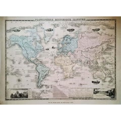
1864 Original illustrated planisphere - World Map - Geography
Located in PARIS, FR
and wonder to your interior with this unique Historical Planisphere. 📜✨
Map - Geography
Edit
Category
1860s Antique Geography
Materials
Linen, Paper, Lithograph
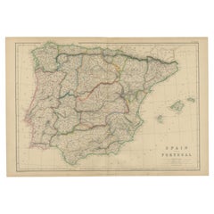
Vintage Geographic Splendor: 1859 Spain and Portugal
Located in Langweer, NL
The "Vintage Geographic Splendor: 1859 Spain and Portugal" map is an original antique piece from
Category
Mid-19th Century Antique Geography
Materials
Paper
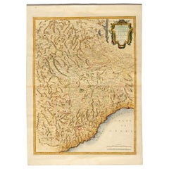
Geographical Antique Map of Principality of Monaco
By Bruno Santini
Located in Alessandria, Piemonte
ST/609 - Interesting antique color map of Monaco Principality in French language : "Carte qui contient le Principauté de Piémont, le Monferrat et la comté de Nice avec la Rivière de ...
Category
Late 18th Century Italian Other Antique Geography
Materials
Paper
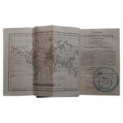
First Edition Guthrie's Geographical Grammmar in Miniature, 1807
Located in Langweer, NL
First edition of 'Guthrie's Geographical Grammar in Miniature'. 358 p. 13 fold. engr. maps, contemp
Category
Early 19th Century Antique Geography
Materials
Paper
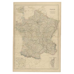
1859 Classic Map of France: Blackie's Imperial Geographic Masterpiece
Located in Langweer, NL
The "Antique Map of France" from 'The Imperial Atlas of Modern Geography', published in 1859 by W
Category
Mid-19th Century Antique Geography
Materials
Paper
H 21.26 in W 14.57 in D 0.02 in
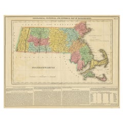
Antique Geographical, Historical and Statistical Map of Massachusetts, 1822
Located in Langweer, NL
extensive text outlining the geography, climate, and political composition of the state. The map, designed
Category
1820s Antique Geography
Materials
Paper
H 17.13 in W 21.46 in D 0 in
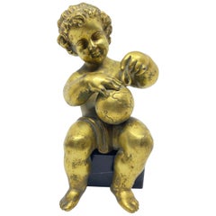
Gilt Bronze Boy Allegory of Geography, French, 18th Century
Located in Kensington, MD
geography. This bronze was cast using the lost wax technique and is fire gilded. He sits, but is not affixed
Category
Late 18th Century French Baroque Antique Geography
Materials
Marble, Bronze
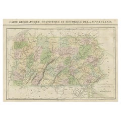
French Geographical, Statistical and Historical Map of Pensylvania, 1825
Located in Langweer, NL
Maryland, Delaware, New York and New jersey. Printed on the same page as the map is geographical
Category
1820s Antique Geography
Materials
Paper
H 20.08 in W 25.99 in D 0 in
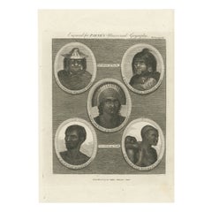
Portraits of the World: Engraved Illustrations for Payne's Universal Geography
Located in Langweer, NL
An original antique engraving titled "Engraved for PAYNE'S Universal Geography."
This title
Category
1790s Antique Geography
Materials
Paper
Free Shipping
H 11.62 in W 8.27 in D 0 in
Circa 1850 French Gold Leaf Mirror, The Allegory of Geography
Located in Dallas, TX
mirror (circa 1850) is topped by a winged cherub and a globe, representing the Allegory of Geography. An
Category
1850s French Napoleon III Antique Geography
Materials
Glass, Wood, Giltwood
Burgos 1902: Geographic Map of Castile's Historic Heartland in Spain
Located in Langweer, NL
The map of the province of Burgos in the autonomous community of Castile and León in Spain, dated 1902. It includes the following features:
The map highlights the varied terrain wit...
Category
Early 1900s Antique Geography
Materials
Paper
Free Shipping
H 14.77 in W 20.08 in D 0 in
Girona 1902: Geographic and Infrastructural Map of Catalonia’s Northern Province
Located in Langweer, NL
The map provided is of the province of Girona (in Catalan, Girona), located in the northeast of Spain, within the autonomous community of Catalonia, as of the year 1902. Here are the...
Category
Early 1900s Antique Geography
Materials
Paper
Free Shipping
H 14.77 in W 20.08 in D 0 in
Set of 4 Antique Geographical Maps French-German War 1870-71
Located in Casale Monferrato, IT
Elegant late 19th century set of four antique geographical maps relating to the positioning of the
Category
1890s Italian Antique Geography
Materials
Paper
1859 Vintage Maps of England and Wales: Blackie's Imperial Geographic Detail
Located in Langweer, NL
The "Antique Map of England & Wales" from 'The Imperial Atlas of Modern Geography', published by W
Category
Mid-19th Century Antique Geography
Materials
Paper
H 14.57 in W 21.26 in D 0.02 in
1859 Vintage Map of Holland and Belgium: Blackie's Imperial Geographic Insight
Located in Langweer, NL
The "Antique Map of Holland and Belgium" from 'The Imperial Atlas of Modern Geography', published
Category
Mid-19th Century Antique Geography
Materials
Paper
H 21.26 in W 14.57 in D 0.02 in
Huesca 1901: A Geographic Overview of Aragon's Northern Frontier in Spain
Located in Langweer, NL
The map provided is of the province of Huesca, located in the northeastern part of Spain, within the autonomous community of Aragon, as of the year 1901. Here are some of the key fea...
Category
Early 1900s Antique Geography
Materials
Paper
Free Shipping
H 20.08 in W 14.77 in D 0 in
1877 "Geological and Geographical Atlas of Colorado" by F. V. Hayden
Located in Colorado Springs, CO
This is F. V. Hayden's Geological and Geographical Atlas of Colorado and Portions of Adjacent
Category
1870s American Antique Geography
Materials
Paper
Ávila in a Historical Map of 1902: A Geographic and Administrative Overview
Located in Langweer, NL
and León in Spain, and it is dated from 1902. The map illustrates several geographic and man-made
Category
Early 1900s Antique Geography
Materials
Paper
Free Shipping
H 14.77 in W 20.08 in D 0 in
Álava in Northern Spain: The Geography of Basque Heritage and Terrain, 1902
Located in Langweer, NL
. Benito Chias y Carbo, a known cartographer.
The map features various elements common to geographic maps
Category
Early 1900s Antique Geography
Materials
Paper
Free Shipping
H 14.77 in W 20.08 in D 0 in
Atlas Minor Du Monde World Geography 1695 17th Century in Hand Colored
By Pierre Mortier
Located in Diest, Vlaams Brabant
World Atlas Minor world107 detailed maps and overviews
Hand colored
17th century, dated 1695
Complete with minor and old original paper restoration.
Category
17th Century Dutch Renaissance Antique Geography
Materials
Paper
H 2.76 in W 29.53 in D 21.26 in
Antique Map of the British Isles According to the Geography of the Roman Empire
Located in Langweer, NL
shows a rudimentary outline of the islands according to the geography of the Roman Empire, after
Category
Late 18th Century Antique Geography
Materials
Paper
H 8.08 in W 10.24 in D 0.02 in
Original 1859 Map of Asia from W.G. Blackie's Imperial Atlas of Modern Geography
Located in Langweer, NL
Atlas of Modern Geography’. Published by W. G. Blackie, 1859.
The "Classic Cartographic Masterpiece
Category
Mid-19th Century Antique Geography
Materials
Paper
H 14.57 in W 21.26 in D 0.02 in
Large Antique Map of Asia The Royal Atlas of Modern Geography by Johnston, 1882
Located in Langweer, NL
Atlas of Modern Geography, Exhibiting, in a Series of Entirely Original and Authentic Maps, the Present
Category
19th Century Antique Geography
Materials
Paper
H 19.53 in W 24.22 in D 0 in
A Cary’s 15 inch terrestrial globe 1849
By George & John Cary
Located in Lymington, Hampshire
, Drawn from the most recent Geographical Works shewing the whole of the New Discoveries (with) Tracks of
Category
19th Century English Antique Geography
Materials
Mahogany
Ancient Cartography of Britannia and Hibernia, Published in 1880
Located in Langweer, NL
This map depicts the geographical area of Great Britain and Ireland, labeled "BRITANNIA et HIBERNIA
Category
1880s Antique Geography
Materials
Paper
Free Shipping
H 18.51 in W 15.56 in D 0 in
Antique Map of Egypt, John Bartholomew & Sons Ltd C. 1880
Located in Atlanta, GA
Egypt Map - The Edinburgh and Geographical Institute, John Bartholomew & Son LTD, W & R Chambers
Category
19th Century Scottish Antique Geography
Materials
Giltwood, Paper
Antique Decorative Coloured Map of North America, 1882
Located in Langweer, NL
shading for mountainous terrain, and hand coloring.
3. **Geographic Features**: The map details
Category
1880s Antique Geography
Materials
Paper
Map of Greece, Macedonia, Thrace from the time of the Peloponnesian War, 1880
Located in Langweer, NL
, Plataeae, and others, provide focused geographical information on important battle sites and regions
Category
1880s Antique Geography
Materials
Paper
No Reserve
H 15.56 in W 18.51 in D 0 in
Colorful Detailed Antique Map of Europe, Published in 1882
Located in Langweer, NL
"The Antique Map of Europe from 'The Comprehensive Atlas and Geography of the World,' published in
Category
1880s Antique Geography
Materials
Paper
Final Voyage: The Death of Captain Cook at Kealakekua Bay, Hawaii, 1779
Located in Langweer, NL
Copper engraving from Thomas Bankes’s “New System of Geography” published by Royal Authority c.1775
Category
1770s Antique Geography
Materials
Paper
The Khoikhoi of Southwestern Africa, Original Engraving of circa 1801
Located in Langweer, NL
C. Cooke for a work titled "Modern & Authentic System of Universal Geography." As for the engraver
Category
Early 1800s Antique Geography
Materials
Paper
Free Shipping
H 10.44 in W 7.88 in D 0 in
Mid-19th Century Decorative Map of India with Cultural and Natural Vignettes
Located in Langweer, NL
art form as a means of geographic representation.
John Tallis & Company, founded by John Tallis, was
Category
1850s Antique Geography
Materials
Paper
H 14.26 in W 10.71 in D 0 in
Antique Map of The Regions of Italy and Sicily during the Roman Empire, 1880
Located in Langweer, NL
contour lines to indicate elevation. Rivers and lakes are also marked, adding to the geographical detail
Category
1880s Antique Geography
Materials
Paper
Free Shipping
H 18.51 in W 15.56 in D 0 in
Ancient Crossroads: Albania to Assyria in Antiquity, Published in 1880
Located in Langweer, NL
, Babylonia, and Armenia, with a history that stretches back thousands of years.
2. **Geographical Features
Category
1880s Antique Geography
Materials
Paper
Free Shipping
H 18.51 in W 15.56 in D 0 in
Relics of Antiquity: Egyptian Sphinx and Colossal Statues of Canopus, 1801
Located in Langweer, NL
print showcases two striking images from George Alexander Cooke's "Universal Geography." The upper panel
Category
Early 1800s Antique Geography
Materials
Paper
Free Shipping
H 10.44 in W 7.88 in D 0 in
Roman Italy and Provinces: A Cartographic Snapshot, 1880
Located in Langweer, NL
-century European scholarship on ancient geography and history.
The period represented is likely during
Category
1880s Antique Geography
Materials
Paper
Silhouette of Antiquity: The Great Sphinx of Giza in Egypt, 1801
Located in Langweer, NL
"Universal Geography" .
The print is part of George Alexander Cooke's comprehensive work "A Modern and
Category
Early 1800s Antique Geography
Materials
Paper
Free Shipping
H 7.88 in W 10.44 in D 0 in
Threshold of Divinity: The Dendera Isis Temple Doorway in Upper Egypt, 1801
Located in Langweer, NL
is a circa 1801 copperplate engraving from George Alexander Cooke's "Universal Geography" .
The
Category
Early 1800s Antique Geography
Materials
Paper
Free Shipping
H 7.88 in W 10.44 in D 0 in
1880s Map of The Italian Alps from Milan to Lake Garda
Located in Roma, IT
Geographical Map of the Profile and Elevation of the Italian Alps from Milano to Lake Garda. The
Category
1880s Italian Antique Geography
Materials
Parchment Paper
Decorative Antique Map of Eastern Canada, Published in 1882
Located in Langweer, NL
of contour lines.
Major cities, towns, rivers, and other geographical features are noted, allowing
Category
1880s Antique Geography
Materials
Paper
Free Shipping
H 14.97 in W 22.45 in D 0 in
Antique Map Depicting Burma, Siam, Annam (Vietnam) and Japan, 1882
Located in Langweer, NL
important geographical landmarks are marked.
**JAPAN Map:**
The map of Japan shows the main islands
Category
1880s Antique Geography
Materials
Paper
Free Shipping
H 14.97 in W 22.45 in D 0 in
North African Coasts: Marmarica to Mauretania in Roman Times, Published in 1880
Located in Langweer, NL
" presents a historical geographical view of the northern coast of Africa, detailing regions that correspond
Category
1880s Antique Geography
Materials
Paper
Free Shipping
H 15.56 in W 18.51 in D 0 in
Ceremonial Rites: A Human Sacrifice in Otaheite (Tahiti), 1801
Located in Langweer, NL
Cooke's "Universal Geography" .
The print is part of George Alexander Cooke's comprehensive work "A
Category
Early 1800s Antique Geography
Materials
Paper
Free Shipping
H 7.88 in W 10.44 in D 0 in
Title: Mid-19th Century Map of Australasia by Carl Flemming - 1855
Located in Langweer, NL
the Australian continent, which is depicted with its major geographical features, including mountain
Category
1850s Antique Geography
Materials
Paper
No Reserve
H 14.06 in W 17.52 in D 0 in
Eternal Gaze: An Alaskan Enigma by John Webber, Circa 1795
Located in Langweer, NL
Geography," around the year 1795, this piece embodies the intersection of art, exploration, and anthropology
Category
Late 18th Century Antique Geography
Materials
Paper
Guardian of Nootka Sound: A Lyddiker Etching from John Webber's Artistry, 1795
Located in Langweer, NL
George Alexander Cooke's "Modern and Authentic System of Universal Geography." Dated around 1795, this
Category
Late 18th Century Antique Geography
Materials
Paper
H 10.63 in W 8.27 in D 0 in
Indigenous Peoples of the Bering Sea: Portraits from the 18th-Century Engravings
Located in Langweer, NL
Geography," published by royal authority.
The top two portraits are labeled "A Woman of Oonalashka" and "A
Category
1780s Antique Geography
Materials
Paper
Free Shipping
H 15.36 in W 9.85 in D 0 in
Original Historical Map of L'Ile De La Martinique by Vaugondy, 1749
Located in Langweer, NL
cartographic masterpiece offers a detailed and comprehensive view of Martinique's geographical features. From
Category
1740s Antique Geography
Materials
Paper
No Reserve
H 8.27 in W 11.42 in D 0 in
Old Map of the Chinese Empire and Japan, 1882
Located in Langweer, NL
& Son. It is a color map with geographical features such as mountain ranges, rivers, and political
Category
1880s Antique Geography
Materials
Paper
Elementary playful atlas composed of a puzzle, by D. Locchi, Paravia, Italy 1920
Located in Milan, IT
paper faces. Each of the faces of each die participates in a geographical table, or elementary atlas, on
Category
Early 20th Century Italian Antique Geography
Materials
Fruitwood, Paper
H 1.25 in W 12.5 in D 10.25 in
Authentic Old Map of Arabia with Original Border Coloring, 1745
Located in Langweer, NL
geographical accuracy and attention to detail characteristic of his maps. It provides a comprehensive depiction
Category
1740s Antique Geography
Materials
Paper
Echoes of Thebes: The Luxor Palace Ruins in Upper Egypt, 1801
Located in Langweer, NL
engraving from George Alexander Cooke's "Universal Geography" .
The print is part of George Alexander
Category
Early 1800s Antique Geography
Materials
Paper
Free Shipping
H 7.88 in W 10.44 in D 0 in
Natives Of Caria, A Province Of Anatolia In Turkey In Asia, 1801
Located in Langweer, NL
"Universal Geography" .
The print is part of George Alexander Cooke's comprehensive work "A Modern and
Category
Early 1800s Antique Geography
Materials
Paper
Free Shipping
H 7.88 in W 10.44 in D 0 in
Antique Print of a Sea Otter of Nootka Sound in British Columbia, Canada, 1801
Located in Langweer, NL
engraving from George Alexander Cooke's "Universal Geography" .
More info on its publication: The print is
Category
Early 1800s Antique Geography
Materials
Paper
Free Shipping
H 7.88 in W 10.44 in D 0 in
Diplomatic Dawn: The First Encounter of Wallis with Queen Oberea of Tahiti, 1801
Located in Langweer, NL
engraving from George Alexander Cooke's "Universal Geography" .
The print is part of George Alexander
Category
Early 1800s Antique Geography
Materials
Paper
Free Shipping
H 10.44 in W 7.88 in D 0 in
Encounters at Dawn: The Standoff at Tahiti with Captain Wallis Engraved, 1801
Located in Langweer, NL
: This is a circa 1801 copperplate engraving from George Alexander Cooke's "Universal Geography" .
The
Category
Early 1800s Antique Geography
Materials
Paper
Free Shipping
H 7.88 in W 10.44 in D 0 in
Roman Frontiers Engraved: Germania, Raetia, and Noricum, Published in 1880
Located in Langweer, NL
. **Topography**: It details the mountain ranges, rivers, and other geographical features of the region. The Alps
Category
1880s Antique Geography
Materials
Paper
No Reserve
H 15.56 in W 18.51 in D 0 in
Antique Lithograph of the Aborigines of South America, 1882
Located in Langweer, NL
South America", an antique print from Blackie's Comprehensive Atlas and Geography, circa 1882. This
Category
1880s Antique Geography
Materials
Paper
Vigilance in the Tropics: The Spear-Thrower of New Caledonia, 1801
Located in Langweer, NL
This engraving from George Alexander Cooke's "A Modern and Authentic System of Universal Geography
Category
Early 1800s Antique Geography
Materials
Paper
Free Shipping
H 10.44 in W 7.88 in D 0 in
Barados and St Christopher or St Kitts and Nevis Islands in the Caribbean, 1748
Located in Langweer, NL
intricate cartographic skills of Le Rouge. It meticulously outlines the geography, coastal features
Category
Mid-18th Century Antique Geography
Materials
Paper
H 13.98 in W 9.65 in D 0 in
- 1
- ...
Get Updated with New Arrivals
Save "Antique Geography", and we’ll notify you when there are new listings in this category.
Antique Geography For Sale on 1stDibs
Choose from an assortment of styles, material and more with respect to the antique geography you’re looking for at 1stDibs. Frequently made of paper, metal and wood, every antique geography was constructed with great care. There are many kinds of the antique geography you’re looking for, from those produced as long ago as the 18th Century to those made as recently as the 20th Century. When you’re browsing for the right antique geography, those designed in Baroque, Georgian and Industrial styles are of considerable interest. A well-made antique geography has long been a part of the offerings for many furniture designers and manufacturers, but those produced by Bruno Santini, C.H. Delagrave and Delamarche and Dien are consistently popular.
How Much is a Antique Geography?
Prices for an antique geography can differ depending upon size, time period and other attributes — at 1stDibs, they begin at $75 and can go as high as $32,221, while the average can fetch as much as $1,279.
More Ways To Browse
Map Of Normandy
Romania Map
Gien Renaissance
Sand Majolica
North Carolina Map
Venezuela Antique Map
Map Of North Carolina
French Blue Tone Planter
Antique Portuguese Chandelier
Greenland Map
Antique Map New South Wales
Antique Map Of Turkish Empire
Naples Map
Pudding Stone
Antique Vintage Emerald Earrings
Antique Nautical Books
Majolica Urbino
Antique Map By Coronelli
