City Map Art
6
to
94
1,341
466
1,145
798
407
263
243
114
113
105
66
65
53
47
45
41
39
39
37
35
35
33
27
22
19
19
17
15
14
12
11
9
9
9
8
6
6
6
5
5
5
4
4
4
4
4
3
3
3
3
3
2
2
2
2
2
2
1
1
1
1
1
103
97
61
54
51
Sort By
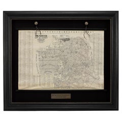
1915 "San Francisco City and County" Hanging Map by W. Bashford Smith
Located in Colorado Springs, CO
1915, this map indicates streets and city districts, and, most notably, shows the site of the Panama
Category
Vintage 1910s American Art Deco Maps
Materials
Wood, Paper
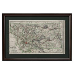
"Clason's Guide Map of Montana" by The Clason Map Company, Circa 1920s
Located in Colorado Springs, CO
transitioned to railroad and city maps of the local area. In the 1920’s, as cars became more commonplace, the
Category
Vintage 1920s American Art Deco Maps
Materials
Paper
H 23.13 in W 33.88 in D 1.5 in
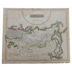
1814 Map of "Russian Empire" Ric.r032
Located in Norton, MA
detail. Thomson's work, including this map, represents some of the finest cartographic art of the 19th
Category
Antique 19th Century Unknown Maps
Materials
Paper
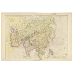
Historical Map Depicting the Continent of Asia, 1882
Located in Langweer, NL
This 1882 map presents a meticulously detailed representation of the continent of Asia, a testament
Category
Antique 1880s Maps
Materials
Paper
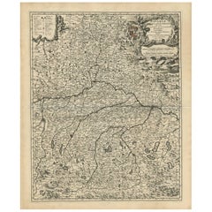
Antique Map of Bavaria with many details, Germany
Located in Langweer, NL
(..)'. Dutch map of Bavaria, showing the many cities, towns, and other features of this historically
Category
Antique Late 17th Century Maps
Materials
Paper
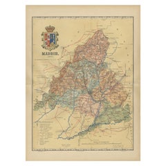
Madrid 1901: A Historical Map of Spain's Capital Province
Located in Langweer, NL
politically. The city is renowned for its rich repositories of European art, including the Prado Museum's
Category
Antique Early 1900s Maps
Materials
Paper
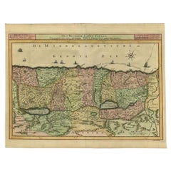
Antique Map of the Holy Land by Schut, 1710
Located in Langweer, NL
Antique map of the Holy Land titled 'Het Beloofde Landt Canaan.' Very detailed and decorative map
Category
Antique 18th Century Maps
Materials
Paper
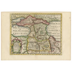
Historical Map of the Black Sea and Surrounding Regions, 1705
Located in Langweer, NL
-Beschryving," this map is not only a geographic document but also a piece of art, which would have been prized
Category
Antique Early 1700s Maps
Materials
Paper
Free Shipping
H 8.67 in W 11.89 in D 0 in
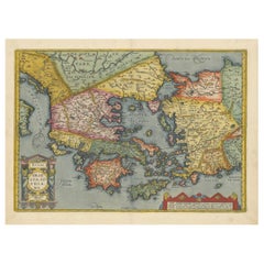
Antique Map of Greece from Ortelius's Theatrum Orbis Terrarum, 1595
Located in Langweer, NL
enthusiasts of historical maps:
1. **Athens (Athenae)** - The historic city-state, known for its rich
Category
Antique 16th Century Maps
Materials
Paper
Free Shipping
H 17.92 in W 21.86 in D 0 in
1644 Janssonius Original Wine Regions Map: The Ducal and Comital Burgundy
Located in Langweer, NL
, rivers, and important cities, enhancing both the map's utility and its aesthetic appeal.
The elaborate
Category
Antique 1640s Maps
Materials
Paper
Free Shipping
H 19.1 in W 22.84 in D 0 in
19th Century Illustrated Map of Ceylon (Sri Lanka) with Notable Landmarks
Located in Langweer, NL
John Tallis & Company is known for producing maps and atlases that were highly regarded for their
Category
Antique 1850s Maps
Materials
Paper
H 14.26 in W 10.71 in D 0 in
Cartographic Elegance of Touraine: A 17th-Century Map Showing French Heritage
Located in Langweer, NL
"Ducatus Turonensis - Touraine," is a original antique historical map of the Touraine region, which
Category
Antique 1630s Maps
Materials
Paper
Free Shipping
H 20.08 in W 23.82 in D 0 in
1864 Johnson's Map of the World on Mercator's Projection, Ric.B009
Located in Norton, MA
attention to detail and the fine steel engraving make them works of art. Johnson maps are characterized by
Category
Antique 19th Century Dutch Maps
Materials
Paper
Original Antique Map of the Western Part of NEW MEXICO & CALIFORNIA
Located in Langweer, NL
Title: "Map of the Western Part of NEW MEXICO and CALIFORNIA According to the Latest Discoveries by
Category
Antique 1760s Maps
Materials
Paper
Mid-19th Century Decorative Map of Asia with Cultural and Natural Vignettes
Located in Langweer, NL
John Tallis & Company, known for their decorative mid-19th-century maps, created this map of Asia
Category
Antique 1850s Maps
Materials
Paper
H 10.71 in W 14.26 in D 0 in
Striking Antique Map of Luxembourg and Northern France 'Lotharingen', c.1680
Located in Langweer, NL
.' -
Striking map of Luxembourg and Northern France. Includes the cities of Toul, Nancy, Metz and Trier
Category
Antique 1680s Maps
Materials
Paper
H 18.71 in W 22.25 in D 0 in
An Ornate and Historical Tallis Map of Jamaica with Decorative Vignettes, 1851
Located in Langweer, NL
ornamented map offers a window into Jamaica's landscapes, important cities, and maritime activities during
Category
Antique 1850s Maps
Materials
Paper
H 10.71 in W 14.26 in D 0 in
Original Antique Hand-Colored Map of Friesland by C. Merian, 1659
Located in Langweer, NL
engravings of cities and landscapes, often with a bird's-eye view perspective, which were highly regarded for
Category
Antique Mid-17th Century Maps
Materials
Paper
Free Shipping
H 11.74 in W 14.3 in D 0.02 in
Mid-19th Century Decorative Map of India with Cultural and Natural Vignettes
Located in Langweer, NL
The Tallis maps, including the one of India, are known for their detailed and ornamental style
Category
Antique 1850s Maps
Materials
Paper
H 14.26 in W 10.71 in D 0 in
Antique Double Hemisphere World Map with California as an Island, 1710
Located in Langweer, NL
Description: Antique map titled 'De Werelt Caart'. First state (out of three) antique double
Category
Antique 1710s Maps
Materials
Paper
Map of New Zealand Showing Maori Culture and Early Colonial Settlements, 1851
Located in Langweer, NL
John Tallis & Company were renowned for their ornate and detailed maps in the mid-19th century
Category
Antique 1850s Maps
Materials
Paper
H 14.26 in W 10.71 in D 0 in
An Old Illustrated Tallis Map of Central America with Volcanic Vignettes, 1851
Located in Langweer, NL
illustrations on Tallis maps usually include important cities, landmarks, local flora, fauna, and scenes
Category
Antique 1850s Maps
Materials
Paper
H 10.71 in W 14.26 in D 0 in
Decorative Hand-Coloured Antique Map of the Four Irish Provinces, Ireland, c1718
Located in Langweer, NL
), was a German engraver, art dealer and publisher. He was born at Redwitz, Free imperial city of Eger in
Category
Antique 1710s Maps
Materials
Paper
H 20.08 in W 15.75 in D 0 in
Original Antique Detailed Map of the Rhine and Moselle River Regions, ca.1680
Located in Langweer, NL
family were important art dealers and map publishers in Amsterdam. The founder of the business, C. J
Category
Antique 1680s Maps
Materials
Paper
H 20.87 in W 24.02 in D 0 in
Original Old Composite of Several Maps of the Ancient World on One Sheet, 1880
Located in Langweer, NL
This original antique map is from Karl Spruner von Merz's "Atlas Antiquus", later edited by
Category
Antique 1880s Maps
Materials
Paper
Free Shipping
H 15.56 in W 18.51 in D 0 in
Large Copper Engraved Map of the Coastline of Friesland and Terschelling, c.1670
Located in Langweer, NL
: Bernardus Schotanus a Sterringa (1640-1704). Publisher: The Visscher family were art and map dealers in
Category
Antique 1670s Maps
Materials
Paper
H 20.28 in W 23.9 in D 0 in
Antique Map of the Rhine and Moselle River Region in Germany and France, c.1680
Located in Langweer, NL
family were important art dealers and map publishers in Amsterdam. The founder of the business, C. J
Category
Antique 17th Century Maps
Materials
Paper
H 20.4 in W 23.94 in D 0 in
Mapping History: The Decorative Cartography of Indre-et-Loire by Levasseur, 1856
Located in Langweer, NL
captured, making this map not only a navigational tool but also a work of art.
The addition of outline
Category
Antique 1850s Maps
Materials
Paper
H 20.67 in W 14.34 in D 0 in
Ornate Cartography of Colonial Grandeur: The West India Islands around 1851
Located in Langweer, NL
but also historical artifacts and works of art.
The map includes islands such as Cuba, Jamaica
Category
Antique 1850s Maps
Materials
Paper
No Reserve
H 10.71 in W 14.26 in D 0 in
The Roman Empire from the Time of Constantine the Great, Published in 1880
Located in Langweer, NL
Antique map titled: "IMPERIUM ROMANORUM inde a Constantini Magni tempore," which translates to "The
Category
Antique 1880s Maps
Materials
Paper
No Reserve
H 15.56 in W 18.51 in D 0 in
Huesca 1901: A Geographic Overview of Aragon's Northern Frontier in Spain
Located in Langweer, NL
The map provided is of the province of Huesca, located in the northeastern part of Spain, within
Category
Antique Early 1900s Maps
Materials
Paper
Free Shipping
H 20.08 in W 14.77 in D 0 in
Málaga 1901: A Cartographic Detailing of Andalusia's Coastal Jewel
Located in Langweer, NL
The map depicts the province of Málaga, located in the autonomous community of Andalusia in
Category
Antique Early 1900s Maps
Materials
Paper
Free Shipping
H 14.77 in W 20.08 in D 0 in
Barcelona 1901: A Cartographic Portrait of Catalonia's Capital Province
Located in Langweer, NL
This orignal antique map is a historical depiction of the province of Barcelona from 1901.
It
Category
Antique Early 1900s Maps
Materials
Paper
Free Shipping
H 14.77 in W 20.08 in D 0 in
Levasseur's 1852 Cartographic Portrait of Gironde: Celebrating the Bordeaux Wine
Located in Langweer, NL
products.
Maps from this era, especially those by Levasseur, are notable for their combination of art and
Category
Antique 1850s Maps
Materials
Paper
H 20.67 in W 14.06 in D 0 in
Albacete, Spain - 1902: A Cartographic Depiction of Landscape and Infrastructure
Located in Langweer, NL
historical map of the province of Albacete, dated 1902, from the "Atlas Geográfico Ibero-Americano España" by
Category
Antique Early 1900s Maps
Materials
Paper
Free Shipping
H 14.77 in W 20.08 in D 0 in
London, City and West End. Antique Map City Plan Chromolithograph, circa 1895
Located in Melbourne, Victoria
'London (City Und Westend)'
Colour lithograph. 1895.
250mm by 305mm (sheet).
Late 19th century
Category
Late 19th Century Victorian More Prints
Materials
Lithograph
Singapore. Antique Map City Plan Chromolithograph, circa 1895
Located in Melbourne, Victoria
'Singapur'
Colour lithograph. 1895.
155mm by 250mm (sheet).
Late 19th century German lithograph plan of Singapore.
Category
Late 19th Century Victorian More Prints
Materials
Lithograph
Space Invader Invasion Potosi Map 27 Street Art
By Invader
Located in Draper, UT
27th map features the invasion of Potosi, Bolivia, the city located at 4000 meters above sea level
Category
2010s Street Art More Art
Materials
Screen
House on the City Map - Modern Architectural Painting, Modernism Painting
By Maria Kiesner
Located in Salzburg, AT
, from the Fine Arts Academy in Warsaw. In 2009, Maria completed her Ph.D. in Art, titled 'The city
Category
2010s Contemporary Landscape Paintings
Materials
Canvas, Acrylic
H 39.38 in W 55.12 in D 0.79 in
Prague, Czechoslovakia. Antique Map City Plan Chromolithograph, circa 1895
Located in Melbourne, Victoria
plan of Prague, Czechoslovakia.
Central vertical fold. Printed street index on the reverse of the map.
Category
Late 19th Century Victorian More Prints
Materials
Lithograph
H 9.85 in W 12.01 in
Paris, France. Antique Map City Plan Chromolithograph, circa 1895
Located in Melbourne, Victoria
plan of Paris, France.
Central vertical fold. Printed street index on the reverse of the map.
Category
Late 19th Century Victorian More Prints
Materials
Lithograph
Budapest, Hungary. Antique Map City Plan Chromolithograph, circa 1901.
Located in Melbourne, Victoria
'Budapest'
Colour lithograph. 1901.
305mm by 240mm (sheet).
Late 19th century German lithograph plan of Budapest, Hungary.
Central horizontal fold.
Category
Late 19th Century Victorian More Prints
Materials
Lithograph
Venice, Italy. Antique Map City Plan Chromolithograph, circa 1895
Located in Melbourne, Victoria
'Venedig'
Colour lithograph. 1895.
250mm by 355mm (sheet).
Late 19th century German lithograph plan of Venice, Italy. Three vertical folds as issued. Street index printed on the...
Category
Late 19th Century Victorian More Prints
Materials
Lithograph
Dublin, Ireland. Antique Map City Plan Chromolithograph, circa 1895
Located in Melbourne, Victoria
'Dublin'
Colour lithograph. 1895.
155mm by 250mm (sheet).
Late 19th century German lithograph plan of Dublin, Ireland.
Category
Late 19th Century Victorian More Prints
Materials
Lithograph
Istanbul, Turkey. Antique Map City Plan Chromolithograph, circa 1895
Located in Melbourne, Victoria
'Konstantinopel'
Colour lithograph. 1895.
155mm by 250mm (sheet).
Late 19th century German lithograph plan of Constantinople (istanbul), Turkey.
Category
Late 19th Century Victorian More Prints
Materials
Lithograph
Lisbon, Portugal. Antique Map City Plan Chromolithograph, circa 1895
Located in Melbourne, Victoria
'Lissabon'
Colour lithograph. 1895.
155mm by 250mm (sheet).
Late 19th century German lithograph plan of Lisbon, Portugal.
Category
Late 19th Century Victorian More Prints
Materials
Lithograph
Florence, Italy. Antique Map City Plan Chromolithograph, circa 1895
Located in Melbourne, Victoria
'Florenz'
Colour lithograph. 1895.
155mm by 250mm (sheet).
Late 19th century German lithograph plan of Florence, Italy.
Category
Late 19th Century Victorian More Prints
Materials
Lithograph
Athens, Greece. Antique Map City Plan Chromolithograph, circa 1895
Located in Melbourne, Victoria
'Athen'
Colour lithograph. 1895.
250mm by 305mm (sheet).
Late 19th century German lithograph plan of Athens, Greece.
Central vertical fold.
Category
Late 19th Century Victorian More Prints
Materials
Lithograph
Great Britain, Money Map Art, Map Art, Finance Artwork, Great British Artwork
By Justine Smith
Located in Deddington, GB
gallery at Wychwood Art. Justine was born in Somerset , Justine Smith moved to London to study at The City
Category
2010s Contemporary Landscape Prints
Materials
Paper, Archival Ink, Inkjet
H 23.43 in W 16.15 in D 0.04 in
Antique Map of The City of Rome by Sebastian Münster, 1549
By Sebastian Münster
Located in Larchmont, NY
Münster, a German cartographer and cosmographer. The map details important sites around the city as they
Category
1960s Realist Figurative Prints
Materials
Woodcut
Seeking Alignment - Original Surrealist Art Map Figurative
Located in Los Angeles, CA
, Long Beach, CA
2010 Up: Rising Artists, Subspace Art, Culver City, CA
2010 Charity Art Show
Category
21st Century and Contemporary Surrealist Figurative Paintings
Materials
Charcoal, Paper, Ink, Mixed Media
Just Keep Going Until You Find me - British Abstract oil painting city map red
By Stanza
Located in London, GB
is by London-based artist Stanza. Based on his interest in landscape, cities and surveillance this
Category
21st Century and Contemporary Abstract Abstract Paintings
Materials
Canvas, Paint, Acrylic, Oil
Mexico City & Cusco Antique Map, Civitates Orbis Terrarum by Braun & Hogenberg
By Franz Hogenberg
Located in Roma, IT
Etching black and white from Civitates Orbis Terrarum. View of the Old Mexico City, built over the
Category
16th Century Landscape Prints
Materials
Etching
H 15.95 in W 20.48 in D 0.04 in
US Map
By Boccanegra
Located in New York, NY
kill time (since there were no iPads around).
This painting, titled "US Map" consists of major cities
Category
21st Century and Contemporary Contemporary Figurative Paintings
Materials
Canvas, Acrylic, Stencil
Travelers Mind Map
Located in New Orleans, LA
themes of a lost city and water as a powerful force. In 2008, he embarked on a one-year journey through
Category
2010s Contemporary Paintings
Materials
Fabric, Oil, Acrylic
Blade Takes the City Again
Located in Englishtown, NJ
Gorgeous painting by Graffiti legend Blade, Steven Ogburn on NYC MTA Subway Map.
His paintings on
Category
21st Century and Contemporary Street Art Paintings
Materials
Spray Paint, Permanent Marker
18th Century French Map and City View of Joppe/Jaffa (Tel Aviv) by Sanson
By Nicholas Sanson d'Abbeville
Located in Alamo, CA
of the city of Joppe (in Hebrew Japho), now called Japha or Jaffa, the harbor portion of modern day
Category
Early 1700s Prints and Multiples
Materials
Engraving
H 18.88 in W 23 in D 1.13 in
18th Century Map Engraving - Plan of the Works of the City of Messina, Sicily
Located in Corsham, GB
A map of Messina, a harbour city in northeast Sicily. Inscribed with the title in plate to the
Category
18th Century More Prints
Materials
Engraving
Dutch Map and City Plan of La Roche-sur-Foron, France, 17th Century Hand Colored
By Coenraet Decker
Located in Alamo, CA
represents a bird's-eye view of the city plan of La Roche-sur-Foron, originally presented in Johannes Blaeu's
Category
1680s Prints and Multiples
Materials
Engraving
H 27.75 in W 32.5 in D 0.75 in
Tar Paint Map, Orev-Raven
By Ken Goldman
Located in Surfside, FL
Shluchot
Art in the collection of Mishkan LeOmanut Ein Harod Israel - Wolfson Museum Jerusalem Israel
Category
21st Century and Contemporary Contemporary Photography
Materials
Digital
- 1
- ...
Get Updated with New Arrivals
Save "City Map Art", and we’ll notify you when there are new listings in this category.
City Map Art For Sale on 1stDibs
Surely you’ll find the exact piece of city map art you’re seeking on 1stDibs — we’ve got a vast assortment for sale. You can easily find an example made in the Abstract style, while we also have 1 Abstract versions to choose from as well. You’re likely to find the perfect item from our selection of city map art among the distinctive items we have available, which includes versions made as long ago as the 18th Century as well as those made as recently as the 21st Century. On 1stDibs, the right choice in our collection of city map art is waiting for you and the choices span a range of colors that includes gray, beige, gold and red. An object in our assortment of city map art from George Hayward, Coenraet Decker, Thomas Condor, Frans Hogenberg and Kerry Lee — each of whom created distinctive versions of this kind of work — is worth considering. Artworks like these — often created in lithograph, engraving and gold leaf — can elevate any room of your home.
How Much is a City Map Art?
A piece of city map art can differ in price owing to various characteristics — the average selling price for items in our inventory is $1,035, while the lowest priced sells for $419 and the highest can go for as much as $14,081.
More Ways To Browse
Bol Antique
Francis Drake
Korea Antique Map
New Hebrides
Antique Maps Of Sicily
Hungary Antique Map
Antique Cambridgeshire
Vintage Print Oregon
Atlas Key
Hermes Oil Painting
Dead Christ
Frans Hogenberg On Sale
Chatham Cape Cod
Antique Louisiana Map
Antique Maps Of Louisiana
Huge Antique Map
Antique Compass Drawing
Antique Map San Francisco
