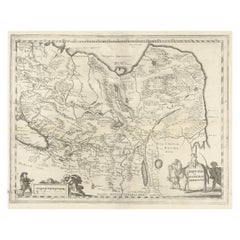
Map Central Asia

3
59
4
1
to
10
44
20
64
64
64
2
1
1
1
30
18
11
5
1
4
4
2
1
2
51
6
5
2
2
17
9
7
5
5
2
2
2
1
1
Sort By
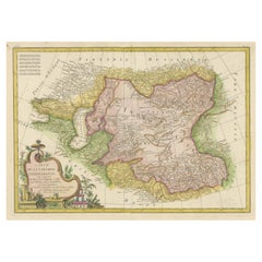
Decorative Antique Map of Central Asia
Located in Langweer, NL
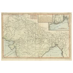
Antique map titled 'Carte de la Tartarie Indépendante (..)'. Decorative map of Central Asia
Category

Antique Late 18th Century Maps

Materials

Paper

Decorative Antique Map of Central Asia
H 14.57 in W 19.69 in D 0.02 in
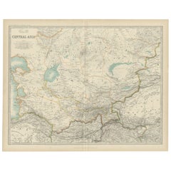
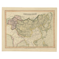
Antique Map of Central Asia by Johnston '1909'
Located in Langweer, NL
Antique map titled 'Central Asia'. Original antique map of Central Asia. This map originates from
Category

Early 20th Century Maps

Materials

Paper

Antique Map of Central Asia by Johnston '1909'
H 19.49 in W 24.41 in D 0.02 in
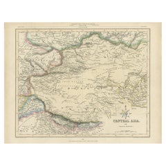
Antique Map of Central Asia, Finely Engraved, 1841
Located in Langweer, NL
Antique map titled 'Central Asia, Middle Division'. A finely engraved and attractive mid 19th
Category

Antique 19th Century Maps

Materials

Paper

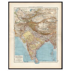
Antique Map of Central Asia and India, 1904
Located in Langweer, NL
Antique map titled 'Zentralasien und Vorderindien'. Map of Central Asia and India. This large
Category

20th Century Maps

Materials

Paper

Antique Map of Central Asia and India, 1904
H 22.09 in W 17.45 in D 0.01 in
Original Antique Map of Central Asia by Smith, 1808
Located in Langweer, NL
Antique map titled 'Central Asia'. Old map of central Asia originating from 'Smith's New General
Category

Antique 19th Century Maps

Materials

Paper

Antique Map of part of Central and Southern Asia
Located in Langweer, NL
d'Ava et de Pegu.' This map shows a part of Asia, with northern India, Mogol, Bengale, Bangladesh, Tibet
Category

Antique Late 18th Century Maps

Materials

Paper

Antique Map of Russia and Central Asia, showing the Northeast Passage
Located in Langweer, NL
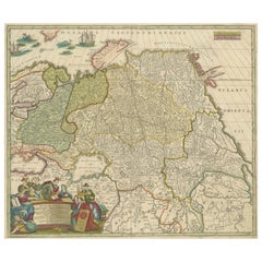
Central Asia, showing the Northeast Passage. The map covers the entirety of the Russian Empire at the time
Category

Antique Mid-18th Century Maps

Materials

Paper

Antique Map of Central Asia between the Caspian Sea and Lake Balkhash
Located in Langweer, NL
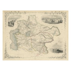
Antique map titled 'Independent Tartary'. Original steel engraved map of Central Asia. It covers
Category

Antique Mid-19th Century Maps

Materials

Paper

Antique Map of China, Tartary and Central Asia by Blaeu, c.1645
Located in Langweer, NL
Antique map titled ‘Tartaria sive Magnichami Imperiorum‘. Early map of Siberia based upon the
Category

Antique 17th Century Maps

Materials

Paper

Steel Engraved Map of Central Asia Covering the Chinese Empire, Tibet Etc, C1843
Located in Langweer, NL
Antique map titled 'Central Asia (Middle Division)'. Steel engraved map of Central Asia
Category

Antique 1840s Maps

Materials

Paper

Antique Map of Central Asia Wiht Nova Zembla as an Island, C.1700
Located in Langweer, NL
Antique map titled 'Asiae Pars Potissima.' Attractive map focusing on the central part of Asia but
Category

Antique 18th Century Maps

Materials

Paper

Vintage Afghan Pictorial Map Rug
Located in New York, NY
A vintage Afghan Pictorial map rug from the mid-20th century. Measures: 3' 0" x 4' 10"
Category

Mid-20th Century Afghan Folk Art Central Asian Rugs

Materials

Wool

1797 Tardieu Map of Southeast Asia: The Malay Archipelago and Beyond
Located in Langweer, NL
interested in maritime history, cartographic art, and regional maps of Asia, enhancing the allure and
Category

Antique 1790s Maps

Materials

Paper

Antique Map of Asia, Showing Tradewinds, Silke Route Cities Etc, c.1780
Located in Langweer, NL
Antique map titled 'L'Asie.' Map of Asia. Offers considerable detail considering the size, showing
Category

Antique 18th Century Maps

Materials

Paper

Hand-Colored 18th Century Homann Map of the Black Sea, Turkey and Asia Minor
By Johann Baptist Homann
Located in Alamo, CA
Anciens et Modernes" (Map of Asia Miner or Natolia and the Pont Evxin Tiree from Voyages and Observations
Category

Antique Early 18th Century German Maps

Materials

Paper

1851 Map of "Independent Tartary", Ric. R018
Located in Norton, MA
Central Asian portion of the ancient Silk Road. Identifies various caravan routes, deserts, wells, and
Category

Antique 19th Century Unknown Maps

Materials

Paper

1814 Map of "Russian Empire" Ric.r032
Located in Norton, MA
into the Caucuses and Central Asia that would vastly increase the landmass of the Russian Empire
Category

Antique 19th Century Unknown Maps

Materials

Paper

1814 Map of "Russian Empire" Ric.r032
H 20.87 in W 24.81 in D 0.4 in
Mehraban Souvenirs by Citizen Artist
By Mehraban Rugs, FORM Design Studio
Located in WEST HOLLYWOOD, CA
--shared through original artwork, expertly translated into fine rugs. Souvenirs is a memory map, a
Category

2010s Nepalese Central Asian Rugs

Materials

Wool, Silk

Antique Map of Turkmenistan, Uzbekistan, Tajikistan and Kyrgyzstan, 1749
Located in Langweer, NL
-18th century French black and white map of Central Asia including Turkmenistan, Uzbekistan, Tajikistan
Category

Antique 18th Century Maps

Materials

Paper

Vintage Fine Pakistani Ardebil Design Carpet
Located in Katonah, NY
thousand flower design motif. Corner spandrels in quarter map of the main medallion, bearing inverted
Category

Vintage 1980s Pakistani Other Central Asian Rugs

Materials

Wool, Cotton

Four 18th Century Engraved and Hand-Colored Maps by Weigel
By Christoph Weigel
Located in Copenhagen, K
Small collection of four engraved maps of Italy, Balkan and of Central Asia. Two are of Italy
Category

Antique 18th Century German Maps

Materials

Paper

Map of Independent Tartary with Vignettes of the Region's Culture, 1851
Located in Langweer, NL
Map - Independent Tartary:** "Independent Tartary" referred to the region of Central Asia that was not
Category

Antique 1850s Maps

Materials

Paper

Antique Map of Tartary, Also Showing the Great Wall of China
Located in Langweer, NL
Russia, Central Asia, China and Korea, first published by Guillaume De L'Isle in 1706. The map extends
Category

Antique Early 18th Century Maps

Materials

Paper

Oriental Realms: A Detailed Map of Persia, Afghanistan, and Beloochistan, 1882
Located in Langweer, NL
influence in Central Asia.
Category

Antique 1880s Maps

Materials

Paper

North & South America: A 17th Century Hand-colored Map by Jansson & Goos
By Johannes Janssonius
Located in Alamo, CA
route between Europe and Asia. The map includes portions of Japan, as well as multiple islands in the
Category

Antique 1620s Dutch Maps

Materials

Paper

"Nova Barbariae Descriptio", a 17th Century Hand-Colored Map of North Africa
By Johannes Janssonius
Located in Alamo, CA
adjacent countries in southern Europe, including Portugal, Spain, Italy, Greece and Asia Minor. The map is
Category

Antique Mid-17th Century Dutch Maps

Materials

Paper

Antique Map of the Caspian Sea, Uzbekistan, Northern Persia Etc, C.1735
Located in Langweer, NL
Antique map titled 'Nova Maris Caspii et Regions Usbeck (..).' Detailed map of Central Asia
Category

Antique 18th Century Maps

Materials

Paper

"Africae Accurata", a Hand-Colored 17th Century Map of Africa by Visscher
By Nicolaes Visscher II
Located in Alamo, CA
Mediterranean Sea and adjacent portions of Portugal, Spain, Italy, Greece and Asia Minor. The map perpetuates
Category

Antique Late 17th Century Dutch Maps

Materials

Paper

Antique Map of the Mouth of the Amu Darya River by Reclus, 1881
Located in Langweer, NL
Amu Darya river in Central Asia. This original old antique print / plate originates from: 'Nouvelle
Category

Antique 19th Century Maps

Materials

Paper

Map Road Strip Britannia Sheet 2 John Ogilby London Aberistwith Islip Bramyard
By John Ogilby
Located in BUNGAY, SUFFOLK
map also includes a miniature town plan of Worcester. Central cartouche inscribed ' The Continuation
Category

Antique 17th Century English Baroque Maps

Materials

Paper

West Coast of Africa, Guinea & Sierra Leone: An 18th Century Map by Bellin
By Jacques-Nicolas Bellin
Located in Alamo, CA
expansive work that mapped China, the East Indies, Asia, the Americas, early voyages to Australia, New
Category

Antique Mid-18th Century French Maps

Materials

Paper

Original Old Composite of Several Maps of the Ancient World on One Sheet, 1880
Located in Langweer, NL
Europe, North Africa, and parts of Asia, reflecting the Roman Empire at its extent. The map includes
Category

Antique 1880s Maps

Materials

Paper

1718 Ides & Witsen Map "Route D'amsterdam a Moscow Et De La Ispahan Et Gamron
Located in Norton, MA
," Ric.b005 Subject: Eastern Europe and Central Asia Period: 1718 (published) Publication: Voyages Par Le
Category

Antique Early 18th Century Dutch Maps

Materials

Paper

Old Map of the Mughal Empire, Persia in the West to Lake Chimay etc., ca.1685
Located in Langweer, NL
Antique map titled 'L'Empire du Grand Mogol'. Old map of India and Central Asia. The map
Category

Antique 1680s Maps

Materials

Paper

Mediterranean Encounters: From the Punic Wars to the Hannibalic War, 1880
Located in Langweer, NL
Emperor Vespasian, around 69-79 AD. Key Observations of the Map: 1. **Central Focus**: The Mediterranean
Category

Antique 1880s Maps

Materials

Paper

Cartographic Elegance: The British Raj's India, 1882 Atlas by Blackie and Son
Located in Langweer, NL
mountain ranges. This part of the map also extends into Central Asia, indicating areas labeled as
Category

Antique 1880s Maps

Materials

Paper

Original Hand-Colored Antique Map of Tartary and Northern India
Located in Langweer, NL
, presents a depiction of the southern portion of Tartary, an ancient region in northern and central Asia
Category

Antique 1780s Prints

Materials

Paper

The Travel Sale: Natural History and Maps. November 2001: Sotheby's London
By Sotheby's
Located in valatie, NY
The Travel Sale: Natural History and Maps. November 2001: Sotheby's London. 1st Ed softcover. Lots
Category

21st Century and Contemporary English Books

Materials

Paper

Schley, Xinjiang Uygur Zizhiqu, Tien Shan, Sinkiang, Map of China
By Jacques-Nicolas Bellin
Located in Norwich, GB
Central Asia. The highest peak in the Tian Shan is Jengish Chokusu, at 7,439 metres high. Its lowest point
Category

Antique 1740s Dutch Prints

Materials

Paper

Antique Engravings of Japan incl a Map and the Arrival of the Dutch, 1732
Located in Langweer, NL
l'Empereur Cubo et la Reception des Ambassadeurs Hollandois en ce Pays la'. It shows: a central table of the
Category

Antique 18th Century Prints

Materials

Paper

Antique Mycology Print of the Lactifluus Volemus by Fries, c.1860
By Elias Magnus Fries
Located in Langweer, NL
well as some subtropical and tropical regions of Central America and Asia. This print originates from
Category

Antique 19th Century Prints

Materials

Paper

English Pocket Globe, London, Circa 1775-1798
By Herman Moll
Located in Milano, IT
region in his 1727 map. (Encyclopaedia Britannica, ed. 1902, under "States of Central Africa"); Tartary
Category

Antique Late 18th Century English George III Globes

Materials

Shagreen, Paper

Rare Hand-Knotted War Rug Depicting Reign & King Amanullah Khan 1919 Afghanistan
Located in Lisse, NL
Hand knotted and superb condition, central Asian war rug with important year date and original
Category

Mid-20th Century Afghan Rugs

Materials

Wool

A truly delightful miniature terrestrial pocket globe
By Nathaniel Mills
Located in ZWIJNDRECHT, NL
turning overhead. In line with its counterpart, the terrestrial globe, celestial globes are mapped by a
Category

Antique Mid-18th Century British Dutch Colonial Globes

Materials

Other

Map Series
By Joseph Carini
Located in New York, NY
From Joseph Carini's celebrated Map Series, “Lower Manhattan” is an ode to the lower tip of the
Category

21st Century and Contemporary Nepalese Central Asian Rugs

Map Series
Map Series
W 72 in L 108 in
Vintage Afghan Map Rug
Located in New York, NY
An Afghan map carpet from the late 20th century. Measures: 3' 5" x 6' 7"
Category

Late 20th Century Afghan Folk Art Central Asian Rugs

Materials

Wool

Vintage Afghan Map Rug
W 68 in L 111 in
NYC Night
By Joseph Carini
Located in New York, NY
From Joseph Carini's famous Map Series, an ode to the city that never sleeps, inspired by a vintage
Category

21st Century and Contemporary Nepalese Central Asian Rugs

NYC Night
NYC Night
W 108 in L 144 in
Lena Delta by Joseph Carini
By Joseph Carini
Located in New York, NY
This exotic hand-knotted silk carpet is an example of the artist's fascination with maps, a
Category

21st Century and Contemporary Nepalese Central Asian Rugs

Original Vintage Pictorial Map Poster French Indochina Asia Indochine Francais
By Lucien Boucher
Located in London, GB
Southeast Asia from 1887-1954: Tonkin in north Vietnam, Annam in central Vietnam and Cochinchina in south
Category

Vintage 1940s French Posters

Materials

Paper

Vintage Cushions, British Bespoke Made Silk Pillow ‘Tartaria', Made in UK
Located in London, GB
and central Asia; beautifully complimented on the reverse in French silk completing the nautical theme
Category

Vintage 1970s British Organic Modern Pillows and Throws

Materials

Silk

Antique Map of Central Asia by Bonne, 1778
Located in Langweer, NL
Antique map titled 'Carte de la Tartarie Indépendante'. Detailed map of Central Asia, from the
Category

Antique Late 18th Century Maps

Materials

Paper

Antique Map of Central Asia by Bonne, 1778
H 14.57 in W 20.08 in D 0.02 in
Antique Map of China, Tartary and Central Asia by Blaeu, circa 1645
Located in Langweer, NL
Antique map titled ‘Tartaria sive Magnichami Imperiorum‘. Early map of Siberia based upon the
Category

Antique Mid-17th Century Maps

Materials

Paper

Antique Map of Independent Tartary 'Central Asia' by J. Tallis, circa 1851
Located in Langweer, NL
A decorative and detailed mid-19th century map of 'Independent Tartary' (modern day Kazakhstan
Category

Antique Mid-19th Century Maps

Antique Map by Mapmaker Blaeu of Northern India and Central Asia, c.1650
Located in Langweer, NL
Central Asia. Pakistan, Afganistan and Bangladesh and extends inland up the Ganges and Indus Rivers to
Category

Antique Mid-17th Century Maps

Materials

Paper

Antique Map of Central Africa by J.B. Elwe, 1792
Located in Langweer, NL
Arabia, Asia Minor and Armenia, centered on Central Africa. Excellent detail throughout, including
Category

Antique Late 19th Century Maps

Materials

Paper

Antique Map of Tartary "Asia" by Mercator/Hondius, 1606
Located in Langweer, NL
Antique map of central and eastern Asia. In 1607 Jodocus Hondius published a reduced size version
Category

Antique Early 17th Century Maps

Antique Map of Tartary ‘Asia’ by J. Hondius, 1606
Located in Langweer, NL
Tartaria, Central Asia and Asiatic Russia. Decorative vignettes in include a nomadic tribe, tents and
Category

Antique Early 17th Century Maps

Empires of the East: An Ornate Tallis Map of Tibet, Mongolia, and Manchuri, 1851
Located in Langweer, NL
- Tibet, Mongolia, and Manchuria:** This map would have represented the regions of Central and East Asia
Category

Antique 1850s Maps

Materials

Paper

Empires of the East: The Indo-Scythian and Parthian Kingdoms, Published in 1880
Located in Langweer, NL
area of what is now part of Iran, Iraq, Central Asia, and possibly parts of South Asia, representing
Category

Antique 1880s Maps

Materials

Paper

Middle East The Cradle of Civilization Revealed by Stephen Bourke Hardcover
Located in North Hollywood, CA
the region. The text is illustrated with detailed maps and photographs, enabling readers to visualize
Category

20th Century Central Asian Moorish Books

Materials

Paper

  • 1
Get Updated with New Arrivals
Save "Map Central Asia", and we’ll notify you when there are new listings in this category.

Map Central Asia For Sale on 1stDibs

Choose from an assortment of styles, material and more with respect to the map central Asia you’re looking for at 1stDibs. Frequently made of paper, fabric and wool, every map central Asia was constructed with great care. Whether you’re looking for an older or newer map central Asia, there are earlier versions available from the 18th Century and newer variations made as recently as the 21st Century. A map central Asia, designed in the Folk Art style, is generally a popular piece of furniture. Joseph Carini each produced at least one beautiful map central Asia that is worth considering.

How Much is a Map Central Asia?

Prices for a map central Asia start at $155 and top out at $1,094 with the average selling for $633.

Read More

Pamela Shamshiri Shares the Secrets behind Her First-Ever Book and Its Effortlessly Cool Interiors

The sought-after designer worked with the team at Hoffman Creative to produce a monograph that beautifully showcases some of Studio Shamshiri's most inspiring projects.

Moroccan Artworks and Objects Take Center Stage in an Extraordinary Villa in Tangier

Italian writer and collector Umberto Pasti opens the doors to his remarkable cave of wonders in North Africa.

Montecito Has Drawn Royalty and Celebrities, and These Homes Are Proof of Its Allure

Hollywood A-listers, ex-pat aristocrats and art collectors and style setters of all stripes appreciate the allure of the coastal California hamlet — much on our minds after recent winter floods.

Whaam! Blam! Pow! — a New Book on Pop Art Packs a Punch

Publishing house Assouline and writer Julie Belcove have teamed up to trace the history of the genre, from Roy Lichtenstein, Andy Warhol and Yayoi Kusama to Mickalene Thomas and Jeff Koons.

The Sparkling Legacy of Tiffany & Co. Explained, One Jewel at a Time

A gorgeous new book celebrates — and memorializes — the iconic jeweler’s rich heritage.

What Makes a Gem-Encrusted Chess Set Worth $4 Million?

The world’s most opulent chess set, weighing in at 513 carats, is literally fit for a king and queen.

Tauba Auerbach’s Geometric Pop-Up Book Is Mighty Rare, Thanks to a Hurricane

This sculptural art book has an epic backstory of its own.

Step inside the Storied Mansions of Palm Beach’s Most Effervescent Architect

From Spanish-style courtyards to fanciful fountains, these acclaimed structures abound in surprising and elegant details.