Antique Map Middle East

5
to
29
99
12
82
51
30
27
17
15
9
8
8
8
8
7
7
6
5
4
4
3
2
2
2
2
2
2
2
2
1
1
1
1
1
4
2
1
1
1
Sort By
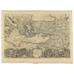
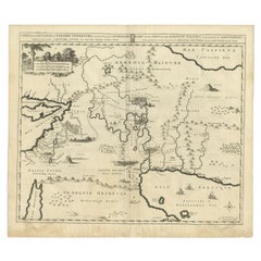
Antique Map Eastern Mediterranean by D. Stoopendaal 'circa 1710'
Located in Langweer, NL
Antique map Middle East titled 'De Beschryving van de Reysen Pauli en van de Andere Apostelen
Category

Early 18th Century Dutch Antique Map Middle East

Materials

Paper

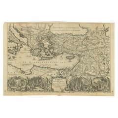
Antique Map of the Eastern Mediterranean, C.1710
Located in Langweer, NL
Antique map Middle East titled 'De Beschryving van de Reysen Pauli en van de Andere Apostelen
Category

18th Century Antique Map Middle East

Materials

Paper

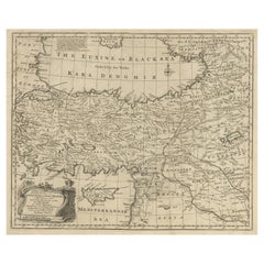
Antique Map of Asia Minor with Cyprus, Syria and Turkey and the Black Sea, 1747
Located in Langweer, NL
Antique map Middle East titled 'A New and accurate map of Anatolia or Asia Minor, with Syria and
Category

18th Century Antique Map Middle East

Materials

Paper

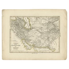
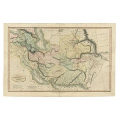
Antique Map of the Middle East by Perthes, 1848
Located in Langweer, NL
Antique map titled 'Terra inter Euphratem et Indum Antiqua'. Old map of the Middle East originating
Category

19th Century Antique Map Middle East

Materials

Paper

Antique Map of the Middle East by Smith, 1809
Located in Langweer, NL
Antique map titled 'Regiones inter Euphraten et Indum'. Old map of the Middle East showing the
Category

19th Century Antique Map Middle East

Materials

Paper

Antique Map of the Middle East by Mortier, 1700
Located in Langweer, NL
and the Middle East, centered on the Garden of Eden and including a large Cyprus. Includes the cities
Category

18th Century Antique Map Middle East

Materials

Paper

Antique Map of the Middle East by Von Sandrart, 1708
Located in Langweer, NL
Antique map titled 'Die Gegend des Irdlisches Paradieses und des Landes Kanaan.' Map of the Middle
Category

18th Century Antique Map Middle East

Materials

Paper

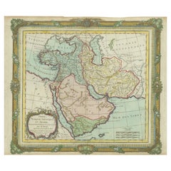
Antique Map of the Middle East with a Large Arabia, 1799
Located in Langweer, NL
Antique map titled 'Perse, Turquie Asiatique et Arabie (..)'. Map of the Middle East with a large
Category

Late 18th Century Antique Map Middle East

Materials

Paper

Antique Map of the Middle East with a Large Arabia, 1799
Free Shipping
H 11.03 in W 15.63 in D 0.02 in
Finely Engraved Historical Map of Middle East and Asia, c.1745
Located in Langweer, NL
historical map with a profusion of details. It shows the Middle East and Asia. Decorative title cartouche and
Category

1740s Antique Map Middle East

Materials

Paper

Antique Bible Map of the Middle East by A. Schut, 1743
Located in Langweer, NL
Antique map titled 'De Gelegentheyt van 't Paradys en 't Landt Canaan'. Dutch Bible map covering
Category

Mid-18th Century Antique Map Middle East

Materials

Paper

Antique Map of the Middle East by Brion de la Tour '1772'
Located in Langweer, NL
Antique map titled 'Carte des Pays et Principaux Lieux (..)'. Original antique map of Middle East
Category

Late 18th Century Antique Map Middle East

Materials

Paper

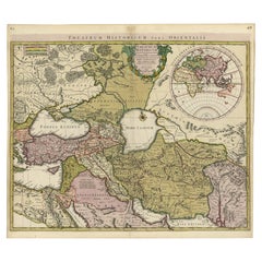
Scarce Antique Map of the Middle East, Surrounded by Latin Text, 1624
Located in Langweer, NL
Antique map titled 'Lumen Historium per Orientem (..).' Scarce map of the Middle East
Category

1620s Antique Map Middle East

Materials

Paper

Original Antique Map of the Middle East, Published in Germany, c.1870
Located in Langweer, NL
Antique map titled 'Asia Citerior'. Old map of the Middle East. This map originates from 'Atlas
Category

19th Century Antique Map Middle East

Materials

Paper

Scarce Map of the Mediterranean and Parts of Europe, Africa & Middle East, 1725
Located in Langweer, NL
, Africa and the Middle East, illustrating the travels of Paul between the Holy Land and Rome, through the
Category

1720s Antique Map Middle East

Materials

Paper

Scarce Middle East and Arabia Map Showing The Exodus of the Israelites, 1725
Located in Langweer, NL
uytgang uyt Egypten, tot den overtogt over de Jordaane.' Scarce map of the Middle East and Arbabia. It
Category

1720s Antique Map Middle East

Materials

Paper

Highly Decorative Map of The Eastern Mediterranean and The Middle East, ca.1700
Located in Langweer, NL
(..).' Highly decorative map of the eastern Mediterranean and the Middle East features the tract of St. Paul
Category

Early 1700s Antique Map Middle East

Materials

Paper

Old Engraved Map of the Middle East, Arabia and Part of Greece 'Cyprus', 1706
Located in Langweer, NL
Mogol, opt spoor gevolgd'. Old map of the Middle East, also depicting part of Greece (Cyprus). This
Category

Early 1700s Antique Map Middle East

Materials

Paper

Antique Map of Asia from the Middle East to the Coast of Alaska, 1816
Located in Langweer, NL
""Nouv. Abrége de Géographie"". An engraved map with coloring of Asia from the Middle East to the coast
Category

19th Century Antique Map Middle East

Materials

Paper

Intriguing Antique Map of Europe, the Middle East and Africa by Scherer, c.1703
Located in Langweer, NL
Antique map depicting part of Africa, Europe and the Middle East. Also showing various cities in
Category

18th Century Antique Map Middle East

Materials

Paper

Antique Map of North and East Asia, 1751
Located in Langweer, NL
Map 2: 'Carte des parties nord et est de L'Asie'. (Map of the Northern parts and East Asia.) Five
Category

18th Century Antique Map Middle East

Materials

Paper

Antique Map of North and East Asia, 1751
H 18.35 in W 14.97 in D 0 in
Antique Map of Batavia, Dutch East Indies, Nowadays Jakarta, Indonesia, ca.1669
Located in Langweer, NL
Antique map titled 'Ware afbeeldinge wegens het Casteel ende Stadt Batavia gelegen opt groot Eylant
Category

1660s Antique Map Middle East

Materials

Paper

Rare and Very Old Antique Map of South East Asia, Published circa 1574
Located in Langweer, NL
A very fine impression of this map of the Malay Peninsula, Sumatra, Java, with Singapore denoted as
Category

16th Century Antique Map Middle East

Materials

Paper

Original Old Map East of Stockholm, the Island Ljusterö and Värmdö, Sweden, 1720
Located in Langweer, NL
Konigle Schwedisch Haupt und Residentz Stadt Stockholm.' Map of the area east of Stockholm, embracing
Category

1720s Antique Map Middle East

Materials

Paper

Antique Map Made After a Roman Papyrus Travel Map, Known as Peutinger Map, 1773
Located in Langweer, NL
Iberian Peninsula and the British Isles), North Africa, and parts of Asia, including the Middle East
Category

18th Century Antique Map Middle East

Materials

Paper

Antique Map of Scotland With an Inset Map of the Shetland Islands, 1854
Located in Langweer, NL
Stunning Map of Scotland that will look beautiful in any setting framed on the wall. Description
Category

1850s Antique Map Middle East

Materials

Paper

Antique Map of Stavoren by Blaeu, 1649
Located in Langweer, NL
cartographer of the Dutch East India Company. Around 1649 Joan Blaeu published a collection of Dutch city maps
Category

17th Century Antique Map Middle East

Materials

Paper

Antique Map of Stavoren by Blaeu, 1649
H 21.78 in W 25.32 in D 0 in
Antique Map of Stavoren by Blaeu, 1649
Located in Langweer, NL
cartographer of the Dutch East India Company. Around 1649 Joan Blaeu published a collection of Dutch city maps
Category

17th Century Antique Map Middle East

Materials

Paper

Antique Map of Stavoren by Blaeu, 1649
H 19.69 in W 24.1 in D 0 in
Antique Map of Stavoren by Blaeu, 1649
Located in Langweer, NL
cartographer of the Dutch East India Company. Around 1649 Joan Blaeu published a collection of Dutch city maps
Category

17th Century Antique Map Middle East

Materials

Paper

Antique Map of Stavoren by Blaeu, 1649
H 17.88 in W 25.52 in D 0 in
Antique Map of German Colonies by Meyer, 1895
Located in Langweer, NL
Antique map titled 'Deutsche Kolonien.' Lithographed map of the German Colonies. German East-Africa
Category

19th Century Antique Map Middle East

Materials

Paper

Antique Map of the Gaspar Strait by Huddart, '1788'
Located in Langweer, NL
Antique map titled 'Sketch of the Straits of Gaspar'. Detailed sea chart of the Gaspar Strait
Category

Late 18th Century Antique Map Middle East

Materials

Paper

Antique Map of the Turkish Empire by Tirion 'c.1760'
Located in Langweer, NL
Southern Europe, the Middle East, Arabia, and Northeastern Africa. Published by I. Tirion, circa 1760.
Category

Mid-18th Century Antique Map Middle East

Materials

Paper

Antique Map of Flanders, Belgium by Homann Heirs, c.1735
Located in Langweer, NL
Antique map titled 'Comitatus Flandriae in omnes ejusdem subjecentes Ditioes (..).' Original
Category

18th Century Antique Map Middle East

Materials

Paper

Antique Map of the City of Sneek by Blaeu, 1652
Located in Langweer, NL
Antique map titled: 'Sneeck.' Bird's-eye view plan of Sneek, Friesland, The Netherlands. From a
Category

17th Century Antique Map Middle East

Materials

Paper

Antique Map of the City of Franeker by Blaeu, 1652
Located in Langweer, NL
cartographer of the Dutch East India Company. Around 1649 Joan Blaeu published a collection of Dutch city maps
Category

17th Century Antique Map Middle East

Materials

Paper

Mediterranean Tapestry: A 19th Century Map of the Mediterranean Shores, 1882
Located in Langweer, NL
the Middle East. Topographical features such as mountain ranges, valleys, and plateaus are carefully
Category

1880s Antique Map Middle East

Materials

Paper

Antique Engraved Map of Saxonia in Northern Germany, ca.1721-1750
Located in Langweer, NL
Principatus accurate divisus ex conatibus - A large map of Lower Saxony, extending from Hamburg with the
Category

Mid-18th Century Antique Map Middle East

Materials

Paper

Original Antique Map of Canaan, Armenia, Syria, Mesopotamia and Arabia, 1709
Located in Langweer, NL
, Armenia, Syria, Mesopotamia and Arabia. It displays the Middle East from the eastern Mediterranean Sea to
Category

Early 1700s Antique Map Middle East

Materials

Paper

Antique Map of the Moluccas in Indonesia by Janssonius, C.1650
By Johannes Janssonius
Located in Langweer, NL
Antique map titled 'Insularum Moluccarum Nova Descriptio.' Old map of the Moluccas. The famous
Category

17th Century Antique Map Middle East

Materials

Paper

Large and Detailed Map of the Russian Empire in Asia, ca.1780
Located in Langweer, NL
Description: Antique map titled 'Bowles's New Pocket Map of the East Part of the Russian Empire in
Category

1780s Antique Map Middle East

Materials

Paper

Original Old Map of Leeuwarden, European Cultural Capital 2018, Holland, 1649
Located in Langweer, NL
Antique print, titled: 'Leoverdia.' This map shows Leoverdia (Leeuwarden). Bird's-eye view plan
Category

1640s Antique Map Middle East

Materials

Paper

Old Map of Holstein with the Imperial Towns Hamburg & Lubeck, Germany, 1854
Located in Langweer, NL
Antique map titled 'Map of the Duchy of Holstein with the territories of the Imperial Towns Hamburg
Category

1850s Antique Map Middle East

Materials

Paper

Old Map of Indonesian Islands Borneo, Celebes, New Guinea & New Britain, 1792
Located in Langweer, NL
Antique map titled 'Partie de la Nouvelle Grande Carte des Indes Orientales, contenant les Isles de
Category

1790s Antique Map Middle East

Materials

Paper

Large Antique Map of Egypt and the Nile Delta by Wyld, 1854
Located in Langweer, NL
Antique map titled 'Lower Egypt and the adjacent desert, with a part of Palestine to which has been
Category

19th Century Antique Map Middle East

Materials

Paper

The World in the Assyrian Empire's Era: A Historical Map, Published in 1880
Located in Langweer, NL
at its peak, including detailed territories across the Middle East. 2. **Historical Geography**: It
Category

1880s Antique Map Middle East

Materials

Paper

Antique Map of the Caspian Sea, Uzbekistan, Northern Persia Etc, C.1735
Located in Langweer, NL
Antique map titled 'Nova Maris Caspii et Regions Usbeck (..).' Detailed map of Central Asia
Category

18th Century Antique Map Middle East

Materials

Paper

Beautiful Original Antique Map of Antwerp, Belgium by Mapmaker Blaeu, ca.1652
Located in Langweer, NL
Dutch East India Company. Around 1649 Joan Blaeu published a collection of Dutch city maps named Tooneel
Category

1650s Antique Map Middle East

Materials

Paper

Antique Map of the Strait of Malacca, Malay Peninsula & Dutch Indies, c.1670
Located in Langweer, NL
Antique map titled 'Indiae Orientalis, nec non Insularum Adiacentium Nova Descriptio.' Map of
Category

1670s Antique Map Middle East

Materials

Paper

Antique Map of the Danube River and Surroundings by Homann Heirs, c.1730
By Homann Heirs
Located in Langweer, NL
Bavaria and Bohemia, to Provence in the west, and modern day Albania in the east. This highly detailed map
Category

18th Century Antique Map Middle East

Materials

Paper

Antique Plan of Batavia, Capital of the Dutch East Indies, by Van Der Aa, 1725
By Pieter Van Der Aa
Located in Langweer, NL
Antique map titled 'Plan de Batavia'. (Plan of Batavia.) This plate shows a plan of the city of
Category

18th Century Antique Map Middle East

Materials

Paper

Old Map by Blaeu of the City of Franeker, Friesland, The Netherlands, 1649
Located in Langweer, NL
cartographer of the Dutch East India Company. Around 1649 Joan Blaeu published a collection of Dutch city maps
Category

1640s Antique Map Middle East

Materials

Paper

Original Old Composite of Several Maps of the Ancient World on One Sheet, 1880
Located in Langweer, NL
inset maps. The topmost one appears to show the Arabian Peninsula; the middle one could be depicting the
Category

1880s Antique Map Middle East

Materials

Paper

Very Decorative Original Antique Map of the World, Published in France in c.1780
By Rigobert Bonne
Located in Langweer, NL
Antique map titled 'L'Ancien Monde Et Le Nouveau en Deux Hemispheres' - Double hemisphere map of
Category

18th Century Antique Map Middle East

Materials

Paper

Old Map of Turkey in Asia with Mosul Environs and Assyrian Ruins Inset , 1859
Located in Langweer, NL
, covering a vast area that includes modern-day Turkey, parts of the Middle East, and extending towards the
Category

Mid-19th Century Antique Map Middle East

Materials

Paper

Original 1859 Map of Asia from W.G. Blackie's Imperial Atlas of Modern Geography
Located in Langweer, NL
includes regions from the Middle East to the far reaches of East Asia, and from the Arctic shores of
Category

Mid-19th Century Antique Map Middle East

Materials

Paper

Antique Map of France according to the Treaty of Paris '1815', Published in 1854
Located in Langweer, NL
Antique map titled 'The Kingdom of France, describing the new limits according to the treaty of
Category

19th Century Antique Map Middle East

Materials

Paper

Rare Sea Chart of the East Frisian Islands or Watten and the North Sea, c.1700
Located in Langweer, NL
Description: Antique map titled 'Paskaarte van de rievier de Elve streckende van Oldenbroek tot
Category

Early 1700s Antique Map Middle East

Materials

Paper

Antique Carte de De la Perse Saudie Arabia UAE Turkey Qatar Bahrein, 1836
Located in Amsterdam, Noord Holland
Antique Carte de De la Perse Saudie Arabia UAE Turkey Qatar Bahrein, 1836 Very nice map of Middle
Category

18th Century European Antique Map Middle East

Materials

Paper

Ancient Cartography of the Indian Subcontinent, Published in 1880
Located in Langweer, NL
the Silk Road and maritime paths used by traders to reach Southeast Asia, the Middle East, and East
Category

1880s Antique Map Middle East

Materials

Paper

Rare Antique Map of the Middle East, ca.1690
Located in Langweer, NL
Description: Antique print, untitled. Two decorative maps on one sheet of the middle east in
Category

1690s Antique Map Middle East

Materials

Paper

Antique Engraving of Dutch and German North Sea Coast of Friesland, ca.1680
Located in Langweer, NL
Friesland, with West Frisian Islands and below East Frisian Islands with inset map of the Elbe around
Category

1680s Antique Map Middle East

Materials

Paper

  • 1
Get Updated with New Arrivals
Save "Antique Map Middle East", and we’ll notify you when there are new listings in this category.

Antique Map Middle East For Sale on 1stDibs

At 1stDibs, there are many versions of the ideal antique map middle east for your home. Each antique map middle east for sale was constructed with extraordinary care, often using paper. There are many kinds of the antique map middle east you’re looking for, from those produced as long ago as the 18th Century to those made as recently as the 19th Century. You’ll likely find more than one antique map middle east that is appealing in its simplicity, but Heinrich Kiepert and Guillaume De L'Isle produced versions that are worth a look.

Finding the Right collectibles-curiosities for You

Antique and vintage collectibles and curiosities can bring whimsy and wonder to any interior. 

Decorating with old scientific instruments, historical memorabilia and vintage musical instruments, as well as other authentic collectibles and curiosities that can be found on 1stDibs, presents an opportunity to create a unique, natural history museum-like atmosphere in your home that can provoke conversation as often as it pays tribute to how far we’ve come in understanding our world. 

And bringing collectibles and curiosities into your space is actually on trend — Wunderkammern, or curiosity cabinets, were all the rage in Europe during the 1500s and continued to have adherents there and in the U.S. in the following centuries. Today, however, they’re experiencing a real surge in popularity and influencing how many interior designers are furnishing and decorating homes — combining contemporary with antique, scientific with tribal, earthly with extraterrestrial, Les Lalanne tables with Flemish tapestries.

The original Wunderkammern were entire rooms filled with objects demonstrating their owners’ worldly knowledge: A proper one included artificiala or preciosa (objets d’art); naturalia (such as skeletons, shells, minerals); exotica (taxidermy or dried plants); and scientifica (scientific instruments), frequently alongside religious relics and ancient artifacts.

Pay tribute to a history of rich and diverse musical traditions that have taken shape all over the world by decorating your home with a collection of antique and vintage musical instruments — with a little help from strong hanging wire or some wall hooks, vintage brass instruments such as a gong, French horn or trumpet can help elevate a home office or complement the efforts you’ve made to ensure a welcoming vibe in your home’s entryway. Bells or antique wind instruments can add provocative metallic contrasts to dark woods as tabletop decorative objects.  

Create an intriguing focal point with Georgian scientific instruments, such as stick barometers with mahogany cases or lacquered brass telescopes. These items stem from an era named for the monarchies of the four King Georges, who ruled England in succession starting in 1714 (plus King William’s reign, which lasted until 1837). Just as there was beautiful jewelry produced during the period that today is coveted by collectors, there is much to be found in the collectibles and curiosities realm too.

Wanderlust, nostalgia and a shared love of good design are contributing factors to certain trends in decorating — just as vintage trunks and luggage have reappeared as furniture or home accents in a bedroom or foyer, decorating with globes, maps or nautical objects is similarly rooted in the allure of travel and a penchant for the stylish finishing touch that collectibles bring to our homes.

Find a wide range of antique and vintage collectibles and curiosities on 1stDibs.

Read More

Pamela Shamshiri Shares the Secrets behind Her First-Ever Book and Its Effortlessly Cool Interiors

The sought-after designer worked with the team at Hoffman Creative to produce a monograph that beautifully showcases some of Studio Shamshiri's most inspiring projects.

Moroccan Artworks and Objects Take Center Stage in an Extraordinary Villa in Tangier

Italian writer and collector Umberto Pasti opens the doors to his remarkable cave of wonders in North Africa.

Montecito Has Drawn Royalty and Celebrities, and These Homes Are Proof of Its Allure

Hollywood A-listers, ex-pat aristocrats and art collectors and style setters of all stripes appreciate the allure of the coastal California hamlet — much on our minds after recent winter floods.

Whaam! Blam! Pow! — a New Book on Pop Art Packs a Punch

Publishing house Assouline and writer Julie Belcove have teamed up to trace the history of the genre, from Roy Lichtenstein, Andy Warhol and Yayoi Kusama to Mickalene Thomas and Jeff Koons.

The Sparkling Legacy of Tiffany & Co. Explained, One Jewel at a Time

A gorgeous new book celebrates — and memorializes — the iconic jeweler’s rich heritage.

What Makes a Gem-Encrusted Chess Set Worth $4 Million?

The world’s most opulent chess set, weighing in at 513 carats, is literally fit for a king and queen.

Tauba Auerbach’s Geometric Pop-Up Book Is Mighty Rare, Thanks to a Hurricane

This sculptural art book has an epic backstory of its own.

Step inside the Storied Mansions of Palm Beach’s Most Effervescent Architect

From Spanish-style courtyards to fanciful fountains, these acclaimed structures abound in surprising and elegant details.