Maps
76
2,896
to
582
2,785
108
2,896
2,896
2,896
21
9
1
1
2,897
2,121
414
5
229
32
11
85
7
57
7
3
3
4
5
2
2,880
15
5
4
3
189
69
55
36
28
63
26
16
13
13
Maps For Sale
Period: 18th Century
Period: 17th Century
Period: 15th Century and Earlier
Period: 16th Century
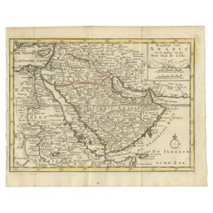
Authentic Old Map of Arabia with Original Border Coloring, 1745
Located in Langweer, NL
Title: "Kaartje van Arabië na de stelling van den Heer Guillaume de L'Isle"
Translates to "Map of Arabia based on the work of Mr. Guillaume de L'Isle." Guillaume de L'Isle was a pr...
Category
1740s Antique Maps
Materials
Paper
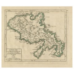
Original Historical Map of L'Ile De La Martinique by Vaugondy, 1749
Located in Langweer, NL
Description: De Vaugondy's map of Martinique, initially published in Paris in 1748 within his Atlas Portatif, Universel et Militaire, stands as a striking representation of the isla...
Category
1740s Antique Maps
Materials
Paper
Antique French Map of Asia Including China Indoneseia India, 1783
Located in Amsterdam, Noord Holland
Very nice map of Asia. 1783 Dedie au Roy.
Additional information:
Country of Manufacturing: Europe
Period: 18th century Qing (1661 - 1912)
Condition: Overall Condition B (Good Used)...
Category
18th Century European Antique Maps
Materials
Paper
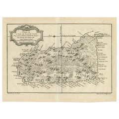
Original Engraved Map of Saint Lucia in the West Indies by Bellin, 1758
Located in Langweer, NL
The "Carte de L’Isle de Sainte Lucie" by Jacques Nicolas Bellin, a prominent figure as the Royal Hydrographer and engineer of the French Navy, is a remarkable antique map showcasing ...
Category
1750s Antique Maps
Materials
Paper
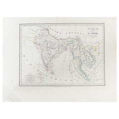
Antique Carte de L'Inde Myanmar, Malaysia Vietnam Map of Asia the Chinese Empire
Located in Amsterdam, Noord Holland
Antique Carte de L'Inde Myanmar, Malaysia Vietnam Map of Asia the Chinese Empire
Very nice map of Asia.
Additional information:
Type: Map
Country of Man...
Category
18th Century European Antique Maps
Materials
Paper
Martinique Island in the Caribbean by Bellin Original Original Antique Map, 1780
Located in Langweer, NL
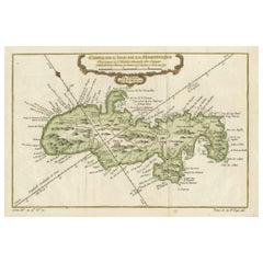
This mid-18th century map, "Carte de l'Isle de la Martinique pour servir a l'historie generale des voyages," was issued in 1780 by M. Bellin in Paris. It presents a detailed and visually captivating depiction of the Island of Martinique within the context of the Caribbean and the Lesser Antilles.
**Title:** Carte de l'Isle de la Martinique pour servir a l'historie generale des voyages
**Issuer:** M. Bellin
**Date:** 1780
**Location Coverage:** North America, Caribbean, Martinique, Lesser Antilles
This engraved map is notable for its pleasing aesthetics, featuring lovely hand coloring that enhances its visual appeal. The inclusion of a scroll cartouche, an ornamental frame, and measurement lines adds a distinctive and visually appealing quality to the map.
Martinique, situated within the Lesser Antilles in the Caribbean, is presented with meticulous detail, showcasing geographical features, coastlines, settlements, and other notable landmarks. Bellin, known for his accuracy in cartography, crafted this map to serve as a geographical reference within the broader context of historical voyages and exploration.
The combination of detailed cartographic information and artistic embellishments, such as hand coloring and decorative elements, makes this map not only a valuable geographical document but also a visually pleasing piece of cartographic art...
Category
Late 18th Century Antique Maps
Materials
Paper
Detailed Map of the Holy Land, Showing the Travels of Christ & Apostles, ca.1650
Located in Langweer, NL
Antique map titled 'Het Beloofde Landt Canaan door wandelt van onsen Salichmaeker Jesu Christo neffens syne Apostelen.'
Detailed map of the Holy Land, showing the travels of Christ and the Apostles, including Paul's travel's at sea and numerous sailing vessels. Below bible scenes such as the nativity and crucifiction of Christ. An excellent example of a Duch Bible map...
Category
1650s Antique Maps
Materials
Paper
Authentic Old Map of Southeast Asia with Original Border Coloring, 1745
Located in Langweer, NL
Title: "Kaartje van Oost-Indien na de stelling van den Heer Guillaume de L'Isle"
Translates to "Map of the East-Indies based on the work of Mr. Guillaume de L'Isle." Guillaume de L...
Category
1740s Antique Maps
Materials
Paper
Authentic Old Map of Sumatra, Malaysia and Singapore, 1745
Located in Langweer, NL
Title: "Kaartje van't Eiland Sumatra en de Maleidse Kust gelegen na de stelling van de G. de L'Isle"
Published by Jacob Keizer and by Jan de Lat
Creator: Keizer, Jacob, active 1706...
Category
1740s Antique Maps
Materials
Paper
Original Antique Map of the Peninsula of India with Part of Ceylon by Wyld, 1844
Located in Langweer, NL
This extensive map of India, spanning two sheets, draws from Reynell’s original map and incorporates data provided by Sir Archibald Campbell, as well as surveys conducted by Colonel ...
Category
Mid-18th Century Antique Maps
Materials
Paper
Imperial Splendor: Antique Map of the Ottoman Empire by Blaeu, circa 1640
Located in Langweer, NL
The antique map titled 'Turcicum Imperium' is an original old map of the Ottoman Empire, historically and colloquially known as the Turkish Empire. Here are the key features and deta...
Category
Mid-17th Century Antique Maps
Materials
Paper
Antique Print of the Malabar Coast of India showing the VOC establishments, 1726
Located in Langweer, NL
Dutch print with the title: Platte Grond van t'Fort Tricoen male met de daar aangelegen Pagoods-Berg (Trincomalee, Sri Lanka)
The map is taken from: 'Oud en Nieuw Oost-Indiën' van...
Category
1720s Antique Maps
Materials
Paper
Original Antique Map of Brasil, Published in the 16th Century, 1561
Located in Langweer, NL
This important Ruscelli map of Brazil, from his work La Geografia di Claudio Tolomeo Alessandrino, is one of the earliest obtainable modern maps of the re...
Category
1660s Antique Maps
Materials
Paper
Original Antique Engrving of Chinese Tartary in the 18th Century, 1737
Located in Langweer, NL
The antique map titled " Ozieme feuille particuls de la Tartarie Chinoise, qui contient un pays dependant de la russie aucouchant de NIPTCHOU " translates to "Sixth sheet of parts of...
Category
1730s Antique Maps
Materials
Paper
Print of a Dutch VOC Fort on the Peninsula Trincomalee, Ceylon (Sri Lanka), 1726
Located in Langweer, NL
Dutch print with the title: Platte Grond van t'Fort Tricoen male met de daar aangelegen Pagoods-Berg (Trincomalee, Sri Lanka)
The map is taken from: 'Oud en Nieuw Oost-Indiën' van...
Category
1720s Antique Maps
Materials
Paper
Antique Engraving of the Island Nzwani or Anzuany of the Comoros Islands, 1726
Located in Langweer, NL
Historical titles: Ansjouan, Ansuany, Anjouan, Anzuani, Anzuany
Country: Comoros
The map is taken from: 'Oud en Nieuw Oost-Indiën' van François Valentyn.
1) Ottens, Frederik (engra...
Category
1720s Antique Maps
Materials
Paper
Antique Map of the World by Stoopendaal, c.1714
Located in Langweer, NL
Antique world map titled 'Orbis Terrarum Tabula Recens Emendata et in Lucem Edita'. Decorative double hemisphere world map. Illustrated with numerous exotic animals and four female a...
Category
18th Century Antique Maps
Materials
Paper
Antique Map of the region of Lennep, Blankenburg and Dortmund, Germany
Located in Langweer, NL
Antique map titled 'Berge Ducatus Marck Comitatus'. Original antique map of the region of Lennep, Blankenburg and Dortmund, Germany. Published by Hondius, circa 1644.
Category
Mid-17th Century Antique Maps
Materials
Paper
Antique Map of the Ancient Greek Colonization
Located in Langweer, NL
Antique map titled 'Map I containing the Western Division of the Grecian Colonies & Conquests'. Original antique map of the ancient Greek colonization. Frontispiece map of 'The Histo...
Category
Late 18th Century Antique Maps
Materials
Paper
Antique Map of Baja California and parts of Alta California, Arizona and Sonora
Located in Langweer, NL
Antique map titled 'Kaart van het Westelyk Gedeelte van Nieuw Mexico en van California'. Beautiful map of Baja California and parts of Alta California, Arizona and Sonora. Isaac Tiri...
Category
Mid-18th Century Antique Maps
Materials
Paper
Antique Map of Bavaria, Bayern, with original Hand Coloring
Located in Langweer, NL
Antique map titled 'Bavariae Circulus atq Electoratus tam cum Adiacentibus quam insertis Regionibus'. Original old map of Bavaria, Bayern, Germany. The map stretches south to Innsbru...
Category
Late 17th Century Antique Maps
Materials
Paper
Antique Map of Persia with Dedication Cartouche
Located in Langweer, NL
Antique map titled 'Persia sive Sophorum Regnum'. Original old map of Persia. The map extends from the Eastern Mediteranian to Tacalistan and the Indus River and the Dalanguer Mounta...
Category
Mid-17th Century Antique Maps
Materials
Paper
Antique Italian Map of Viaggio da Roma a Napoli 1775
Located in Roma, IT
An original print from 1775 showing an early route map of the journey from Rome to Naples. This route map was part of a collection of travellers routes published in a book translated...
Category
1770s Italian Antique Maps
Materials
Parchment Paper
Antique Map of Southeast Asia, China, Philippines and India
Located in Langweer, NL
Antique map titled 'Indiae Orientalis et Insularum Adiacentium'. Decorative map of Southeast Asia, China, Philippines, and India. A native holds a wild dog or hyena on a chain, while...
Category
Early 18th Century Antique Maps
Materials
Paper
Antique Map of the Holy Land, showing the travels of Abraham, Isaac and Jacob
Located in Langweer, NL
Antique map titled 'Tabula Itineraria Patriarcharum Abrahami, Isaaci et Iacobi'. Decorative regional map of the Holy Land, showing the travels of Abraham, Isaac and Jacob. Published ...
Category
Mid-17th Century Antique Maps
Materials
Paper
Antique Map of Northeastern India, Nepal, Bhutan, Assam and Bangladesh
Located in Langweer, NL
Antique map titled 'De Land-Reyse door Benedictus Goes, van Lahor gedaan, door Tartaryen na China'. Interesting map showing the region of northeastern India, Nepal, Bhutan, Assam and...
Category
Early 18th Century Antique Maps
Materials
Paper
Original Antique Map of the Holy Land with Decorative Cartouche
Located in Langweer, NL
Antique map titled 'Totius Terrae Sanctae'. Original old map of the Holy Land, with a large decorative cartouche. The term "Holy Land" usually refers to a territory roughly correspon...
Category
Late 17th Century Antique Maps
Materials
Paper
Large Decorative Map of the Iberian Peninsula
Located in Langweer, NL
Antique map titled 'L'Espagne (..)'. Large map of the Iberian Peninsula, including the Balearic Islands and part of the north coast of Africa. The map is based on the cartography of ...
Category
Mid-18th Century Antique Maps
Materials
Paper
Antique Map of Southeast Asia with Decorative Allegorical Cartouche
Located in Langweer, NL
Antique map titled 'Les Indes Orientales et leur Archipel'. Old map of Southeast Asia, the Straits of Malaca, Philippines, Sumatra, Java, India etc., extending north to Canton and Ma...
Category
Mid-18th Century Antique Maps
Materials
Paper
Antique Map of the Nassau Region in Western Germany
Located in Langweer, NL
Antique map titled 'Nassovia Principatus (..)'. Detailed map of the Nassau region in western Germany between Koblenz, Hadamar, Giessen, Frankfurt and Mainz. The map is filled with in...
Category
Early 18th Century Antique Maps
Materials
Paper
Large Antique Map of Ceylon, Sri Lanka
Located in Langweer, NL
Antique map titled 'Nieuwe Kaart van het Eyland Ceylon opgestelt door Francois Valentyn'. Beautiful map of Sri Lanka. Originates from 'Oud en Nieuw Oost Indien (..)' by F. Valentijn,...
Category
Mid-18th Century Antique Maps
Materials
Paper
Antique Map of the Holy Land with Picture Frame Border
Located in Langweer, NL
Antique map titled 'Terre Sainte Suivant les Nouvelles Observations (..)'. Original old map of the Holy Land with the picture frame border. The term "Holy Land" usually refers to a t...
Category
Early 18th Century Antique Maps
Materials
Paper
Antique Map of the Iberian Peninsula with two decorative Cartouches
Located in Langweer, NL
Antique map titled 'Hispaniae et Portugalliae Regna'. Original old map of the Iberian peninsula showing Spain, Portugal and the Balearic Islands. Two beautiful cartouches with severa...
Category
Late 17th Century Antique Maps
Materials
Paper
Original Antique Map of the Roman Empire
Located in Langweer, NL
Antique map titled 'Carte de l'Empire Romain'. Original antique map of the Roman Empire, two sheets joined. Engraved by Pierre Francois Tardieu and published by Edme Mentelle, circa ...
Category
Late 18th Century Antique Maps
Materials
Paper
Antique Map of Indochina, the Malaysian Peninsula and Northern Sumatra
Located in Langweer, NL
Antique map titled 'Nieuwe Kaart van India over de Ganges of van Malakka, Siam, Cambodia, Chiampa, Kochinchina, Laos, Pegu, Ava, enz'. Original old map of Indochina, the Malaysian Pe...
Category
Mid-18th Century Antique Maps
Materials
Paper
Antique Map of Africa with Mountain Ranges and other details
Located in Langweer, NL
Antique map titled 'Carte générale et Politique de l'Afrique'. Original antique map of Africa. Highlights numerous mountain ranges, lakes and rivers, regions, countries and places. P...
Category
Late 18th Century Antique Maps
Materials
Paper
Original Hand-colored Antique Map of the Southern Part of India
Located in Langweer, NL
Antique map titled 'Orarum Malabariae, Coromandelae &c Tabula Accuratissima - Carte des Cotes de Malabar et de Coromandel'. Beautiful map of the southern part of India. It focuses on...
Category
Early 18th Century Antique Maps
Materials
Paper
Antique Map of Greece, Turkey and surroundings with original coloring
Located in Langweer, NL
Antique map titled 'Nieuwe Kaart van Europisch Turkyen na de alderlaatste ontdekking in t licht gebracht'. Antique map of Greece with Crete and Cyprus, Turkey and the Black Sea. Publ...
Category
Mid-18th Century Antique Maps
Materials
Paper
Antique Hand-colored Map of Brandenburg, Germany
Located in Langweer, NL
Antique map titled 'Marchionatus Brandenburgicus'. Original antique map of Brandenburg, with Königsberg and Stettin, Germany. Published by J. Janssonius, circ 1650.
Jan Janssonius ...
Category
Mid-17th Century Antique Maps
Materials
Paper
Antique Map of the Westphalia region of Germany
Located in Langweer, NL
Antique map titled 'Circulus Westphaliae (..)'. Original old map of the Westphalia region, Germany. Published by Justus Danckerts, circa 1696.
Justus Danckerts I (11 November 1635 ...
Category
Late 17th Century Antique Maps
Materials
Paper
Large Antique Map of Ancient Spain and Portugal, Published in circa 1760
Located in Langweer, NL
Antique map titled 'Hispania Antiqua (..)'. Map of ancient Spain and Portugal. Engraved by G. Delahaye. Published circa 1760, by or after Sanson & Vaugondy.
Category
Mid-18th Century Antique Maps
Materials
Paper
Charting Eastern Tartary: An 18th-Century Jesuit and English Collaboration, 1757
Located in Langweer, NL
The antique map titled 'Carte de la Tartarie Orientale pour Servir a l'Histoire Generale des Voyages Tiree des Cartes Levees par les P.P. Jesuites' is an original old map that covers...
Category
Mid-18th Century Antique Maps
Materials
Paper
Exploring Ancient Persia: Ptolemaic Map of Iran and Iraq by Ptolemy and Mercator
Located in Langweer, NL
Claudius Ptolemy was a mathematician, astronomer and geographer who worked in Alexandria, then a part of the Roman Empire, in the 2nd century AD. One of the most learned and influent...
Category
1610s Antique Maps
Materials
Paper
Antique Map op Siberia and Chinese Tartary with original hand coloring, 1732
Located in Langweer, NL
Antique map titled 'Nieuwe Kaart van Tartarie na de alderlaatste ontdekking int ligt gebragt'. Map op Siberia and Chinese tartary. In the north Novaya Zemlya curls back to attach its...
Category
Mid-18th Century Antique Maps
Materials
Paper
Antique Ptolemaic Map of Ceylon or nowadays Sri Lanka
Located in Langweer, NL
Antique map titled 'Tab XII. Asiae Taprobanam'. Ptolemaic map of Sri Lanka. Ptolemy drew on the accounts of travelers and sailors and though the information was secondhand and often ...
Category
Mid-18th Century Antique Maps
Materials
Paper
Antique Map of the North Sea and Dunkirk
Located in Langweer, NL
Untitled map of the North Sea, top left a large compass rose, bottom right Dunkirk (Duinkerke / Dunkerque), France. Part of a bundled collection of plans of battles and cities renown...
Category
Early 18th Century Antique Maps
Materials
Paper
Antique Map of the Northwestern Coast of Spain
Located in Langweer, NL
Antique map titled 'Gallaecia Regnum'. Original old map of the northwestern coast of Spain, extending from the Asturias de Oviedo region and Aviles in the Northeast to Bayona and the...
Category
Mid-17th Century Antique Maps
Materials
Paper
Antique plan of Ayutthaya, the capital of Siam, Thailand
Located in Langweer, NL
Antique map titled 'Judia, De Hoofd-Stad van Siam'. Antique plan of Ayutthaya, the capital of Siam (Thailand). This print originates from 'Oud en Nieuw Oost-...
Category
Mid-18th Century Antique Maps
Materials
Paper
Antique Map of Cyprus and Asia Minor with Medallions and Vignettes
Located in Langweer, NL
Antique map titled 'Asiae Peninsula sive Asia intra Taurum'. Decorative map of Cyprus and Asia Minor, featuring the geographical features known to the ancients and decorated with a v...
Category
Early 18th Century Antique Maps
Materials
Paper
Antique Map of Germany and Central Europe
Located in Langweer, NL
Antique map titled 'S. Imperium Romano-Germanicum oder Teutschland mit seinen angrantzenden Königreichen und Provincien'. Original antique map of Germany...
Category
Late 17th Century Antique Maps
Materials
Paper
Original Hand-Colored Antique Map of Ancient Germany, circa 1630
Located in Langweer, NL
Antique map titled 'Germaniae Veteris typus'. Very attractive map of ancient Germany. Published by G. Blaeu after A. Ortelius, circa 1630.
Willem Jans...
Category
Mid-17th Century Antique Maps
Materials
Paper
Antique Map of the French Coast at Boulogne and Picardy
Located in Langweer, NL
Antique map titled 'Les Costes du Boulenois et de la Picardie'. Map of the French coast at Boulogne and Picardy. Left a large wind rose. Part of a bundled collection of plans of batt...
Category
Early 18th Century Antique Maps
Materials
Paper
Antique Sea Chart of the Western Coast of Africa
Located in Langweer, NL
Antique map titled 'Nieuwe Paskaert van de Kust van Genehoa (..)'. This attractive sea chart covers the western coast of Africa from Cape Blanco (Ras Nouadhibou) to Cape Verde (Dakar...
Category
Late 17th Century Antique Maps
Materials
Paper
Antique Map of Eastern Turkey, Caucasus, Israel through Iraq and part of Arabia
Located in Langweer, NL
Antique map titled 'Nieuwe Kaart van Irak Arabia, Kurdistan, Diarbek, Turkomannia, Syrie en het Heilige Land'. Beautiful map including eastern Turkey, the Caucasus, Israel through Ir...
Category
Mid-18th Century Antique Maps
Materials
Paper
Antique Map of the Empire of the Great Mogul
Located in Langweer, NL
Antique map titled 'Magni Mogolis Imperium'. This map depicts the Empire of the Great Mogul in northern India including the region from Iran to Burma. The Indus and Ganges Rivers are...
Category
Late 17th Century Antique Maps
Materials
Paper
Antique Map of Africa with Original Hand Coloring
Located in Langweer, NL
Antique map titled 'Kaart van Afrika door den Heer d'Anville'. Detailed original old map of Africa, with very small inset map titled 'Vlaamsche Eilanden', which shows the Azores. Pub...
Category
Mid-18th Century Antique Maps
Materials
Paper
Antique Map of the Holy Land, with vignette of the Garden of Eden
Located in Langweer, NL
Antique map titled 'Hondius his Map of Paradise'. Beautiful map of the region bounded by the Holy Land. Syria, Mesopotamia, Chaldea and part of Arabia. With decorative vignette of th...
Category
Mid-17th Century Antique Maps
Materials
Paper
Antique Map of Tartary and Northeast Asia with Hand Coloring
Located in Langweer, NL
Antique map titled 'Carte de la Tartarie Occidentale'. An interesting map of Tartary and northeast Asia, from Lake Baykal, Partie du Siberia in the north, Pays des Kalkas at the cent...
Category
Mid-18th Century Antique Maps
Materials
Paper
Recently Viewed
View AllMore Ways To Browse
Antique Sailing Map
Antique Sailing Maps
Bay Area Antique Furniture
West Coat Of Arms
Greek Asia Minor
Hemisphere World Map
Speed Map
Antique Maps Canada
Antique Map Canada
Canada Antique Map
Malaysian Antique
West Indies Map
Blaeu World Map
Charing Cross
Antique Maps Of Canada
Bali Map
Antique Portuguese Plates
Map Of Brazil
