Engraved More Furniture and Collectibles

to
340
612
270
895
5
5
22
16
13
12
12
12
10
7
4
2
2
2
1
1
1
1
513
240
142
10
66
33
25
7
4
3
5
6
1
4
10
3
4
674
196
98
78
40
356
103
78
70
63
905
905
905
10
9
9
8
5
Technique: Engraved
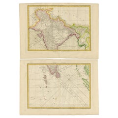
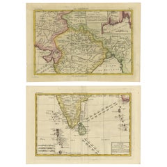
18th Century Cartographic Depiction of Upper India and Ceylon, 1835
Located in Langweer, NL
An exquisite set of two maps, 'Carte de la Partie Superieure De L'Inde en de Cadu Gange,' masterfully crafted by the renowned 18th-century French cartographer, Charles Marie Rigobert...
Category

1830s Antique Engraved More Furniture and Collectibles

Materials

Paper

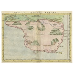
Original Antique Map of Brasil, Published in the 16th Century, 1561
Located in Langweer, NL
This important Ruscelli map of Brazil, from his work La Geografia di Claudio Tolomeo Alessandrino, is one of the earliest obtainable modern maps of the re...
Category

1660s Antique Engraved More Furniture and Collectibles

Materials

Paper

Charting the Course of Empire: Bonne's 1770 Masterpiece Maps of the Indian Ocean
Located in Langweer, NL
A voyage through history with an exquisite collection of Rigobert Bonne's 1770 maps, as featured in the coveted Atlas Moderne circa 1770. Each map, a cartographic treasure, captures ...
Category

1770s Antique Engraved More Furniture and Collectibles

Materials

Paper

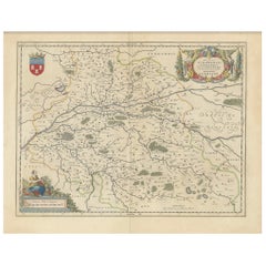
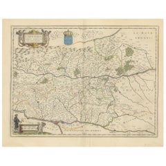
Cartographic Elegance of Touraine: A 17th-Century Map Showing French Heritage
Located in Langweer, NL
"Ducatus Turonensis - Touraine," is a original antique historical map of the Touraine region, which is located in the heart of France, centered...
Category

1630s Antique Engraved More Furniture and Collectibles

Materials

Paper

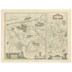
Loudun and Mirebeau: A Cartographic Masterpiece of 17th Century France by Blaeu
Located in Langweer, NL
Cartography, 17th century. Willem (1571-1638) and Joan Blaeu (1596-1673), Theatrum Orbis Terrarum sive Atlas Novus..., 1635. Figure: Loudonois. Laudunum (Loudun); Mirebalais (Mirebea...
Category

1650s Antique Engraved More Furniture and Collectibles

Materials

Paper

Lyonnais, Beaujolais, Forez, Mâconnais: A 1644 Depiction of France's Provinces
Located in Langweer, NL
An original antique map from 1644, depicting the French provinces of Lyonnais, Beaujolais, Forez, and Mâconnais. In this map, north is oriented to the right, which is a cartographic ...
Category

1640s Antique Engraved More Furniture and Collectibles

Materials

Paper

Antique Map of the City of Kampen by Guicciardini, 1613
Located in Langweer, NL
Antique map titled 'Urbis Campensis (..)'. Plan of the city of Kampen, the Netherlands. This map originates from the 1613 edition of 'Discrittione di tutti i Paesi Bassi', by L. Guic...
Category

17th Century Antique Engraved More Furniture and Collectibles

Materials

Paper

Serene Vista of Messina and its Strait: An Engraved Jewel, circa 1800
Located in Langweer, NL
Title: "Vue de Messine & de Son Détroit" This evocative print titled "Vue de Messine & de Son Détroit" presents a picturesque view of Messina and its strait, a vital waterway separa...
Category

Early 19th Century Antique Engraved More Furniture and Collectibles

Materials

Paper

1726 Valentyn's Map of Bali and Lombok, Original Engraving
Located in Langweer, NL
This antique map is a detailed 18th-century chart of the island of Bali, one of the many islands of Indonesia, with an inset of the neighboring island Lombok, attributed to François ...
Category

Early 18th Century Antique Engraved More Furniture and Collectibles

Materials

Paper

Roseaux, St. Lucia Island Map by BELLIN, Handcolored Engraving, 1763
Located in Langweer, NL
Dating back to around 1763, this antique hand-colored print, a creation by Jacques Nicolas Bellin, unveils a meticulously detailed "Plan du Cul de Sac des Roseaux dans l'Isle de Ste....
Category

1760s Antique Engraved More Furniture and Collectibles

Materials

Paper

Original Antique Map of West Central France in Frame, 1748
Located in Langweer, NL
A nicely framed and hand-coloured decorative map titled "Gouvernemens Generaux De Poitou et De Saintonge" and engraved by M. Robert. This historical international map includes several specific locations, such as the Isle Dieu, Bretagne, Anjou, Touraine, Angoumois, Perigold, Saintonge, Mer de Gascogne (Bay of Biscay), Poitou, Aunis, Guienne, la Garonne Riviere (Garonne River), and Loudunois, as well as the Tour de Cordouan (Cordouan Lighthouse). Featured towns on this map include Tonnay, Talmont, Loudun, Mortemer, Poitiers, Chalais, Riberac, Angoule, Marton, Blaye, and Monbrun. This antique map represents the west-central region of France. The theme of the atlas from which this map originates is the "Atlas Portatif Universel Et Militaire" by M. Robert. The source description indicates that this atlas is a portable, universal, and military collection...
Category

1740s Antique Engraved More Furniture and Collectibles

Materials

Paper

L'isle De La Martinique Caribbean Copper Engraving Original Handcoloring, 1704
Located in Langweer, NL
The original hand-colored map titled "Isle de la Martinique," published in 1704 and part of De Fer's Atlas Curieux, is a cartographic masterpiece offering an intricate portrayal of t...
Category

Late 19th Century Antique Engraved More Furniture and Collectibles

Materials

Paper

Early 18th Century Map of Denmark in Old Coloring, Published in 1706
Located in Langweer, NL
Denmark. Schenk (Petrus), Dania Regnum Ducatus Holsatia. et Slesvicum Insulae Danicae et Provinciae Jutia Scania etc. Amsterdam, 1706, engraved reticulated map on thick paper with co...
Category

Early 1700s Antique Engraved More Furniture and Collectibles

Materials

Paper

Three Antique Maps on One Folio: Turkey, Northern Egypt, and Ancient Carthage
Located in Langweer, NL
The map consists of three distinct sections on a single folio sheet: 1. **Map of Turkey**: - Orientation: The map is oriented with the east at the top, which is a common practic...
Category

16th Century Antique Engraved More Furniture and Collectibles

Materials

Paper

Old Map Showing Info Related to the Ottoman Wars including Conflict Dates, c1690
Located in Langweer, NL
"Corso del Danubio da Vienna Sui a Vicopoli, e Paesi Adiacenti - Northwestern Sheet", Coronelli, Vincenzo Maria Subject: Central Europe, Danube River Period: 1690 (circa) Publicatio...
Category

1690s Antique Engraved More Furniture and Collectibles

Materials

Paper

Antique Map of the Cape Verde Islands and Part of Senegal, West Africa, 1690
Located in Langweer, NL
Antique map titled 'Bocche del Fivme Negro et Isole di Capo Verde'. Beautiful double-page map of the Cape Verde Islands and part of the coast of Senegal, with large decorative cartou...
Category

17th Century Antique Engraved More Furniture and Collectibles

Materials

Paper

18th Century French Religious Fer a Hosties Eucharist Host Iron Waffle Press
Located in Forney, TX
A scarce antique, circa 1765, French fer a hosties (cast iron host press / host mold). Exquisitely hand forged in France in the 18th century, showcasing the blacksmith's high qual...
Category

Late 18th Century French Medieval Antique Engraved More Furniture and Collectibles

Materials

Iron

1797 Tardieu Map of Southeast Asia: The Malay Archipelago and Beyond
Located in Langweer, NL
An original historical map titled 'Presqu' Île Au Dela Du Gange et Archipel De L'Inde', created by Pierre Francois Tardieu and published in the "Atlas Universel" by Pierre Grégoire C...
Category

1790s Antique Engraved More Furniture and Collectibles

Materials

Paper

1585 Mercator Map of Ireland, Entitled "Irlandiae Regnvm, " Hand Colored Ric0006
Located in Norton, MA
1585 Mercator map of Ireland, entitled "Irlandiae Regnvm." Hand Colored Description: Published in Amsterdam by Mercator/Hondius ca. 1585. Artists and Engravers: 1585 Mercator map of Ireland, entitled "Irlandiae Regnvm." Copperplate engraving on verge type hand laid paper with watermark. Description: Published in Amsterdam by Mercator/Hondius ca. 1585.Artists and Engravers: Mercator was born in Rupelmonde in Flanders and studied in Louvain under Gemma Frisius, Dutch writer, astronomer and mathematician. The excellence of his work brought him the patronage of Charles V, but in spite of his favor with the Emperor he was caught up in the persecution of Lutheran protestants and charged with heresy, fortunately without serious consequences. No doubt the fear of further persecution influenced his move in 1552 to Duisburg, where he continued the production of maps, globes and instruments. Mercator's sons and grandsons, were all cartographers and made their contributions in various ways to his atlas. Rumold, in particular, was responsible for the complete edition in 1595. The map plates...
Category

16th Century Dutch Antique Engraved More Furniture and Collectibles

Materials

Paper

Grande Bilancia Italiana Inizio 1800 in Legno Scolpito e Ferro a Due Piatti
Located in Milano, MI
Alta quasi 51 inches, questa grande bilancia italiana da terra del XIX secolo è realizzata con un capitello corinzio intagliato a motivi folgiati, scolpito con foglie di acanto e la...
Category

Early 19th Century Italian Louis XV Antique Engraved More Furniture and Collectibles

Materials

Iron, Metal

Captain Cook's Exploration of Tahiti 18th C. Hand-Colored Map by Bellin
Located in Alamo, CA
This beautiful 18th century hand-colored copper plate engraved map is entitled "Carte de l'Isle de Taiti, par le Lieutenant J. Cook" was created by Jacques Nicolas Bellin and publish...
Category

Mid-18th Century French Antique Engraved More Furniture and Collectibles

Materials

Paper

Old Engraving of Batavia 'Jakarta, Indonesia' with Map and Harbour View, 1750
Located in Langweer, NL
Antique map titled 'Carte des environs de Batavia '. French map of the Batavia area (Jakarta) in Indonesia. With cartouche, scale and compass rose. Published circa 1750. The map i...
Category

1750s Antique Engraved More Furniture and Collectibles

Materials

Paper

Historical Map of Holstein - Copperplate Engraving by Matthias Seutter, ca. 1730
Located in Langweer, NL
Historical Map of Holstein - Copperplate Engraving by Matthias Seutter, ca. 1730 This impressive historical map, titled Holsatiae. Mappa universalis in suos ducatus nimirum Holsat...
Category

1730s Antique Engraved More Furniture and Collectibles

Materials

Paper

Historic 1690 Map of Lorraine in France by Allard - Cities of Toul, Nancy, Metz
Located in Langweer, NL
Exactissima Lotharingia - A Rare 17th Century Map of Lorraine by Carel Allard This fascinating map of Lorraine, created by Carel Allard around 1690, is a stunning example of coppe...
Category

1690s Antique Engraved More Furniture and Collectibles

Materials

Paper

Authentic Old Map of Southeast Asia with Original Border Coloring, 1745
Located in Langweer, NL
Title: "Kaartje van Oost-Indien na de stelling van den Heer Guillaume de L'Isle" Translates to "Map of the East-Indies based on the work of Mr. Guillaume de L'Isle." Guillaume de L...
Category

1740s Antique Engraved More Furniture and Collectibles

Materials

Paper

Antique Engraving of Kirby Hall Near Gretton, Northamptonshire, England c.1770
Located in Langweer, NL
Antique print titled 'Principal Front of Kirby Hall'. Kirby Hall is an Elizabethan country house, located near Gretton, Northamptonshire, England. The nearest main town is Corby. One of the great Elizabethan houses of England, Kirby Hall was built for Sir Humphrey Stafford of Blatherwick, beginning in 1570. In 1575 the property was purchased by Sir Christopher Hatton of Holdenby,[1] Lord Chancellor to Queen Elizabeth I. It is a leading and early example of the Elizabethan prodigy house. Construction on the building began in 1570, based on the designs in French architectural pattern books and expanded in the Classical style over the course of the following decades. The house is now in a semi-ruined state with many parts roof-less although the Great Hall and state rooms remain intact. The gardens, with their elaborate "cutwork" design, complete with statues and urns, have been recently restored. Anne of Denmark stayed at Kirby on 9 August 1605 while King James stayed at Rockingham Castle. King James stayed for three days in August 1616. During a royal progress Esmé Stewart, 3rd Duke of Lennox died at Kirby of the "spotted ague" on 30 July 1624. The building and gardens are owned by the Earl of Winchilsea and are managed by English Heritage. Kirby Hall has been used as a filming location in many productions. These include the following; an episode (6. Protest and Communication) of Kenneth Clark...
Category

18th Century Antique Engraved More Furniture and Collectibles

Materials

Paper

Antique Bird's-Eye Plan of Tutecoryn (Tuticorin or Thoothukudi), India, 1672
Located in Langweer, NL
Antique map, titled: 'Tutecoryn.' Bird's-eye plan of map of Tutecoryn (Tuticorin or Thoothukudi), India. This map originates from 'Naauwkeurige Beschryvinge van Malabar en Choroman...
Category

1670s Antique Engraved More Furniture and Collectibles

Materials

Paper

Antique Map of the Netherlands by N. Visscher, 1684
Located in Langweer, NL
Antique map titled 'Comitatus Hollandiae Tabula Pluribus Locis Recens Emendata a Nicolao I. Visschero'. West to the top. Lower left inset of the Wadden Islands, Texel, Vlieland, Ters...
Category

Late 17th Century Antique Engraved More Furniture and Collectibles

Materials

Paper

Antique Map Eastern Mediterranean by D. Stoopendaal 'circa 1710'
Located in Langweer, NL
Antique map Middle East titled 'De Beschryving van de Reysen Pauli en van de Andere Apostelen'. Antique map of the Eastern Mediterranean with details of the travels by Apostle Paul...
Category

Early 18th Century Dutch Antique Engraved More Furniture and Collectibles

Materials

Paper

Antique English Order of the Odd Fellows Society Trophy Award c1939 Silver plate
Located in Shreveport, LA
Antique English Order of the Odd Fellows Society Trophy Award c1939 Silver plate. Direct from England, just arrived in our most recent container, we have several of these one-of-a-kind English trophies that are brimming with provenance, and oh “the stories they could tell”! This large oak plaque/trophy is highly engraved, with large, dimensional descriptive plaque at the top, as follows: “INDEPENDENT ORDER OF ODD FELLOWS...
Category

1930s British Other Vintage Engraved More Furniture and Collectibles

Materials

Silver Plate

Antique Print with Views of Sir Charles Saunders Island and Other Islands, 1774
Located in Langweer, NL
Explore the captivating world of the 18th century with this exquisite antique print titled 'Isles de Sir Charles Saunder Latitude (...)'. I A journey through time as you delve into t...
Category

Late 18th Century Antique Engraved More Furniture and Collectibles

Materials

Paper

Rare Antique Map of Leeuwarden, Friesland, The Netherlands, by P. Bast, 1603
By P. Bast
Located in Langweer, NL
Very rare plan of Leeuwarden, Friesland, The Netherlands. With several cartouches and coat of arms. With a legend and compass rose at bottom right. Made by 'Pieter Bast' after the su...
Category

Early 17th Century Antique Engraved More Furniture and Collectibles

Materials

Paper

LES PASTORALES. Binding by René Kieffer with Original Wood Block.
Located in Middletown, NY
Les Pastorales by Theocritus / Théocrite, illustrated and with unique binding by Kieffer, René Les Pastorales; Traduites intégralement par Gabriel Soulages. Bois originaux de J.-B. ...
Category

Early 20th Century French Engraved More Furniture and Collectibles

Materials

Leather, Wood, Paper

RARE ‘De Conjugio Episcoporum et Diaconorum’ by Johannes Bugenhagen – 1525
Located in Dallas, TX
PRESENTING AN EXTREMELY RARE EDITION hardback copy of De Conjugio Episcoporum et Diaconorum ad uenerandum Doctorem VVolfgangum Reissenbush monasterii Lichtenbergensis Prae ceptorem ...
Category

16th Century German Renaissance Antique Engraved More Furniture and Collectibles

Materials

Leather, Paper

1627 Hondius Map "La Principaute d'Orange et Comtat de Ve", Ric.0003
Located in Norton, MA
1627 Hondius map entitled "La Principaute d'Orange et Comtat de Venaissin," Original Hand-Colored Description: From Johannes Janssonius's Atlantis Maioris Appendix of 1630. ...
Category

17th Century Unknown Antique Engraved More Furniture and Collectibles

Materials

Paper

Antique Map of the Coast of Guinea from, Cape Apollonia to the Volta River
Located in Langweer, NL
Antique map titled 'Suite de la Coste de Guinée (..) - Vervolg van de Kust van Guinée (..)'. Decorative map of the coast of Guinea from, Cape Apollonia to the Volta River. Engraved b...
Category

Mid-18th Century Antique Engraved More Furniture and Collectibles

Materials

Paper

18th Century Hand Colored Map of Spain and Portugal by Visscher
Located in Alamo, CA
This is an early 18th century map of Spain and Portugal, with attractive original hand-coloring, entitled "Hispaniae et Portugalliae Regna per Nicolaum Visscher cum Privilegio Ordinu...
Category

Early 18th Century Dutch Antique Engraved More Furniture and Collectibles

Materials

Paper

Old Map of Indonesian Islands Borneo, Celebes, New Guinea & New Britain, 1792
Located in Langweer, NL
Antique map titled 'Partie de la Nouvelle Grande Carte des Indes Orientales, contenant les Isles de Borneo, Iava, Celebes, Mindanao (..)'. Detailed map of the Indonesian islands Bo...
Category

1790s Antique Engraved More Furniture and Collectibles

Materials

Paper

Antique Map by Janssonius of the Dutch Province of Overijsel, ca.1650
Located in Langweer, NL
Very good, given the age. Center fold as issued with wide margins. Sharp print with beautiful old-fashioned colouring, carbon copy on verso. Paper in the margins somewhat browned.
Category

1650s Antique Engraved More Furniture and Collectibles

Materials

Paper

Old Engraving of French Visiting Tomari, a Village in Far East Russia, 1797
Located in Langweer, NL
Plate: 'Costumes des Habitants de la Baie de Langle.' (Costumes of the inhabitants of Langle Bay, Russia). Tomari (Russian: ??????) is a coastal town and the administrative cente...
Category

1790s Antique Engraved More Furniture and Collectibles

Materials

Paper

The Astronomer Unique Historical Folk Art Painting Signed 1918
Located in South Burlington, VT
Unique Historical Work of Art Dated 1918 "L' Astronome (The Astronomer) by Fedinant Roybet. This is an original and one-of-a-kind artistic presentation- a superb pyrography incis...
Category

Early 20th Century French Engraved More Furniture and Collectibles

Materials

Wood

Antique Geographical, Historical and Statistical Map of Massachusetts, 1822
Located in Langweer, NL
This attractive map of Massachusetts presents a finely detailed overview of the state in the first quarter of the 19th century. Transportation ...
Category

1820s Antique Engraved More Furniture and Collectibles

Materials

Paper

Original Antique Map of the Coast of Part of Greece, with Athens and Thebes
Located in Langweer, NL
Original antique map titled 'Achaia quae et Hellas hodie Livadia'. Detailed map of the coast of part of Greece. With inset maps of Athens and Thebes. This map originates from 'Philippi Cluveri Introductionis in universam geographiam (..)' by P. Clüver. Published 1729. Philipp Clüver was an Early Modern German geographer and historian. Cluver's Geography was one of the most enduring works of the 17th & 18th Centuries, issued by several different publishers with many different sets of maps...
Category

Early 18th Century Antique Engraved More Furniture and Collectibles

Materials

Paper

Map of the Holy Land "Carte de la Syrie et de l'Egypte" by Pierre M. Lapie
Located in Alamo, CA
An early 19th century map of ancient Syria and Egypt entitled "Carte de la Syrie et de l'Egypte anciennes/dressée par M. Lapie, Colonel d'Etat Major, et...
Category

Early 19th Century French Antique Engraved More Furniture and Collectibles

Materials

Paper

Rare French Engraving of the Niagara Waterfalls in Ontario, Canada, 1801
Located in Langweer, NL
Title: Vue d'une partie des deux Branches de la Cataracte de Niagara. Dirigé par P.F. Tardieu, Place de l'Estrapade No. 18. Upper Left: Pl.VIII, Tom.II Pag.192. Lower Left: Bonfil...
Category

Early 1800s Antique Engraved More Furniture and Collectibles

Materials

Paper

Antique Map of Gabon, Angola and the Congo Region in Africa c.1680
Located in Langweer, NL
Antique map titled 'Royaume de Congo'. Map of Gabon, the Congo and Angola from Cape Lopez and Sao Tomé to approximately the border with present-day Namibia. The map is fully engrav...
Category

17th Century Antique Engraved More Furniture and Collectibles

Materials

Paper

1718 Ides & Witsen Map "Route D'amsterdam a Moscow Et De La Ispahan Et Gamron
Located in Norton, MA
1718 Ides & Witsen map, entitled "Route D'Amsterdam A Moscow Et De La Ispahan Et Gamron," Ric.b005 Subject: Eastern Europe and Central Asia Period: 1718 (published) Publicati...
Category

Early 18th Century Dutch Antique Engraved More Furniture and Collectibles

Materials

Paper

Antique Map of Celebes 'Sulawesi, Indonesia' by Bellin, ciarca 1755
Located in Langweer, NL
Antique map titled 'Carte de l'Isle Celebes ou Macassar'. Map of Celebes (Sulawesi, Indonesia), showing Makassar, which was the most important trading city of eastern Indonesia in th...
Category

Mid-18th Century European Antique Engraved More Furniture and Collectibles

Materials

Paper

Interesting Map of the Thousand Islands in the Bay of Batavia 'Jakarta', ca.1740
Located in Langweer, NL
A single unfolded page border colored engraved map, printed no. 107 in top corner. This same map is found as plate 107 in Atlas Universelle aus dem Jahre 1787 by Philippe de Pretot b...
Category

1740s Antique Engraved More Furniture and Collectibles

Materials

Paper

18th Century Dutch Copper Tobacco Box
Located in Delft, NL
18th century Dutch copper tobacco box 18th century copper tobacco box in oval shape with rims. Engraved with Biblical scenes and Dutch text. Text is: "...
Category

Mid-18th Century Dutch Antique Engraved More Furniture and Collectibles

Materials

Copper

Herculaneum Monuments, 1762: Bayardi's Engraving Plate 61
Located in Langweer, NL
Antique print originating from 'Le Antichita di Ercolano Esposte'. A vast survey of the bronzes, statues, wall-paintings, and monuments of Herculaneum. This monumental work was the f...
Category

18th Century Antique Engraved More Furniture and Collectibles

Materials

Paper

1750 Bellin Map of the Red River (Tonkin River) and Hanoi, Vietnam
Located in Langweer, NL
Title: 1750 Bellin Map of the Red River and Hanoi, Vietnam Description: This finely engraved eighteenth-century French map, titled Carte du Cours de la Riviere de Tunquin, was created by the renowned cartographer Jacques-Nicolas Bellin and published in 1750. It depicts the course of the Red River, historically referred to as the Tonkin River, from Hanoi, labeled as Cacho, Ville Capitale du Tunquin, to the Gulf of Tonkin, labeled as Baye de Tunquin. Bellin’s work was based on navigational surveys by an English explorer, as stated in the title, reflecting the growing European interest in Southeast Asia during the early colonial period. The Red River Delta was a crucial region for trade and agriculture, forming the backbone of Vietnam’s economic and cultural history. The river originates in China and flows through northern Vietnam, passing through Hanoi before emptying into the Gulf of Tonkin. This map captures the strategic importance of the river, as it served as a major trade route for goods and a point of interest for European navigators, merchants, and missionaries seeking access to Indochina. The map includes numerous geographical details. Hanoi is prominently labeled as the capital of Tonkin, a historical term used by Europeans to describe northern Vietnam. The surrounding settlements, islands, and tributaries are carefully marked, illustrating the intricate network of waterways that characterized the region. Notable features include Île de la Potterie, referring to a location known for ceramic production, and various sandbanks and fortified locations along the river. A decorative compass rose is placed in the upper left corner, reinforcing the map’s navigational purpose. The scale of measurement is provided in French leagues, labeled as Grandes Lieues...
Category

1750s Antique Engraved More Furniture and Collectibles

Materials

Paper

Antique Print of San Nicola Da Tolentino Agli Orti Sallustiani by De Rossi
Located in Langweer, NL
Antique print titled 'Facciata della Chiesa di S. Nicola da Tolentio, a Capo le Case'. Old print of the San Nicola da Tolentino agli Orti Sallustiani church...
Category

18th Century Antique Engraved More Furniture and Collectibles

Materials

Paper

Antique County Map of Derbyshire, England, 1804
Located in Langweer, NL
Antique county map of Derbyshire first published, circa 1800. Villages, towns, and cities illustrated include Chesterfield, Wirksworth, Derby, and ...
Category

Early 1800s Antique Engraved More Furniture and Collectibles

Materials

Paper

Rare Theodore Danckerts Map of the Lower Rhine and Moselle River Regions
Located in Langweer, NL
Original antique map titled 'Accuratissima Rheni Inferioris Mosae et Mosellae Tabula'. Rare Theodore Danckerts map of the Lower Rhine and Moselle River Regions. The map covers the lo...
Category

Early 18th Century Antique Engraved More Furniture and Collectibles

Materials

Paper

Set of Six The Works of Sir Wm Stirling Maxwell, Ltd #178/250
Located in valatie, NY
Set of six volumes, full Moroccan leather bindings. Annals of The Artists of Spain by Wm Stirling-Maxwell. London: John Nimmo, 1891. In four volumes. First Edition, thus. Numbered #1...
Category

Late 19th Century English Antique Engraved More Furniture and Collectibles

Materials

Leather, Paper

Antique Map of the Region of Le Mans 'France' by Blaeu, circa 1640
Located in Langweer, NL
Antique Map: Cenomanorum Galliae regionis typus vulgo le Mans – Blaeu, circa 1640 This beautifully engraved and hand-colored map depicts the historical province of Maine in northw...
Category

Mid-17th Century Antique Engraved More Furniture and Collectibles

Materials

Paper

Old Color Engraving of Blaeu's first Map of Brazil, North Oriented to the Right
Located in Langweer, NL
Antique map titled 'Novus Brasiliae Typus'. Fine old color example of Blaeu's first map of Brazil, with north oriented to the right. Includes inset map of Baya de todos Santos, elaborate cartouche, 2 compass roses and richly embellished vignettes of native Brazilian life and animals. The interior of the map includes vignettes of indigenous animals and native scenes, including cannibalism. Inset within a decorative border is a small map of "Baya de todos Sanctos". In the sea are monsters, a galleon and two compass roses. The large title cartouche features a male and female Brazilian, both of whom are shown naked. Willem Janszoon Blaeu (1571-1638) was a prominent Dutch geographer and publisher. Born the son of a herring merchant, Blaeu chose not fish but mathematics and astronomy for his focus. He studied with the famous Danish astronomer Tycho Brahe...
Category

Mid-17th Century Antique Engraved More Furniture and Collectibles

Materials

Paper

1612 Abraham Ortelius, Entitled "Lorraine, Lotharingiae, Nova Desciptio, " Ric008
Located in Norton, MA
1612 Abraham Ortelius, entitled "Lorraine, Lotharingiae, Nova Desciptio," Hand Colored Description: Artists and Engravers: Ortelius is the best known for producing the atla...
Category

17th Century Dutch Antique Engraved More Furniture and Collectibles

Materials

Paper

Flanders, Holland & Norfolk: Hand-Colored 17th Century Sea Chart by Collins
Located in Alamo, CA
This hand-colored chart of the seas about Flanders, Holland, Frisia, and Norfolk is from "Great Britain's Coasting Pilot. Being a New and Exact Survey of the Sea-Coast of England" by...
Category

Late 17th Century English Antique Engraved More Furniture and Collectibles

Materials

Paper

Read More

Medal-Worthy Memorabilia from Epic Past Olympic Games

Get into the games! These items celebrate the events, athletes, host countries and sporting spirit.

Ahoy! You’ve Never Seen a Collection of Sailor Art and Kitsch Quite Like This

French trendsetter and serial collector Daniel Rozensztroch tells us about his obsession with objects related to seafaring men.

39 Incredible Swimming Pools

It's hard to resist the allure of a beautiful pool. So, go ahead and daydream about whiling away your summer in paradise.

Pamela Shamshiri Shares the Secrets behind Her First-Ever Book and Its Effortlessly Cool Interiors

The sought-after designer worked with the team at Hoffman Creative to produce a monograph that beautifully showcases some of Studio Shamshiri's most inspiring projects.

Moroccan Artworks and Objects Take Center Stage in an Extraordinary Villa in Tangier

Italian writer and collector Umberto Pasti opens the doors to his remarkable cave of wonders in North Africa.

Montecito Has Drawn Royalty and Celebrities, and These Homes Are Proof of Its Allure

Hollywood A-listers, ex-pat aristocrats and art collectors and style setters of all stripes appreciate the allure of the coastal California hamlet — much on our minds after recent winter floods.

Whaam! Blam! Pow! — a New Book on Pop Art Packs a Punch

Publishing house Assouline and writer Julie Belcove have teamed up to trace the history of the genre, from Roy Lichtenstein, Andy Warhol and Yayoi Kusama to Mickalene Thomas and Jeff Koons.

The Sparkling Legacy of Tiffany & Co. Explained, One Jewel at a Time

A gorgeous new book celebrates — and memorializes — the iconic jeweler’s rich heritage.
Recently Viewed

View All