Engraved Collectibles and Curiosities

to
343
514
242
768
5
5
17
12
11
10
9
8
7
5
4
2
1
1
1
1
460
193
115
10
63
24
16
7
4
2
5
3
1
3
6
3
4
588
167
89
53
35
253
68
55
54
53
778
778
778
10
9
9
8
5
Technique: Engraved
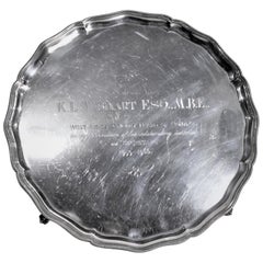
Midcentury Sterling Silver West Indies Cricket Control Board Presentation Tray
Located in Hamilton, Ontario
This sterling silver footed presentation tray was made by the well-known English maker, Barker Ellis in circa 1967 in an Edwardian style. The tray is...
Category

Mid-20th Century English Edwardian Engraved Collectibles and Curiosities

Materials

Sterling Silver

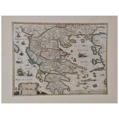
Greece, "Graeciae Antiquae"" A 17th Century Hand-colored Map by Sanson
Located in Alamo, CA
This is an original 17th century hand colored copperplate engraved map of Greece entitled "Graeciae Antiquae Tabula Hanc Geographicam" by Nicolas d'Abbeville Sanson, engraved and pub...
Category

Mid-17th Century French Antique Engraved Collectibles and Curiosities

Materials

Paper

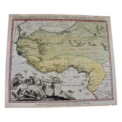
West Africa Entitled "Guinea Propria": An 18th Century Hand Colored Homann Map
Located in Alamo, CA
This is a scarce richly hand colored copper plate engraved map of Africa entitled "Guinea Propria, nec non Nigritiae vel Terrae Nigrorum Maxima Pars" by Johann Baptist Homann (1664-1...
Category

Mid-18th Century German Antique Engraved Collectibles and Curiosities

Materials

Paper

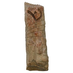
Western Wall Heritage Mezuzah – Hand-Carved Stone Depicting Prayer at the Kotel
Located in New York, NY
This exceptional mezuzah is meticulously hand-carved from authentic Jerusalem stone, originally part of the Western Wall. These historic stones, uprooted due to structural shifts over 70 years ago, were later repurposed to cover marble sinks used...
Category

2010s Israeli Engraved Collectibles and Curiosities

Materials

Stone

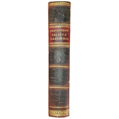
Demosthenis Selectae Orationes by Richard Mounteney 1791 7th Edition
Located in Dallas, TX
Presenting a fabulously rare antiquarian book from 1791, namely, Demosthenis Selectae Orationes by Richard Mounteney 1791 7th Edition. Leather Spine in very good condition. Leathe...
Category

18th Century English Classical Greek Antique Engraved Collectibles and Curiosities

Materials

Leather, Paper

England, Scotland & Ireland: A Hand Colored Map of Great Britain by Tirion
Located in Alamo, CA
This is a hand-colored double page copperplate map of Great Britain entitled "Nieuwe Kaart van de Eilanden van Groot Brittannien Behelzende de Kon...
Category

Mid-18th Century Dutch Antique Engraved Collectibles and Curiosities

Materials

Paper

17th Century Hand-Colored Map of Southeastern England by Mercator and Hondius
Located in Alamo, CA
A 17th century copperplate hand-colored map entitled "The Sixt Table of England" by Gerard Mercator and Jodocus Hondius, published in Amsterdam in 1635 in 'Cosmographicall Descriptio...
Category

Mid-17th Century Dutch Antique Engraved Collectibles and Curiosities

Materials

Paper

Antique Engraved Map with Original Hand Colour of French Guiana, 1876
Located in Langweer, NL
The 1876 map of French Guiana from the "Grand Atlas Départemental de la France de L'Algérie et des colonies" by H. Fisquet, published by A. Le Vasseur in Paris, is a significant piec...
Category

Late 19th Century Antique Engraved Collectibles and Curiosities

Materials

Paper

Antique Engraving of the Island Nzwani or Anzuany of the Comoros Islands, 1726
Located in Langweer, NL
Historical titles: Ansjouan, Ansuany, Anjouan, Anzuani, Anzuany Country: Comoros The map is taken from: 'Oud en Nieuw Oost-Indiën' van François Valentyn. 1) Ottens, Frederik (engraver / etcher) 2) Braam, J. van (publisher) 3) Linden, Gerard onder de (publisher) Anjouan is an island to the north-west of Madagascar. It is one of the Comoros Islands. The Company made regular voyages from Cape of Good Hope to Madagascar, Anjouan and the east coast of Africa to take slaves. These slaves were used as labourers in the Cape colony and Batavia. Anjouan was also employed as a staging post; it supplied VOC ships...
Category

1720s Antique Engraved Collectibles and Curiosities

Materials

Paper

Original Antique Engrving of Chinese Tartary in the 18th Century, 1737
Located in Langweer, NL
The antique map titled " Ozieme feuille particuls de la Tartarie Chinoise, qui contient un pays dependant de la russie aucouchant de NIPTCHOU " translates to "Sixth sheet of parts of...
Category

1730s Antique Engraved Collectibles and Curiosities

Materials

Paper

1840 "New Map of the City of New York With Part of Brooklyn & Williamsburg"
Located in Colorado Springs, CO
Presented is a hand-colored, engraved folding map titled "New Map of the City of New York With Part of Brooklyn & Williamsburg" by J. Calvin Smith. The map was issued bound in the bo...
Category

1840s American Antique Engraved Collectibles and Curiosities

Materials

Paper

Southern Greece: A Large 17th C. Hand-colored Map by Sanson and Jaillot
Located in Alamo, CA
This large original hand-colored copperplate engraved map of southern Greece and the Pelopponese Peninsula entitled "La Moree Et Les Isles De Zante, Cefalonie, Ste. Marie, Cerigo & C...
Category

1690s French Antique Engraved Collectibles and Curiosities

Materials

Paper

Hampshire County, Britain/England: A Map from Camden's" Britannia" in 1607
By John Norden
Located in Alamo, CA
An early hand-colored map of Britain's Hampshire county, published in the 1607 edition of William Camden's great historical description of the British Isles, "Britannia". This map was drawn by cartographer John Norden (c. 1547-1625) and engraved by William Hole (active 1607-1624) and William Kip...
Category

Early 17th Century English Antique Engraved Collectibles and Curiosities

Materials

Paper

17th Century Hand-Colored Map of a Region in West Germany by Janssonius
Located in Alamo, CA
This attractive highly detailed 17th century original hand-colored map is entitled "Archiepiscopatus Maghdeburgensis et Anhaltinus Ducatus cum terris adjacentibus". It was published ...
Category

Mid-17th Century Dutch Antique Engraved Collectibles and Curiosities

Materials

Paper

Portugal: A Large 17th Century Hand-colored Map by Sanson and Jaillot
Located in Alamo, CA
This large hand-colored map entitled "Le Royaume de Portugal et des Algarves Divisee en see Archeveches, Eveches et Territoires Par le Sr Sanson" was originally created by Nicholas S...
Category

1690s French Antique Engraved Collectibles and Curiosities

Materials

Paper

Large 17th Century Hand Colored Map of England and the British Isles by de Wit
Located in Alamo, CA
A large hand colored 17th century map of England and the British Isles by Frederick de Wit entitled "Accuratissima Angliæ Regni et Walliæ Principatus", published in Amsterdam in 1680. It is a highly detailed map of England, Scotland, the Scottish Isles...
Category

Late 17th Century Dutch Antique Engraved Collectibles and Curiosities

Materials

Paper

St. Christophe 'St. Kitts' Island: An 18th Century Hand-colored Map by Bellin
Located in Alamo, CA
Jacques Bellin's copper-plate map of the Caribbean island of Saint Kitts entitled "Carte De De l'Isle St. Christophe Pour servir á l'Histoire Genle. des V...
Category

Mid-18th Century French Antique Engraved Collectibles and Curiosities

Materials

Paper

Scandinavia & Portions of Eastern Europe: 18th Century Hand-Colored Homann Map
Located in Alamo, CA
An early 18th century hand-colored copper-plate map entitled "Regni Sueciae in omnes suas Subjacentes Provincias accurate divisi Tabula Generalis" by Johann Baptist Homann (1663-1724...
Category

Early 18th Century German Antique Engraved Collectibles and Curiosities

Materials

Paper

17th Century Hand Colored Map of the Liege Region in Belgium by Visscher
Located in Alamo, CA
An original 17th century map entitled "Leodiensis Episcopatus in omnes Subjacentes Provincias distincté divisusVisscher, Leodiensis Episcopatus" by Nicolaes Visscher II, published in Amsterdam in 1688. The map is centered on Liege, Belgium, includes the area between Antwerp, Turnhout, Roermond, Cologne, Trier and Dinant. This attractive map is presented in a cream-colored mat measuring 30" wide x 27.5" high. There is a central fold, as issued. There is minimal spotting in the upper margin and a tiny spot in the right lower margin, which are under the mat. The map is otherwise in excellent condition. The Visscher family were one of the great cartographic families of the 17th century. Begun by Claes Jansz Visscher...
Category

Late 17th Century Dutch Antique Engraved Collectibles and Curiosities

Materials

Paper

Northern Scotland: A 17th Century Hand-colored Map by Mercator
Located in Alamo, CA
This is a framed hand-colored 17th century map of Northern Scotland by Gerard Mercator entitled "Scotiae pars Septentrionalis", published in Amsterdam in 1636. It is a highly detailed map of the northern part of Scotland, with the northwest Highlands and the cities Inverness and Aberdeen, as well as the Orkney Islands and the Hebrides. There is a decorative title cartouche in the upper left corner. The map is presented in an antiqued brown wood...
Category

1630s Dutch Antique Engraved Collectibles and Curiosities

Materials

Paper

Antique Map of the Namen or Namur Region in Wallonia, Belgium
Located in Langweer, NL
Description: Antique map titled 'Namurcum Comitatus' A map of the Namen/Namur region in Wallonia, Belgium. It is the capital of the province Namur and hosts the Walloon Parliament. T...
Category

1610s Antique Engraved Collectibles and Curiosities

Materials

Paper

Flanders, Holland & Norfolk: Hand-Colored 17th Century Sea Chart by Collins
Located in Alamo, CA
This hand-colored chart of the seas about Flanders, Holland, Frisia, and Norfolk is from "Great Britain's Coasting Pilot. Being a New and Exact Survey of the Sea-Coast of England" by...
Category

Late 17th Century English Antique Engraved Collectibles and Curiosities

Materials

Paper

Antique Map of Christmas Island by Cook, 1784
Located in Langweer, NL
Antique map Kiribati titled 'Christmas Island (..)'. Antique map of Christmas Island, also known as Kiritimati. Originates from an edition of Cook's Voyages. Artists and Engravers...
Category

18th Century Antique Engraved Collectibles and Curiosities

Materials

Paper

Old German Map of Northern America with Attractive Hand Colouring, 1864
Located in Langweer, NL
Interesting German map of Northern America in a handsome coloring. Genuine antique hand colored map of North America, with handsome detail, in German detai...
Category

1860s Antique Engraved Collectibles and Curiosities

Materials

Paper

Late 19th Century Russian Silver Torah Pointer
Located in New York, NY
Handmade silver Torah pointer, Russia, circa 1880. The handle is made with a knob shape interval engraved with floral ornaments. The reading end is shaped as a hand with a pointing index finger. A suspension loop is connected to the top of upper section of the pointer. Marked with Russian silver hallmarks...
Category

Late 19th Century German Antique Engraved Collectibles and Curiosities

Materials

Silver

Dartmouth, England: A Hand-Colored 17th Century Sea Chart by Captain Collins
Located in Alamo, CA
This hand-colored sea chart of the area around Dartmouth, England is from "Great Britain's Coasting Pilot. Being a New and Exact Survey of the Sea-Coast of England", first published ...
Category

Late 17th Century English Antique Engraved Collectibles and Curiosities

Materials

Paper

18th Century French Map and City View of Joppe/Jaffa 'Tel Aviv' by Sanson
Located in Alamo, CA
An original antique engraving entitled "Joppe; in ’t Hebreeusch by ouds Japho; hedendaags Japha, of Jaffa; volgens d’aftekening gedaan 1668", by Nicholas Sanson d'Abbeville (1600 - 1667). This is a view of the city of Joppe (in Hebrew Japho), now called Japha or Jaffa, the harbor portion of modern day Tel Aviv, Israel as it appeared in 1668 . It depicts a very busy harbor with numerous boats. A large ship on the left appears to be firing its canons and a small ship on the right appears to be sitting very low in the water, either heavily loaded with cargo or sinking. The town is seen on the far shore with a fortress on a hill across in the background. The map is printed from the original Sanson copperplate and was published in 1709 by his descendants. The map is presented in an ornate brown wood frame embellished by gold-colored leaves and gold inner trim with a double mat; the outer mat is cream-colored and the inner mat is black. There is a central vertical fold, as issued. There are two small spots in the lower margin and one in the upper margin, as well as two tiny spots adjacent to the central fold. 1717 is written below the date 1668 in the inscription. The map is otherwise in very good condition. Another map of the "Holy Land" (by Claes Visscher in 1663), with an identical style frame and mat is available. This pair of maps would make a wonderful display grouping. Please see Reference #LU5206220653552. A discount is available for the purchase of the pair of maps. Artist: Nicholas Sanson d'Abbeville (1600-1667) and his descendents were important French cartographer's active through the 17th century. Sanson started his career as a historian and initially utilized cartography to illustrate his historical treatises. His maps came to the attention of Cardinal Richelieu and then King Louis XIII of France, who became a supporter and sponsor. He subsequently appointed Sanson 'Geographe Ordinaire du Roi' the official map maker to the king. Sanson not only created maps for the king, but advised him on geographical issues and curated his map collection...
Category

Early 18th Century French Antique Engraved Collectibles and Curiosities

Materials

Paper

Edinburgh, Scotland Coast: A 17th Century Hand-Colored Sea Chart by Collins
Located in Alamo, CA
This hand-colored sea chart is entitled "Edinburgh Firth" from "Great Britain's Coasting Pilot. Being a New and Exact Survey of the Sea-Coast of England" by Captain Greenville Collin...
Category

Late 17th Century English Antique Engraved Collectibles and Curiosities

Materials

Paper

Antique Print of the Old University Town Franeker in the Netherlands '1786'
Located in Langweer, NL
Antique print titled 'Franeker van den kant van Schalsum te zien'. Old print with a view on the city of Franeker, as seen from Schalsum. This print originates from 'Hedendaagsche His...
Category

18th Century Antique Engraved Collectibles and Curiosities

Materials

Paper

Antique Print of the King of Barsalli & the Yamyamakunda Factory, Gambia, C1730
Located in Langweer, NL
Old Engraving with Title: Bumey Haman Seaka, King of Barsalli on the Gambia // plan of Yamyamakunda Factory on ye Gambia. Artist/engraver/cartographer: ...
Category

1730s Antique Engraved Collectibles and Curiosities

Materials

Paper

The Cape Verde Islands Coast Antique Engraving by Van Schley, 1747
Located in Langweer, NL
Antique map titled ‘Carte Exacte de la cote du Cap Verd (..) - Naauwkeurige Kaart van de Kust van Kabo Verde (..)'. Original antique map of the coast of the Cape Verde Islands. This ...
Category

18th Century Antique Engraved Collectibles and Curiosities

Materials

Paper

Comore Island Original Antique Engraving by Van Schley, 1749
Located in Langweer, NL
Antique map titled 'Carte des Isles de Comore Johanna ou Anouan Mohilla ou Moaly et Mayote (..) - Kaart van de Eilanden Komoro, Anjuan, Moelia, en Mayotta (..)'. Copper engraving of ...
Category

18th Century Antique Engraved Collectibles and Curiosities

Materials

Paper

Antique Map of the Coast of Acapulco by Anson, c.1740
Located in Langweer, NL
Antique map titled 'Disposition des Vaisseaux de l'Escadre commandée par Mr. Anson croisant vis à vis d'Acapulco en 1742'. This map depicts the coast of Acapulco in Mexico with a decorative cartouche and windrose. Acapulco and its port were important to the Mission of Commodore George Anson, who captured a Spanish treasure...
Category

18th Century Antique Engraved Collectibles and Curiosities

Materials

Paper

Antique Print of San Nicola Da Tolentino Agli Orti Sallustiani by De Rossi
Located in Langweer, NL
Antique print titled 'Facciata della Chiesa di S. Nicola da Tolentio, a Capo le Case'. Old print of the San Nicola da Tolentino agli Orti Sallustiani church...
Category

18th Century Antique Engraved Collectibles and Curiosities

Materials

Paper

Original Hand-Coloured Nautical Chart of West-Africa, c.1680
Located in Langweer, NL
NIEUWE PASKAERT VAN DE KUST VAN GENEHOA (Senegal) alsmede een gedeelte van Gambia beginnende an C. Blanco tot C. Verde (...). Amsterdam, Johannus van Keulen, c. 1680. Large folio...
Category

17th Century Antique Engraved Collectibles and Curiosities

Materials

Paper

Antique Decorative Map of The County of Nottinghamshire, England, 1804
Located in Langweer, NL
Antique county map of Nottinghamshire first published c.1800. Villages, towns, and cities illustrated include Worksop, Neware, Tuxford, and Maplebe...
Category

Early 1800s Antique Engraved Collectibles and Curiosities

Materials

Paper

Antique Colourful and Decorative County Map of Bedfordshire, England, 1804
Located in Langweer, NL
Antique county map of Bedfordshire first published c.1800. Villages, towns, and cities illustrated include Bedford, Todington, and Potton. Charl...
Category

Early 1800s Antique Engraved Collectibles and Curiosities

Materials

Paper

Antique County Map of Leicestershire, England, 1804
Located in Langweer, NL
Antique county map of Leicestershire first published c.1800. Villages, towns, and cities illustrated include Lutterworth, Ashby, Hinkley, and Marke...
Category

Early 1800s Antique Engraved Collectibles and Curiosities

Materials

Paper

Antique Decorative County Map of Huntingdonshire, England, 1804
Located in Langweer, NL
Antique county map of Huntingdonshire first published c.1800. Cities illustrated include Kimbolton, Chesterton, Folkesworth, and Great Stewkeley. Charles Smith was a cartographer ...
Category

Early 1800s Antique Engraved Collectibles and Curiosities

Materials

Paper

Four 18th Century Engraved and Hand-Colored Maps by Weigel
By Christoph Weigel
Located in Copenhagen, K
Small collection of four engraved maps of Italy, Balkan and of Central Asia. Two are of Italy, one Corsica and Northern Italy and the other of the Southern Italian boot...
Category

18th Century German Antique Engraved Collectibles and Curiosities

Materials

Paper

Antique Coastal Map of Sumatra by De La Haye, circa 1780
Located in Langweer, NL
Antique map titled 'Carte de la Côte Occidentale de l'Isle Sumatra'. Sea chart of the part of the south-western coast of Sumatra with the Nassau (Nias) and Fortune isles. Engraved by...
Category

Late 18th Century French Antique Engraved Collectibles and Curiosities

Materials

Paper

Map of Saintonge and Aunis with Cognac and Rochefort, France - 1665 Original
Located in Langweer, NL
Map of Saintonge and Aunis, with Charente Coast and Cognac, 1665 This beautifully hand-colored antique map, titled *Xaintonge, avec Le Pays D’Avlnis* (Saintonge, with the Country of...
Category

1660s Antique Engraved Collectibles and Curiosities

Materials

Paper

Map of Avenches Region Switzerland by Mercator, Original 1585 Engraving
Located in Langweer, NL
Map of Wiflispurgergov by Gerardus Mercator, Avenches Region, 1585 This rare and finely engraved map, titled *Das Wiflispurgergov*, was produced by Gerardus Mercator and published i...
Category

16th Century Dutch Antique Engraved Collectibles and Curiosities

Materials

Paper

Map of Lake Geneva and Surroundings by Hondius, Geneva Region, circa 1612
Located in Langweer, NL
Map of Lake Geneva and Surroundings by Hondius, Geneva Region, 1606 This rare and intricately engraved map, titled *Chorographica Tabula Lacus Lemanni Locorumque Circumiacentium*, w...
Category

Early 17th Century Dutch Antique Engraved Collectibles and Curiosities

Materials

Paper

Map of Zurich and Basel Region by Mercator, Uncolored Engraving c.1600
Located in Langweer, NL
Map of Zurich and Basel Region by Mercator, Uncolored Engraving c.1600 This original uncolored copperplate engraving, titled *Zurichgow et Basiliensis Provincia*, was created by the...
Category

Early 17th Century Antique Engraved Collectibles and Curiosities

Materials

Paper

A Mezuzah Case by Chava Wolpert Richard, New York Circa 1970, Judaica
Located in New York, NY
A Modern Mezuzah Case made by Chava Wolpert Richard in New York Circa 1970. Chava Wolpert Richard was an artist who dedicated her career to the creation of Jewish ceremonial art. Growing up in the shadow of her father, Ludwig Yehuda Wolpert — one of the most influential innovators of modern Judaica of the twentieth century — she soon carved out her own career and came to be recognized as an artist in her own right. Richard brought several innovative practices to the art of Judaica. For example, her mezuzah cases of the early 1960s were made of aluminum coated with phenolic. This Mezuzah case is one of the classic examples of the modernistic designs. Reverse and rounded sides are made of aluminum and the front center is coated with phenolic. The front black panel fits smoothly into its rounded sides where a mezuzah scroll...
Category

1960s American Vintage Engraved Collectibles and Curiosities

Materials

Aluminum

Antique English Nine Karat Yellow Gold Football or Soccer Medals & Two Plated
Located in Hamilton, Ontario
This group of antique English football medals are sugned by an unknown maker, and date to approximately 1914 and done in the period Georgie V style. The three larger medals are each ...
Category

Early 20th Century English Georgian Engraved Collectibles and Curiosities

Materials

Gold

Mid-19th Century Syrian Kabbalistic Copper Plate – Handcrafted and Engraved
Located in New York, NY
This intricately engraved copper plate from mid-19th century Syria is a remarkable example of Kabbalistic artistry and spiritual symbolism. Featuring finely inscribed Hebrew letters,...
Category

Mid-19th Century Syrian Antique Engraved Collectibles and Curiosities

Materials

Copper

Antique American Hand Engraved .900 Fine Coin Silver Albert Coles Card Case
Located in CHARLESTON, SC
Fabulous antique American hand engraved and engine turned .900 fine coin silver card case by the prolific New York silversmith and Maker's marks for Albert Coles, New York. Highly ...
Category

Mid-19th Century American Antique Engraved Collectibles and Curiosities

Materials

Silver

1762 Berri, Nivernois Bourbonois, Lyonois, Bourgogine, Bresse, et, Franche - Com
Located in Norton, MA
1762 Vaugondy map, entitled "Berrl Nivernois Bourbonois Lyonois, Bourgone, Bresse, Et Franche-Comte," Ric.b003 About this Item A fine Copperplate Engraving with original han...
Category

18th Century Unknown Antique Engraved Collectibles and Curiosities

Materials

Paper

1844 Map "Russia in Eurpoe, Part II to Part VIII", 7 Maps Ric.r023
Located in Norton, MA
1844 Map "Russia in Eurpoe, Part II to Part VIII" 7 Maps Ric.r023 Fine, original, steel-engraved Map of Russia in Europe Part II t oPart VIII, by the Society for the Diffusion of Useful Knowledge. Detailed map of the regions to the northeast of Moscow. Including Arkhangel, Vologda, Viatka, Perm, Olonetz, Iaroslavl. The SDUK began its map publishing project under the leadership of Captain Francis Beaufort R.N. in 1829, and published the maps in parts, haltingly, over the next 15 years, completing the series in 1844, finally permitting the publication of a whole atlas. Many of the maps were actually drawn by Beaufort, who at the time was the Hydrographer to the Royal Navy, and all were closely supervised by him. J. & C. Walker worked closely with Beaufort in engraving the maps. Finely engraved, carefully researched, the maps set...
Category

19th Century Unknown Antique Engraved Collectibles and Curiosities

Materials

Paper

1751 Map of Spain Castilla Robert De Vaugondy 1st Edition, Ric.a001
Located in Norton, MA
Large Spain Castilla Robert De Vaugondy 1751 1st Edition -Colored- Ric.a001 Coming from a family of cartographers, a descendant of the famous Nicolas Sanson and ordinary geographer of the king, Gilles Robert de Vaugondy makes himself known by his maps of the French provinces. He published an Essay on the History of Geography (1755) from which he excluded the physical geography "too systematic". After a Small Atlas (1748), he draws a universal Atlas (1758), a portable Atlas (1762). His Atlas of the revolutions of the globe remains unpublished. His warnings and prefaces, his book reviews reveal a Cartesian mind and solid knowledge. Very early, he associates with his works his son Didier who publishes, since 1742, the methodical tables of Nicolas Sanson, two Globes, one terrestrial, the other celestial (1752). He is credited with a map of Poland...
Category

18th Century Unknown Antique Engraved Collectibles and Curiosities

Materials

Paper

1657 Janssonius Map of Vermandois and Cappelle, Ric. A-004
Located in Norton, MA
1657 Janssonius map of Vermandois and Cappelle Ric.a004 Description: Antique map of France titled 'Descriptio Veromanduorum - Gouvernement de la Cappelle'. Two detailed maps o...
Category

17th Century Unknown Antique Engraved Collectibles and Curiosities

Materials

Paper

1771 Bonne Map of Poitou, Touraine and Anjou, France, Ric.a015
Located in Norton, MA
1771 Bonne Map of Poitou, Touraine and Anjou, France Ric.a015 1771 Bonne map of Potiou, Touraine and Anjou entitled "Carte des Gouvernements D'Anjou et du Saumurois, de la Touraine, du Poitou,du Pays d'aunis, Saintonge?Angoumois," Carte des gouvernements d'Anjou et du Saumurois, de la Touraine, du Poitou, du Pays d'Aunis, Saintonge-Angoumois. Projettee et assujettie au ciel par M. Bonne, Hyd. du Roi. A Paris, Chez Lattre, rue St. Jacques a la Ville de Bord(ea)ux. Avec priv. du Roi. 1771. Arrivet inv. & sculp., Atlas moderne ou collection de cartes sur toutes...
Category

17th Century Unknown Antique Engraved Collectibles and Curiosities

Materials

Paper

1790 Thomas Stackhouse Map, Entitled "Russia in Europe, " , Ric.a004
Located in Norton, MA
1790 Thomas Stackhouse map, entitled "Russia in Europe" Ric.a004 Stackhouse, Thomas Russia in Europe [map] London: T. Stackhouse, 1783. Map. Matted hand-colored copper engraving. Image size: 14.5 x 15.25 inches. Mat size: 22.75 x 23.75 inches. A beautiful example of this map of Eastern Europe...
Category

17th Century Unknown Antique Engraved Collectibles and Curiosities

Materials

Paper

1860 Large Map "Carte De La Siberie Russie D'asie, " Ric.R0001
Located in Norton, MA
Large 1860 map "Carte De La Siberie Russie D'Asie," R-0001 " Authentic" - 1860 map "Carte De La Siberie Russie D'Asie," Dimension: Paper: 68 cm W x 51 cm H ; Sight: 51cm W x 4...
Category

19th Century Unknown Antique Engraved Collectibles and Curiosities

Materials

Paper

1633 Map, Entitled "La Douche De Berry, " Ric.0005
Located in Norton, MA
1633 map, entitled "La douche de Berry," Hand Colored Ric.0005 Description: 1633 map, entitled "La douche de Berry," Dimension: Paper: 23.3" W x 20.3" H (59 cm W x 51.7 c...
Category

17th Century Unknown Antique Engraved Collectibles and Curiosities

Materials

Paper

1714 Henri Chatelain "Nouvelle Carte Des Etatas Du Grand.Duc De Mos Moscovie Eur
Located in Norton, MA
A 1714 Henri Chatelain map, entitled "Nouvelle Carte Des Etatas Du Grand Duc De Moscovie En Europe," Ricb001 Henri Abraham Chatelain (1684-1743) was a Huguenot pastor of Parisi...
Category

Early 18th Century Dutch Antique Engraved Collectibles and Curiosities

Materials

Paper

Read More

Medal-Worthy Memorabilia from Epic Past Olympic Games

Get into the games! These items celebrate the events, athletes, host countries and sporting spirit.

Ahoy! You’ve Never Seen a Collection of Sailor Art and Kitsch Quite Like This

French trendsetter and serial collector Daniel Rozensztroch tells us about his obsession with objects related to seafaring men.

Pamela Shamshiri Shares the Secrets behind Her First-Ever Book and Its Effortlessly Cool Interiors

The sought-after designer worked with the team at Hoffman Creative to produce a monograph that beautifully showcases some of Studio Shamshiri's most inspiring projects.

Moroccan Artworks and Objects Take Center Stage in an Extraordinary Villa in Tangier

Italian writer and collector Umberto Pasti opens the doors to his remarkable cave of wonders in North Africa.

Montecito Has Drawn Royalty and Celebrities, and These Homes Are Proof of Its Allure

Hollywood A-listers, ex-pat aristocrats and art collectors and style setters of all stripes appreciate the allure of the coastal California hamlet — much on our minds after recent winter floods.

Whaam! Blam! Pow! — a New Book on Pop Art Packs a Punch

Publishing house Assouline and writer Julie Belcove have teamed up to trace the history of the genre, from Roy Lichtenstein, Andy Warhol and Yayoi Kusama to Mickalene Thomas and Jeff Koons.

The Sparkling Legacy of Tiffany & Co. Explained, One Jewel at a Time

A gorgeous new book celebrates — and memorializes — the iconic jeweler’s rich heritage.

What Makes a Gem-Encrusted Chess Set Worth $4 Million?

The world’s most opulent chess set, weighing in at 513 carats, is literally fit for a king and queen.
Recently Viewed

View All