Paper Collectibles and Curiosities

392
7,504
161
31
to
1,339
7,696
4,014
7,696
7,683
7,691
158
81
57
43
34
22
12
6
5
4
4
3
3
2
1
1
1
1
3,106
2,573
1,825
192
501
455
395
120
31
122
102
51
113
118
106
86
124
7,696
3,862
2,877
869
736
1,342
627
256
234
231
106
59
30
29
23
Item Ships From: Europe
Material: Paper
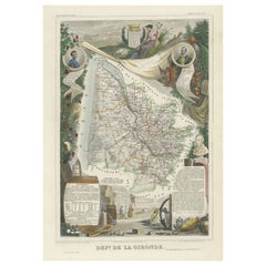
Levasseur's 1852 Cartographic Portrait of Gironde: Celebrating the Bordeaux Wine
Located in Langweer, NL
This original hand-colored map is from the "Atlas National Illustré," a work by Victor Levasseur, a French geographer and cartographer known for his richly illustrated maps. The map is a steel engraving, which was a common and precise method for creating maps at the time. The inclusion of the publisher's name, A. Combette from Paris, and the addresses of the various contributors to the map's creation, like the engravers Laguillermie and Rainaud, adds to the historical context of the piece. The margins of the map are adorned with detailed illustrations that serve as a visual encyclopedic reference to the region's geography, economy, and notable figures. The use of color along the boundaries makes the map not only a tool for navigation but also an educational resource, providing insights into the department's landscape, economy, and cultural significance. The text included in the map's design provides statistical information, a map legend, and discussions about the land, local curiosities, notable personalities, products, and commerce, which would have been invaluable for education and reference at the time. The 'Atlas National Illustré' is celebrated for its combination of cartographic detail and artistic embellishment, making it a valuable cultural artifact. It represents the height of decorative map-making in the 19th century, alongside the works of John Tallis and Archibald Fullarton. This uploaded image is a detailed and colored map of the Département de la Gironde from Victor Levasseur's "Atlas National Illustré." Similar to the other maps from this series, it features a central map with the title 'Dépt. de la Gironde' at the bottom. Surrounding the map are decorative vignettes and elements that bring to life the cultural and economic aspects of the Gironde department. On the left, there is likely statistical information about the department and its subdivisions, reflecting the population and administrative details. This is framed by images that may represent the local industries and natural resources, such as wine, which is a central feature of the Bordeaux region located within Gironde. The right side of the map contains a textual history and descriptions of the region, coupled with portraits of notable figures, possibly historic personages or contributors to the region's cultural and economic development. The illustrations often include agricultural products, symbols of commerce, and scenes of daily life, as well as architectural landmarks. The presence of wine bottles, barrels, and vineyards in the illustrations would be indicative of the Gironde's prominence in wine production, particularly Bordeaux wines, which are esteemed worldwide. These engravings serve to emphasize the richness of the land and the sophistication of its products. Maps from this era, especially those by Levasseur, are notable for their combination of art and education, providing a snapshot not only of the geography but also of the societal and economic conditions of the time. The detailed engravings also suggest that this map was as much a decorative piece as it was a functional one, intended for display and reference by those interested in the illustrated region. The Gironde department in France is renowned for its significant contribution to the wine industry, particularly through the Bordeaux wine region. A bit more about the important places within Gironde and the types of wine the area is known for: 1. **Bordeaux**: The capital city of the department and the heart of the wine region. It's not only an urban center but also a hub for the wine trade. 2. **Médoc**: North of Bordeaux, known for prestigious châteaux and wines like Margaux, Saint-Julien, Pauillac, and Saint-Estèphe. 3. **Saint-Émilion**: East of Bordeaux, recognized for its full-bodied red wines and the picturesque medieval town. 4. **Pomerol**: Also near Saint-Émilion, smaller than its neighbor but equally renowned, particularly for Château Pétrus...
Category

1850s Antique Paper Collectibles and Curiosities

Materials

Paper

Large Antique Reference Book, Parliamentary Record, Latin Language, Georgian
Located in Hele, Devon, GB
This is a large antique reference book, Calendarium Rotulorum Patentium in Turri Londinensi. Printed in Latin, a later bound House of Commons record, dating to the Georgian period, p...
Category

Early 19th Century European Georgian Antique Paper Collectibles and Curiosities

Materials

Paper

Authentic 1644 Janssonius Map of the Champagne Region (Campania) in France
Located in Langweer, NL
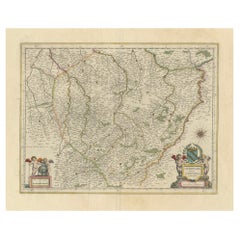
"1644 Janssonius Map of Champagne, France" This meticulously detailed original antique map, engraved in 1644, is a work by the esteemed cartographer Johannes Janssonius. It depicts the historic province of Champagne, situated in the northeastern part of France. The map is notable for its high level of detail, with meticulously drawn boundaries, city markers, and river courses. It features a beautifully rendered cartouche adorned with the provincial coat of arms, flanked by classical figures, indicative of the region's cultural significance. In the lower left corner, a pair of cherubs are engaged in surveying, symbolizing the scientific endeavor of cartography. The elaborate compass rose and the scale bar further complement the map's utility and artistic merit. Champagne is renowned globally for its viticultural heritage, being the birthplace of the eponymous Champagne sparkling wine. The region's unique terroir, with its chalky soil and cool climate, is ideal for the production of the grapes used in champagne-making. The historical significance of Champagne extends beyond winemaking; it has been the site of pivotal battles and royal coronations, which shaped the course of French and European history. This map is not only a navigational tool but also a snapshot of a region rich in history and tradition, an artifact that embodies the geographical and cultural prestige of Champagne. This description provides a detailed visual and contextual presentation of the map, suitable for a catalog entry, emphasizing both its artistic features and the historical and cultural importance of the Champagne region. THE WINE AREAS: The Champagne region, known primarily for its production of the sparkling wine that bears its name, encompasses several important cities and sites of historical and cultural significance: 1. **Reims**: Often considered the unofficial capital of the Champagne region, Reims is renowned for its grand cathedral, Notre-Dame de Reims, where French kings were historically crowned...
Category

1640s Antique Paper Collectibles and Curiosities

Materials

Paper

2 Antique Books, The Lives of Scottish Poets, English, Biographical, Regency
Located in Hele, Devon, GB
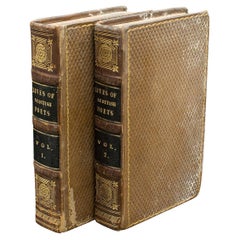
This is a 2 volume antique book set, The Lives of Scottish Poets. An English language biographical work, dating to the Regency period, published 1821....
Category

Early 19th Century British Regency Antique Paper Collectibles and Curiosities

Materials

Paper

Mapping the Heart of France: Willem Blaeu's 17th Century Île-de-France, ca.1650
Located in Langweer, NL
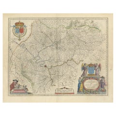
This original antique map titled "Le Gouvernement de l'Isle de France" represents the Île-de-France region, which historically was one of the provinces of France and contained the ci...
Category

1650s Antique Paper Collectibles and Curiosities

Materials

Paper

Old Map of Part of France: Poitou, Berry, Bourbonnais, and Nivernais in 1768
Located in Langweer, NL
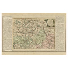
The map with text neatly mounted on both sides of the map on the plate, is a section of an old map with accompanying French text. The map mentions several historical French provinces...
Category

1760s Antique Paper Collectibles and Curiosities

Materials

Paper

Antique Map of Greece from Ortelius's Theatrum Orbis Terrarum, 1595
Located in Langweer, NL
Original antique map titled "Graecia Sophiani." This is a very detailed and decorative engraved map, with two decorative cartouches and a hand-colored initial on the verso, from Abra...
Category

16th Century Antique Paper Collectibles and Curiosities

Materials

Paper

Pierre Jeanneret / Le Corbusier "The Indian Adventure" Book About Chandigarh
Located in Stockholm, SE
Rare and collectable book about the Pierre Jeanneret & Le Corbusier's "The Indian Adventure" in Chandigarh, India. In good used condition. Published in 2010 in a limited numbers. Very sought after. LE CORBUSIER, PIERRE JEANNERET. L'Aventure Indienne / The Indian Adventure. Design, Art, Architecture. By Éric Touchaleaume and Gérald Moreau, with the collaboration of Martial Vigo. Editions Éric Touchaleaume, Architecture design du XXe siècle, Galerie 54...
Category

2010s French Mid-Century Modern Paper Collectibles and Curiosities

Materials

Paper

1884 The Works of Thomas Carlyle
By Thomas Carlyle
Located in Bath, GB
A superb limited deluxe edition of the works of notable Scottish historian, Thomas Carlyle. Limited edition of three hundred and fifteen copies on parchment linen paper of which thi...
Category

1880s American Antique Paper Collectibles and Curiosities

Materials

Paper

Serene Vista of Messina and its Strait: An Engraved Jewel, circa 1800
Located in Langweer, NL
Title: "Vue de Messine & de Son Détroit" This evocative print titled "Vue de Messine & de Son Détroit" presents a picturesque view of Messina and its strait, a vital waterway separa...
Category

Early 19th Century Antique Paper Collectibles and Curiosities

Materials

Paper

1920 The Happy Prince and Other Tales
By Oscar Wilde
Located in Bath, GB
A beautifully bound edition of these charming short tales by Oscar Wilde, illustrated with colour plates from Charles Robinson. This charming collection of five short stories by Osc...
Category

1920s European Vintage Paper Collectibles and Curiosities

Materials

Paper

1900 The Works of Oliver Goldsmith
Located in Bath, GB
A truly beautiful limited edition set of the works of Anglo-Irish novelist Oliver Goldsmith, illustrated throughout and with a number of volumes signed by the artists. The twelve vo...
Category

Early 1900s American Antique Paper Collectibles and Curiosities

Materials

Paper

Antique Map of the City of Batavia by Van der Aa 'c.1730'
Located in Langweer, NL
Antique map titled 'Plan de la Ville et du Chateau de Batavia en l'Isle de Iava - Ware affbeeldinge wegens het Casteel ende Stadt Batavia gelegen op groot Eylant Java'. Detailed plan...
Category

Mid-18th Century Antique Paper Collectibles and Curiosities

Materials

Paper

Cartographic Elegance of Touraine: A 17th-Century Map Showing French Heritage
Located in Langweer, NL
"Ducatus Turonensis - Touraine," is a original antique historical map of the Touraine region, which is located in the heart of France, centered...
Category

1630s Antique Paper Collectibles and Curiosities

Materials

Paper

1797 Tardieu Map of Southeast Asia: The Malay Archipelago and Beyond
Located in Langweer, NL
An original historical map titled 'Presqu' Île Au Dela Du Gange et Archipel De L'Inde', created by Pierre Francois Tardieu and published in the "Atlas Universel" by Pierre Grégoire C...
Category

1790s Antique Paper Collectibles and Curiosities

Materials

Paper

Burgundy's Viticultural Landscape: A 1640 Cartographic Engraving by Willem Blaeu
Located in Langweer, NL
An hand-colored original antique map with the title "Utriusque Burgundiae tum Ducatus tum Comitatus Descriptio," which translates to "A Description of Both Burgundies, both the Duchy...
Category

1640s Antique Paper Collectibles and Curiosities

Materials

Paper

The Killers / A Bout Portant
Located in London, GB
Original French film poster for Don Siegel's 1964 This film was an adaption of the 1927 short story of the same name by Ernest Hemingway. This was the second time the story was made ...
Category

1960s French Vintage Paper Collectibles and Curiosities

Materials

Paper

Lyonnais, Beaujolais, Forez, Mâconnais: A 1644 Depiction of France's Provinces
Located in Langweer, NL
An original antique map from 1644, depicting the French provinces of Lyonnais, Beaujolais, Forez, and Mâconnais. In this map, north is oriented to the right, which is a cartographic ...
Category

1640s Antique Paper Collectibles and Curiosities

Materials

Paper

1958 Ordeal By Innocence
Located in Bath, GB
A vanishingly scarce to see signed first edition of this classic Christie mystery. The first edition, first impression, with no further impressions stated. In the original unclipped...
Category

1950s British Vintage Paper Collectibles and Curiosities

Materials

Paper

Antique Book, Compendium of Farriery, English, Georgian, Equestrian, London 1796
Located in Hele, Devon, GB
This is a delicate antique book, Compendium of Farriery. An English language, Georgian guide to equestrian care, published in London, 1796. Full title: Taplin Improved; or a Compend...
Category

Late 18th Century British Georgian Antique Paper Collectibles and Curiosities

Materials

Paper

Mattel The Great Eras Collection Barbie Victorian Lady 1996
Located in Milano, IT
In 1995, a Barbie doll emerged from the annals of history as a testament to the grace and elegance of a bygone era. It is Victorian Lady, a prized piece from Mattel's Great Era Colle...
Category

1990s Italian Modern Paper Collectibles and Curiosities

Materials

Plastic, Paper

1970 A Portfolio of Thomas Bewick Wood Engravings
By Thomas Bewick
Located in Bath, GB
One hundred stunning wood engravings by Thomas Bewick in two beautifully presented portfolios with an introductory volume, enclosed in a slipcase. One of 150 limited edition copies ...
Category

1970s American Vintage Paper Collectibles and Curiosities

Materials

Paper

1963 The Clocks
Located in Bath, GB
A vanishingly scarce signed first edition of this evocative travel memoir by Agatha Christie. Signed and dedicated to her secretary and friend, Carlo Fisher. The first edition, firs...
Category

1960s European Vintage Paper Collectibles and Curiosities

Materials

Paper

Loudun and Mirebeau: A Cartographic Masterpiece of 17th Century France by Blaeu
Located in Langweer, NL
Cartography, 17th century. Willem (1571-1638) and Joan Blaeu (1596-1673), Theatrum Orbis Terrarum sive Atlas Novus..., 1635. Figure: Loudonois. Laudunum (Loudun); Mirebalais (Mirebea...
Category

1650s Antique Paper Collectibles and Curiosities

Materials

Paper

Champagne: The Sparkling Heart of France - A Blaeu Cartographic Engraving, c1650
Located in Langweer, NL
An original hand-colored antique map showing the historical region of Champagne in France, known in Latin as "Campania Comitatus". Champagne is a region that is world-renowned for ...
Category

1650s Antique Paper Collectibles and Curiosities

Materials

Paper

Antique Book, Days of King Arthur, Mythology, English, Fiction, Late Victorian
Located in Hele, Devon, GB
This is an antique mythology book, Days of King Arthur by Charles Henry Hanson. An English language, hard bound fictional work with illustrations by Gus...
Category

Late 19th Century British Late Victorian Antique Paper Collectibles and Curiosities

Materials

Paper

The Principality of Dombes: A 17th-Century Cartographic Jewel by Jan Jansson
Located in Langweer, NL
The text on the map "La principaute de Dombes; J. van den Eynde sculpit.; La Principavte de Dombes" indicates that it is a map of the principality of Dombes, engraved by J. van den E...
Category

1630s Antique Paper Collectibles and Curiosities

Materials

Paper

Vintage Tobacco Advertising Sign, Belgium, 1950s
Located in Antwerp, BE
1950s Advertising Sign for the Belgian Tobacco Brand VDC - Deinze. This Litho Cardboard Sign has lots of colors due the different packages and types of tobacco flavors. Made in Brussels - Belgium by J.De Grève and co. This Vintage Sign can stand as a Counter Display Sign ( standing system has never been used before ) or can be hung as Wall Decoration - Wall Art It's a New Old Stock Sign, so in very good condition. Only the left upper corner has a small trace due storage through the time. Tobacco collectables - vintage signs - retro wall decoration...
Category

Mid-20th Century Belgian Paper Collectibles and Curiosities

Materials

Paper

4 Vols Antique Botany Books, Flowers of Modern Voyages, English, Georgian, 1820
Located in Hele, Devon, GB
This is a set of 4 antique botany books, the Flowers of Modern Voyages by William Adams. An English language botany record with maps, dating to th...
Category

Early 19th Century British Antique Paper Collectibles and Curiosities

Materials

Paper

5 Vols, Antique Books, Lives of the British Admirals, English, Georgian, 1817
Located in Hele, Devon, GB
This is a set of 5 antique volumes, Lives of the British Admirals by Dr John Campbell et al. An English language, hard bound naval interest book, published in London, 1817. Includes...
Category

Early 19th Century British Georgian Antique Paper Collectibles and Curiosities

Materials

Paper

Manly P Hall, the Secret Teachings of All Ages, First Edition Book & 4 Prints
Located in Los Angeles, CA
The classic encyclopedia of the arcane in an expanded edition. Renowned philosopher and lecturer Manly P. Hall’s masterful encyclopedia of ancient symbols, hidden rituals, and arcane practices has remained a classic since first published in 1928. Hall’s densely detailed writings explore topics ranging from Hermeticism to Tarot, Egyptian mythology to Pythagorean theory. Each chapter is accompanied by the vivid illustrations of artist J. Augustus Knapp, with additional images by Mihran Serailian found in the companion volume, each taking their own unique approach to nearly 60 artworks depicting occult subject matter. The initial concept for what became known as Hall’s “Great Book”, first began in 1923 when the young Los Angeles-based orator began a months-long trip around the globe. Circumnavigating by ship, Hall visited Egypt, China and India, immersing himself in the philosophical and religious history of each country. Upon his return he spent the next five years penning his massive compendium of philosophy and myth. Nearly a century after its release, this iconic masterwork has been reproduced for the first time from the rare and extravagant original edition. This meticulously-restored version of Hall’s “Great Book” is also accompanied by an expansive companion book, featuring condensed summaries of each chapter of The Secret Teachings, alongside newly-discovered artworks, rare photography...
Category

21st Century and Contemporary Paper Collectibles and Curiosities

Materials

Foil

Globe, globe SVH, scale 1 to 38500000
Located in EINDHOVEN, NL
This beautiful globe has some minor damage at the height of the Galapagos Islands. Height: 50 cm. Width: 35 cm. Depth (= Ø sphere): 33 cm. Origin: The Netherlands, 1960s. Material: ...
Category

1960s Dutch Mid-Century Modern Vintage Paper Collectibles and Curiosities

Materials

Aluminum

Antique Scottish History Book, Tales of a Grandfather, Walter Scott, Victorian
Located in Hele, Devon, GB
This is an antique compendium book of Scottish history, Tales of a Grandfather by Walter Scott. An English language, hard bound title, printed in E...
Category

Mid-19th Century British Victorian Antique Paper Collectibles and Curiosities

Materials

Paper

Antique Reference Book, Old English Glasses, Hartshorne, History, Victorian
Located in Hele, Devon, GB
This is an antique reference book, Old English Glasses. An English language, bound historical title by Albert Hartshorne, published in the late Victorian period, 1897. Full title: O...
Category

Late 19th Century British Late Victorian Antique Paper Collectibles and Curiosities

Materials

Paper

Atlantic Eden: The Azores and Madeira Archipelagos in 1903
Located in Langweer, NL
This original antique print is a historical map titled "PORTUGAL INSULAR," which translates to "Insular Portugal." It shows the Portuguese archipelagos of the Azores and Madeira, wit...
Category

Early 1900s Antique Paper Collectibles and Curiosities

Materials

Paper

Hollywood Legends Collection Barbie Doll Scarlett O'Hara in Green Drapery Dress
Located in Milano, IT
In the enchanting year of 1994, a Barbie doll emerged, not as a mere plaything, but as a living legend. She embodied the timeless allure of Hollywood, capturing the essence of Scarle...
Category

1990s Italian Modern Paper Collectibles and Curiosities

Materials

Plastic, Paper

Isles of Enchantment: The Balearic Archipelago in 1902
Located in Langweer, NL
The Balearic Islands, Spain, from the year 1902. The title on the map is "ISLAS BALEARES 1902." This map illustrates the Balearic archipelago in the Mediterranean Sea, highlighting t...
Category

Early 1900s Antique Paper Collectibles and Curiosities

Materials

Paper

Topographical and Administrative Cartography of Segovia in Spain, 1902
Located in Langweer, NL
An original old map of the province of Segovia from the year 1902. Segovia is a historic area located in the central part of Spain, northwest of Madrid. Known for its rich history, a...
Category

Early 1900s Antique Paper Collectibles and Curiosities

Materials

Paper

Teruel 1901: A Cartographic Depiction of Heritage and Natural Splendor in Spain
Located in Langweer, NL
Original antique map of Teruel in Spain, with highlighted gold. The province of Teruel, located in the region of Aragon in eastern Spain, is known for several unique features: 1. **Mudejar Architecture**: Teruel is famous for its well-preserved Mudejar architecture, which is a style that is a fusion of Christian and Islamic design. This includes notable examples like the Tower of El Salvador and the Teruel Cathedral, both of which are UNESCO World Heritage sites. 2. **Dinopolis**: It hosts Dinópolis, a paleontological park that is one of the largest of its kind in Europe, featuring dinosaur fossils and interactive...
Category

Early 1900s Antique Paper Collectibles and Curiosities

Materials

Paper

Vintage Reproduction 17th Century Map of Europe, American, Cartography, Blaeuw
Located in Hele, Devon, GB
This is a vintage reproduction map of Europe. An American, paper stock cartography print in frame after the work by Blaeuw, dating to the late 20t...
Category

Late 20th Century Central American Mid-Century Modern Paper Collectibles and Curiosities

Materials

Glass, Wood, Paper

European Vintage Earth Globe on Stand with Compass
Located in Sofia, BG
Vintage handmade world globe standing on a base with small compass in the bottom. The piece is in fare condition with no restaurations ever made. France, circa 1950
Category

Mid-20th Century French Paper Collectibles and Curiosities

Materials

Plastic, Paper

The Valley of Inspruck: An 18th-Century Engraved Perspective, 1792
Located in Langweer, NL
Title: "The Valley of Inspruck: An 18th-Century Engraved Perspective" This elegant original antique engraving, titled "The Valley of Inspruck," showcases a serene view of the Innsbruck Valley. The artwork is delicately rendered, capturing the grandeur of the mountains and the pastoral tranquility of the valley. The print depicts a detailed landscape scene, replete with towering craggy peaks that loom over a peaceful settlement nestled in the valley. A striking feature is the contrast between the ruggedness of the natural environment and the cultivated lands and architecture, indicating a harmonious coexistence of humanity with nature. It was published as directed on January 1, 1792, by T & G Egerton of Whitehall for the author. Albanis Beaumont is credited with the original design ('Del.' for delineavit, indicating he drew the initial illustration), and Cornelis Apostool is noted for the engraving work ('Sculp.' for sculpsit, indicating he engraved the image). The publication of this print during the late 18th century aligns with a time when there was a heightened interest in natural beauty and the picturesque, reflected in the art and literature of the Romantic period. This print would have appealed to those with an appreciation for both the aesthetic and the sublime qualities of the European landscape. The publication by T & G Egerton, a reputable firm known for their work in the arts, and the involvement of a skilled artist and engraver like Beaumont and Apostool, respectively, underline the quality and desirability of the print. It is a piece that would attract collectors of fine engravings and admirers of European landscapes, offering a window into the aesthetic values and artistic endeavors of the late 18th century. As a historical piece, this print offers a view into the past, inviting contemplation of the rich cultural and natural heritage of the Innsbruck area. It is a valuable collectible for enthusiasts of antique maps and prints...
Category

Late 18th Century Antique Paper Collectibles and Curiosities

Materials

Paper

Ávila in a Historical Map of 1902: A Geographic and Administrative Overview
Located in Langweer, NL
The map is of the province of Ávila, one of the provinces of the autonomous community of Castile and León in Spain, and it is dated from 1902. The map illustrates several geographic ...
Category

Early 1900s Antique Paper Collectibles and Curiosities

Materials

Paper

Álava in Northern Spain: The Geography of Basque Heritage and Terrain, 1902
Located in Langweer, NL
This original antique map is a historical depiction of the province of Álava (in Basque: Araba), which is one of the provinces of the Basque Country in northern Spain, as indicated b...
Category

Early 1900s Antique Paper Collectibles and Curiosities

Materials

Paper

Map of Sevilla Province, 1901: A Depiction of The Spanish Cultural Heartland
Located in Langweer, NL
The print for sale here depicts a historical map of the province of Sevilla (Seville) from the year 1901. Sevilla is located in the southern part of Spain and is part of the autonomo...
Category

Early 1900s Antique Paper Collectibles and Curiosities

Materials

Paper

Book.Neu eröffnete Mahometanische Moschea.First German Translation of Quran 1703
Located in CADALSO, ES
Absolutly rare to find. First German Translation of the Quran from 1703 Author: NERRETER, DAVID. The book was rebound around 1900.
Category

16th Century German Baroque Antique Paper Collectibles and Curiosities

Materials

Paper

Islands of Diversity: Portugal's Atlantic Archipelagos in 1903
Located in Langweer, NL
The image is an original historical map from 1903 depicting Portuguese possessions in the Atlantic Ocean, specifically the islands of Cape Verde and the islands of São Tomé and Prínc...
Category

Early 1900s Antique Paper Collectibles and Curiosities

Materials

Paper

An Antique Map of Extremadura: Crossroads of History and Nature, 1903
Located in Langweer, NL
The image is a historical map of Extremadura, an autonomous community of Spain, from an unspecified year. The map features the region's topography, including mountain ranges, river s...
Category

Early 1900s Antique Paper Collectibles and Curiosities

Materials

Paper

Beira Alta: A Cartographic Journey Through Portugal's Heartland in 1903
Located in Langweer, NL
The uploaded image is a historical map of the Beira Alta region in Portugal. The map is detailed, showing the topography, hydrography, and transportation networks of the region, incl...
Category

Early 1900s Antique Paper Collectibles and Curiosities

Materials

Paper

Zamora: A Mosaic of Romanesque Heritage and Natural Wonders in Spain, 1901
Located in Langweer, NL
This authentic antique print is a historical map of the province of Zamora, Spain, from the year 1901. The title on the map is "ZAMORA. 1901." As with the previous map, it displays t...
Category

Early 1900s Antique Paper Collectibles and Curiosities

Materials

Paper

Madrid 1901: A Historical Map of Spain's Capital Province
Located in Langweer, NL
The map is of the province of Madrid, the capital region of Spain, as it appeared in 1901. Here are the key features it displays: The map shows the central part of Spain, with the Guadarrama mountain range prominently visible, marking the natural border to the north of Madrid. Blue lines likely indicate rivers, including the Manzanares River, which flows through Madrid, and the Jarama River, a tributary to the Tagus. Red lines depict the roads and railways, outlining the infrastructure that connects Madrid's various towns and cities within the province and beyond. Symbols and labels mark the locations of cities, towns, and villages, with Madrid itself likely being the focal point. Dotted lines may represent the administrative divisions within the province. The map includes a legend (Signos Convencionales) that explains the symbols used for provincial capitals, roads, railways, and other geographic features. The coat of arms of Madrid, featuring a bear and a strawberry tree (madroño), is prominently featured, symbolizing the city's and the province's historical coat of arms. About the province of Madrid: Madrid is not only the capital of Spain but also the heart of the Iberian Peninsula, both geographically and politically. The city is renowned for its rich repositories of European art, including the Prado Museum's works by Goya, Velázquez, and other Spanish masters. The province of Madrid is characterized by a blend of historical and modern elements, with a rich cultural life that includes theater, opera, and flamenco, as well as gastronomy that features a mix of traditional Spanish dishes and international cuisine...
Category

Early 1900s Antique Paper Collectibles and Curiosities

Materials

Paper

Barcelona 1901: A Cartographic Portrait of Catalonia's Capital Province
Located in Langweer, NL
This orignal antique map is a historical depiction of the province of Barcelona from 1901. It showcases the varied terrain of the province, with the Serra de Collserola ridge near the city of Barcelona and the Pyrenees to the north. The map includes the coastline along the Mediterranean Sea, indicating Barcelona's position as a coastal province. Blue lines indicate rivers, such as the Llobregat and Besòs, which are significant features in the province's geography. Dotted lines may signify the borders of the province within Catalonia. The coat of arms of Barcelona, highlighted with gold, is prominently displayed, featuring the Cross of Saint George (Cruz de Sant Jordi), the patron saint of Catalonia, and the red and yellow bars which are a symbol of the Aragonese and Catalan heritage. About the province of Barcelona: The province of Barcelona is part of the autonomous community of Catalonia in northeastern Spain. It is the most economically significant region of Catalonia, playing a crucial role in the country's economy due to its port, manufacturing, and service industries. The city of Barcelona is the capital and the second most populous city in Spain, known for its rich cultural heritage, architecture by Antoni Gaudí, such as the Sagrada Família, and its influential art scene. The province enjoys a Mediterranean climate and features diverse landscapes from the beaches along the coast to the mountains in the interior. Barcelona is also known for its vibrant festivals, cuisine, fashion, and sports, particularly football, being home to FC Barcelona...
Category

Early 1900s Antique Paper Collectibles and Curiosities

Materials

Paper

Gipuzkoa 1902: A Cartographic Snapshot of the Basque Coastline and Highlands
Located in Langweer, NL
The map showcases the province of Gipuzkoa (also known as Guipúzcoa in Spanish), which is part of the autonomous community of the Basque Country in northern Spain, as of the year 190...
Category

Early 1900s Antique Paper Collectibles and Curiosities

Materials

Paper

The Lay of the Land: A 1901 Topographic Map of Oviedo, Asturias
Located in Langweer, NL
The province depicted on the historical map on offer, Oviedo, corresponds to the modern-day autonomous community of Asturias in northwestern Spain. Here are some points about Asturia...
Category

Early 1900s Antique Paper Collectibles and Curiosities

Materials

Paper

Cartographic Heritage: The 1901 Map of the Vizcaya Province in Spain
Located in Langweer, NL
This is a historical map of the province of Vizcaya (Biscay) in Spain, dated 1901. The title on the map is "VIZCAYA. 1901." It shows the topographical details of the region with cont...
Category

Early 1900s Antique Paper Collectibles and Curiosities

Materials

Paper

Almería 1901: Coastal Contours and Landscapes in a Map of Southeastern Spain
Located in Langweer, NL
An original antique map of the province of Almería, Spain, from the year 1901. The Mediterranean Sea, labeled as "Mar Mediterraneo," forms the southeastern boundary of the province...
Category

Early 1900s Antique Paper Collectibles and Curiosities

Materials

Paper

Duchy of Brunswick-Lüneburg, 1595: A Renaissance Cartographic Masterpiece
Located in Langweer, NL
Title: "Braunschweig and Lüneburg Duchies: Authentic Depiction by Abraham Ortelius" This is an exquisite example of Abraham Ortelius’s cartographic craftsmanship: an original antiqu...
Category

16th Century Antique Paper Collectibles and Curiosities

Materials

Paper

Douro: The River of Tradition and Wine in Portugal, 1903
Located in Langweer, NL
The uploaded image is a historical map of the Beira Baixa region in Portugal. The map details the topography, including mountain ranges and river systems, as well as the transportati...
Category

Early 1900s Antique Paper Collectibles and Curiosities

Materials

Paper

Read More

Pamela Shamshiri Shares the Secrets behind Her First-Ever Book and Its Effortlessly Cool Interiors

The sought-after designer worked with the team at Hoffman Creative to produce a monograph that beautifully showcases some of Studio Shamshiri's most inspiring projects.

Moroccan Artworks and Objects Take Center Stage in an Extraordinary Villa in Tangier

Italian writer and collector Umberto Pasti opens the doors to his remarkable cave of wonders in North Africa.

Montecito Has Drawn Royalty and Celebrities, and These Homes Are Proof of Its Allure

Hollywood A-listers, ex-pat aristocrats and art collectors and style setters of all stripes appreciate the allure of the coastal California hamlet — much on our minds after recent winter floods.

Whaam! Blam! Pow! — a New Book on Pop Art Packs a Punch

Publishing house Assouline and writer Julie Belcove have teamed up to trace the history of the genre, from Roy Lichtenstein, Andy Warhol and Yayoi Kusama to Mickalene Thomas and Jeff Koons.

The Sparkling Legacy of Tiffany & Co. Explained, One Jewel at a Time

A gorgeous new book celebrates — and memorializes — the iconic jeweler’s rich heritage.

What Makes a Gem-Encrusted Chess Set Worth $4 Million?

The world’s most opulent chess set, weighing in at 513 carats, is literally fit for a king and queen.

Tauba Auerbach’s Geometric Pop-Up Book Is Mighty Rare, Thanks to a Hurricane

This sculptural art book has an epic backstory of its own.

Step inside the Storied Mansions of Palm Beach’s Most Effervescent Architect

From Spanish-style courtyards to fanciful fountains, these acclaimed structures abound in surprising and elegant details.
Recently Viewed

View All