Engraved Collectibles and Curiosities

to
343
515
242
769
5
5
17
12
11
10
9
8
7
5
4
2
1
1
1
1
460
194
115
10
63
24
16
7
4
2
5
3
1
3
6
3
4
589
167
89
53
35
253
68
55
54
53
779
779
779
10
9
9
8
5
Technique: Engraved
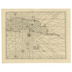
Antique Map of Ambon and Surroundings by Valentijn '1726'
Located in Langweer, NL
Antique map titled 'De landvoogdy van Amboina met de elf onderhoorige Eylanden'. Decorative map of the eastern tip of the islands of Ambon, Indonesia. This print originates from 'Oud...
Category

Early 18th Century Dutch Antique Engraved Collectibles and Curiosities

Materials

Paper

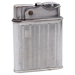
BENEY 1940 Art Deco Penge Model Petrol Pocket Lighter In Chromed Steel
Located in Miami, FL
Petrol pocket lighter designed by Robert Ernest Beney. This is an unusual petrol pocket lighter, created in London England by the Beney company back in the 1940. This lighter is the Penge semiautomatic model and has been crafted with modernist art deco patterns in solid chromed steel with engine turned geometric designs. The lighter is in near mint condition with very little trace of use. This lighter is a treasure from the past, that embodies the elegance and style of its era, making it a must-have for collectors and enthusiasts alike. Brand & Model: Beney, Penge Mechanism: Petrol, push button semi-automatic. Material: Chrome, steel and brass. Year: 1940-1946. Weight: 49.5 Grams, (31.75 Dwt). Measurements: 53 mm by 40 mm by 10 mm (2.09 x 1.58 x 0.39 Inches). Hallmarks: The lighter is stamped at the base with British marks and signed in full, "BENEY PENGE MODEL MADE IN ENGLAND". The Beney Company The Beney Company was founded by Robert Ernest Beney in 1918, who invented and sold the first Beney mechanical lighter in 1919, three years prior to Dunhill. Beney also designed an automatic mechanism for Dunhill's hunting horn lighter...
Category

1940s English Art Deco Vintage Engraved Collectibles and Curiosities

Materials

Brass, Steel, Chrome

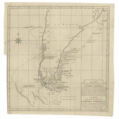
Antique Map of South America by G. Anson, 1749
Located in Langweer, NL
Antique map titled 'Kaart van het Zuidelykste Gedeelte van Zuider Amerika (..) - Carte de la Partie Meridionale de l'Amerique Meridionale (..)'. Detailed chart tracking the route of Capt. George Anson's ship The Centurion in 1745. The chart shows the tracks of Anson's ships around South America & Cape Horn to the Juan Fernandes Islands, with notes on currents and positions. This map originates from 'Reize rondsom de Werreld (..)' by George Anson, published 1749. In 1740 Capt. George Anson (1697-1762) of the Royal Navy, was given command of a squadron of ships. As England was at war with France and Spain, Anson's task was to intercept and capture a Spanish treasure...
Category

Mid-18th Century Dutch Antique Engraved Collectibles and Curiosities

Materials

Paper

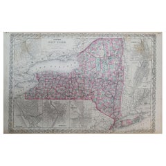
1858 Colton's Map of New York, Ric.B011
Located in Norton, MA
An 1858 Colton's map of New York Ric.b011 Colton’s New York, 1858 - A large original color engraved and very detailed map of the state of New York,...
Category

19th Century Unknown Antique Engraved Collectibles and Curiosities

Materials

Paper

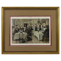
“The Restaurant of the House of Representatives” Engraving by Harper's Weekly
Located in Colorado Springs, CO
This original wood engraving is titled “The Restaurant of the House of Representatives, Washington, DC.” It was published as a double-page image, in the August 12, 1893 issue of the famous 19th century newspaper Harper’s Weekly. The print was illustrated by Charles Stanley Reinhardt. The House Restaurant, a unique part of life in the Capitol, has been in the same location since the 1857 Capitol Expansion. Congressional members’ busy work schedule made the availability of food on site a necessity. But the restaurant also served as an informal meeting spot for members to continue conversations and deal making. This 1893 print illustrates the convivial atmosphere. Details including elegantly dressed tables...
Category

1890s American Antique Engraved Collectibles and Curiosities

Materials

Paper

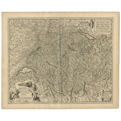
Antique Map of Switzerland by N. Visscher, circa 1690
Located in Langweer, NL
Beautifully detailed map of Switzerland and surrounding regions in present-day France, Germany, and Italy. This map features two decorative cartouches: the larger is flanked by two p...
Category

Late 17th Century Antique Engraved Collectibles and Curiosities

Materials

Paper

19th Century Chinese Silver Kiddush Goblet with a Saucer
Located in New York, NY
Chinese export silver covered Kiddush cup, 19th century. Round bowl on baluster stem mounted to stepped and flat circular foot. Double domed cover with pointed finial. Engraved band...
Category

19th Century Chinese Antique Engraved Collectibles and Curiosities

Materials

Silver

1635 Willem Blaeu Map of Northern France"Comitatvs Bellovacvm" Ric.a08
Located in Norton, MA
1635 Willem Blaeu map of northern France, entitled. "Comitatvs Bellovacvm Vernacule Beavvais," Colored Ric.a008 “COMITATVS BELLOVACVM…” Amsterdam: W...
Category

17th Century Unknown Antique Engraved Collectibles and Curiosities

Materials

Paper

1636 Jansson Map of Ireland Entitled "Comitatus Lageniae, " Ric.a007
Located in Norton, MA
1646 Jansson map entitled "Procinvia connactiae," Ric.a006 Description: The PROVINCE of CONNAVGT 490 x 380From vol 4 of Jansson's Atlas Novus 1646, published in Amsterdam with...
Category

17th Century Unknown Antique Engraved Collectibles and Curiosities

Materials

Paper

1620 Map of Artois Entitled "Artesia Comitatvs Artois, " by Bleau, Ric.a012
Located in Norton, MA
1640 map of Artois entitled "Artesia Comitatvs Artois," by Bleau Colored A-012. Detailed map of the northern province of Artois, France on the border with Belgium. Feature...
Category

17th Century Dutch Antique Engraved Collectibles and Curiosities

Materials

Paper

Dutch Map and City Plan of La Roche-sur-Foron, France, 17th Century Hand Colored
Located in Alamo, CA
"Rupes Allobrogum vulgo La Roche" by Dutch engraver Coenraet Decker (1650-1685) is from the atlas Theatrum Statuum Regiae Celestudinis Sabaudiae Ducis, published in 1682. This richly...
Category

Late 17th Century Dutch Antique Engraved Collectibles and Curiosities

Materials

Paper

1868 Map of the Upper Part of the Island of Manhattan Above 86th Street
Located in San Francisco, CA
This wonderful piece of New York City history is over 150 years old. It depicts 86th street and above. It was lithographed by WC Rogers and company. It was made to show what was the Battle of Harlem during the Revolutionary war...
Category

1860s American American Colonial Antique Engraved Collectibles and Curiosities

Materials

Paper

1839 Map of Karte Des "Russischen Reiches in Europa Und Asien" Ric.R0013
Located in Norton, MA
1839 map of Karte Des "Russischen Reiches in Europa and Asien" Ric.r013 Map of the European and Asian parts of Russian Empire. Karte der Russischen Reiches in Europa und Asien...
Category

19th Century Unknown Antique Engraved Collectibles and Curiosities

Materials

Paper

Hand Engraved Glass Art Table Plaque Depicting Child Jesus Blessing the Land
Located in Lisse, NL
Joyful and colorful, Van Gogh-esk work of religious art with maker's monogram. Because we are always looking for the rarest and most beautifully hand-crafted antiques, we 'regularly...
Category

Mid-20th Century European Art Deco Engraved Collectibles and Curiosities

Materials

Glass, Wood

Dutch 18th Century Copper Tobacco Box
Located in Delft, NL
A Dutch 18th century copper tobacco box A Dutch 18th century copper tobacco box, octagonal with engraving on the front and back. Name and title engraved on top and front. The copp...
Category

18th Century Dutch Antique Engraved Collectibles and Curiosities

Materials

Tin, Copper

1627 Hondius Map "La Principaute d'Orange et Comtat de Ve", Ric.0003
Located in Norton, MA
1627 Hondius map entitled "La Principaute d'Orange et Comtat de Venaissin," Original Hand-Colored Description: From Johannes Janssonius's Atlantis Maioris Appendix of 1630. ...
Category

17th Century Unknown Antique Engraved Collectibles and Curiosities

Materials

Paper

Southern & Eastern Europe: A Large 17th C. Hand-colored Map by Sanson & Jaillot
Located in Alamo, CA
This large hand-colored map entitled "Estats de L'Empire des Turqs en Europe, ou sont les Beglerbeglicz our Gouvernements" was originally created by Nicholas Sanson d'Abbeville and t...
Category

1690s French Antique Engraved Collectibles and Curiosities

Materials

Paper

Antique Equestrian Print, Heywood Hardy Engraving "Too Late"
Located in Oxfordshire, GB
Equestrian Print, Heywood Hardy. A fine photogravure after the original painting by Heywood Hardy titled 'Too Late'. The 'romantic' print depicts a young couple leaving the church w...
Category

1880s French Sporting Art Antique Engraved Collectibles and Curiosities

Materials

Paper

1640 Willem Blaeu Map Entitled "Contado di molise et principato vltra, " Ric.a003
Located in Norton, MA
1640 Willem Blaeu map entitled "Contado di molise et principato vltra," Colored Ric. a003 Measures: 38 x 49.6 cm and wide margins DBLAEU. Cou...
Category

17th Century Dutch Antique Engraved Collectibles and Curiosities

Materials

Paper

A Detailed Mid-18th Century German Map of North-Central Europe
Located in Langweer, NL
This is an antique, hand-colored engraved map of north-central Europe (centered on the region of Brandenburg, Pomerania, and portions of what is now northern Poland) that was produce...
Category

1730s Antique Engraved Collectibles and Curiosities

Materials

Paper

Southeastern Ireland: A 17th Century Hand Colored Map by Mercator and Hondius
Located in Alamo, CA
A 17th century copperplate hand-colored map entitled "The Second Table of Ireland, Udrone" by Gerard Mercator and Jodocus Hondius, published in Amsterdam in 1635 in 'Cosmographicall ...
Category

Mid-17th Century Dutch Antique Engraved Collectibles and Curiosities

Materials

Paper

1594 Maurice Bouguereau Map of the Region Limoges, France, Ric0015
Located in Norton, MA
1594 Maurice Bouguereau map of the region Limoges, France, entitled "Totivs Lemovici et Confinium Pro Uinciarum Quantum ad Dioecefin Lemo Uicenfen Fpectant," Hand Colored Ric0015 Jean IV Le Clerc...
Category

16th Century Dutch Antique Engraved Collectibles and Curiosities

Materials

Paper

Late 19th Century Russian Silver Torah Pointer
Located in New York, NY
Handmade silver Torah pointer, Russia, circa 1880. The handle is made with a knob shape interval engraved with floral ornaments. The reading end is shaped as a hand with a pointing index finger. A suspension loop is connected to the top of upper section of the pointer. Marked with Russian silver hallmarks...
Category

Late 19th Century German Antique Engraved Collectibles and Curiosities

Materials

Silver

1643 Willem&Joan Blaeu Map NW Flanders "Flandriae Teutonicae Pars Prientalior
Located in Norton, MA
1643 Willem and Joan Blaeu map of northwest Flanders, entitled "Flandriae Teutonicae Pars Prientalior," Ric0012 " Authentic" - Map of the northwest Fl...
Category

17th Century Dutch Antique Engraved Collectibles and Curiosities

Materials

Paper

1640 Joan Bleau Map Entitled"Diocecese de rheims et le pais de rethel, " Eic.a011
Located in Norton, MA
1640 Joan Bleau map entitled "Diocecese de rheims et le pais de rethel," Ric.a011 OAN BLAEU Diocecese de Rheims, et le pais de Rethel. Handcolored engraving, c.1640. ...
Category

17th Century Dutch Antique Engraved Collectibles and Curiosities

Materials

Paper

1656 Jansson Map Metz Region of France Entitled "Territorium Metense" Ric0014
Located in Norton, MA
1656 Jansson map Metz Region of France entitled "Territorium Metense." Ric0014 " Authentic" - Map of the historical region surrounding Metz, in Lorraine, France. Oriented with ...
Category

17th Century Dutch Antique Engraved Collectibles and Curiosities

Materials

Paper

1590 Ortelius Map of Calais and Vermandois, France and Vicinity Ric.a014
Located in Norton, MA
1590 Ortelius map of Calais and Vermandois, France and Vicinity Ric.a014 Two rare regional Abraham Ortelius maps on a single folio sheet. Left map, entitled Caletensium, depic...
Category

16th Century Dutch Antique Engraved Collectibles and Curiosities

Materials

Paper

A Brass Butterfield Type Dial French Early 18th Century
Located in Firenze, IT
signed Buterfield A Paris., the octagonal dial with hinged gnomon and bird pointer, inset compass and engraved with hour scales, the reverse engraved with towns and their latitudes, ...
Category

Early 18th Century French Napoleon III Antique Engraved Collectibles and Curiosities

Materials

Brass

1633 Map "La Souverainete De Sedan Et De Raucourt, Et La Prevoste Ric0011
Located in Norton, MA
1653 map entitled "La Souverainete de Sedan et de Raucourt, et la Prevoste de Doncheri," Ric0011 Description: Lovely map centered on Sedan and Doncheri and the Meuze River fr...
Category

17th Century Dutch Antique Engraved Collectibles and Curiosities

Materials

Paper

California, Alaska and Mexico: 18th Century Hand-Colored Map by de Vaugondy
By Didier Robert de Vaugondy
Located in Alamo, CA
This an 18th century hand-colored map of the western portions of North America entitled "Carte de la Californie et des Pays Nord-Ouest separés de l'Asie par le détroit d'Anian, extra...
Category

1770s French Antique Engraved Collectibles and Curiosities

Materials

Paper

1646 Jansson Map Entitled "Procinvia Connactiae, " Ric.a006
Located in Norton, MA
1646 Jansson map entitled "Procinvia connactiae," Ric.a006 Description: The PROVINCE of CONNAVGT 490 x 380From vol 4 of Jansson's Atlas Novus 1646, published in Amsterdam with...
Category

17th Century Unknown Antique Engraved Collectibles and Curiosities

Materials

Paper

1811 John Cary Map of Lower Saxony - Featuring Bremen, Holstein, and More
Located in Langweer, NL
Title: "1811 John Cary Map of Lower Saxony - Featuring Bremen, Holstein, and More" Description: This is an exquisite map of the Lower Saxony region, created by the renowned cartogra...
Category

1810s Antique Engraved Collectibles and Curiosities

Materials

Paper

Map of the Dutchy of Holstein and the Territories of Hamburg & Lübek, 1875
Located in Langweer, NL
Title: Map of the Dutchy of Holstein and the Territories of Hamburg & Lübek by James Wyld, ca. 1875 Description: This is an antique map titled "A Map of the Dutchy of Holstein, with...
Category

1870s Antique Engraved Collectibles and Curiosities

Materials

Paper

Prussian Dominions Map by John Pinkerton, 1818 - Detailed Copperplate Engraving
Located in Langweer, NL
Prussian Dominions Map by John Pinkerton, 1818 - Detailed Copperplate Engraving Description: This detailed map by John Pinkerton depicts the Prussian Dominions as of 1818, including...
Category

1810s Antique Engraved Collectibles and Curiosities

Materials

Paper

Vibrant 1782 Map of Northern Upper Saxony and Baltic Coast by Antonio Zatta
Located in Langweer, NL
This map is titled "Parte Settentrionale del Circolo dell'Alta Sassonia" and was created by Pietro Antonio Zatta in 1782. It is a beautifully colored copperplate engraving, depicting...
Category

1780s Antique Engraved Collectibles and Curiosities

Materials

Paper

1633 Map, Entitled "La Douche De Berry, " Original Hand Colored Ric.0005
Located in Norton, MA
1633 map, entitled. "La douche de Berry," Hand Colored Ric.0005 Description: 1633 map, entitled "La douche de Berry,". Dimension: Paper: 23.3" W x 20.3" H (59 cm W x 51.7...
Category

17th Century Unknown Antique Engraved Collectibles and Curiosities

Materials

Paper

1640 Flandriae Partes Duae Quarum Altera Proprietaria, Ric0016
Located in Norton, MA
1640 Willem and Joan Blaeu map entitled "Flandriae Partes duae quarum altera Proprietaria, altera Imperialis vulgo dictur," Ric0016 (Mounted on Carboard) Willem Janszoon Blaeu...
Category

17th Century Dutch Antique Engraved Collectibles and Curiosities

Materials

Paper

1633 map, entitled "La douche de Berry, " Original Hand Colored Ric.0005
Located in Norton, MA
1633 map, entitled "La douche de Berry," Hand Colored Ric.0005 Description: 1633 map, entitled "La douche de Berry," Dimension: Paper: 23.3" W x 20.3" H (59 cm W x 51.7 cm H) ; ...
Category

17th Century Dutch Antique Engraved Collectibles and Curiosities

Materials

Paper

1853 Map of "Russia in Europe Including Poland" Ric.r016
Located in Norton, MA
Description Russia in Europe incl. Poland by J Wyld c.1853 Hand coloured steel engraving Dimension: Paper: 25 cm W x 33 cm H ; Sight: 22 cm W x 28 cm H Condition: Good ...
Category

19th Century Unknown Antique Engraved Collectibles and Curiosities

Materials

Paper

1571-1638 Willem Blaeu map entitled, "Ilcadorino, " Hand Colored Ric0009
Located in Norton, MA
Willem Blaeu map entitled, "Ilcadorino,". Hand colored. Description: large, unusual, and nice antique copper engraved map of Ilcadorino, by Willem BL...
Category

16th Century Dutch Antique Engraved Collectibles and Curiosities

Materials

Paper

1633 Map Entitled "Beauvaisis Comitatus Belova Cium, Ric.0002
Located in Norton, MA
1633 map entitled "Beauvaisis Comitatus Belova Cium," Hand Colored Ric.0002 Description: Cartographer : - Hondius, Henricus 1587-1638 Artists and Engravers:Jodocus Hondius, one of the most notable engravers of his time. He is known for his work in association with many of the cartographers and publishers prominent at the end of the sixteenth and the beginning of the seventeenth century. A native of Flanders, he grew up in Ghent, apprenticed as an instrument and globe maker and map engraver. In 1584, to escape the religious troubles sweeping the Low Countries at that time, he fled to London where he spent some years before finally settling in Amsterdam about 1593. In the London period he came into contact with the leading scientists and geographers of the day and engraved maps in The Mariner\\\\\\\\\\\\\\\'s Mirrour, the English edition of Waghenaer\\\\\\\\\\\\\\\'s Sea Atlas, as well as others with Pieter van den Keere, his brother-in-law. No doubt his temporary exile in London stood him in good stead, earning him an international reputation, for it could have been no accident that Speed chose Hondius to engrave the plates for the maps in The Theatre of the Empire of Great Britaine in the years between 1605 and 1610. In 1604 Hondius bought the plates of Mercator\\\\\\\\\\\\\\\'s Atlas which, in spite of its excellence, had not competed successfully with the continuing demand for the Ortelius Theatrum Orbis Terrarum. To meet this competition Hondius added about 40 maps to Mercator\\\\\\\\\\\\\\\'s original number and from 1606 published enlarged editions in many languages, still under Mercator\\\\\\\\\\\\\\\'s name but with his own name as publisher. These atlases have become known as the Mercator/Hondius series. The following year the maps were reengraved in miniature form and issued as a pocket Atlas Minor. After the death of Jodocus Hondius the Elder in 1612, work on the two atlases, folio and miniature, was carried on by his widow and sons, Jodocus II and Henricus, and eventually in conjunction with Jan Jansson in Amsterdam. In all, from 1606 onwards, nearly 50 editions with increasing numbers of maps with texts in the main European languages were printed. Summaries of these issues are given under the entry for Gerard Mercator. Jodocus Hondius the Elder * 1588 Maps in The Mariner\\\\\\\\\\\\\\\'s Mirrour (Waghenaer/Ashley) * 1590 World Map...
Category

17th Century Dutch Antique Engraved Collectibles and Curiosities

Materials

Paper

1656 "La Souverainete de Sedan et de Raucourt, et la Prevoste de Doncheri Ric004
Located in Norton, MA
1656 map entitled "La Souverainete de Sedan et de Raucourt, et la Prevoste de Doncheri," Hand Colored Ric0004. Description: Lovely map centered on Sedan and Doncheri an...
Category

17th Century Dutch Antique Engraved Collectibles and Curiosities

Materials

Paper

1752 Vaugoundy Map of Flanders : Belgium, France, and the Netherlands, Ric.a002
Located in Norton, MA
Large Vaugoundy Map of Flanders: Belgium, France, and the Netherlands Colored -1752 Ric.a002 Description: This is a 1752 Didier Robert de Vaugondy map of Flanders. The map de...
Category

17th Century Unknown Antique Engraved Collectibles and Curiosities

Materials

Paper

Large1852 Map "Russian Empire" Ric.r0011
Located in Norton, MA
Large 1852 map "Russian Empire" George Phillips & Son 1852 Ric.r0011 Dimension: Paper: 67 cm W x 52 cm H ; Sight: 60cm W x 50 cm H Condition: Good Condition with aged tonin...
Category

19th Century Unknown Antique Engraved Collectibles and Curiosities

Materials

Paper

1654 Joan Blaeu Map the Sutherland, Scotland, Entitled "Southerlandia, "Ric0007
Located in Norton, MA
1654 Joan Blaeu map of the Sutherland, Scotland, entitled "Southerlandia," Hand Colored Ric0007 Description: Lovely map centered on Sedan and D...
Category

17th Century Dutch Antique Engraved Collectibles and Curiosities

Materials

Paper

1625 Mercator Map of the Provenience of Quercy, "Quercy Cadvrcivm Ric.0013
Located in Norton, MA
1625 Mercator map of the provenience of Quercy, entitled "Quercy Cadvrcivm," Ric.0013 " Authentic" - Map of the provenience of Quercy Cadvrcivm D...
Category

17th Century French Antique Engraved Collectibles and Curiosities

Materials

Paper

Prussia, Poland, N. Germany, Etc: A Hand-colored 17th Century Map by Janssonius
Located in Alamo, CA
This is an attractive hand-colored copperplate engraved 17th century map of Prussia entitled "Prussia Accurate Descripta a Gasparo Henneberg Erlichensi", published in Amsterdam by Joannes Janssonius in 1664. This very detailed map from the golden age of Dutch cartography includes present-day Poland, Latvia, Lithuania, Estonia and portions of Germany. This highly detailed map is embellished by three ornate pink, red, mint green and gold...
Category

Mid-17th Century Dutch Antique Engraved Collectibles and Curiosities

Materials

Paper

Africa: A Large 17th Century Hand-Colored Map by Sanson and Jaillot
Located in Alamo, CA
This large original hand-colored copperplate engraved map of Africa entitled "L'Afrique divisee suivant l'estendue de ses principales parties ou sont distingues les uns des autres, L...
Category

1690s French Antique Engraved Collectibles and Curiosities

Materials

Paper

Epic of America by Jt Adams First Edition Re-Print
Located in Dallas, TX
PRESENTING A RARE EDITION hardback copy of The Epic of America by James Truslow Adams, Illustrated by M.J. Gallagher, Published by Little, Brown and Company of Boston in 1932. Con...
Category

Early 20th Century American American Classical Engraved Collectibles and Curiosities

Materials

Paper

19th C Grand Tour Painting on Porcelain View of Vatican/St. Peter's Basilica
Located in West Palm Beach, FL
19th century Grand Tour Painting on Porcelain View of Vatican/St. Peter's Basilica Italy, circa 1880s Standing in rectangular gilt bronze engraved frame with applied stylized flo...
Category

Late 19th Century Grand Tour Antique Engraved Collectibles and Curiosities

Materials

Bronze

Map of Friesland (La Frise), from "Atlas Nouveau Portatif" (1756)
Located in Langweer, NL
Title: Map of Friesland (La Frise), from "Atlas Nouveau Portatif" (1756) This is an 18th-century map of Friesland (Frise), a northern province of the Netherlands, engraved by *Georg...
Category

1750s Antique Engraved Collectibles and Curiosities

Materials

Paper

West Coast of Africa, Guinea & Sierra Leone: An 18th Century Map by Bellin
Located in Alamo, CA
Jacques Bellin's copper-plate map entitled "Partie de la Coste de Guinee Dupuis la Riviere de Sierra Leona Jusquau Cap das Palmas", depicting the coast of Guinea and Sierra Leone in ...
Category

Mid-18th Century French Antique Engraved Collectibles and Curiosities

Materials

Paper

Engraved Copper Plate – 18th Century
Located in Madrid, ES
Interesting and rare original 18th-century copper plate used for printing religious engravings. The plate is finely engraved with a burin, depicting sacred scenes typical of the devo...
Category

18th Century European Baroque Antique Engraved Collectibles and Curiosities

Materials

Copper

Vienna, Austria: A Large 17th Century Hand-Colored Map by Sanson and Jaillot
Located in Alamo, CA
This large 17th century hand-colored map of Vienna, Austria and the surrounding countryside and villages entitled "Plan de la Ville de Vienne en Austrich...
Category

1690s French Antique Engraved Collectibles and Curiosities

Materials

Paper

Northern Schleswig and Haderslev Map by Johannes Mejer and Johannes Blaeu, 1662
Located in Langweer, NL
The map shows the Duchy of Schleswig, which spans the area between the North Sea coast, Kolding, and Flensburg. The maps were originally published by Johannes Mejer in the regional a...
Category

1660s Antique Engraved Collectibles and Curiosities

Materials

Paper

Antique Art Deco Sterling Silver and Blue Guilloche Enamel Ladies Dresser Set
Located in Hamilton, Ontario
This three piece sterling silver and guilloche enameled dresser set was made in England in circa 1920 in the period Art Deco style. The set is compo...
Category

Early 20th Century English Art Deco Engraved Collectibles and Curiosities

Materials

Sterling Silver

Mapping Stormarn: Johannes Meier's 1650 Cartographic Masterpiece
Located in Langweer, NL
This detailed description enhances our understanding of the historical map titled "Landtcarte von dem Furstenthumbe Stormarn," a copper etching by Johannes Meier (Mejer), dated to 16...
Category

1650s Antique Engraved Collectibles and Curiosities

Materials

Paper

Plymouth, England: A Hand-Colored 17th Century Sea Chart by Captain Collins
Located in Alamo, CA
This hand-colored sea chart of the area around Plymouth, England from "Great Britain's Coasting Pilot. Being a New and Exact Survey of the Sea-Coast of England", first published in 1...
Category

Late 17th Century English Antique Engraved Collectibles and Curiosities

Materials

Paper

Read More

Medal-Worthy Memorabilia from Epic Past Olympic Games

Get into the games! These items celebrate the events, athletes, host countries and sporting spirit.

Ahoy! You’ve Never Seen a Collection of Sailor Art and Kitsch Quite Like This

French trendsetter and serial collector Daniel Rozensztroch tells us about his obsession with objects related to seafaring men.

Pamela Shamshiri Shares the Secrets behind Her First-Ever Book and Its Effortlessly Cool Interiors

The sought-after designer worked with the team at Hoffman Creative to produce a monograph that beautifully showcases some of Studio Shamshiri's most inspiring projects.

Moroccan Artworks and Objects Take Center Stage in an Extraordinary Villa in Tangier

Italian writer and collector Umberto Pasti opens the doors to his remarkable cave of wonders in North Africa.

Montecito Has Drawn Royalty and Celebrities, and These Homes Are Proof of Its Allure

Hollywood A-listers, ex-pat aristocrats and art collectors and style setters of all stripes appreciate the allure of the coastal California hamlet — much on our minds after recent winter floods.

Whaam! Blam! Pow! — a New Book on Pop Art Packs a Punch

Publishing house Assouline and writer Julie Belcove have teamed up to trace the history of the genre, from Roy Lichtenstein, Andy Warhol and Yayoi Kusama to Mickalene Thomas and Jeff Koons.

The Sparkling Legacy of Tiffany & Co. Explained, One Jewel at a Time

A gorgeous new book celebrates — and memorializes — the iconic jeweler’s rich heritage.

What Makes a Gem-Encrusted Chess Set Worth $4 Million?

The world’s most opulent chess set, weighing in at 513 carats, is literally fit for a king and queen.
Recently Viewed

View All