18th Century Maps
54
1,902
to
408
1,866
34
1,902
1,902
1,902
21
1
2,900
2,127
416
5
231
32
11
85
7
59
8
3
3
4
5
2
1,888
13
4
3
2
97
27
23
18
17
26
16
13
13
13
Period: 18th Century
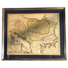
Four 18th Century Engraved and Hand-Colored Maps by Weigel
Located in Copenhagen, K
Small collection of four engraved maps of Italy, Balkan and of Central Asia.
Two are of Italy, one Corsica and Northern Italy and the other of the Southern Italian boot...
Category
German Antique 18th Century Maps
Materials
Paper
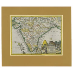
Antique Map of India during the height of the Mughal Imperial Expansion, 1713
Located in Langweer, NL
Antique map titled 'L'Inde de ca le Gange (..)'. Beautiful original antique map embracing most of India, made during the height of the Mughal imperial expansion. The map encompasses ...
Category
Antique 18th Century Maps
Materials
Paper
Antique Map of a Bay of Borneo, Indonesia, c.1760
Located in Langweer, NL
Antique map titled 'La Baye de l'isle et Ville de Borneo'. Small map depicting a Bay of Borneo.
Artists and Engravers: Anonymous.
Condition: Good, general age-related toning. ...
Category
Antique 18th Century Maps
Materials
Paper
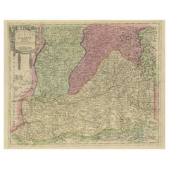
Senex Map of Castile, Leon & La Mancha in The Spanish Heartland, 1714
Located in Langweer, NL
This antique map, titled "A Map of Old & New Castile from the Observations of Rodrigo Mendes Silva and others," depicts the regions of Old Castile and New Castile in Spain, along wit...
Category
Antique 18th Century Maps
Materials
Paper
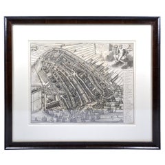
Amsterdam city plan - Joost van Sassen
Located in UTRECHT, UT
“Afbeeldinge der Stad Amsterdam, gelyk deselve in den jaren 1536 door Cornelis Antonisz na ’t leven is geschildert, en Ao 1544 in druk uytgegeven.”, engraved by Joost van Sassen and ...
Category
Dutch Other Antique 18th Century Maps
Materials
Paper
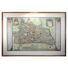
Utrecht city plan
Located in UTRECHT, UT
“Platte grond der Stad Utrecht vertonende alle Gragten, Straaten, Stegen, Gangen, Markten, en plaatsen der openbare Gebouwen”, engraving published by Johannes van Schoonhoven in Amst...
Category
Dutch Other Antique 18th Century Maps
Materials
Paper
Original Antique Map of West Central France in Frame, 1748
Located in Langweer, NL
A nicely framed and hand-coloured decorative map titled "Gouvernemens Generaux De Poitou et De Saintonge" and engraved by M. Robert. This historical international map includes severa...
Category
Antique 18th Century Maps
Materials
Paper
Old Map of The Mughal Empire and the Indian Peninsula South of the Ganges, 1787
Located in Langweer, NL
This is a historical map titled "L'Empire Du Mogol, Et La Presqu Isle De L'Inde En Deca Du Gange."
An original authentic map, created by Rigobert Bonne (1727-1794), an influential ...
Category
Antique 18th Century Maps
Materials
Paper
Antique Map of Brabant 'The Netherlands' by N. Visscher, circa 1690
Located in Langweer, NL
Antique map titled 'Brabantiae Batavae pars orientalis, comprehendens Tetrarchiam sive majoratum sylvaeducensem in ejusdem subjacentes ditiones (..)'. Map of the Dutch province 'Brab...
Category
Antique 18th Century Maps
Materials
Paper
Historical Map of the Black Sea and Surrounding Regions, 1705
Located in Langweer, NL
Title: "Map of Turcomania, Georgia, and Comania"
This print presents an intricately detailed map of the Caucasus region, titled “Turcomania, Georgien Commanie,” by the esteemed cart...
Category
Antique 18th Century Maps
Materials
Paper
Charting the Course of Empire: Bonne's 1770 Masterpiece Maps of the Indian Ocean
Located in Langweer, NL
A voyage through history with an exquisite collection of Rigobert Bonne's 1770 maps, as featured in the coveted Atlas Moderne circa 1770. Each map, a cartographic treasure, captures ...
Category
Antique 18th Century Maps
Materials
Paper
Antique Map of the Sunda Islands Including Sumatra, Java, and Borneo, 1705
Located in Langweer, NL
Title: “Antique Map of the Sunda Islands Including Sumatra, Java, and Borneo”
This print is a beautifully detailed and relatively rare map of Western Indonesia, encompassing the reg...
Category
Antique 18th Century Maps
Materials
Paper
Authentic Antique Map of the Caribbean, Gulf Coast and Central America, 1787
Located in Langweer, NL
Antique map titled 'Les Isles Antilles et le Golfe du Méxique'. Original old map of the Caribbean, Gulf Coast and Central America. With inset map of Bermuda. Originates from 'Histoir...
Category
Antique 18th Century Maps
Materials
Paper
Cartographic Elegance of the Mughal Dominion in a Hand-Colored Antique Map, 1705
Located in Langweer, NL
This original antique map titled “'T Ryk van den Grooten Mogol” by Nicolas Sanson from 1705 is an interesting historical artifact. It depicts the extent of the Mughal Empire in North...
Category
Antique 18th Century Maps
Materials
Paper
Antique Coaching Road Map, Devon, English, Regional Cartography, Georgian, 1720
Located in Hele, Devon, GB
This is an antique coaching road map of Devon. An English, framed lithograph engraving of regional interest, dating to the early 18th century and later.
Fascinating 18th century hig...
Category
British Georgian Antique 18th Century Maps
Materials
Wood
Antique Coaching Road Map, South Devon, English, Framed, Cartography, Georgian
Located in Hele, Devon, GB
This is an antique coach road map of South Devon. An English, framed lithograph engraving of regional interest, dating to the early 18th century and later.
Delightful early 18th cen...
Category
British Georgian Antique 18th Century Maps
Materials
Wood
18th Century Antique Map of the Virgin Islands and Caribbean Inset Maps
Located in Langweer, NL
A fascinating piece of cartographic history! The map, titled "Carte du supplément pour les Isles Antilles," featuring inset maps of various islands in the Caribbean, is from the "Atl...
Category
Antique 18th Century Maps
Materials
Paper
Original Antique Map of the Virgin Islands with Insets of Caribbean Isles, 1787
Located in Langweer, NL
Antique map titled 'Supplément pour les Isles Antilles (..)'. Original old map of the Virgin Islands, with insets of Barbuda, St. Kits, Antigua, Dominica, St. Lucia, Barbados, St. Vi...
Category
Antique 18th Century Maps
Materials
Paper
Antique Coach Road Map, East Devon, English, Framed, Cartography, Georgian, 1720
Located in Hele, Devon, GB
This is an antique coach road map of East Devon. An English, framed lithograph engraving of regional interest, dating to the early 18th century and later.
Fascinating 18th century h...
Category
British Georgian Antique 18th Century Maps
Materials
Wood
Antique Lithography Map, Cumbria, English, Framed Cartography Interest, Georgian
Located in Hele, Devon, GB
This is an antique lithography map of Cumbria. An English, framed engraving of cartographic interest, dating to the early 18th century and later.
...
Category
British Georgian Antique 18th Century Maps
Materials
Wood
Antique Lithography Map, Durham, English, Framed, Cartography, Early Georgian
Located in Hele, Devon, GB
This is an antique lithography map of Durham. An English, framed engraving of cartographic interest, dating to the early 18th century and later, circa 1720.
Superb lithography of Du...
Category
British Georgian Antique 18th Century Maps
Materials
Wood
The Valley of Inspruck: An 18th-Century Engraved Perspective, 1792
Located in Langweer, NL
Title: "The Valley of Inspruck: An 18th-Century Engraved Perspective"
This elegant original antique engraving, titled "The Valley of Inspruck," showcases a serene view of the Innsbruck Valley. The artwork is delicately rendered, capturing the grandeur of the mountains and the pastoral tranquility of the valley.
The print depicts a detailed landscape scene, replete with towering craggy peaks that loom over a peaceful settlement nestled in the valley. A striking feature is the contrast between the ruggedness of the natural environment and the cultivated lands and architecture, indicating a harmonious coexistence of humanity with nature.
It was published as directed on January 1, 1792, by T & G Egerton of Whitehall for the author. Albanis Beaumont is credited with the original design ('Del.' for delineavit, indicating he drew the initial illustration), and Cornelis Apostool is noted for the engraving work ('Sculp.' for sculpsit, indicating he engraved the image).
The publication of this print during the late 18th century aligns with a time when there was a heightened interest in natural beauty and the picturesque, reflected in the art and literature of the Romantic period. This print would have appealed to those with an appreciation for both the aesthetic and the sublime qualities of the European landscape.
The publication by T & G Egerton, a reputable firm known for their work in the arts, and the involvement of a skilled artist and engraver like Beaumont and Apostool, respectively, underline the quality and desirability of the print. It is a piece that would attract collectors of fine engravings and admirers of European landscapes, offering a window into the aesthetic values and artistic endeavors of the late 18th century.
As a historical piece, this print offers a view into the past, inviting contemplation of the rich cultural and natural heritage of the Innsbruck area. It is a valuable collectible for enthusiasts of antique maps and prints...
Category
Antique 18th Century Maps
Materials
Paper
Old Map of Part of France: Poitou, Berry, Bourbonnais, and Nivernais in 1768
Located in Langweer, NL
The map with text neatly mounted on both sides of the map on the plate, is a section of an old map with accompanying French text. The map mentions several historical French provinces...
Category
Antique 18th Century Maps
Materials
Paper
1797 Tardieu Map of Southeast Asia: The Malay Archipelago and Beyond
Located in Langweer, NL
An original historical map titled 'Presqu' Île Au Dela Du Gange et Archipel De L'Inde', created by Pierre Francois Tardieu and published in the "Atlas Universel" by Pierre Grégoire C...
Category
Antique 18th Century Maps
Materials
Paper
Colored wall map of the WORLD
By Chambon
Located in ZWIJNDRECHT, NL
“Mappe Monde, contenant les Parties Connues du Globe Terrestre”
CHAMBON, Gobert-Denis (France, 17.. - 1781)
Paris, Longchamps et Janvier, 1754
Size H. 115 x W. 145 cm.
Gobert-Denis Chambon made copper engraving after the work of Guillaume De L’Isle, published in 1754 by Jean Janvier and S.G. Longschamps.
A huge wall map of the world in two hemispheres printed on two sheets, depicting the Eastern and Western hemispheres supported by two male figures, decorated at the bottom right and left with two celestial hemispheres (boreal and southern) and at the bottom in the middle with an armillary sphere, in addition.
This map is most notable for its depiction of the Sea of Japan labeled "Mer de Corée" and of "Mer de L'Ouest" or Sea of the West - a great sea, easily the size of the Mediterranean, to flow from the then-known Strait of Juan de Fuca...
Category
French French Provincial Antique 18th Century Maps
Materials
Wood, Paper
1720 Panoramic Vista of Istanbul and the Bosphorus - with Column of Pompey
Located in Langweer, NL
Title: "1701-1720 Bosphore de Thrace and Views of Istanbul - Chatelain/Guedeville"
Description: This finely detailed folio from Chatelain's 'Atlas Historique', dated 1720, features ...
Category
Antique 18th Century Maps
Materials
Paper
Old 18th Century Composite Map of Key Caribbean Islands with Descriptive Texts
Located in Langweer, NL
Antique map titled 'Dominia Anglorum in praecipuis Insulis Americae ut sunt Insula S. Christophori, Antegoa, Iamaica, Barbados nec non Insulae Bermudes vel Sommers dictae. Die Englis...
Category
Antique 18th Century Maps
Materials
Paper
Original Antique Map of Martinique Island In The West Indies by Bonne, circa1780
Located in Langweer, NL
Antique map titled 'Carte de l'Isle de la Martinique Colonie Francoise dans les Isles Antilles'. Detailed map of the French Island of Martinique.
Many towns and harbours, anchor pl...
Category
Antique 18th Century Maps
Materials
Paper
Authentic Old Map of Persia with Original Border Coloring, 1745
Located in Langweer, NL
Title: "Kaartje van Persien na de stelling van den Heer Guillaume de L'Isle"
Translates to "Map of Persia based on the work of Mr. Guillaume de L'Isle." Guillaume de L'Isle was a p...
Category
Antique 18th Century Maps
Materials
Paper
Original Antique Map of the Island of Dominica in the West Indies, 1794
Located in Langweer, NL
MAP OF THE ISLAND OF DOMINICA for the History of the West Indies, by Bryan Edwards. Esq.
Dominica, an island renowned for its lucrative exports of sugar, cocoa, and coffee, operated...
Category
Antique 18th Century Maps
Materials
Paper
1726 Valentyn's Map of Bali and Lombok, Original Engraving
Located in Langweer, NL
This antique map is a detailed 18th-century chart of the island of Bali, one of the many islands of Indonesia, with an inset of the neighboring island Lombok, attributed to François ...
Category
Antique 18th Century Maps
Materials
Paper
Original Engraving of the West Indies, Gulf of Mexico, Antilles, Caribbean, 1780
Located in Langweer, NL
Rigobert Bonne and G. Raynal's 1780 map of the West Indies, Gulf of Mexico, Antilles, and the Caribbean stands as a remarkable cartographic piece, offering a detailed and expansive v...
Category
Antique 18th Century Maps
Materials
Paper
Super Rare Antique French Map of Chine and the Chinese Empire, 1780
Located in Amsterdam, Noord Holland
Super Rare Antique French Map of Chine and the Chinese Empire, 1780
Very nice map of Asia. 1780 Made by Bonne.
Additional information:
Type: Map
...
Category
European Antique 18th Century Maps
Materials
Paper
Authentic Old Map of Arabia with Original Border Coloring, 1745
Located in Langweer, NL
Title: "Kaartje van Arabië na de stelling van den Heer Guillaume de L'Isle"
Translates to "Map of Arabia based on the work of Mr. Guillaume de L'Isle." Guillaume de L'Isle was a pr...
Category
Antique 18th Century Maps
Materials
Paper
Old Map of Anatolia, part of modern-day Turkey, Armenia and Syria, 1745
Located in Langweer, NL
Title: "Kaartje van Natolie en Syrie opgesteld door de Hr. Lucas en de Hr. Guil de L'Isle en andere auteuren"
The title "Kaartje van Natolie en Syrie opgesteld door de Hr. Lucas en...
Category
Antique 18th Century Maps
Materials
Paper
Antique Map of Grenada, West Indies, 1758
Located in Langweer, NL
"Exquisite 1758 Map: 'CARTE DE L'ISLE DE LA GRENADE'
This alluring map presents a detailed depiction of the Island of Grenada, boasting remarkable intricacy for its time. Notably, i...
Category
Antique 18th Century Maps
Materials
Paper
Antique Carte de De la Perse Saudie Arabia UAE Turkey Qatar Bahrein, 1836
Located in Amsterdam, Noord Holland
Antique Carte de De la Perse Saudie Arabia UAE Turkey Qatar Bahrein, 1836
Very nice map of Middle East.
Additional information:
Material: Paper
Typ...
Category
European Antique 18th Century Maps
Materials
Paper
Roseaux, St. Lucia Island Map by BELLIN, Handcolored Engraving, 1763
Located in Langweer, NL
Dating back to around 1763, this antique hand-colored print, a creation by Jacques Nicolas Bellin, unveils a meticulously detailed "Plan du Cul de Sac des Roseaux dans l'Isle de Ste....
Category
Antique 18th Century Maps
Materials
Paper
Stunning Decorative Antique Map of Venice in Italy, ca.1787
Located in Langweer, NL
Title: Piano elevato dell'inclita città di Venezia
Bird's-eye view (etching) of Venice.
Print made by: Marco Sebastiano Giampiccoli
After: Matthäus Merian I
Two copper engraved sh...
Category
Antique 18th Century Maps
Materials
Paper
Authentic Old Map of Southeast Asia with Original Border Coloring, 1745
Located in Langweer, NL
Title: "Kaartje van Oost-Indien na de stelling van den Heer Guillaume de L'Isle"
Translates to "Map of the East-Indies based on the work of Mr. Guillaume de L'Isle." Guillaume de L...
Category
Antique 18th Century Maps
Materials
Paper
Antique French Map of Asia Including China Indoneseia India, 1783
Located in Amsterdam, Noord Holland
Very nice map of Asia. 1783 Dedie au Roy.
Additional information:
Country of Manufacturing: Europe
Period: 18th century Qing (1661 - 1912)
Condition: Overall Condition B (Good Used)...
Category
European Antique 18th Century Maps
Materials
Paper
Original Historical Map of L'Ile De La Martinique by Vaugondy, 1749
Located in Langweer, NL
Description: De Vaugondy's map of Martinique, initially published in Paris in 1748 within his Atlas Portatif, Universel et Militaire, stands as a striking representation of the isla...
Category
Antique 18th Century Maps
Materials
Paper
Original Engraved Map of Saint Lucia in the West Indies by Bellin, 1758
Located in Langweer, NL
The "Carte de L’Isle de Sainte Lucie" by Jacques Nicolas Bellin, a prominent figure as the Royal Hydrographer and engineer of the French Navy, is a remarkable antique map showcasing ...
Category
Antique 18th Century Maps
Materials
Paper
Antique Carte de L'Inde Myanmar, Malaysia Vietnam Map of Asia the Chinese Empire
Located in Amsterdam, Noord Holland
Antique Carte de L'Inde Myanmar, Malaysia Vietnam Map of Asia the Chinese Empire
Very nice map of Asia.
Additional information:
Type: Map
Country of Man...
Category
European Antique 18th Century Maps
Materials
Paper
Barados and St Christopher or St Kitts and Nevis Islands in the Caribbean, 1748
Located in Langweer, NL
This original map, a copperplate engraving by Le Rouge, presents two significant areas in the Caribbean. Titled "Isle St. Christophle une des Antilles aux anglois" and "La Barbade. d...
Category
Antique 18th Century Maps
Materials
Paper
Religious Antique Map of the Twelve Tribes of Israel, circa 1750
Located in Langweer, NL
Antique map titled 'Palaestina in XII. Tribus (..)'. Large map of the Holy Land, published by the Homann Heirs for the Maior Atlas Superiore following the cartography of the theologian Johann Christoph Harenberg. The map divides the region into the territories of the Twelve Tribes of Israel, as well as featuring the neighbouring kingdoms and nations of Egypt, the Edomites, the Nabataeans, the Moabites, the Ammonites, Syria, and the Arabian Desert...
Category
Antique 18th Century Maps
Materials
Paper
Martinique Island in the Caribbean by Bellin Original Original Antique Map, 1780
Located in Langweer, NL
This mid-18th century map, "Carte de l'Isle de la Martinique pour servir a l'historie generale des voyages," was issued in 1780 by M. Bellin in Paris. It presents a detailed and visually captivating depiction of the Island of Martinique within the context of the Caribbean and the Lesser Antilles.
**Title:** Carte de l'Isle de la Martinique pour servir a l'historie generale des voyages
**Issuer:** M. Bellin
**Date:** 1780
**Location Coverage:** North America, Caribbean, Martinique, Lesser Antilles
This engraved map is notable for its pleasing aesthetics, featuring lovely hand coloring that enhances its visual appeal. The inclusion of a scroll cartouche, an ornamental frame, and measurement lines adds a distinctive and visually appealing quality to the map.
Martinique, situated within the Lesser Antilles in the Caribbean, is presented with meticulous detail, showcasing geographical features, coastlines, settlements, and other notable landmarks. Bellin, known for his accuracy in cartography, crafted this map to serve as a geographical reference within the broader context of historical voyages and exploration.
The combination of detailed cartographic information and artistic embellishments, such as hand coloring and decorative elements, makes this map not only a valuable geographical document but also a visually pleasing piece of cartographic art...
Category
Antique 18th Century Maps
Materials
Paper
Original Antique Map of the Peninsula of India with Part of Ceylon by Wyld, 1844
Located in Langweer, NL
This extensive map of India, spanning two sheets, draws from Reynell’s original map and incorporates data provided by Sir Archibald Campbell, as well as surveys conducted by Colonel ...
Category
Antique 18th Century Maps
Materials
Paper
Authentic Old Map of Sumatra, Malaysia and Singapore, 1745
Located in Langweer, NL
Title: "Kaartje van't Eiland Sumatra en de Maleidse Kust gelegen na de stelling van de G. de L'Isle"
Published by Jacob Keizer and by Jan de Lat
Creator: Keizer, Jacob, active 1706...
Category
Antique 18th Century Maps
Materials
Paper
Antique Print of the Malabar Coast of India showing the VOC establishments, 1726
Located in Langweer, NL
Dutch print with the title: Platte Grond van t'Fort Tricoen male met de daar aangelegen Pagoods-Berg (Trincomalee, Sri Lanka)
The map is taken from: 'Oud en Nieuw Oost-Indiën' van...
Category
Antique 18th Century Maps
Materials
Paper
Print of a Dutch VOC Fort on the Peninsula Trincomalee, Ceylon (Sri Lanka), 1726
Located in Langweer, NL
Dutch print with the title: Platte Grond van t'Fort Tricoen male met de daar aangelegen Pagoods-Berg (Trincomalee, Sri Lanka)
The map is taken from: 'Oud en Nieuw Oost-Indiën' van...
Category
Antique 18th Century Maps
Materials
Paper
Original Antique Engrving of Chinese Tartary in the 18th Century, 1737
Located in Langweer, NL
The antique map titled " Ozieme feuille particuls de la Tartarie Chinoise, qui contient un pays dependant de la russie aucouchant de NIPTCHOU " translates to "Sixth sheet of parts of...
Category
Antique 18th Century Maps
Materials
Paper
Antique Engraving of the Island Nzwani or Anzuany of the Comoros Islands, 1726
Located in Langweer, NL
Historical titles: Ansjouan, Ansuany, Anjouan, Anzuani, Anzuany
Country: Comoros
The map is taken from: 'Oud en Nieuw Oost-Indiën' van François Valentyn.
1) Ottens, Frederik (engra...
Category
Antique 18th Century Maps
Materials
Paper
Antique Italian Map of Viaggio da Roma a Napoli 1775
Located in Roma, IT
An original print from 1775 showing an early route map of the journey from Rome to Naples. This route map was part of a collection of travellers routes published in a book translated...
Category
Italian Antique 18th Century Maps
Materials
Parchment Paper
Antique Map of the World by Stoopendaal, c.1714
Located in Langweer, NL
Antique world map titled 'Orbis Terrarum Tabula Recens Emendata et in Lucem Edita'. Decorative double hemisphere world map. Illustrated with numerous exotic animals and four female a...
Category
Antique 18th Century Maps
Materials
Paper
Original Hand-colored Antique Map of the Southern Part of India
Located in Langweer, NL
Antique map titled 'Orarum Malabariae, Coromandelae &c Tabula Accuratissima - Carte des Cotes de Malabar et de Coromandel'. Beautiful map of the southern part of India. It focuses on...
Category
Antique 18th Century Maps
Materials
Paper
Antique Map of Southeast Asia, China, Philippines and India
Located in Langweer, NL
Antique map titled 'Indiae Orientalis et Insularum Adiacentium'. Decorative map of Southeast Asia, China, Philippines, and India. A native holds a wild dog or hyena on a chain, while...
Category
Antique 18th Century Maps
Materials
Paper
Antique Map of the Ancient Greek Colonization
Located in Langweer, NL
Antique map titled 'Map I containing the Western Division of the Grecian Colonies & Conquests'. Original antique map of the ancient Greek colonization. Frontispiece map of 'The Histo...
Category
Antique 18th Century Maps
Materials
Paper
Recently Viewed
View AllMore Ways To Browse
Antique Mexican Maps
Antique Nautical Map
Antique Classroom
Antique Map Box
Sea Chart Map
Antique Nautical Maps
Mexican Antique Map
Antique Nautical Charts
King Charles I Of England
17th Century Corpus
Antique Celestial Maps
Antique Celestial Map
Celestial Maps Antique
Antique Map Middle East
Vintage Wooden Roller
Middle East Antique Map
Topographical Plate
Central America Map
